 Block
From the record
6 National Register listings published here.
Sources: the county history on the Internet Archive · the National Register database, National Park Service
83 topographic sheets cover 48 settlements here, and 6 properties are on the National Register of Historic Places.
6 National Register listings published here.
Sources: the county history on the Internet Archive · the National Register database, National Park Service
Every property in this county listed on the National Register of Historic Places, with the year it was listed and the federal nomination document.
| Photograph | Property | Type | Listed | Reference |
|---|---|---|---|---|
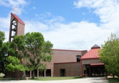 | Cathedral of the Immaculate Conception | building | 1998 | 98001219 |
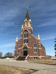 | Church of St. Peter-Catholic | building | 1982 | 82002994 |
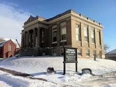 | Crookston Carnegie Public Library | building | 1984 | 84001646 |
| Crookston Commercial Historic District | district | 1984 | 84002709 | |
 | E. C. Davis House | building | 1984 | 84001648 |
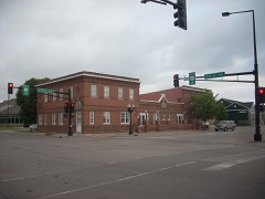 | Hamm Brewing Company Beer Depot | building | 1984 | 84001651 |
Every wildfire the federal occurrence database records inside this county: 159 of them, burning about 21,939 acres. 2 started naturally and 46 were recorded as arson. Each settlement page carries the fires within five miles of it.
| Reported cause | Fires |
|---|---|
| Debris and open burning | 51 |
| Arson/incendiarism | 46 |
| Missing data/not specified/undetermined | 31 |
| Equipment and vehicle use | 15 |
| Railroad operations and maintenance | 7 |
| Recreation and ceremony | 3 |
| Smoking | 2 |
| Natural | 2 |
| Misuse of fire by a minor | 1 |
| Other causes | 1 |
The five largest, by the area the report gives. Four of them were set deliberately.
| Date | Cause | Size | Reported by | Name on the report |
|---|---|---|---|---|
| 9 April 2003 | Arson/incendiarism | 2,140 acres | Minnesota Department of Natural Resources | GULLY FIRE |
| 21 May 2020 | Missing data/not specified/undetermined | 1,792 acres | Glacial Ridge | MNGLR-FY20-WF-GRAVEL PIT |
| 11 April 2003 | Arson/incendiarism | 836 acres | Minnesota Department of Natural Resources | not named |
| 22 April 2003 | Arson/incendiarism | 800 acres | Minnesota Department of Natural Resources | not named |
| 5 April 2010 | Debris and open burning | 758 acres | Detroit Lakes Wetland Management District | HILL RIVER |
| 11 April 2010 | Debris and open burning | 740 acres | Minnesota Department of Natural Resources | not named |
| 10 April 2006 | Arson/incendiarism | 712 acres | Minnesota Department of Natural Resources | TRAIL |
| 5 April 2010 | Missing data/not specified/undetermined | 700 acres | Glacial Ridge | ONSTAD 12WF |
Every settlement page carries the fires within five miles of it - see the settlement index below.
The NOAA Storm Events Database holds 914 reports for this county, causing 4 deaths, 24 injuries and about $11,873,400 in recorded property damage. Each settlement page carries the reports that name it.
| Kind of event | Reports |
|---|---|
| Hail | 423 |
| Thunderstorm Wind | 318 |
| Tornado | 82 |
| Flash Flood | 38 |
| Funnel Cloud | 32 |
| Flood | 16 |
| Lightning | 4 |
| Heavy Rain | 1 |
The most serious of them, by death, then injury, then recorded damage. The accounts are quoted exactly as the forecast office filed them.
| When | Event | Place named | Harm | What the report says |
|---|---|---|---|---|
| August 1975 | Tornado (F1) | not stated | 2 killed, $250,000 | no account filed |
| July 1978 | Tornado (F2) | not stated | 1 killed, 9 hurt | no account filed |
| June 2010 | Tornado (EF3) | Maple Bay | 1 killed, 2 hurt | This tornado began in Polk County and tracked northeastward for nine miles to the Red Lake County line about 5 miles north-northeast of Mentor. After crossing into Red Lake County, it continued for an additional 6 miles. The tornado tracked across Maple Lake and the community of Mentor. Trees were sheared off or uprooted, power poles were snapped, and roofs and garages were destroyed. A convenience store and gas station along U. S. Highway 2 were flattened. Cabins, campers, boats, and docks were damaged along the northeast side of Maple Lake. Peak winds were estimated at 145 mph. |
| June 1955 | Tornado (F2) | not stated | 7 hurt, $25,000 | no account filed |
| July 1977 | Tornado (F2) | not stated | 2 hurt, $25,000 | no account filed |
| June 1994 | Thunderstorm Wind | Fertile and Mentor | 2 hurt | A 19-year-old man was struck by lightning while driving a motorcycle along Highway 2 near Erskine and was killed. Another 17-year-old cyclist, traveling alongside the other, was injured. |
| July 1966 | Tornado (F1) | not stated | 1 hurt, $250,000 | no account filed |
| October 1997 | Thunderstorm Wind | Climax | 1 hurt, $2,000 | The wind blew out a window on a tractor, injuring the man inside. |
| June 2018 | Tornado (EF2) | Winger | $6,500,000 | This tornado was likely wrapped in downburst winds and heavy rain for most of its path. It tracked nearly due east at about 60 mph, for at least 15 miles. It tore down trees in shelterbelts and tore roofing off of a couple of homes and farm buildings. It tore down 11 miles, or more than 50 high voltage towers, and snapped wooden power poles at cross roads along its path. Peak winds were estimated at 120 mph. |
| April 2006 | Flood | Countywide | $932,000 | The Red River at Grand Forks/East Grand Forks rose above flood stage around 4 PM CST on March 31st and remained above flood stage until around 6 PM CST on April 22nd. The river peaked at roughly 47.85 feet around 2 AM CST on April 6th. Unofficially, 47.85 feet would be the fifth highest modern-day river stage recorded. The seventh highest modern-day river stage of 25.00 feet (unofficial) was recorded on the Red Lake River at Crookston on April 2nd. The Red Lake River crest actually arrived in the Grand Forks/East Grand Forks area prior to the Red River crest. On the Red Lake River, an ice jam caused the river to peak a second time, just after the first crest. A voluntary evacuation occurred for neighborhoods along the Red Lake River, but few people actually evacuated. Overland flooding also occurred in addition to the river flooding, with many roads around the county closed due to flooding. State Highway 220 was closed north of East Grand Forks. Red River bridges at Nielsville (MN), Climax (MN), and east of Thompson (ND) were closed due to flooding. In the city of East Grand Forks, the Sorlie and the Point Red River bridges were also closed. This left the U.S. Highway 2 bridge as the only Red River crossing open in the county. The Minnesota Governor authorized the National Guard to assist in the flood fight, working on dike patrols, security, and traffic control. After the spring flood of 1997, many communities along the Red River looked at ways to mitigate flood effects. The permanent levee system constructed around East Grand Forks got its first test and performed well. Many low-lying or flood-prone neighborhoods close to the rivers were bought out and razed, which allowed both rivers to spread out into wider channels through the cities. Polk County received a Presidential Disaster Declaration for damages caused by spring flooding.In summary, the total public and private flood losses experienced within the Red River of the North basin through late March and April 2006 were likely in excess of $20 million. This includes the following amounts. For Minnesota state and local infrastructure (this total includes the damages listed for each county), $8.5 million. For North Dakota state and local infrastructure (this total includes the damages listed for each county), $8 million. For Federal agencies (USACE, USGS, and USCG), $1.5 million. For the transportation industry costs due to traffic diversions caused by prolonged road and bridge closures, $1.5 million. For personal property losses due to floodwaters surrounding more than 500 individual farmsteads and rural homesteads, $1.0 million. |
| August 2001 | Thunderstorm Wind | East Grand Forks | $500,000 | The strong wind hit East Grand Forks, knocking over trees, powerlines, signs, and traffic lights. An estimated 400 trees were flattened by the storm, falling on roofs, vehicles, and homes. Power was knocked out for about half of the city. Windows in the new city hall building were broken and the roof on an apartment building was torn off. A semi trailer was also blown over as were the outer boards on an outdoor skating rink. |
| May 2011 | Thunderstorm Wind | Crookston | $400,000 | There were many reports of damage around Crookston, with many trees, power lines, and street signs blown over. A small shed was blown down and falling tree limbs damaged the roofs of numerous homes. |
| June 1983 | Tornado (F0) | not stated | $250,000 | no account filed |
| May 1977 | Tornado (F1) | not stated | $250,000 | no account filed |
| July 1977 | Tornado (F2) | not stated | $250,000 | no account filed |
| May 1998 | Lightning | Angus | $200,000 | Lightning struck a church in Angus, igniting a fire that totally destroyed the church. |
| June 1997 | Flash Flood | Erskine | $200,000 | Seven inches of rain caused many basements to fill with several inches to several feet of water. Several township roads were also washed out. |
| August 2021 | Tornado (EF1) | Davidson | $120,000 | This tornado blew out two walls and the roof of a pole shed, broke several ash and cottonwood trees, and peeled up steel siding and roofing on other farm buildings in one farmstead. It carried and/or spread debris to the east and southeast for up to 500 yards while it tracked to the east. It also tore off some roof trim, shingles, and siding at three other farmsteads along its path. |
| July 2018 | Thunderstorm Wind | Mallory | $100,000 | Roof panels and roofing material was peeled up from a steel clad pole shed and flung over 100 yards to the east-southeast. Nearby farmsteads across northern Huntsville and southern Sullivan townships had large tree branches blown down and had shingles and gutters torn off the houses and sheds. |
| July 2013 | Tornado (EF1) | Trail | $100,000 | This tornado continued into Clearwater County before it dissipated. The tornado snapped and uprooted numerous trees along its path. Peak winds were estimated at 90 mph. The entire path length across the two counties was nearly 7 miles. |
| August 2001 | Thunderstorm Wind | Erskine | $100,000 | Trees, powerlines, and signs were destroyed by the strong wind. A greenhouse and a storage shed were demolished. A trailer home was flipped over and several roofs sustained damage. The town restricted water use. |
| August 2001 | Thunderstorm Wind | Trail | $75,000 | A barn was lifted off its foundation and carried 20 feet, which destroyed it. The roof and walls of a mobile home were torn apart and blown over a half a mile away. A car was also heavily damaged. |
| August 2001 | Tornado (F1) | Gully | $75,000 | An auto repair shop had its roof torn off. Many trees were uprooted, falling on signs, powerlines, homes, and garages. Several grain bins were destroyed. |
| September 2017 | Tornado (EF1) | Beltrami | $50,000 | This tornado began in Norman County, about three miles north-northeast of Lockhart, at 650 PM CST. As it crossed into Polk County, about 653 PM CST, debris from the tornado broke windows in a vehicle. The tornado then snapped trees in and around the community of Beltrami and dismantled a metal wrapped pole shed. Peak winds were estimated at 105 mph. |
| July 2017 | Tornado (EF1) | Northland | $50,000 | This tornado tracked intermittently across northern Northland and Tabor townships. The tornado snapped or uprooted a few spruce trees and broke down numerous large branches in shelterbelts along its path. At one farmstead east of Tabor, it tore steel panels off a shed roof and snapped large tree limbs. Peak winds were estimated at 95 mph. |
| June 2014 | Thunderstorm Wind | Greenview | $50,000 | Numerous trees and large tree limbs were snapped in farmsteads and shelter belts across northern Scandia and far southern Hammond townships. |
| May 2011 | Tornado (EF1) | Eldred | $50,000 | This tornado tracked intermittently to the northeast for about nine miles. A 30x40 foot wooden shed was completely blown off its foundation and destroyed in one farmyard. Numerous trees were snapped in shelterbelts along its path. Peak winds were estimated at 105 mph. |
| July 2001 | Thunderstorm Wind | Erskine | $50,000 | Boats were overturned and trees uprooted at Lake Sarah. |
| July 2001 | Thunderstorm Wind | Fosston | $50,000 | A warehouse roof was blown off and parts of the roof severed the nearby powerlines. This cut power for parts of Fosston for several hours. A parked semi truck was also overturned nearby. |
| July 2001 | Thunderstorm Wind | Crookston | $50,000 | Tree branches were blown down. |
| August 2001 | Thunderstorm Wind | Erskine | $50,000 | A mobile home and storage shed were destroyed and a metal shop was blown apart. Many trees were blown down. |
| August 2001 | Thunderstorm Wind | Crookston | $50,000 | Many trees and powerlines were blown down and several buildings were damaged. One tree fell on a car, totalling it. A portion of a brick building was blown over. |
| July 2001 | Thunderstorm Wind | Gentilly | $50,000 | Branches were blown down. |
| July 2001 | Thunderstorm Wind | Fisher | $50,000 | Power poles were blown down. |
| June 1999 | Hail | Mc Intosh | $50,000 | Many vehicles were dented in McIntosh. |
| June 1997 | Flash Flood | Maple Lake | $50,000 | Six inches of rain caused a hill to erode, dumping two inches of mud and water on the floor of a resort store. Two boats at the resort were sunk due to the heavy rain. |
| April 2019 | Flood | Northland | $50,000 | no account filed |
| August 2001 | Thunderstorm Wind | Fertile | $30,000 | Trees were uprooted by the strong wind and windows were broken. The roof on a trucking garage also blew off. |
| June 1999 | Thunderstorm Wind | Tabor | $30,000 | A quonset building was blown down. |
| May 1998 | Thunderstorm Wind | Erskine | $30,000 | A large storage shed, grain bins, a hay shed, and a church roof were damaged in the strong wind. |
| October 1997 | Thunderstorm Wind | Climax | $30,000 | A pole barn was destroyed. |
| October 1997 | Thunderstorm Wind | Nielsville | $25,000 | A large farm garage was blown over, tipping over a large truck inside. Another shed was slightly damaged. |
| July 1978 | Tornado (F1) | not stated | $25,000 | no account filed |
| July 1977 | Tornado (F2) | not stated | $25,000 | no account filed |
| July 1977 | Tornado (F1) | not stated | $25,000 | no account filed |
| June 1970 | Tornado (F1) | not stated | $25,000 | no account filed |
| June 1963 | Tornado (F1) | not stated | $25,000 | no account filed |
| July 2018 | Hail | Euclid | $20,000 | Large, wind driven hail stripped sugar beet, bean, and wheat fields in far eastern Euclid and western Belgium townships. Large tree branches were torn down across the area as well. |
| July 2002 | Tornado (F1) | Winger | $20,000 | A metal shed roof was damaged and a steel bin roof was torn off 2 miles north of Winger. The path was intermittent. |
| June 1999 | Thunderstorm Wind | Sherack | $20,000 | A grain bin was destroyed in the wind. |
| June 1999 | Thunderstorm Wind | Sherack | $20,000 | Windows were blown out of a house and a hayshed was destroyed. |
| June 1999 | Flood | East Grand Forks | $20,000 | A thunderstorm complex converged over the greater Grand Forks area, producing 1 to 3 inches of rain in about an hour. Several roads and intersections were flooded. |
| July 2022 | Lightning | Freeman | $15,000 | Lightning struck a pickup truck that was travelling southbound on US Highway 2. The driver was not injured; however, the truck caught fire and was destroyed. |
| July 2001 | Flash Flood | East Grand Forks | $15,000 | Basements were flooded in the point area of East Grand Forks. |
| August 2001 | Thunderstorm Wind | Maple Bay | $15,000 | Numerous trees were blown down and one tree fell on a cabin. Boats, docks, pontoons, and boat lifts were flipped and sunk. |
| June 1999 | Thunderstorm Wind | Tabor | $15,000 | A barn roof was blown off. |
| July 2014 | Flash Flood | East Grand Forks | $10,000 | Two to four inches of rain fell in a little over an hour, flooding city streets and low lying areas. |
| July 2006 | Tornado (F0) | Gentilly | $10,000 | This tornado originated in Red Lake county 1 mile east of Huot at 1746 CST. The tornado broke numerous large branches in various shelterbelts along its route. Peak wind speeds were estimated at 65 mph. |
| May 2005 | Tornado (F2) | Crookston | $10,000 | A tornado touched down north of Crookston, and created a west-to-east damage path. The tornado hit a well-constructed pole barn and then travelled into an open field. Several large trees were snapped in half. The estimated peak wind speed was 140 mph. |
| August 2001 | Thunderstorm Wind | Trail | $10,000 | Many trees were blown down. |
The Survey's mineral resources record lists 16 workings inside this county. 14 still produce and 2 are closed or unrecorded. Each settlement page carries the workings within five miles of it.
| Commodity | Workings |
|---|---|
| Sand and Gravel, Construction | 16 |
The least common of them first, because a county's hundredth gravel pit says nothing its first ten did not.
| Where | Site | Commodity | Status | Recorded |
|---|---|---|---|---|
| Arnold Olson Pit and Mill | Sand and Gravel, Construction | Producer | ||
| Bakken Pit and Mill | Sand and Gravel, Construction | Producer | ||
| Black Gold Pit and Mill | Sand and Gravel, Construction | Producer | ||
| Bradshaw Sand and Gravel Pit | Sand and Gravel, Construction | Producer | ||
| Brandt Pit and Mill | Sand and Gravel, Construction | Producer | ||
| Crookston Cattle Co Pit and Mill | Sand and Gravel, Construction | Producer | ||
| East Polk County Pit and Mill | Sand and Gravel, Construction | Unknown | ||
| Lloyd Bruce Pit and Mill | Sand and Gravel, Construction | Producer | ||
| Northern Sand and Gravel Pit | Sand and Gravel, Construction | Producer | ||
| Northern Sand and Gravel Pit | Sand and Gravel, Construction | Producer | ||
| Power Ready Mix Pit and Mill | Sand and Gravel, Construction | Producer | ||
| Ruben Olson Pit and Mill | Sand and Gravel, Construction | Unknown | ||
| Spring Gravel Pit | Sand and Gravel, Construction | Producer | ||
| Thorson Pit | Sand and Gravel, Construction | Producer | ||
| Tilden Junction Pit and Mill | Sand and Gravel, Construction | Producer | ||
| Weberg Pit and Mill | Sand and Gravel, Construction | Producer |
One book written about this county, cut here where the book itself is cut, at its printed chapters: 16 chapters in all. Every chapter is public domain, machine-read from the scan and reproduced complete. A chapter already given under one of the county's towns is not repeated in this list.
| Chapter | Length |
|---|---|
| Chapter 1: Geography and Geology of Polk County | 5,320 words |
| Chapter 2: The Early Indian Inhabitants | 7,557 words |
| Chapter 3: The First White Men in Polk County | 3,925 words |
| Chapter 4: Fur Traders the First White Residents | 3,774 words |
| Chapter 5: Early American Explorations in Red River Valley | 3,592 words |
| Chapter 6: Chief Historic Features of Early Times | 6,713 words |
| Chapter 7: Early Historical Data After 1850 | 18,703 words in 2 parts |
| Chapter 9: Crookston and Its Institutions | 2,069 words |
| Chapter 10: The Newspapers Op Polk County | 3,371 words |
| Chapter 11: The Schools of Polk County | 5,394 words |
| Chapter 12: The Crookston School of Agriculture | 2,930 words |
| Chapter 13: The Northwest School of Agriculture and Experiment Station | 2,656 words |
| Chapter 14: History of Agriculture in Polk County | 5,107 words |
| Chapter 15: The Rise and Pall of Columbia County | 3,445 words |
| Chapter 16: The Banking Interests of the County | 4,059 words |
| Biographical sketches | 224,875 words in 15 parts |
Named settlements recorded in the Geographic Names Information System, each with the topographic sheets covering it. Villages, hamlets and abandoned places alike. Each is shown with the nearest named watercourse or landform and the survey quadrangle it falls on.
East Grand Forks city · 56721 · On Red Lake River · Grand Forks quadrangle
16 sheets, 1934 to 1994
Columbia township · 56651 · On Sugar Bush Creek · Fosston East quadrangle
10 sheets, 1919 to 1985