 Block
From the record
20 National Register listings published here.
Sources: the National Register database, National Park Service
18 topographic sheets cover 11 settlements here, and 20 properties are on the National Register of Historic Places.
20 National Register listings published here.
Sources: the National Register database, National Park Service
Every property in this county listed on the National Register of Historic Places, with the year it was listed and the federal nomination document.
| Photograph | Property | Type | Listed | Reference |
|---|---|---|---|---|
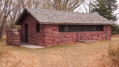 | Blue Mounds State Park WPA/Rustic Style Historic Resources | district | 1989 | 89001657 |
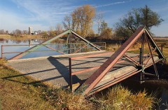 | Bridge No. 1482 | structure | 1992 | 92000775 |
 | Bridge No. L-2162 | structure | 1989 | 89001839 |
| Bridge No. L-2315 | structure | 1989 | 89001841 | |
| Bridge No. L-2316 | structure | 1989 | 89001843 | |
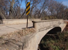 | Bridge No. L-4646 | structure | 1989 | 89001844 |
 | First National Bank of Beaver Creek | building | 1980 | 80002148 |
 | J. W. Gerber House | building | 1980 | 80002151 |
 | R. B. Hinkly House | building | 1975 | 75001027 |
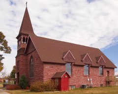 | Holy Trinity Church-Episcopal | building | 1980 | 80002152 |
| Jasper Stone Company and Quarry | site | 1978 | 78001562 | |
| Kenneth School | building | 1980 | 80002150 | |
 | Pierce J. Kniss House | building | 1980 | 80002153 |
 | Luverne Carnegie Library | building | 1980 | 80002154 |
| Frederick and Maryanna Manfred House | building | 2022 | 100007790 | |
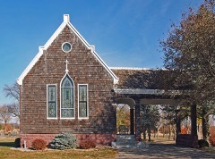 | Maplewood Chapel | building | 1980 | 80002155 |
| Jacob Nuffer Farmstead | building | 1980 | 80002149 | |
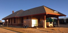 | Omaha Depot | building | 1980 | 80002156 |
 | Palace Theater | building | 1980 | 80002157 |
 | Rock County Courthouse and Jail | building | 1977 | 77000769 |
Every wildfire the federal occurrence database records inside this county: 5 of them, burning about 40 acres. None started naturally and none was recorded as arson. Each settlement page carries the fires within five miles of it.
| Reported cause | Fires |
|---|---|
| Missing data/not specified/undetermined | 3 |
| Equipment and vehicle use | 1 |
| Debris and open burning | 1 |
The five largest, by the area the report gives. None of them was recorded as arson.
| Date | Cause | Size | Reported by | Name on the report |
|---|---|---|---|---|
| 31 October 2011 | Missing data/not specified/undetermined | 35 acres | Minnesota Department of Natural Resources | not named |
| 20 July 2014 | Missing data/not specified/undetermined | 4.0 acres | Windom Wetland Management District | TOUCH THE SKY PRAIRIE |
| 29 September 2020 | Equipment and vehicle use | 1.0 acres | South Dakota Wildland Fire Suppression | INC # 105 9/29/2020 |
| 11 April 2014 | Debris and open burning | under an acre | Minnesota Department of Natural Resources | not named |
| 11 July 2005 | Missing data/not specified/undetermined | under an acre | Windom Wetland Management District | TOUCH THE SKY PRAIRIE |
Every settlement page carries the fires within five miles of it - see the settlement index below.
The NOAA Storm Events Database holds 353 reports for this county, causing no deaths, 7 injuries and about $9,428,600 in recorded property damage. Each settlement page carries the reports that name it.
| Kind of event | Reports |
|---|---|
| Hail | 137 |
| Thunderstorm Wind | 126 |
| Flood | 47 |
| Flash Flood | 18 |
| Tornado | 14 |
| Heavy Rain | 6 |
| Funnel Cloud | 4 |
| Lightning | 1 |
The most serious of them, by death, then injury, then recorded damage. The accounts are quoted exactly as the forecast office filed them.
| When | Event | Place named | Harm | What the report says |
|---|---|---|---|---|
| June 1969 | Tornado (F2) | not stated | 5 hurt, $250,000 | no account filed |
| July 1957 | Tornado (F1) | not stated | 2 hurt, $250,000 | no account filed |
| June 2014 | Flash Flood | Luverne | $3,000,000 | In the midst of very heavy rain, estimated as much as 7 inches, a dam partially gave way on Blue Mounds Creek at Blue Mounds Lake in Blue Mounds State Park. The dam break drained the lake and flooded roads downstream to the Rock River. |
| June 2024 | Flood | Bruce | $2,000,000 | Rainfall amounts across Rock County from June 20-22 ranged from 2 to 7 inches. Widespread overland flooding ensued with additional moderate to major flooding along the Rock River and Split Rock Creek.||During peak flooding, numerous township, county, and state roads were under water and closed. A No Travel Advisory was issued by law enforcement. Interstate 90 was under water and briefly closed between Luverne and Worthington where a swift water rescue was conducted near mile marker 17. U.S. Highway 75 was also closed from Luverne to the Iowa state line. ||In Luverne, numerous roads were reported under water and flood waters from the Rock River inundated Redbird Field and the Luverne City Park. Preliminary damage assessments estimate loss to public infrastructure to be at least 2 million dollars. |
| August 2004 | Thunderstorm Wind | Luverne | $2,000,000 | Thunderstorm winds blew down part of the roof of a large store, destroyed a hangar, and damaged a small plane inside. The winds also blew down signs including a large gas station sign, blew down the roof of a hardware store shed onto a pickup parked inside and destroyed several storage sheds and other small structures. Parts of roofs of several homes and garages were blown off or damaged. The winds caused widespread tree damage, with falling trees or debris damaging several homes and vehicles, and debris blocking several roads. Power lines and poles were blown down, causing power outages, and several light poles were also blown down. The winds also caused severe crop damage in the area, but the amount of crop damage could not be determined. |
| April 2018 | Thunderstorm Wind | Magnolia | $728,000 | Numerous power poles down along I-90 and either side at Magnolia exit. |
| March 2019 | Flood | Bruce | $215,000 | Water flowed over multiple areas of U.S. Highway 71, mainly in areas east of Steen and near Hardwick. Numerous other county and township roads were covered by water at times. The property damage costs include estimates for public property losses. |
| April 2019 | Flood | Jasper | $215,000 | Runoff from occasional precipitation in late March and early April produced considerable flooding of agricultural land. Other than a brief period from 0600CST April 26 to 1300CST April 27, the river remained in flood through the end of the month. Split Rock Creek below Jasper (gage site JSPM5) crested in major flood stage (5.49 feet above flood stage) on April 7, the third highest crest on record. A second crest in moderate flood stage occurred on April 17 at 3.79 feet above flood stage. Minor flooding continued at the end of the month. |
| June 2014 | Flood | Hardwick | $200,000 | Repeated heavy rains caused record flooding of the Rock River. Numerous roads and some homes and businesses were flooded in Hardwick and Luverne. Farmland and other lowlands along the river were also flooded. In Luverne the flooding included parkland and part of Interstate 90, which was closed by the flooding. A dam break at Blue Mounds Lake in Blue Mounds State Park was determined to have added slightly to the flooding at Luverne. The river crested at a record 7.18 feet above flood stage at Hardwick, and at a record 6.85 feet above flood stage at Luverne, both on June 17th. |
| August 2004 | Thunderstorm Wind | Beaver Creek | $100,000 | Thunderstorm winds destroyed two empty grain bins which each had a 150 thousand bushel capacity. The winds also blew down power lines, resulting in a power outage, and caused widespread tree damage, including several trees uprooted or blown down. Tree debris blocked several city streets. The winds also damaged crops, especially corn, but the amount of crop damage could not be determined. |
| September 2019 | Flood | Bruce | $50,000 | Damage to several county and township roads resulted from significant ponding of water, mainly for areas north of Interstate 90. Hardest hit were areas near County Roads 65 and 10 in far northern Rock County. Property damage costs are rough estimates. Flooding also resulted in crop losses across the area. Crop loss estimates provided by the United States Department of Agriculture. |
| September 2019 | Flood | Luverne | $50,000 | After excessive two-day rainfall during September 10-12 (9.08 inches near Edgerton and 4.72 inches at Luverne), the Rock River at Luverne (gage site LUVM5) reached the third highest stage on record of 3.94 feet above flood stage on September 13. Numerous county roads were inundated, and the city park in Luverne was under several feet of water. |
| June 2014 | Flood | Jasper | $50,000 | Persistent moderate to heavy rain caused flooding of fields and other lowlands, including several roads, homes, and businesses. This flooding lasted for two days, and was aggravated locally by additional storms during that time. Some roads were damaged or washed out. |
| April 2001 | Thunderstorm Wind | Luverne | $50,000 | no account filed |
| July 1998 | Thunderstorm Wind | Luverne | $50,000 | no account filed |
| July 2010 | Thunderstorm Wind | Hardwick | $40,000 | Thunderstorm winds destroyed a barn, heavily damaged a house, and caused tree damage, including several trees blown down. |
| July 2010 | Thunderstorm Wind | Hardwick | $25,000 | Thunderstorm winds destroyed a barn, killing several cattle inside. |
| May 2004 | Tornado (F1) | Luverne | $20,000 | A tornado destroyed a storage shed, silo, and outbuildings on a farm. The tornado also caused shingle and gutter damage to a house on the farm. On another farm, two corn bins were destroyed and a pole barn was damaged. Two large trees were blown down at the second farm, one of the trees damaging the corner of a house when it fell. The tornado was visible from long distances and photographed from several locations. |
| July 2004 | Thunderstorm Wind | Luverne | $20,000 | Thunderstorm winds caused tree damage, with numerous branches broken off. The winds also damaged a storage shed and blew down power lines, causing a power outage. The winds also blew down crops in the area. |
| August 2004 | Thunderstorm Wind | Beaver Creek | $20,000 | Thunderstorm winds overturned a semi truck on State Highway 23. |
| September 2019 | Flood | Jasper | $10,000 | After excessive two-day rainfall during September 10-12 (record 2-day rainfall of 6.75 inches at Pipestone), Split Rock Creek below Jasper (gage site JSPM5) reached the highest stage on record of 9.39 feet above flood stage on September 12. Numerous county roads were under water near Sherman, including 250th Street. Significant amounts of agricultural land were flooded. |
| September 2019 | Flood | Hardwick | $10,000 | After excessive two-day rainfall during September 10-12 (9.08 inches near Edgerton), the Rock River near Hardwick (gage site HRDM5) reached the second highest stage on record of 6.14 feet above flood stage on September 12. Numerous county roads were under water south of Edgerton, with significant flooding of agricultural land. |
| April 2004 | Thunderstorm Wind | Magnolia | $10,000 | Thunderstorm winds destroyed a barn. |
| June 2001 | Thunderstorm Wind | Hills | $10,000 | Thunderstorm winds caused tree damage, including a large tree blown down. |
| June 2001 | Thunderstorm Wind | Luverne | $10,000 | Thunderstorm winds blew a large tree onto a small building, destroying the building. |
| July 1998 | Lightning | Luverne | $10,000 | no account filed |
| May 1996 | Tornado (F0) | Luverne | $10,000 | no account filed |
| July 1995 | Thunderstorm Wind | Luverne | $8,000 | Thunderstorm winds of unknown speed blew down a large tree onto a truck. |
| June 2007 | Tornado (EF0) | Beaver Creek | $5,000 | A weak tornado knocked the chimney off a roof. Debris from the chimney damaged a truck and lawn chairs. |
| July 2000 | Thunderstorm Wind | Luverne | $5,000 | Thunderstorm winds caused tree damage at Blue Mounds State Park, including several large trees blown down. |
| July 1995 | Thunderstorm Wind | Hardwick | $5,000 | Thunderstorm Winds of unknown speed blew down trees. |
| July 1968 | Tornado (F1) | not stated | $2,500 | no account filed |
| June 1995 | Thunderstorm Wind | Kanarrowanzi | $100 | Thunderstorm winds blew off six to eight inch tree limbs. |
| April 2026 | Hail | Luverne | - | Hail occurred for 5 to 10 minutes, largest briefly up to ping-pong ball size. |
| April 2025 | Hail | Beaver Creek | - | A very non-uniform hailstone measured at 2.8 inches at its widest. |
| September 2025 | Hail | Magnolia | - | Hail size varied between quarter and half dollar size. |
| September 2025 | Thunderstorm Wind | Beaver Creek | - | Thunderstorm wind gusts were measured as high as 70 mph at the Minnesota Department of Transportation site near Beaver Creek. |
| September 2025 | Thunderstorm Wind | Beaver Creek | - | Strong thunderstorm wind gusts knocked down a large rotten tree in town and also some small branches on other trees. |
| September 2025 | Thunderstorm Wind | Beaver Creek | - | The roof on a cattle barn was blown off by thunderstorm wind gusts. Several surrounding tree limbs from 6 to 10 inches in diameter were also broken. |
| September 2025 | Funnel Cloud | Luverne | - | A funnel cloud was viewed by several law enforcement officers and storm chasers. |
| July 2024 | Thunderstorm Wind | Beaver Creek | - | Thunderstorm wind gusts up to 58 mph were measured at the Minnesota Road Weather Information System site near Beaver Creek. |
| July 2024 | Thunderstorm Wind | Magnolia | - | Thunderstorm wind gusts up to 59 mph were measured at the Minnesota Road Weather Information System site near Magnolia. |
| June 2024 | Flood | Luverne | - | The Rock River at Luverne rose above flood stage the morning of June 21st, cresting around 3.61 feet above flood stage (13.61 feet) on June 22nd. This crest is in the Moderate Stage. The river then fell below flood stage on the morning of June 24th. For a more comprehensive description of flood damage, please see other entries for Rock County. |
| June 2024 | Flash Flood | Hardwick | - | Heavy rainfall from 5 to 8 inches in the later evening and overnight hours brought widespread flooding to roads in areas to the east and south of Luverne. One water rescue occurred along Interstate 90 near mile marker 17 when a semi-truck tipped over in the ditch and was mostly covered by water. Interstate 90 was closed near Magnolia for several hours with water flowing over the roadway. The river gage near Hardwick on the Rock River reached flood stage at 2 am CST after three hours of heavy rainfall in the area. For a more comprehensive description of flood damage, please see other entries for areal and river flooding for Rock County. |
| June 2024 | Flood | Hardwick | - | The Rock River near Hardwick rose above flood stage the morning of June 21st, cresting around 5.89 feet above flood stage (19.89 feet) on June 22nd. This crest is in the Major Stage. The river then fell below flood stage on the afternoon of June 25th. For a more comprehensive description of flood damage, please see other entries for Rock County. |
| June 2024 | Flood | Jasper | - | Split Rock Creek below Jasper rose above flood stage the morning of June 21st, cresting around 9.10 feet above flood stage (100.10 feet) on June 22nd. This crest is in the Major Stage. The creek then fell below flood stage on the morning of June 27th. For a more comprehensive description of flood damage, please see other entries for Rock County. |
| April 2023 | Flood | Hardwick | - | The Rock River near Hardwick, MN rose above flood stage on the evening of April 9th before cresting around 1.36 feet above flood stage (15.36 feet) on April 12th. The river then fell below flood stage on the morning of April 13th. |
| June 2023 | Thunderstorm Wind | Luverne | - | Thunderstorm winds downed a large tree limb. |
| July 2023 | Thunderstorm Wind | Magnolia | - | Thunderstorm wind gusts up to 61 mph were measured by Minnesota Road Weather Information System site MN147 1 mile southwest of Magnolia. |
| July 2023 | Thunderstorm Wind | Luverne | - | Thunderstorm wind gusts up to 73 mph were measured by a personal weather station 1 mile north-northeast of Luverne. |
| May 2022 | Thunderstorm Wind | Beaver Creek | - | A thunderstorm wind gust of 72 mph was measured by Minnesota Road Weather Information System site MN005 1 mile west-southwest Beaver Creek. Crop damage is an estimate from insured losses. Information provided by the United States Department of Agriculture. |
| May 2022 | Hail | Hardwick | - | Crop damage is an estimate from insured losses. Information provided by the United States Department of Agriculture. |
| May 2022 | Thunderstorm Wind | Beaver Creek | - | Thunderstorm winds downed a concrete silo, damaged numerous outbuildings, and snapped several trees. |
| May 2022 | Thunderstorm Wind | Luverne Arpt | - | A thunderstorm wind gust of 70 mph was measured by mesonet site FW5856 3 miles west-southwest of Luverne. |
| May 2022 | Thunderstorm Wind | Magnolia | - | A thunderstorm wind gust of 58 mph was measured by a Minnesota Road Weather Information System site 1 mile south of Magnolia. |
| May 2022 | Tornado (EFU) | Jasper | - | A tornado briefly spun up in open fields and lowlands around 3 miles north-northeast of Sherman. The tornado was viewed moving northeast and soon dissipated. The tornado caused no damage from which the NWS could assign an EF-scale rating. The average path width was estimated at 20 yards. |
| May 2022 | Thunderstorm Wind | Magnolia | - | A thunderstorm wind gust of 70 mph was measured by a Minnesota Road Weather Information System site 1 mile west-southwest of Magnolia. |
| May 2022 | Thunderstorm Wind | Beaver Creek | - | A thunderstorm wind gust of 60 mph was measured by Minnesota Road Weather Information System site 1 mile west-southwest of Beaver Creek. |
| May 2022 | Thunderstorm Wind | Luverne Arpt | - | A thunderstorm wind gust of 68 mph was measured by Automated Weather Observing System site KLYV 3 miles south of Luverne. |
| May 2022 | Thunderstorm Wind | Beaver Creek | - | Roof panels were torn off a hog barn by thunderstorm winds. |
The Survey's mineral resources record lists 3 workings inside this county. All of them still produce. Each settlement page carries the workings within five miles of it.
| Commodity | Workings |
|---|---|
| Sand and Gravel, Construction | 2 |
| Stone, Crushed/Broken | 1 |
The least common of them first, because a county's hundredth gravel pit says nothing its first ten did not.
| Where | Site | Commodity | Status | Recorded |
|---|---|---|---|---|
| Jasper Stone Quarry | Stone, Crushed/Broken | Producer | ||
| Hallett Pit and Mill | Sand and Gravel, Construction | Producer | ||
| Pronk Pit and Mill | Sand and Gravel, Construction | Producer |
Named settlements recorded in the Geographic Names Information System, each with the topographic sheets covering it. Villages, hamlets and abandoned places alike. Each is shown with the nearest named watercourse or landform and the survey quadrangle it falls on.
Beaver Creek township · 57068 · On Springwater Creek · Valley Springs quadrangle
8 sheets, 1955 to 1985