 Block
From the record
5 National Register listings published here, 1 of them a National Historic Landmark.
Sources: the National Register database, National Park Service
55 topographic sheets cover 16 settlements here, and 5 properties are on the National Register of Historic Places.
5 National Register listings published here, 1 of them a National Historic Landmark.
Sources: the National Register database, National Park Service
Every property in this county listed on the National Register of Historic Places, with the year it was listed and the federal nomination document.
| Photograph | Property | Type | Listed | Reference |
|---|---|---|---|---|
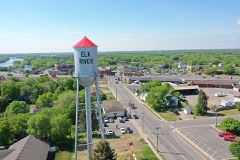 | Elk River Water Tower | structure | 2012 | 12000284 |
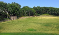 | Elkhi Stadium | structure | 2004 | 04000540 |
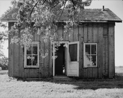 | Herbert M. Fox House | building | 1980 | 80002175 |
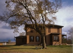 | Oliver H. Kelley Homestead | district | 1966 | 66000406 |
 | Minnesota State Reformatory for Men Historic District | district | 1986 | 86001671 |
Every wildfire the federal occurrence database records inside this county: 1,311 of them, burning about 4,708 acres. 12 started naturally and 178 were recorded as arson. Each settlement page carries the fires within five miles of it.
| Reported cause | Fires |
|---|---|
| Debris and open burning | 552 |
| Missing data/not specified/undetermined | 178 |
| Arson/incendiarism | 178 |
| Equipment and vehicle use | 136 |
| Recreation and ceremony | 116 |
| Railroad operations and maintenance | 71 |
| Smoking | 30 |
| Misuse of fire by a minor | 24 |
| Natural | 12 |
| Power generation/transmission/distribution | 6 |
| Fireworks | 5 |
| Other causes | 2 |
| Firearms and explosives use | 1 |
The five largest, by the area the report gives. Two of them were set deliberately.
| Date | Cause | Size | Reported by | Name on the report |
|---|---|---|---|---|
| 30 April 1996 | Debris and open burning | 1,299 acres | Sherburne National Wildlife Refuge | NIKKO |
| 21 October 1995 | Debris and open burning | 320 acres | Sherburne National Wildlife Refuge | CARPENTER |
| 3 May 2000 | Equipment and vehicle use | 220 acres | Minnesota Department of Natural Resources | not named |
| 24 November 1994 | Debris and open burning | 140 acres | Minnesota Department of Natural Resources | not named |
| 9 November 2006 | Arson/incendiarism | 108 acres | Minnesota Department of Natural Resources | HAMMER FIRE |
| 30 April 1996 | Arson/incendiarism | 100 acres | Minnesota Department of Natural Resources | not named |
| 8 January 2003 | Debris and open burning | 70 acres | Minnesota Department of Natural Resources | not named |
| 28 March 2000 | Missing data/not specified/undetermined | 68 acres | Minnesota Department of Natural Resources | not named |
Every settlement page carries the fires within five miles of it - see the settlement index below.
The NOAA Storm Events Database holds 355 reports for this county, causing 1 death, 13 injuries and about $33,222,250 in recorded property damage. Each settlement page carries the reports that name it.
| Kind of event | Reports |
|---|---|
| Hail | 181 |
| Thunderstorm Wind | 135 |
| Tornado | 13 |
| Funnel Cloud | 12 |
| Heavy Rain | 9 |
| Flash Flood | 4 |
| Lightning | 1 |
The most serious of them, by death, then injury, then recorded damage. The accounts are quoted exactly as the forecast office filed them.
| When | Event | Place named | Harm | What the report says |
|---|---|---|---|---|
| July 1967 | Tornado (F2) | not stated | 1 killed, 12 hurt, $2,500,000 | no account filed |
| July 1997 | Thunderstorm Wind | Big Lake | 1 hurt | Five airplanes overturned at local airport. Roof blown off lumberyard, injurying a motorist. Fire hall doors blown off. Hundreds of trees blown down. Roofs ripped off numerous structures including middle school, apartment building and hardware store. Traffic lights down. Restaurant destroyed. Police car blown off the road. Estimated windspeed. |
| September 2005 | Hail | Big Lake | $25,000,000 | Roof damage reported to hundreds of homes, and golf ball size hail punched through some home siding. Numerous vehicles damaged. A newspaper reported that two insurance companies totaled over 1500 claims in this area. Property damage total is for all of Sherburne County on 9-21-05. |
| May 1998 | Thunderstorm Wind | Elk River | $3,000,000 | Garage destroyed. Roof ripped off nursery. Estimated windspeed. Many trees blown over. Damage estimate for entire county. |
| April 2001 | Flash Flood | Countywide | $2,000,000 | no account filed |
| July 2010 | Thunderstorm Wind | Becker | $250,000 | Several large 13-15 inch diameter trees were uprooted near Becker, Minnesota. In addition, a farm irrigation system was destroyed. |
| July 2010 | Thunderstorm Wind | Elk River | $100,000 | Numerous trees were blown down, along with damage to a farm's fence. Extensive damage occurred in the town of Elk River Minnesota, including the Sherburne County Fair where tents and sheds were blown over. |
| September 2006 | Thunderstorm Wind | Elk River | $100,000 | A used car sales trailer at Elk River Ford-Dodge-Jeep dealership was rolled; the dealership also incurred damage to a sign and some vehicles. Part of a townhome roof was blown off in the Kliever Lake Fields subdivision along County Road 12, just west of Fillmore Street. Some garage doors in the subdivision were pushed in, and one garage was damaged. An area along Yale Street, behind Broadway Bar, saw some damage, as did Park Pointe development. A garage door was blown in at the Furniture and Things warehouse on Ulysses Street. A semi-trailer outside a restaurant was blown over. Trees were blown down and signs were bent. Most information provided by the Annandale Advocate and the Elk River Star newspapers. |
| July 2011 | Hail | Big Lake | $50,000 | Several reports of very large hail occurred from Big Lake, to approximately 5 miles north of Big Lake, Minnesota. |
| July 2011 | Thunderstorm Wind | Orrock | $50,000 | Several spotters reported large trees blown down, along with damage to an antenna in Zimmerman, Minnesota. Several of the trees blown down had diameters of 30 inches from Orrock, to Zimmerman, Minnesota. |
| September 2016 | Thunderstorm Wind | Big Lake | $25,000 | A 20 foot trailer was picked up and blown into a pickup truck and spread across a yard. There was damage to a shed and siding from the debris. |
| August 2011 | Thunderstorm Wind | Elk River | $25,000 | Multiple trees and power lines were blown down near Elk River. |
| July 2002 | Flash Flood | Countywide | $25,000 | Four to seven inches of rain fell, producing water over numerous roads. State highway 169 was closed between Princeton and Zimmerman, and County Road 31 was closed west of Santiago. Several dozen basements were flooded. |
| August 2002 | Thunderstorm Wind | Elk River | $25,000 | Roof partially removed from apartment building. |
| June 1983 | Tornado (F0) | not stated | $25,000 | no account filed |
| July 2001 | Thunderstorm Wind | Becker | $15,000 | Scattered trees down, some on cars. Roof was peeled off a pole barn. |
| July 2001 | Thunderstorm Wind | Clear Lake | $10,000 | Numerous trees down, boats and docks flipped along Briggs Lake. Some trees came down on homes and vehicles. |
| August 2002 | Thunderstorm Wind | Becker | $7,000 | Roof partially peeled off business. |
| July 2010 | Thunderstorm Wind | Clear Lake | $5,000 | Several trees were uprooted in Clear Lake, Minnesota. |
| July 2010 | Thunderstorm Wind | Lake Fremont | $5,000 | A few trees were uprooted and landing on power lines near Zimmerman, Minnesota. |
| July 1973 | Tornado (F0) | not stated | $2,500 | no account filed |
| September 2016 | Hail | Big Lake | $2,000 | Hail occurred in the Aspen Hills area of Big Lake Township. Damage occurred to a vehicle in this location. |
| May 2022 | Thunderstorm Wind | Elk River | $500 | Several large tree branches were blown down in an Elk River parking lot. |
| April 1986 | Tornado (F0) | not stated | $250 | no account filed |
| April 2025 | Hail | Clear Lake | - | Photo measurement provided via social media. |
| April 2025 | Hail | Santiago | - | Photo provided on social media of 1.5-inch hail. |
| July 2025 | Thunderstorm Wind | Clear Lake | - | Snapped trees deposited debris on County Rd 16 off Hwy 10. |
| July 2025 | Thunderstorm Wind | Becker | - | Report from Sheriffs dispatch of a tree down along a road in Becker Township. |
| July 2025 | Thunderstorm Wind | Elk River | - | Ten-inch tree broken by thunderstorm winds. |
| August 2024 | Thunderstorm Wind | Zimmerman | - | Three trees were reported down. |
| July 2023 | Funnel Cloud | Becker | - | A storm chaser reported a brief funnel cloud. |
| July 2023 | Thunderstorm Wind | Zimmerman | - | Dispatch relayed multiple reports of trees down in Zimmerman. Time estimated by radar. |
| July 2023 | Thunderstorm Wind | Elk River | - | Dispatch relayed multiple reports of trees down in Elk River. |
| July 2023 | Hail | Becker | - | Quarter to half dollar size hail via picture on Twitter. |
| July 2023 | Thunderstorm Wind | Elk River | - | Tree fell on house and tent, three people had minor injuries. Time based on radar and dispatch report. |
| May 2022 | Thunderstorm Wind | Elk River | - | A few trees and power lines were blown down in Elk River. |
| May 2022 | Thunderstorm Wind | Zimmerman | - | A few trees were blown down south of Zimmerman. |
| May 2022 | Hail | Becker | - | There was a social media picture of 2 inch hail. |
| May 2022 | Hail | Becker | - | There was a social media picture of 2 inch hail. |
| May 2022 | Hail | Zimmerman | - | There was a social media picture of 1 inch hail. |
| May 2022 | Thunderstorm Wind | Big Lake | - | A large tree blew down in Big Lake. |
| June 2022 | Thunderstorm Wind | Orrock | - | Several trees were blown down south of Orrock, and a few roads were blocked. |
| June 2020 | Hail | Elk River | - | A social media picture of mainly dime to nickel size hail was noted. |
| July 2020 | Thunderstorm Wind | Becker | - | Numerous trees were blown down, including one blown down on a house. |
| August 2018 | Hail | Big Lake | - | A picture of half dollar size hail was posted on social media. |
| March 2017 | Tornado (EF1) | Orrock | - | A NWS storm survey concluded that an EF-1 tornado touched down about 5 miles west of Zimmerman and traveled northeast 8.8 miles, dissipating before reaching Highway 169. The storm also produced non-tornadic scattered tree damage due to strong inflow into the storm in a few locations, including on the east side of Highway 169, just south of Princeton. The tornado had a width of 300 yards, and maximum winds of 110 mph. |
| March 2017 | Thunderstorm Wind | Princeton | - | Large trees were blown down along Highway 169, in Princeton. This was associated with the secondary downburst from the previous tornado in northeast Sherburne County. |
| June 2017 | Thunderstorm Wind | Becker | - | A few trees were snapped or split in half. |
| June 2017 | Thunderstorm Wind | Big Lake | - | There were numerous large branches blown down in Big Lake, some as large as 10 inches in diameter. |
| March 2017 | Hail | Becker | - | Large hail was reported northeast of Becker. Almost all of the hail was dime or smaller. |
| June 2016 | Thunderstorm Wind | Elk River | - | A large tree was blown down in Elk River. |
| July 2016 | Thunderstorm Wind | Elk River | - | Several large trees were blown down northwest of Elk River. |
| July 2016 | Heavy Rain | Becker | - | A trained spotter measured 3.25 inches of rain near Becker. |
| June 2015 | Hail | Big Lake | - | There were several reports of penny to nickel size hail northwest of Big Lake, and through the north and northeast part of town. The largest hail stone was quarter size, northeast of Big Lake. |
| June 2015 | Hail | Elk River | - | There were several reports of hail west and south of Elk River. The largest hail stone was nickel size. |
| July 2015 | Thunderstorm Wind | Big Lake | - | A large tree blew down onto a power line on Riverview Drive in Monticello. |
| May 2014 | Thunderstorm Wind | Princeton | - | A large 2.5 foot wide tree was snapped in half, along with two 30-40 feet tall trees uprooted just southeast of Princeton. |
| June 2013 | Thunderstorm Wind | Orrock | - | Severe thunderstorms knocked down power lines. |
| June 2013 | Thunderstorm Wind | Orrock | - | Several large one to two foot diameter trees were blown down. |
| June 2013 | Heavy Rain | Princeton | - | Storm total rainfall amount of 2.04 inches was measured near Princeton. |
The Survey's mineral resources record lists 18 workings inside this county. 17 still produce and 1 is closed or unrecorded. Each settlement page carries the workings within five miles of it.
| Commodity | Workings |
|---|---|
| Sand and Gravel, Construction | 18 |
The least common of them first, because a county's hundredth gravel pit says nothing its first ten did not.
| Where | Site | Commodity | Status | Recorded |
|---|---|---|---|---|
| Barsody Pit | Sand and Gravel, Construction | Producer | ||
| Barton Pit No 715 | Sand and Gravel, Construction | Producer | ||
| Barton Pit No 717 | Sand and Gravel, Construction | Producer | ||
| Big Lake Pit and Mill | Sand and Gravel, Construction | Producer | ||
| Bussee Pit | Sand and Gravel, Construction | Producer | ||
| Country Club Pit | Sand and Gravel, Construction | Prospect | ||
| Elk River Pit | Sand and Gravel, Construction | Producer | ||
| Elk River Sand & Gravel | Sand and Gravel, Construction | Producer | ||
| Granite City S and G Pit | Sand and Gravel, Construction | Producer | ||
| Granite City Sand and Gravel Pit | Sand and Gravel, Construction | Producer | ||
| Hanson Pit and Mill | Sand and Gravel, Construction | Producer | ||
| Johnson Pit | Sand and Gravel, Construction | Producer | ||
| Kreger Pit and Mill | Sand and Gravel, Construction | Producer | ||
| Malstrom Pit No 726 | Sand and Gravel, Construction | Producer | ||
| Nemeth Pit and Mill | Sand and Gravel, Construction | Producer | ||
| Plaisted Sand | Sand and Gravel, Construction | Producer | ||
| Preussers Pit | Sand and Gravel, Construction | Producer | ||
| Utz Pit | Sand and Gravel, Construction | Producer |
Named settlements recorded in the Geographic Names Information System, each with the topographic sheets covering it. Villages, hamlets and abandoned places alike. Each is shown with the nearest named watercourse or landform and the survey quadrangle it falls on.