 Block
From the record
6 National Register listings published here.
Sources: the National Register database, National Park Service
24 topographic sheets cover 13 settlements here, and 6 properties are on the National Register of Historic Places.
6 National Register listings published here.
Sources: the National Register database, National Park Service
Every property in this county listed on the National Register of Historic Places, with the year it was listed and the federal nomination document.
| Photograph | Property | Type | Listed | Reference |
|---|---|---|---|---|
 | Flanders' Block | building | 1984 | 84001714 |
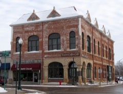 | Grand Opera House | building | 2009 | 09001152 |
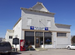 | Nelson and Albin Cooperative Mercantile Association Store | building | 1987 | 86003599 |
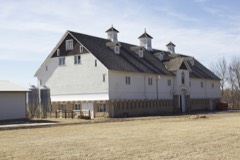 | Alfred R. Voss Farmstead | building | 1988 | 88002054 |
 | Watonwan County Courthouse | building | 1987 | 86003591 |
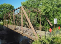 | West Bridge | structure | 2013 | 13000883 |
The NOAA Storm Events Database holds 223 reports for this county, causing no deaths, no injuries and about $10,900,500 in recorded property damage. Each settlement page carries the reports that name it.
| Kind of event | Reports |
|---|---|
| Hail | 100 |
| Thunderstorm Wind | 71 |
| Tornado | 24 |
| Flash Flood | 10 |
| Flood | 7 |
| Heavy Rain | 6 |
| Funnel Cloud | 5 |
The most serious of them, by death, then injury, then recorded damage. The accounts are quoted exactly as the forecast office filed them.
| When | Event | Place named | Harm | What the report says |
|---|---|---|---|---|
| September 2010 | Flood | Odin | $3,900,000 | Numerous roads were closed due to excessive rainfall that fell on September 22nd and 23th. The major areal flooding didn't recede until late Saturday when most of the small streams and creeks had crested and only mainstem rivers remained flooded. |
| June 1979 | Tornado (F1) | not stated | $2,500,000 | no account filed |
| August 2006 | Tornado (F3) | Butterfield | $2,000,000 | Initial damage occurred at farmstead just east of the Watonwan/Cottonwood line. Damage included the partial removal of roofs off two large sheds, along with scattered downed trees. The tornado then moved across corn and bean fields. Another farmstead was hit just southwest of the intersection of County Roads 10 and 2. This was the location of the F3 damage. A house was leveled, a 60 foot concrete base silo was toppled and rolled. Virtually all barns, sheds and outbuildings were completely destroyed. |
| June 2019 | Thunderstorm Wind | St James Arpt | $500,000 | St. James regional airport measured a wind gust of 78 mph. A storm survey team from the NWS determined the damage from surrounding areas was due to a downburst, with a classic fanning out pattern. Part of a roof from a turkey barn was blown off, several vehicles were blown off Highway 60, and hundreds of trees were broken or uprooted southwest to southeast of the airport. There was also significant damage to the airport's hanger. |
| August 2006 | Tornado (F1) | Echols | $500,000 | The tornado developed near Mary's Lake and moved across corn and bean fields before striking a farmstead just northwest of County Roads 10 and 27. Nearly empty grain bins were dented, sheds demolished, and a 32 foot camper was destroyed. A house lost its garage, part of its roof, and was pushed off its foundation. A large vehicle was also pushed a couple of hundred feet. Shortly after hitting the farmstead, it veered southeast into some fields, where it dissipated. |
| August 2006 | Tornado (F1) | St James | $500,000 | Shortly after another tornado dissipated at 1842 CST four miles south of St. James, another tornado quickly developed about 1/4 mile away. It moved across corn and bean fields until it struck a farm just southwest of County Roads 110 and 122, where it destroyed machine sheds and removed the roof of the barn. It continued moving northeast before veering to the north, where it dissipated as it hit an abandoned farmhouse. |
| August 1977 | Tornado (F2) | not stated | $250,000 | no account filed |
| July 1963 | Tornado (F2) | not stated | $250,000 | no account filed |
| July 2015 | Tornado (EF0) | Echols | $100,000 | A landspout-type tornado briefly occurred north of Ormsby. A storage building and some piles of tiling were damaged as the tornado hit a construction business. The tornado was photographed or recorded on video by several people. |
| August 2002 | Thunderstorm Wind | St James | $75,000 | Garage complex at apartment building partially collapsed; four cars damaged. Roof came off a home that was under construction. Numerous trees down. |
| May 2022 | Thunderstorm Wind | St James | $50,000 | Several trees were blown down in St. James, including some that landed on homes and damaged them. |
| May 2022 | Thunderstorm Wind | Madelia | $50,000 | Numerous large branches were blown down, a few structures were damaged, including a building under construction that had its roof blown off. Power poles were also blown down near the same area, east of Madelia. |
| June 2015 | Thunderstorm Wind | St James | $50,000 | A large tree was blown down and landed on a house in St. James. |
| July 1994 | Thunderstorm Wind | Madelia | $50,000 | Strong winds toppled a tree onto the side of a home in Madelia. This led to several broken windows and damage to the roof and siding. |
| June 1981 | Tornado (F1) | not stated | $25,000 | no account filed |
| March 1968 | Tornado (F2) | not stated | $25,000 | no account filed |
| May 1962 | Tornado (F2) | not stated | $25,000 | no account filed |
| June 2020 | Hail | Ormsby | $20,000 | A swath of large hail, up to half dollar size, fell around the Odin/Ormsby area where vehicles were damaged. |
| July 2016 | Thunderstorm Wind | St James | $10,000 | Several large trees and power lines were blown down in the town of St. James. A mobile home was knocked off its foundation near St. James Lake. |
| July 2012 | Thunderstorm Wind | St James | $10,000 | A large tree, several large tree branches, and several power lines were blown down in St. James. In addition, a small part of a roof was blown off. |
| August 2010 | Tornado (EF0) | Sveadahl | $5,000 | A funnel had been visible for several minutes before it touched down. The tornado stirred up some dirt, knocked over some small items, and tore off a few shingles. |
| June 1980 | Tornado (F0) | not stated | $2,500 | no account filed |
| July 1971 | Tornado (F1) | not stated | $2,500 | no account filed |
| July 1994 | Hail | St. James | $500 | no account filed |
| April 2026 | Tornado (EFU) | Lewisville | - | This tornado was witnessed by multiple storm chasers. The location is approximate and based on video from various chasers. It crossed open fields and appeared to not hit any damage indicators. |
| April 2026 | Tornado (EFU) | Lewisville | - | This tornado was witnessed by multiple storm chasers. The location is based on video from various chasers. It crossed open fields while in Watonwan County and appeared to not hit any damage indicators. Once it moved into Blue Earth County, it hit several farms. The tornado was also reported by personnel with Truman Fire. |
| July 2025 | Thunderstorm Wind | Godahl | - | Tree fell on a power line, taking out power in Godahl. |
| August 2024 | Tornado (EF1) | Sveadahl | - | The tornado mostly moved across corn and bean fields, with non-continuous crop damage. It did move across a farmstead where it uprooted numerous trees, but there was little damage to nearby structures. A power pole was damaged. Several storm chasers took video of the tornado, including one who filmed it for nearly seven minutes. |
| August 2024 | Funnel Cloud | Lewisville | - | A funnel cloud was caught on video. It was not possible to see if there was any ground contact. The county Emergency Manager surveyed the area and found no evidence of any tree, crop, or structural damage, and there were no reports of any damage, nor were there any other pictures or videos. Therefore this is listed as a funnel cloud. |
| June 2024 | Flash Flood | Madelia | - | Numerous roads were flooded across the county. |
| May 2023 | Hail | Madelia | - | Nickel size hail just east of Madelia. |
| August 2023 | Hail | Odin | - | There was also a report of power out in Odin. |
| August 2023 | Thunderstorm Wind | St James | - | Powerlines were reported down in St. James. |
| August 2021 | Thunderstorm Wind | Sveadahl | - | There were several trees blown down around the Sveadahl community. |
| August 2021 | Thunderstorm Wind | St James | - | A few trees were blown down in St. James. |
| August 2021 | Funnel Cloud | Madelia | - | A trained spotter observed a funnel cloud north of Madelia. |
| June 2020 | Thunderstorm Wind | South Branch | - | A large tree was blown down. |
| March 2019 | Flood | Sveadahl | - | Flood waters from snow melt caused Highway 4, north of St. James which is along the Watonwan River, to close for several days. |
| June 2019 | Tornado (EF0) | Godahl | - | This tornado touched down in an open field. |
| August 2019 | Thunderstorm Wind | Darfur | - | A large tree blew down near Butterfield and caused a gas leak. No injuries were reported. |
| August 2019 | Thunderstorm Wind | St James | - | Several power lines were blown down in the city of St. James. |
| August 2019 | Thunderstorm Wind | St James Arpt | - | Several power lines were blown down in Madelia, and between St. James and Madelia. |
| July 2019 | Thunderstorm Wind | St James | - | Power was knocked out in the city of St. James due to blown down power lines. |
| July 2018 | Hail | Darfur | - | A swath of large hail, up to 1.5 inches in diameter, was observed from near Darfur, southeast to west of St. James. |
| May 2018 | Funnel Cloud | Lewisville | - | A skinny funnel extended from a high-based shower or thunderstorm. The photo showed it about about halfway to the ground, but it was not possible to determine whether it ever touched down. Photo relayed by KEYC-TV. |
| July 2017 | Thunderstorm Wind | St James | - | A large tree was blown down near St. James. |
| June 2016 | Thunderstorm Wind | St James | - | Several large tree limbs, up to 10 inches in diameter, and a large tree was blown down in St. James. The most concentrated area was on Armstrong Avenue. |
| June 2016 | Thunderstorm Wind | Madelia | - | A large tree was blown down over a road. |
| June 2016 | Thunderstorm Wind | Darfur | - | A few large trees were blown down in the town of Darfur. |
| June 2016 | Thunderstorm Wind | Ormsby | - | A few large trees were blown down in the town of Ormsby. |
| June 2016 | Heavy Rain | Madelia | - | A 4 hour rainfall report of 3.80 inches occurred in the town of Madelia. |
| June 2016 | Thunderstorm Wind | St James | - | Several large tree branches were blown down in St. James. |
| July 2016 | Hail | Lewisville | - | Some minor crop damage also occurred with wind driven hail. |
| August 2014 | Flash Flood | Darfur | - | Rainfall amounts exceeded five inches in portions of Watonwan County, with roads closed due to flooding in the town of St. James. |
| September 2014 | Thunderstorm Wind | Madelia | - | Numerous trees and large branches were blown down in the town of Madelia. |
| May 2014 | Tornado (EF0) | Madelia | - | A trained spotter reported a tornado touching down briefly in an open field in extreme northeastern Watonwan County before it moved into extreme southeastern Brown County and then Blue Earth County. The tornado was videotaped by a storm chaser when it was in Blue Earth County. |
| May 2014 | Tornado (EF0) | Butterfield | - | Tornado was witnessed and filmed my multiple storm chasers. It moved across open fields and caused no damage. |
| June 2014 | Flash Flood | St James | - | Several roads were closed in St. James due to high water from heavy rainfall in the past hour. |
| June 2014 | Heavy Rain | St James | - | A measured 12 hour rainfall total of 3.00 inches in St. James. |
| May 2012 | Heavy Rain | Sveadahl | - | A local observer measured 3.27 inches in the last 24 hours. |
The Survey's mineral resources record lists 2 workings inside this county. All of them still produce. Each settlement page carries the workings within five miles of it.
| Commodity | Workings |
|---|---|
| Sand and Gravel, Construction | 2 |
The least common of them first, because a county's hundredth gravel pit says nothing its first ten did not.
| Where | Site | Commodity | Status | Recorded |
|---|---|---|---|---|
| Flitter Pit & Mill | Sand and Gravel, Construction | Producer | ||
| Nasman Pit and Mill | Sand and Gravel, Construction | Producer |
Named settlements recorded in the Geographic Names Information System, each with the topographic sheets covering it. Villages, hamlets and abandoned places alike. Each is shown with the nearest named watercourse or landform and the survey quadrangle it falls on.
Riverdale township · 56056 · On Butterfield Creek · La Salle quadrangle
10 sheets, 1953 to 1991