 Block
Aitkin, Minnesota
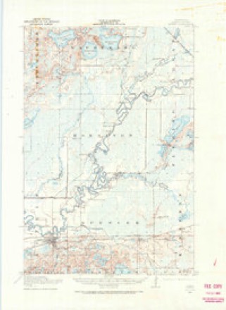
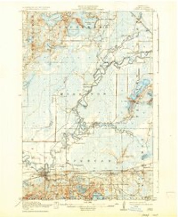
10 topographic sheets cover this place, the earliest surveyed in 1914 and the latest in 1994. It stands in Aitkin City. It lies in ZIP code area 56431. It stands on Ripple River. The Survey maps it on the Aitkin quadrangle. 2,168 people lived here at the 2020 count. It stands 1,211 feet above sea level.
Research this city
On record in Aitkin
Buildings and businesses the archive holds for this place. Each opens its own page, with the source record it came from.
On the National Register 7 records
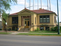 Aitkin Carnegie Librarylisted 1982
 Aitkin County Courthouse and Jaillisted 1982
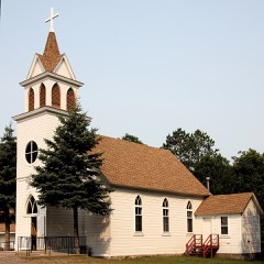 Bethelhem Lutheran Churchlisted 1982
 Patrick Casey Houselisted 1982
 Northern Pacific Depotlisted 1982
 Pine-Hickory Lakes Roadside Parking Arealisted 2016
 Potter/Casey Company Buildinglisted 1982
Population over time
2 figuresAitkin grew from 2,165 to 2,168 between 2010 and 2020. These are the recorded population figures Wikidata holds for this place, reached through the Geographic Names Information System number this page is keyed on rather than by name, so they belong to this place and not to another of the same name. Most are census counts, but not all are: an early figure may be a founding or settlement estimate, and an estimate published within five years of a census is left out. The change column is computed, and is left blank where more than 20 years separate a figure from the one before it, because a gap that long is not a change between two counts.
| Year | People | Change |
|---|---|---|
| 2010 | 2,165 | |
| 2020 | 2,168 | +3 (+0%) |
Topographic sheets covering this place
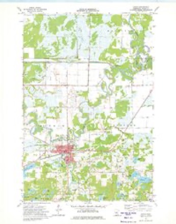
6 surveys from 10 printed sheetsMatched by testing this settlement's coordinate against the published boundary of every sheet in the United States Geological Survey's historical collection. Each opens the scanned sheet at the Survey.
- 1914 USGS Aitkin quadrangle1:62500
- 1915 USGS Aitkin quadrangle1:62500, 4 printings
- 1953 USGS Duluth quadrangle1:250000, 2 printings
- 1958 USGS Duluth quadrangle1:250000
- 1973 USGS Aitkin quadrangle1:24000
- 1994 USGS Aitkin quadrangle1:100000
Fires near this place
158 since 1992Regional context, not property-specific evidence. The federal wildfire occurrence database lists 158 fires within 5 miles of Aitkin between 1992 and 2020, burning about 933 acres in total. 4 started naturally. 12 were recorded as arson. Distance is straight-line from the map coordinates, so a fire counted here may appear on a neighbouring settlement's page as well.
| Reported cause | Fires |
|---|---|
| Debris and open burning | 97 |
| Equipment and vehicle use | 19 |
| Missing data/not specified/undetermined | 16 |
| Arson/incendiarism | 12 |
| Natural | 4 |
| Power generation/transmission/distribution | 3 |
| Recreation and ceremony | 3 |
| Misuse of fire by a minor | 2 |
| Smoking | 1 |
| Other causes | 1 |
The most recent of them, most recent first, with the day each was reported and the service that recorded it.
| Date | Cause | Size | Reported by | Name on the report |
|---|---|---|---|---|
| 30 September 2012 | Equipment and vehicle use | 2.0 acres | Minnesota Department of Natural Resources | not named |
| 8 August 1992 | Missing data/not specified/undetermined | 2.0 acres | Minnesota Department of Natural Resources | not named |
| 5 August 1999 | Debris and open burning | under an acre | Minnesota Department of Natural Resources | not named |
| 25 August 1996 | Natural | under an acre | Minnesota Department of Natural Resources | not named |
| 19 August 2018 | Debris and open burning | under an acre | Minnesota Department of Natural Resources | not named |
| 12 August 2008 | Natural | under an acre | Minnesota Department of Natural Resources | not named |
| 1 August 2019 | Debris and open burning | under an acre | Minnesota Department of Natural Resources | not named |
| 4 July 2001 | Equipment and vehicle use | under an acre | Minnesota Department of Natural Resources | not named |
Settlements close enough to share some of these fires:
Mines and quarries near this place
8 within 5 milesRegional context, not property-specific evidence. The federal mineral resources record lists 8 workings within 5 miles of Aitkin: 5 occurrences, 1 unknown, 1 producer, 1 prospect. 1 still produces. What was taken out: Limestone, General, Sand and Gravel, Construction, Iron, Manganese. Distance is straight-line from the map coordinates, so a quarry counted here may appear on a neighbouring settlement's page as well.
| Where | Site | Commodity | Status | Recorded |
|---|---|---|---|---|
| Rice River Reserve St-8 | Iron, Manganese | Prospect | ||
| Haddeland Pit & Mill | Sand and Gravel, Construction | Producer | ||
| Johnson Pit | Sand and Gravel, Construction | Unknown | ||
| Aitkin County Marl Beds No 1 | Limestone, General | Occurrence | ||
| Aitkin County Marl Beds No 2 | Limestone, General | Occurrence | ||
| Aitkin County Marl Beds No 4 | Limestone, General | Occurrence | ||
| Aitkin County Marl Beds No 5 | Limestone, General | Occurrence | ||
| Aitkin County Marl Beds No 6 | Limestone, General | Occurrence |
Storms near this place
60 of 64 shownRegional context, not property-specific evidence. The National Weather Service names Aitkin in 64 storm reports between 1994 and 2025: 28 thunderstorm wind, 21 hail, 8 flood, 3 flash flood. No death or injury is recorded in these reports. Each account below is quoted exactly as the forecast office filed it, from the NOAA Storm Events Database, and each date opens the federal record of that event.
| When | Event | Place named | Harm | What the report says |
|---|---|---|---|---|
| June 2024 | Tornado (EF1) | Aitkin | $500,000 | Another tornado developed on the northern portion of Hammal lake, where localized pockets of extensive tree damage were located, and one three-season cabin and boat house were completely destroyed and partially thrown into the water. The tornado continued east- southeast, uprooting and snapping several mature tree trunks as it crossed Highway 169 and Hanging Kettle Lake. The tornado then took a east-southeastward path through Ripple Lake, uprooting trees and knocking over an 85 foot tall antenna tower before the tornado ended over southeastern Ripple Lake. No fatalities or injuries were reported. |
| June 2024 | Tornado (EF0) | Aitkin | $50,000 | The tornado initially formed near Wolford in Crow Wing County and entered Aitkin County near the end of Cedar Lake Drive on Cedar Lake. The tornado path was to the southeast, crossing 456th Place, 320th Street, and, finally, 310th Street before lifting. This last section of the tornado path after Cedar Lake shows damage to numerous trees via satellite imagery before the visible damage path ends just to the southwest of the intersection of 310th Street and Pioneer Avenue. The tornado was rates as an EF-0 in Aitkin County, but produced EF-2 damage in Crow Wing County just before crossing into Aitkin County. No fatalities or injuries were reported. |
| June 2025 | Thunderstorm Wind | Aitkin | $20,000 | A large oak tree was down on a house with other trees also down on powerlines. |
| June 1994 | Thunderstorm Wind | Aitkin | $500 | Power lines were blown over by strong thunderstorm winds. |
| June 2025 | Thunderstorm Wind | Aitkin | - | County dispatch reported multiple trees and powerlines down in Aitkin. |
| July 2024 | Thunderstorm Wind | Aitkin | - | Two large oak trees were blown down from west to east. |
| May 2022 | Thunderstorm Wind | Aitkin | - | Multiple trees were reported down that were around a foot in diameter. A healthy tree was also snapped a few feet off the ground. |
| June 2022 | Thunderstorm Wind | Aitkin | - | Numerous medium to large trees were snapped and uprooted over roadways and alleyways. |
| June 2022 | Thunderstorm Wind | Aitkin | - | The top of a large pine tree was snapped. |
| June 2022 | Thunderstorm Wind | Aitkin | - | Parts of a metal building were ripped off and strewn over semi trucks. |
| June 2022 | Thunderstorm Wind | Aitkin | - | Numerous trees were reported downed. |
| June 2022 | Thunderstorm Wind | Aitkin | - | Multiple trees were snapped and were covering roads and a house. |
| July 2019 | Thunderstorm Wind | Aitkin | - | Aitkin County Sheriff reported that power lines and trees were downed within the city of Aitkin due to the storm. |
| May 2018 | Hail | Aitkin | - | Nickel-size hail was reported on Wilkins Lake. |
| September 2018 | Thunderstorm Wind | Aitkin | - | A pickup truck was lifted by the wind and landed on top of another truck on 2nd Street in Aitkin. |
| September 2018 | Thunderstorm Wind | Aitkin | - | Several trees were downed in the winds. The largest tree was about 2 feet in diameter. |
| July 2018 | Flash Flood | Aitkin | - | Water was reported flowing into the first floor of an elderly care facility. |
| July 2016 | Thunderstorm Wind | Aitkin | - | The wind caused downed trees and structural damage to a home. A previously secured deck was thrown to the other side of a home. |
| July 2016 | Thunderstorm Wind | Aitkin | - | There were numerous trees blown down in the Aitkin area. |
| July 2016 | Flash Flood | Aitkin | - | There was 10 to 12 of water of the roadway at the intersection of 344th Street and County Road 12. A car was pushed by the water. |
| July 2015 | Hail | Aitkin | - | There was pea to dime sized hail. |
| July 2014 | Thunderstorm Wind | Aitkin | - | Numerous trees were down throughout the county. |
| July 2014 | Thunderstorm Wind | Aitkin | - | Trees were blown down. |
| May 2013 | Flood | Aitkin | - | The Mississippi River at Aitkin rose above flood stage on April 30 and fell below flood stage on May 17. Flood stage is 12 feet and the river crested on 13.35 feet on on May 8th at 11:45 pm CDT. There were no impacts. |
| April 2013 | Flood | Aitkin | - | There was little impact from the flooding. Flood stage is 12.0 feet. The river crested at 13.35 feet on May 8th. |
| June 2012 | Flood | Aitkin | - | River flooding continued from heavy rains in May 2012, with a crest of 15.09 feet on June 1st. The river fell below the 12 foot flood stage at 400 PM CST on June 12th. |
| June 2012 | Flood | Aitkin | - | Flooding began at 1100 PM CST, June 17th as the Mississippi River rose to the flood stage of 12 feet. The river crested at 18.72 feet at 600 PM CST on June 29th, and ended the month above flood stage at 18.42 feet. |
| July 2012 | Flood | Aitkin | - | The Mississippi River at Aitkin began July at 18.40 feet and went below their flood stage of 12 feet at 4:30 PM July 19th. |
| July 2011 | Thunderstorm Wind | Aitkin | - | Trees of one foot diameter were blown down. |
| April 2009 | Hail | Aitkin | - | There were many reports of hail less than one inch. |
| July 2009 | Flash Flood | Aitkin | - | Parts of a rail road track were washed out by the Ripple River in Aitkin. Also, the heavy rain caused streets to be inundated with standing water. One city block was affected by water in, or approaching, buildings. Rainfall of two to four inches occurred in a few hours. |
| August 2005 | Thunderstorm Wind | Aitkin | - | Trees and power lines were blown down in and around Aitkin. Trees were blown onto Highways 18, 65, and 169. There was also damage near Malmo. The damage area was 25 miles wide and 40 miles long across southern Aitkin County. 3500 households were without power, some for up to 4 days. |
| September 2004 | Thunderstorm Wind | Aitkin | - | Trees and power lines were blown down. |
| July 2002 | Thunderstorm Wind | Aitkin | - | Trees were blown down. |
| June 2001 | Thunderstorm Wind | Aitkin | - | Trees and power lines were blown down. |
| June 2001 | Thunderstorm Wind | Aitkin | - | Trees were blown down. The wind speed is estimated. |
| July 2000 | Lightning | Aitkin | - | Lightning started a house fire. There were no injuries. |
| June 1997 | Thunderstorm Wind | Aitkin | - | Strong thunderstorm winds blew down many trees and power lines across a wide area from east and north of Mille Lacs Lake to the vicinity of Aitkin. Wind speed is estimated. |
| July 1995 | Thunderstorm Wind | Aitkin | - | Many trees were blown down. |
| June 1994 | Thunderstorm Wind | Aitkin | - | Numerous large trees were blown down on Highway 18 along the north shore of Mille Lacs Lake. The roadway was blocked in several locations. |
| July 2025 | Hail | Aitkin | - | no account filed |
| July 2025 | Hail | Aitkin | - | no account filed |
| June 2024 | Hail | Aitkin | - | no account filed |
| June 2024 | Hail | Aitkin | - | no account filed |
| June 2022 | Hail | Aitkin | - | no account filed |
| August 2018 | Hail | Aitkin | - | no account filed |
| August 2018 | Hail | Aitkin | - | no account filed |
| August 2018 | Hail | Aitkin | - | no account filed |
| March 2016 | Hail | Aitkin | - | no account filed |
| June 2016 | Hail | Aitkin | - | no account filed |
| June 2016 | Hail | Aitkin | - | no account filed |
| July 2015 | Hail | Aitkin | - | no account filed |
| May 2012 | Flood | Aitkin | - | no account filed |
| May 2012 | Hail | Aitkin | - | no account filed |
| April 2011 | Flood | Aitkin | - | no account filed |
| May 2011 | Flood | Aitkin | - | no account filed |
| May 2007 | Hail | Aitkin | - | no account filed |
| April 2007 | Hail | Aitkin | - | no account filed |
| May 2006 | Hail | Aitkin | - | no account filed |
| May 2006 | Hail | Aitkin | - | no account filed |
Nearest settlements
The eight closest, with where each one stands in the county. Distances are straight-line, computed from the Geographic Names Information System coordinates.
| Map | Place | Distance | Sheets |
|---|---|---|---|
| Pine Knoll | 4.0 miles | 10 | |
| Rossburg | 6.9 miles | 10 | |
| Hassman | 7.0 miles | 10 | |
| Bennettville | 9.3 miles | 10 | |
| Glory | 9.9 miles | 10 | |
| Waldeck | 11.2 miles | 10 | |
| Wealthwood | 12.1 miles | 10 | |
| Cutler | 12.3 miles | 11 |
Elsewhere
Matched on this settlement's Geographic Names Information System number rather than its name, so it cannot be a different place of the same name in another state.
| Wikipedia article on Aitkin | An encyclopaedic summary. Its text is share-alike, so it is linked here rather than copied. |
| Wikidata item Q2232157 | The structured record the population and elevation above come from. Public domain (CC0). |
Provenance
This settlement is recorded in the Geographic Names Information System as feature 639235. The sheet list is computed by point-in-boundary test against the United States Geological Survey's historical topographic inventory. Both are works of the United States government and carry no copyright under 17 U.S.C. 105.
Wildfire. Short, Karen C. 2022. Spatial wildfire occurrence data for the United States, 1992-2020 [FPA_FOD_20221014]. 6th Edition. Fort Collins, CO: Forest Service Research Data Archive. https://doi.org/10.2737/RDS-2013-0009.6 Collected with United States Government funding and usable without additional permissions or fees.
Mines and quarries. USGS Mineral Resources Data System (MRDS) https://mrdata.usgs.gov/mrds/ A work of the United States government, no copyright under 17 U.S.C. 105.
Storms. NOAA National Centers for Environmental Information, Storm Events Database https://www.ncei.noaa.gov/stormevents/ A work of the United States government, no copyright under 17 U.S.C. 105. Narratives are quoted verbatim from the National Weather Service report and are not edited or summarised.