 Block
Brooten, Minnesota
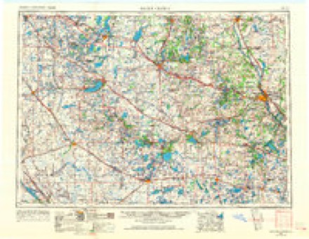
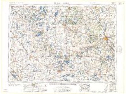
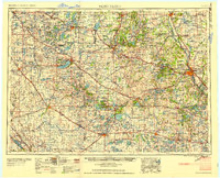
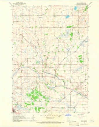
8 topographic sheets cover this place, the earliest surveyed in 1953 and the latest in 1986. It stands in Brooten City. It lies in ZIP code area 56316. The Survey maps it on the Padua quadrangle. 626 people lived here at the 2020 count. It stands 1,312 feet above sea level.
Population over time
2 figuresBrooten fell from 743 to 626 between 2010 and 2020. These are the recorded population figures Wikidata holds for this place, reached through the Geographic Names Information System number this page is keyed on rather than by name, so they belong to this place and not to another of the same name. Most are census counts, but not all are: an early figure may be a founding or settlement estimate, and an estimate published within five years of a census is left out. The change column is computed, and is left blank where more than 20 years separate a figure from the one before it, because a gap that long is not a change between two counts.
| Year | People | Change |
|---|---|---|
| 2010 | 743 | |
| 2020 | 626 | -117 (-16%) |
Topographic sheets covering this place
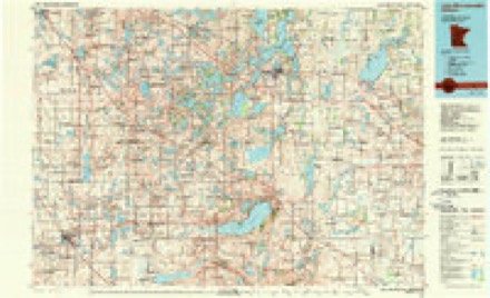
5 surveys from 8 printed sheetsMatched by testing this settlement's coordinate against the published boundary of every sheet in the United States Geological Survey's historical collection. Each opens the scanned sheet at the Survey.
- 1953 USGS Saint Cloud quadrangle1:250000, 3 printings
- 1957 USGS Saint Cloud quadrangle1:250000
- 1958 USGS Saint Cloud quadrangle1:250000
- 1965 USGS Padua quadrangle1:24000
- 1986 USGS Lake Minnewaska quadrangle1:100000, 2 printings
In the county-history sources
3,055 words on this townshipHistory of Stearns County, Minnesota, published 1915 names this settlement in its chapter on Brooten City. These are the passages that mention it, exactly as the scans read.
Brooten village, with a population of 562 persons, is located on the "Soo" line, in the southwest corner of the town, and was started with the building of that line through this locality in 1886. It was organized as a village several years later. In 1907 the Duluth branch was built into Brooten. It had in 1914 nine stores - a harness shop, a drug store, a bakery and confectionery, two meat markets, two hotels, four restaurants, a barber shop, an auto repair shop, a garage, a livery, a printing office, a foundry, four grain elevators, one of which is farmers' co-operative elevator. It has two banks, two implement houses, two real estate offices, two lumber yards, two blacksmith shops, and two churches, a Catholic and a Lutheran. The public school grounds of this village are one of the most beautiful in the Northwest The public school has a full high school course; a course in agriculture was added during the school year of 1913-14. Other public buildings are, an electric plant and the waterworks, also a Farmers' Co-Operative Creamery located in the east part of the village. Brooten has been "dry" for a number of years and is one of the leading business places on the "Soo" west of Minneapolis.
Passage source: History of Stearns County, Minnesota, published 1915.
New Munich was still a small village until the summer of 1907, when the Minneapolis, St. Paul & Sault Ste. Marie Company built a branch from Brooten to Duluth, passing through New Munich, which gave it a new impetus. Fred G. Leach was the first station agent, which position he £till holds. Since that time New Munich has grown until it has at present the New Munich State Bank, with a capital and surplus of $17,500, incorporated Nov. 25, 1907 (P. A. Hilbert, president; Math Pitzl, vice-president; H. J. Terhaar, cashier); a postoffice, a Catholic church, a public school, a brewery, a creamery, a bookbindery, a harnessmaker, a garage, a livery and a dray line, an elevator, a lumber yard, a grist mill, a public hall, a drug store, an implement shop, two hardware stores, two hotels, two blacksmith shops, four sample rooms, three general stores and three shoemaker shops. There are many fine dwellings, cement sidewalks, over 900 feet of water mains with an 80 foot water tank, an up-to-date electric light plant, and a beautiful waterfall in the Sauk river, which some day will probably furnish power for the village as well as for factories.
Passage source: History of Stearns County, Minnesota, published 1915.
Machine-read from a century-old scan, so expect the errors a machine makes: misspelled names, dropped words, stray characters.
Fires near this place
9 since 2000Regional context, not property-specific evidence. The federal wildfire occurrence database lists 9 fires within 5 miles of Brooten between 2000 and 2009, burning about 658 acres in total. None started naturally. None was recorded as arson. Distance is straight-line from the map coordinates, so a fire counted here may appear on a neighbouring settlement's page as well.
| Reported cause | Fires |
|---|---|
| Missing data/not specified/undetermined | 4 |
| Railroad operations and maintenance | 3 |
| Equipment and vehicle use | 1 |
| Debris and open burning | 1 |
The most recent of them, most recent first, with the day each was reported and the service that recorded it.
| Date | Cause | Size | Reported by | Name on the report |
|---|---|---|---|---|
| 15 July 2008 | Missing data/not specified/undetermined | under an acre | Morris National Wildlife Refuge | STEARNS WPA |
| 17 April 2009 | Railroad operations and maintenance | 25 acres | Minnesota Department of Natural Resources | not named |
| 17 April 2009 | Railroad operations and maintenance | 33 acres | Minnesota Department of Natural Resources | not named |
| 17 April 2009 | Railroad operations and maintenance | 39 acres | Minnesota Department of Natural Resources | not named |
| 15 April 2009 | Missing data/not specified/undetermined | 160 acres | Minnesota Department of Natural Resources | not named |
| 10 April 2003 | Debris and open burning | 250 acres | Minnesota Department of Natural Resources | not named |
| 13 December 2006 | Equipment and vehicle use | 1.0 acres | Morris National Wildlife Refuge | LAKE JOHANNA |
| 11 October 2000 | Missing data/not specified/undetermined | 150 acres | Minnesota Department of Natural Resources | not named |
Settlements close enough to share some of these fires:
Storms near this place
22 since 1996Regional context, not property-specific evidence. The National Weather Service names Brooten in 22 storm reports between 1996 and 2025: 12 thunderstorm wind, 8 hail, 1 tornado, 1 funnel cloud. No death or injury is recorded in these reports. Each account below is quoted exactly as the forecast office filed it, from the NOAA Storm Events Database, and each date opens the federal record of that event.
| When | Event | Place named | Harm | What the report says |
|---|---|---|---|---|
| August 2010 | Tornado (EF1) | Brooten | $500,000 | A National Weather Service Storm Survey determined that an EF-1 tornado touched down approximately two miles north of Brooten, and tracked to the northeast to approximately 2.5 miles west of Elrosa, Minnesota. Hundreds of trees were snapped or uprooted. Several farmsteads were damaged. Roofs were blown off of barns, and several sheds and outbuildings, including grain bins were blown down. |
| July 2025 | Thunderstorm Wind | Brooten | - | Multiple trees down in Brooten. |
| July 2023 | Thunderstorm Wind | Brooten | - | Brooten fire department reported wind gusts of 50 to 60 mph about five miles south of Brooten. |
| September 2017 | Thunderstorm Wind | Brooten | - | About 20 trees were broken about 2/3 mile to the southeast of a tornado that was west of Elrosa. The tree damage was deemed to be due to rear flank downdraft winds. |
| September 2017 | Thunderstorm Wind | Brooten | - | About two dozen trees were damaged, a house lost a portion of its roof, siding was peeled away, and corn fields sustained some damage. This area may have been an earlier beginning point of the tornado that tracked from west to northeast of Elrosa, but damage was too scant to be certain, and therefore this damage has been listed as thunderstorm wind damage. |
| September 2017 | Thunderstorm Wind | Brooten | - | A few small trees of <6 inches in diameter and limbs down on the south side of Brooten. |
| June 2016 | Thunderstorm Wind | Brooten | - | Numerous large tree branches blew down in Brooten, some as large as 12 inches in diameter. |
| June 2016 | Funnel Cloud | Brooten | - | The funnel cloud was filmed and photographed by two storm chasers. |
| June 2013 | Thunderstorm Wind | Brooten | - | A one foot diameter tree branch and a flag pole were blown down. |
| August 2010 | Thunderstorm Wind | Brooten | - | Several trees were blown down around Brooten, Minnesota. |
| September 2007 | Hail | Brooten | - | Relayed via ham radio. |
| July 2003 | Thunderstorm Wind | Brooten | - | Numerous trees downed, some on houses on vehicles. Several trees blocked roads. |
| April 2002 | Thunderstorm Wind | Brooten | - | Trees down. |
| June 1998 | Thunderstorm Wind | Brooten | - | Trees down. Estimated windspeed. |
| September 2019 | Hail | Brooten | - | no account filed |
| August 2013 | Hail | Brooten | - | no account filed |
| August 2010 | Hail | Brooten | - | no account filed |
| June 2005 | Hail | Brooten | - | no account filed |
| May 2004 | Hail | Brooten | - | no account filed |
| June 2003 | Hail | Brooten | - | no account filed |
| June 1999 | Hail | Brooten | - | no account filed |
| July 1996 | Thunderstorm Wind | Brooten | - | no account filed |
Nearest settlements
The eight closest, with where each one stands in the county. Distances are straight-line, computed from the Geographic Names Information System coordinates.
| Map | Place | Distance | Sheets |
|---|---|---|---|
| Belgrade | 7.2 miles | 9 | |
| Padua | 8.6 miles | 8 | |
| Elrosa | 10.3 miles | 8 | |
| Georgeville | 11.6 miles | 8 | |
| Greenwald | 15.6 miles | 8 | |
| Spring Hill | 15.7 miles | 8 | |
| Meire Grove | 16.2 miles | 10 | |
| Lake Henry | 17.6 miles | 8 |
Elsewhere
Matched on this settlement's Geographic Names Information System number rather than its name, so it cannot be a different place of the same name in another state.
| Wikipedia article on Brooten | An encyclopaedic summary. Its text is share-alike, so it is linked here rather than copied. |
| Wikidata item Q2232275 | The structured record the population and elevation above come from. Public domain (CC0). |
Provenance
This settlement is recorded in the Geographic Names Information System as feature 640523. The sheet list is computed by point-in-boundary test against the United States Geological Survey's historical topographic inventory. Both are works of the United States government and carry no copyright under 17 U.S.C. 105.
Wildfire. Short, Karen C. 2022. Spatial wildfire occurrence data for the United States, 1992-2020 [FPA_FOD_20221014]. 6th Edition. Fort Collins, CO: Forest Service Research Data Archive. https://doi.org/10.2737/RDS-2013-0009.6 Collected with United States Government funding and usable without additional permissions or fees.
Storms. NOAA National Centers for Environmental Information, Storm Events Database https://www.ncei.noaa.gov/stormevents/ A work of the United States government, no copyright under 17 U.S.C. 105. Narratives are quoted verbatim from the National Weather Service report and are not edited or summarised.