| May 1998 | Tornado (F1) | Albany | 1 killed, 30 hurt, $3,000,000 | Tornado struck outdoor flea market in Albany, blowing numerous recreational vehicles over. One man was killed when a recreational vehicle was blown on top of him. 30 others were injured. A farmstead was severely damaged northeast of St. Francis just before liftoff of the tornado. |
| September 1980 | Tornado (F3) | not stated | 1 killed, 15 hurt, $25,000,000 | no account filed |
| March 1953 | Tornado (F2) | not stated | 1 killed, 3 hurt, $250,000 | no account filed |
| May 2009 | Lightning | Waite Park | 1 killed, 1 hurt | Several thunderstorms developed across the St. Cloud area the afternoon of May 6th. An individual was working in his backyard at the time one of the thunderstorms moved through and was struck by lightning. The injuries related to the lightning strike caused his unfortunate death six days later. |
| June 1998 | Lightning | Meire Grove | 1 killed | Man struck by lightning while working in his hay field. |
| June 2007 | Hail | Sartell | 20 hurt, $7,000,000 | More then a thousand vehicles and many homes in Sartell were damaged by the storm. Hail measured by trained spotter. All injuries were minor. The hail fell when winds were not too strong, so crop damage in the area was limited. |
| May 1962 | Tornado (F1) | not stated | 3 hurt, $2,500 | no account filed |
| October 1996 | Tornado (F2) | Albany | 3 hurt | no account filed |
| June 1958 | Tornado (F2) | not stated | 2 hurt, $250,000 | no account filed |
| August 1978 | Tornado (F1) | not stated | 1 hurt, $25,000 | no account filed |
| June 2015 | Flash Flood | Melrose | 1 hurt, $1,000 | Local officials in Stearns County reported flooding southeast of Freeport on County Road 172 and 157 after midnight. A few cars and a party bus floated off the road into a ditch at that location. One person was injured when the party bus tipped over in the ditch. Part of the road was damaged due to flood waters flowing over that roadway. The town of Albany also had street flooding. |
| June 1958 | Tornado (F1) | not stated | 1 hurt, $30 | no account filed |
| August 2000 | Lightning | Sauk Centre | 1 hurt | Metal trailer struck by lightning. Person standing next to trailer suffered burns. |
| April 2001 | Flash Flood | Countywide | $6,000,000 | no account filed |
| September 1994 | Hail | Carlton Co. | $5,000,000 | no account filed |
| September 1980 | Tornado (F2) | not stated | $2,500,000 | no account filed |
| July 1967 | Tornado (F2) | not stated | $2,500,000 | no account filed |
| August 2024 | Tornado (EF1) | Melrose | $2,000,000 | A tornado moved south-southeast through the west side of Melrose. The worst structural damage took place in the northwest side of town. The tornado destroyed a large metal building system and peeled the roof off of several other buildings. Portions of the roof were torn off some townhomes. Hundreds of trees were uprooted or broken. The tornado moved across a golf course, taking down many dozens of trees. In the far southern part of Melrose, more homes sustained damage and the tornado completely destroyed a large machine shed at a farm. After exiting town, the tornado moved across fields and damaged a few more farms. One turkey barn had much of its roof removed and the roof was blown off a large shed shortly before the tornado dissipated. |
| September 2017 | Thunderstorm Wind | Greenwald | $1,000,000 | Hundreds of trees, possibly over one thousand, were blown down across a broadening swath from northeast of Elrosa to Melrose. Numerous corn fields and other crops were also damaged. A storm survey determined this was due to downburst winds associated with a dissipating tornado and then downstream from the dissipated tornado. A building that was under construction was completely blown apart, and a commercial building lost part of its roof. Other sheds and outbuildings at farms also had some damage. |
| May 1998 | Thunderstorm Wind | St Cloud | $1,000,000 | Roof damage. Trees down. Estimated windspeed. |
| April 2001 | Flash Flood | Countywide | $1,000,000 | no account filed |
| September 1994 | Hail | Esko | $1,000,000 | no account filed |
| September 2017 | Thunderstorm Wind | Elrosa | $500,000 | A large shed lost part of its roof, a grain bin was dented in, other outbuildings were damaged, a few dozen trees were broken, and a few cornfields were damaged. This was all southeast of a tornado that tracked from west to northeast of Elrosa, and was deemed to be due to rear flank downdraft winds. |
| June 2016 | Tornado (EF0) | Spring Hill | $500,000 | Two storm chasers observed a tornado occasionally touching down northeast of Spring Hill. It mostly crossed open fields, but it did hit several turkey barns along County Road 12, removing portions of the tin roofs and causing other damage to siding. Several large pines were also severed near the turkey barns. |
| May 2012 | Hail | Albany | $500,000 | Golf ball size hail lasted for several minutes and caused extensive damage across the city, including numerous cars and home windows shattered. |
| July 2011 | Thunderstorm Wind | Sauk Centre | $500,000 | The Sauk Centre City Officials noted that power was lost in the town at 1908 CST, which is when emergency sirens lost power. Several residents noted that the strong straight line winds lasted for 10 minutes. ||Damage occurred to approximately 200 trees in Sauk Centre which were either uprooted or snapped off with the line of storms. Tree damage was noted from Interstate 94, in the south, to the Sauk Centre Country Club to the north. ||The survey noted that all of the trees were laying toward the east, which was indicative of damage caused by straight line winds. Dozens of structures were also damaged in the town, though almost all of the structural damage was caused by falling trees. There was a toppled truck trailer, just over a dozen downed utility poles, and several snapped road signs. |
| August 2010 | Tornado (EF1) | Brooten | $500,000 | A National Weather Service Storm Survey determined that an EF-1 tornado touched down approximately two miles north of Brooten, and tracked to the northeast to approximately 2.5 miles west of Elrosa, Minnesota. Hundreds of trees were snapped or uprooted. Several farmsteads were damaged. Roofs were blown off of barns, and several sheds and outbuildings, including grain bins were blown down. |
| July 2002 | Flash Flood | Countywide | $300,000 | Four to eight inches rain fell in less than four hours, producing widespread flooding across all but the southwest portion of Stearns County. Several feet of water covered some roads from Sauk Centre to St. Cloud, with many roads closed. Several dozen cars stalled in St. Cloud when people attempted to drive into deep water, and about nine people had to be rescued from vehicles driven into deep water in viaducts. Numerous creeks overflowed their banks. Water was at least two feet deep in several dozen homes and businesses. A house was flooded in Sartell. |
| July 2010 | Hail | St Martin | $250,000 | Several trained spotters reported numerous golf ball, to baseball size hail from near St. Martin, east-southeast to near Richmond, Minnesota. Several areas had car windshields broken. |
| May 1965 | Tornado (F1) | not stated | $250,000 | no account filed |
| May 1964 | Tornado (F3) | not stated | $250,000 | no account filed |
| June 1964 | Tornado (F1) | not stated | $250,000 | no account filed |
| June 1954 | Tornado (F1) | not stated | $250,000 | no account filed |
| July 2010 | Thunderstorm Wind | St Joseph | $150,000 | Several dozen trees were toppled. The roof was partially removed from a barn, and a couple of sheds also sustained damage from a downburst. |
| May 2015 | Tornado (EF0) | Kimball | $100,000 | This tornado knocked down a couple dozen trees, pushed over a barn, and damaged sheds, including a storage shed at the football field at the Kimball Area Schools, where equipment was strewn downfield. The tornado dissipated shortly thereafter. |
| May 2012 | Tornado (EF0) | Elrosa | $100,000 | Several spotters and storm chasers observed a tornado touch down approximately 2 miles southwest of Elrosa, and moved northeast across the southeast part of town. The tornado was rated an EF0, with top winds of 85 mph. The tornado demolished a mobile home, toppled trees (one of the trees landed on top of a wood working shop), and it also blew out a garage door. |
| May 2012 | Hail | Freeport | $100,000 | Large hail stones, up to two inches in diameter, pelted the town of Freeport, Minnesota for several minutes and caused damage to electrical lines, and cars. The hail also accumulated up to 7 inches deep in some areas of town. |
| June 2011 | Flash Flood | St Cloud | $100,000 | Rainfall rates increased to nearly two to three inches per hour, with a few observed rainfall reports of two inches in less than 1 hour occurred across the city of St. Cloud. The heavy rainfall led to flash flooding in low spots across the city where 20 to 30 vehicles were stranded in flood waters. |
| July 2011 | Tornado (EF0) | Pleasant Lake | $100,000 | An EF-0 tornado touched down just northeast of the intersection of Interstate 94 and Highway 23. It moved northeast and dissipated in Waite Park, about 1.5 miles west of the intersection of Highway 15 and 23. Maximum winds were 65 mph with the greatest width of 30 yards. The damage was confined to uprooted or blown down trees along its path. |
| August 2011 | Lightning | Waite Park | $100,000 | Lightning struck Hardrives Inc, business in Waite Park, Minnesota, and caused damage to the building. |
| July 2010 | Hail | St Nicholas | $100,000 | Several trained spotters reported numerous golf ball, up to soft ball size hail between Cold Spring and St. Nicholas. |
| March 2009 | Flood | Fairhaven | $100,000 | Many roads in and around Fairhaven were under two to four feet of running water. County Emergency Managers and other local officials reported that several other county roads throughout the county had minor flooding due to the 2.5 to 3 inch of rainfall. ||In addition, sandbagging continued to take place in communities along the Sauk River Sauk Centre, Melrose, Cold Spring, Richmond, Waite Park. ||The Minnesota Department of Transportation closed approximately 6 miles of State Highway 22 north of Richmond, from County Road 43 to Highway 23 until further notice because of water over the road from the Chain of Lakes and the Sauk River.||On March 31, after flood waters receded, county officials reported minor road damage throughout the county, with some minor home damage in Twin Lakes. |
| August 2002 | Thunderstorm Wind | St Joseph | $60,000 | Steel barn blown apart; some metal found 1/2 mile away. |
| July 2016 | Tornado (EF0) | St Nicholas | $50,000 | This is the continuation track of the Watkins tornado in Meeker County as it moved northeast and dissipated near County Road 143rd. As the tornado moved into Stearns County a farmstead outside of town was hit before lifting shortly thereafter. While in Stearns County, this tornado was rated an EF0 with maximum winds of 65 mph and a width of 100 yards, but when it was in Meeker County, it was rated EF2. |
| May 2013 | Lightning | St Cloud | $50,000 | A lightning strike caused an electrical fire at a home in St. Cloud, Minnesota during the early morning hours of Friday, May 31st. Damage was significant, but the home was not occupied at the time of the fire. |
| June 2013 | Thunderstorm Wind | Waite Park | $50,000 | Several large trees, some over two feet in diameter, were blown down across the a large portion of St. Cloud, Minnesota. Some of the trees were entirely uprooted, and power was out in parts of St. Cloud. |
| July 2011 | Thunderstorm Wind | Farming | $50,000 | Damage was reported to an under construction home along 300th Street south of Albany, Minnesota. In addition, several trees were also uprooted near the area. |
| August 2010 | Tornado (EF0) | St Augusta | $50,000 | A National Weather Service Storm Survey Team determined that an EF-0 tornado touched down on the east side of St. Augusta, Minnesota. Total path length was less than one-quarter of a mile, with several dozen trees blown down in a neighborhood on the east side of St. Augusta. |
| July 2010 | Hail | Kimball | $50,000 | Several trained spotters reported numerous nickel, up to baseball size hail stones near Kimball, Minnesota. |
| July 2010 | Tornado (EF0) | Waite Park | $50,000 | About one dozen trees, and some large branches, were broken or toppled. Minor damage to several houses was noted. |
| August 2010 | Thunderstorm Wind | St Stephen | $50,000 | Hundreds of trees were broken or snapped in an eight mile wide swath extending from County Road 17 to Sartell on the eastern edge of Stearns County. A silo and a shed's roof were blown down. |
| July 2021 | Thunderstorm Wind | Sauk Centre | $25,000 | Numerous trees were uprooted around the city of Sauk Centre. |
| August 2021 | Thunderstorm Wind | Padua | $25,000 | Severe winds damaged a local farm's roof and several trees were uprooted southwest of Padua. |
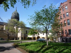
| October 2015 | Lightning | St Cloud | $25,000 | A lightning strike damaged a bell tower at the St. Cloud Children's Home that was built in 1924. |
| July 2011 | Thunderstorm Wind | Melrose | $25,000 | A garage roof was blown off in northwest Melrose. |
| August 2010 | Thunderstorm Wind | Marty | $25,000 | A National Weather Service Storm Survey Team determined that downburst winds caused dozens of trees to blow down from the eastern edge of Grand Lake to approximately three miles east of Rockville, Minnesota. One house suffered significant damage. |
| May 2012 | Hail | St Joseph | $25,000 | no account filed |
| August 1978 | Tornado (F1) | not stated | $25,000 | no account filed |
| May 1954 | Tornado (F1) | not stated | $25,000 | no account filed |
| May 2012 | Hail | Sartell | $20,000 | Several reports of large hail occurred around Sartell, Minnesota. The largest hailstone was hen egg size. In addition, some cars had hail damage. |
 Block