 Block
Detroit Lakes, Minnesota
10 topographic sheets cover this place, the earliest surveyed in 1953 and the latest in 1986. It stands in Detroit Lakes City. It lies in ZIP code area 56501. It stands on Sucker Creek Number One. The Survey maps it on the Detroit Lakes quadrangle. 9,869 people lived here at the 2020 count. It stands 1,368 feet above sea level.
Research this city
On record in Detroit Lakes
Buildings and businesses the archive holds for this place. Each opens its own page, with the source record it came from.
On the National Register 7 records
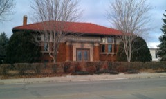 Detroit Lakes Carnegie Librarylisted 1976
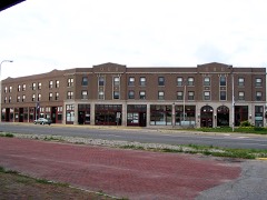 Graystone Hotellisted 1999
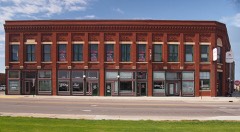 Holmes Blocklisted 2001
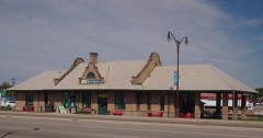 Northern Pacific Passenger Depotlisted 1988
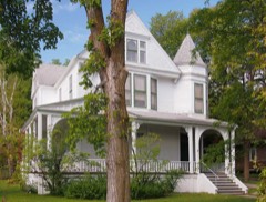 Homer E. Sargent Houselisted 1988
- Detroit Lakes City Parklisted 2008
- Edgewater Beach Cottageslisted 1989
Population over time
2 figuresDetroit Lakes grew from 8,569 to 9,869 between 2010 and 2020. These are the recorded population figures Wikidata holds for this place, reached through the Geographic Names Information System number this page is keyed on rather than by name, so they belong to this place and not to another of the same name. Most are census counts, but not all are: an early figure may be a founding or settlement estimate, and an estimate published within five years of a census is left out. The change column is computed, and is left blank where more than 20 years separate a figure from the one before it, because a gap that long is not a change between two counts.
| Year | People | Change |
|---|---|---|
| 2010 | 8,569 | |
| 2020 | 9,869 | +1,300 (+15%) |
Topographic sheets covering this place
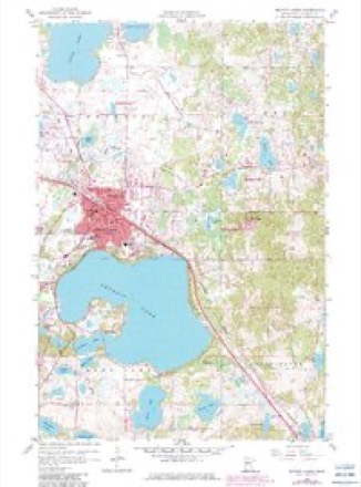
6 surveys from 10 printed sheetsMatched by testing this settlement's coordinate against the published boundary of every sheet in the United States Geological Survey's historical collection. Each opens the scanned sheet at the Survey.
- 1953 USGS Brainerd quadrangle1:250000, 3 printings
- 1957 USGS Brainerd quadrangle1:250000
- 1958 USGS Brainerd quadrangle1:250000
- 1959 USGS Detroit Lakes quadrangle1:24000, 2 printings
- 1965 USGS Brainerd quadrangle1:250000
- 1986 USGS Detroit Lakes quadrangle1:100000, 2 printings
Fires near this place
205 since 1992Regional context, not property-specific evidence. The federal wildfire occurrence database lists 205 fires within 5 miles of Detroit Lakes between 1992 and 2020, burning about 5,252 acres in total. 1 started naturally. 32 were recorded as arson. Distance is straight-line from the map coordinates, so a fire counted here may appear on a neighbouring settlement's page as well.
| Reported cause | Fires |
|---|---|
| Debris and open burning | 92 |
| Missing data/not specified/undetermined | 45 |
| Arson/incendiarism | 32 |
| Equipment and vehicle use | 10 |
| Recreation and ceremony | 8 |
| Misuse of fire by a minor | 6 |
| Smoking | 6 |
| Railroad operations and maintenance | 3 |
| Natural | 1 |
| Power generation/transmission/distribution | 1 |
| Fireworks | 1 |
The most recent of them, most recent first, with the day each was reported and the service that recorded it.
| Date | Cause | Size | Reported by | Name on the report |
|---|---|---|---|---|
| 26 August 2003 | Missing data/not specified/undetermined | 3.0 acres | Detroit Lakes Wetland Management District | BALKE LAKE |
| 25 August 1995 | Natural | under an acre | Minnesota Department of Natural Resources | not named |
| 24 August 2003 | Debris and open burning | under an acre | Minnesota Department of Natural Resources | not named |
| 20 August 2003 | Debris and open burning | 12 acres | Minnesota Department of Natural Resources | not named |
| 19 August 1992 | Misuse of fire by a minor | 2.0 acres | Minnesota Department of Natural Resources | not named |
| 8 July 2003 | Arson/incendiarism | under an acre | Minnesota Department of Natural Resources | not named |
| 5 July 2001 | Missing data/not specified/undetermined | 2.0 acres | Minnesota Department of Natural Resources | not named |
| 4 July 2003 | Missing data/not specified/undetermined | under an acre | Minnesota Department of Natural Resources | not named |
Settlements close enough to share some of these fires:
Mines and quarries near this place
5 within 5 milesRegional context, not property-specific evidence. The federal mineral resources record lists 5 workings within 5 miles of Detroit Lakes: 4 producers, 1 occurrence. 4 still produce. What was taken out: Sand and Gravel, Construction, Clay. Distance is straight-line from the map coordinates, so a quarry counted here may appear on a neighbouring settlement's page as well.
| Where | Site | Commodity | Status | Recorded |
|---|---|---|---|---|
| Becker County Clay Deposit | Clay | Occurrence | ||
| Anderson Pit & Mill | Sand and Gravel, Construction | Producer | ||
| Chadbourne Pit & Mill | Sand and Gravel, Construction | Producer | ||
| Long Pit and Mill | Sand and Gravel, Construction | Producer | ||
| Nester Pit & Mill | Sand and Gravel, Construction | Producer |
Storms near this place
60 of 76 shownRegional context, not property-specific evidence. The National Weather Service names Detroit Lakes in 76 storm reports between 1994 and 2024: 32 hail, 30 thunderstorm wind, 7 flash flood, 2 flood. No death or injury is recorded in these reports. Each account below is quoted exactly as the forecast office filed it, from the NOAA Storm Events Database, and each date opens the federal record of that event.
| When | Event | Place named | Harm | What the report says |
|---|---|---|---|---|
| July 2017 | Thunderstorm Wind | Detroit Lakes | $350,000 | The wind gust was measured by a RAWS station. Numerous trees were snapped near Floyd Lake. One 24x40 foot shed was lifted and collapsed. |
| July 2010 | Flash Flood | Detroit Lakes | $200,000 | Street flooding occurred in Detroit Lakes. Roosevelt Avenue was barricaded due to water over the roadway, mainly on the north side of U. S. Highway 10. About 12 miles east-northeast of Detroit Lakes, rushing water washed out a culvert along highway 34. A nearby house also got water in its basement. |
| July 2001 | Thunderstorm Wind | Detroit Lakes | $50,000 | Strong winds hit the Soo Pass Ranch, which was preparing for its country music festival. Three travel trailers were flipped over, one completely wrecked. Signs, fence posts, and a booth were damaged. One tree fell on a large camper. Two boats were flipper over. |
| June 1997 | Flood | Detroit Lakes | $50,000 | 2.5 to 4.5 inches of rain fell in two hours, flooding city streets and low areas. |
| May 1996 | Thunderstorm Wind | Detroit Lakes | $50,000 | no account filed |
| July 1998 | Flood | Detroit Lakes | $25,000 | 1.6 inches of rain in 90 minutes flooded low spots around Detroit Lakes, including US Highway 10 and the industrial park. Several cars stalled in the deep water. |
| July 2001 | Thunderstorm Wind | Detroit Lakes | $20,000 | Strong winds knocked tree branches onto powerlines and blew over a portable greenhouse. A metal roof was torn off a building. |
| July 2001 | Thunderstorm Wind | Detroit Lakes | $20,000 | The Soo Pass Ranch was holding its Spirit Fest concert south of Detroit Lakes. The strong wind knocked over chairs, vendor booths, and sound equipment. |
| July 1999 | Thunderstorm Wind | Detroit Lakes | $20,000 | Strong winds knocked down many trees in the Lake Sallie area. One landed on an empty tent, another fell on a restaurant, and another fell on a pickup. Pontoons and sailboats were also flipped over. |
| May 2022 | Thunderstorm Wind | Detroit Lakes | $10,000 | Multiple trees blown down. Some trees have fallen on power lines. Shingles were torn of the roof of a house. |
| July 2002 | Lightning | Detroit Lakes | $10,000 | Lightning struck a house and ignited a fire in the attic. |
| August 2002 | Thunderstorm Wind | Detroit Lakes | $10,000 | Three boat docks were damaged and several boats were overturned. A large oak tree was also split. |
| May 1996 | Thunderstorm Wind | Detroit Lakes | $10,000 | no account filed |
| June 1996 | Hail | Detroit Lakes | $10,000 | no account filed |
| July 2001 | Lightning | Detroit Lakes | $5,000 | Lightning hit a major downtown power substation, knocking out power for two-thirds of the city. |
| August 2001 | Thunderstorm Wind | Detroit Lakes | $5,000 | Powerlines were blown down. |
| July 2011 | Flash Flood | Detroit Lakes | $4,000 | Two to three inches of rain fell in less than an hour, causing street flooding in Detroit Lakes. A few sections of rural road between Detroit Lakes and Frazee were closed due to water running across roadways. |
| July 2016 | Flash Flood | Detroit Lakes | $2,000 | Flooding was reported in Washington Park, on Langford Street, and along highway 10. |
| October 1997 | Thunderstorm Wind | Detroit Lakes | $2,000 | Trees were blown down in the Detroit Lakes area by the strong wind. |
| June 1998 | Flash Flood | Detroit Lakes | $1,000 | Water flowed over US Highway 10 west of the city. |
| July 1999 | Thunderstorm Wind | Detroit Lakes | $500 | Trees were blown down at Height of Land Lake. |
| June 1998 | Thunderstorm Wind | Detroit Lakes | $400 | 8 inch diameter trees were knocked down by the strong wind. |
| June 1998 | Thunderstorm Wind | Detroit Lakes | $200 | no account filed |
| June 1998 | Thunderstorm Wind | Detroit Lakes | $200 | no account filed |
| July 2024 | Hail | Detroit Lakes | - | Hail stones up to an inch. |
| July 2024 | Thunderstorm Wind | Detroit Lakes | - | Reports and video of structure damage to at least 2 businesses in Detroit Lakes, MN. Time estimated from radar. |
| July 2023 | Hail | Detroit Lakes | - | Public reports quarter-sized hail via email. |
| May 2022 | Flash Flood | Detroit Lakes | - | Heavy rain causing flooding of residential streets and yards. |
| June 2022 | Thunderstorm Wind | Detroit Lakes | - | Peak wind measured at a RAWS station. Time was estimated based on radar and other nearby wind sensor reports. |
| July 2021 | Hail | Detroit Lakes | - | Several reports of dime to quarter sized hail around Big Detroit Lake. |
| August 2020 | Thunderstorm Wind | Detroit Lakes | - | The wind gust was measured by a RAWS mesonet station. |
| June 2017 | Thunderstorm Wind | Detroit Lakes | - | A large tree was blown down along the highway between Detroit Lakes and Frazee. |
| July 2016 | Thunderstorm Wind | Detroit Lakes | - | Large tree branches were blown down around town. |
| September 2014 | Thunderstorm Wind | Detroit Lakes | - | A tree was blown down near Abbey Lake. |
| July 2013 | Funnel Cloud | Detroit Lakes | - | A pronounced landspout type funnel developed north of Detroit Lakes from a southward moving cumuliform cloud. A cell phone video clip provided by a traveler on U. S. Highway 10 north of downtown Detroit Lakes showed the weak funnel extending to within a few hundred feet of the ground and persisting for almost a minute. |
| June 2012 | Hail | Detroit Lakes | - | Quarter size hail fell. |
| June 2012 | Hail | Detroit Lakes | - | The report was made via Facebook. |
| July 2011 | Thunderstorm Wind | Detroit Lakes | - | A tree blew down and blocked a roadway. |
| August 2009 | Funnel Cloud | Detroit Lakes | - | A series of brief funnels quickly formed and dissipated across portions of central Becker County. These funnels formed coincident with a band of rain showers which crossed the area between 715 pm and 815 pm CDT. |
| June 2007 | Thunderstorm Wind | Detroit Lakes | - | At Lake Maud, strong winds damaged a cabin roof and uprooted many trees. Some trees fell on lake cabins. |
| June 2007 | Thunderstorm Wind | Detroit Lakes | - | Strong winds twisted the fishing pier and knocked over trees. |
| May 2005 | Thunderstorm Wind | Detroit Lakes | - | Two large trees were snapped off by the strong wind. |
| June 2005 | Flash Flood | Detroit Lakes | - | One inch of rain fell in less than 30 minutes, flooding several city streets. |
| May 2005 | Hail | Detroit Lakes | - | The hail covered a deck. |
| May 2004 | Flash Flood | Detroit Lakes | - | [See the event description under the Lawndale, Wilkin county, flash flood event.] |
| July 1999 | Thunderstorm Wind | Detroit Lakes | - | Power was lost in Detroit Lakes. |
| June 1994 | Thunderstorm Wind | Detroit Lakes | - | Several small buildings were damaged and many trees and power lines were blown down. |
| July 2008 | Hail | Detroit Lakes | - | no account filed |
| June 2006 | Hail | Detroit Lakes | - | no account filed |
| July 2006 | Hail | Detroit Lakes | - | no account filed |
| June 2005 | Hail | Detroit Lakes | - | no account filed |
| May 2004 | Hail | Detroit Lakes | - | no account filed |
| May 2004 | Hail | Detroit Lakes | - | no account filed |
| May 2004 | Hail | Detroit Lakes | - | no account filed |
| May 2004 | Hail | Detroit Lakes | - | no account filed |
| June 2004 | Thunderstorm Wind | Detroit Lakes | - | no account filed |
| July 2003 | Hail | Detroit Lakes | - | no account filed |
| June 2002 | Hail | Detroit Lakes | - | no account filed |
| July 2001 | Hail | Detroit Lakes | - | no account filed |
| July 2001 | Thunderstorm Wind | Detroit Lakes | - | no account filed |
Nearest settlements
The eight closest, with where each one stands in the county. Distances are straight-line, computed from the Geographic Names Information System coordinates.
| Map | Place | Distance | Sheets |
|---|---|---|---|
| Richards | 3.8 miles | 11 | |
| Shoreham | 5.0 miles | 11 | |
| Bucks Mill | 7.5 miles | 16 | |
| Westbury | 7.7 miles | 9 | |
| Audubon | 7.9 miles | 11 | |
| Lake Eunice | 8.2 miles | 16 | |
| Rochert | 8.9 miles | 11 | |
| Frazee | 9.8 miles | 12 |
Elsewhere
Matched on this settlement's Geographic Names Information System number rather than its name, so it cannot be a different place of the same name in another state.
| Wikipedia article on Detroit Lakes | An encyclopaedic summary. Its text is share-alike, so it is linked here rather than copied. |
| Wikidata item Q1898538 | The structured record the population and elevation above come from. Public domain (CC0). |
Provenance
This settlement is recorded in the Geographic Names Information System as feature 642777. The sheet list is computed by point-in-boundary test against the United States Geological Survey's historical topographic inventory. Both are works of the United States government and carry no copyright under 17 U.S.C. 105.
Wildfire. Short, Karen C. 2022. Spatial wildfire occurrence data for the United States, 1992-2020 [FPA_FOD_20221014]. 6th Edition. Fort Collins, CO: Forest Service Research Data Archive. https://doi.org/10.2737/RDS-2013-0009.6 Collected with United States Government funding and usable without additional permissions or fees.
Mines and quarries. USGS Mineral Resources Data System (MRDS) https://mrdata.usgs.gov/mrds/ A work of the United States government, no copyright under 17 U.S.C. 105.
Storms. NOAA National Centers for Environmental Information, Storm Events Database https://www.ncei.noaa.gov/stormevents/ A work of the United States government, no copyright under 17 U.S.C. 105. Narratives are quoted verbatim from the National Weather Service report and are not edited or summarised.