 Block
Duluth, Minnesota
17 topographic sheets cover this place, the earliest surveyed in 1895 and the latest in 1980. It stands in Duluth City. It lies in ZIP code area 55802. It stands on Buckingham Creek. The Survey maps it on the Duluth quadrangle. 86,697 people lived here at the 2020 count. It stands 702 feet above sea level.
Research this city
On record in Duluth
Buildings and businesses the archive holds for this place. Each opens its own page, with the source record it came from.
On the National Register 12 of 43 shown
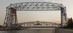 Aerial Lift Bridgelisted 1973
 Bridge No. 5757listed 1998
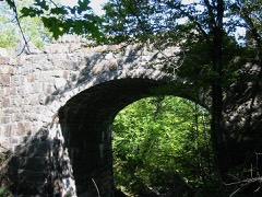 Bridge No. L6007listed 1989
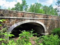 Bridge No. L6113listed 2016
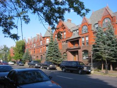 Chester Terracelisted 1980
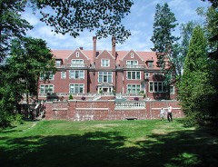 Chester and Clara Congdon Estatelisted 1991
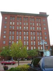 DeWitt-Seitz Buildinglisted 1985
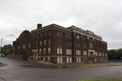 Duluth Armorylisted 2011
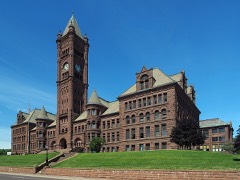 Duluth Central High Schoollisted 1972
 Duluth Civic Center Historic Districtlisted 1986
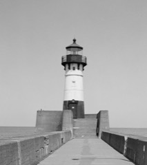 Duluth Harbor North Pier Lightlisted 2016
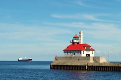 Duluth Harbor South Breakwater Outer Lightlisted 2016
Population over time
2 figuresDuluth grew from 86,265 to 86,697 between 2010 and 2020. These are the recorded population figures Wikidata holds for this place, reached through the Geographic Names Information System number this page is keyed on rather than by name, so they belong to this place and not to another of the same name. Most are census counts, but not all are: an early figure may be a founding or settlement estimate, and an estimate published within five years of a census is left out. The change column is computed, and is left blank where more than 20 years separate a figure from the one before it, because a gap that long is not a change between two counts.
| Year | People | Change |
|---|---|---|
| 2010 | 86,265 | |
| 2020 | 86,697 | +432 (+1%) |
Topographic sheets covering this place
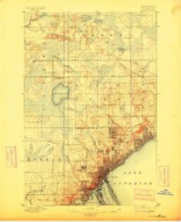
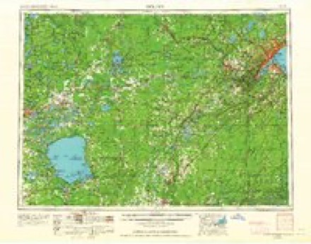
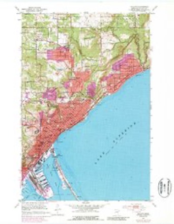
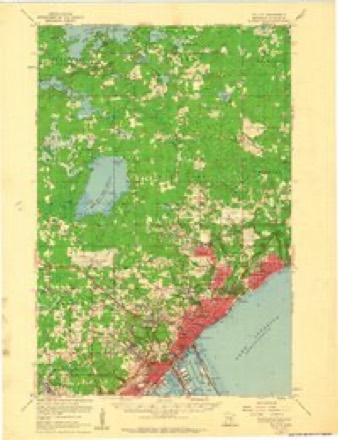
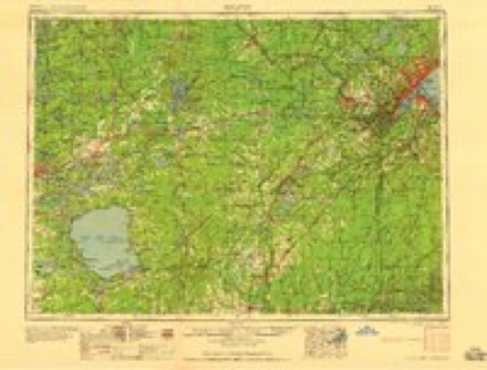
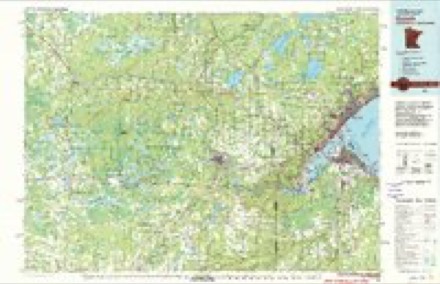
6 surveys from 17 printed sheetsMatched by testing this settlement's coordinate against the published boundary of every sheet in the United States Geological Survey's historical collection. Each opens the scanned sheet at the Survey.
- 1895 USGS Duluth quadrangle1:62500, 5 printings
- 1953 USGS Duluth quadrangle1:250000, 2 printings
- 1953 USGS Duluth quadrangle1:24000, 7 printings
- 1953 USGS Duluth quadrangle1:62500
- 1958 USGS Duluth quadrangle1:250000
- 1980 USGS Duluth quadrangle1:100000
Fires near this place
63 since 1994Regional context, not property-specific evidence. The federal wildfire occurrence database lists 63 fires within 5 miles of Duluth between 1994 and 2020, burning about 16 acres in total. 1 started naturally. 17 were recorded as arson. Distance is straight-line from the map coordinates, so a fire counted here may appear on a neighbouring settlement's page as well.
| Reported cause | Fires |
|---|---|
| Arson/incendiarism | 17 |
| Debris and open burning | 14 |
| Missing data/not specified/undetermined | 9 |
| Recreation and ceremony | 7 |
| Power generation/transmission/distribution | 4 |
| Equipment and vehicle use | 4 |
| Fireworks | 2 |
| Railroad operations and maintenance | 2 |
| Smoking | 2 |
| Natural | 1 |
| Other causes | 1 |
The most recent of them, most recent first, with the day each was reported and the service that recorded it.
| Date | Cause | Size | Reported by | Name on the report |
|---|---|---|---|---|
| 10 September 2003 | Debris and open burning | under an acre | Minnesota Department of Natural Resources | not named |
| 5 August 1994 | Debris and open burning | under an acre | Minnesota Department of Natural Resources | not named |
| 18 August 2019 | Debris and open burning | under an acre | Minnesota Department of Natural Resources | not named |
| 17 August 2019 | Debris and open burning | under an acre | Minnesota Department of Natural Resources | not named |
| 11 August 2019 | Debris and open burning | under an acre | Minnesota Department of Natural Resources | not named |
| 1 August 2019 | Arson/incendiarism | under an acre | Minnesota Department of Natural Resources | not named |
| 4 July 2017 | Fireworks | under an acre | Minnesota Department of Natural Resources | not named |
| 23 July 2019 | Recreation and ceremony | under an acre | Minnesota Department of Natural Resources | not named |
Settlements close enough to share some of these fires:
Mines and quarries near this place
4 within 5 milesRegional context, not property-specific evidence. The federal mineral resources record lists 4 workings within 5 miles of Duluth: 3 producers, 1 plant. All of them still produce. What was taken out: Stone, Crushed/Broken, Sand and Gravel, Construction. Distance is straight-line from the map coordinates, so a quarry counted here may appear on a neighbouring settlement's page as well.
| Where | Site | Commodity | Status | Recorded |
|---|---|---|---|---|
| Mailing Pit | Sand and Gravel, Construction | Producer | ||
| Arrowhead Blacktop Co | Stone, Crushed/Broken | Producer | ||
| Smith Quarry | Stone, Crushed/Broken | Producer | ||
| Superior Grinding Plant | Stone, Crushed/Broken | Plant |
Storms near this place
60 of 97 shownRegional context, not property-specific evidence. The National Weather Service names Duluth in 97 storm reports between 1995 and 2024: 56 hail, 28 thunderstorm wind, 6 flash flood, 6 lightning. The reports record 3 injuries. Each account below is quoted exactly as the forecast office filed it, from the NOAA Storm Events Database, and each date opens the federal record of that event.
| When | Event | Place named | Harm | What the report says |
|---|---|---|---|---|
| October 2001 | Lightning | Duluth | 2 hurt | Lightening struck a hilltop soccer field, injuring a 13-year-old player and his adult coach. The boy was taken to the hospital and initially listed in critical condition. He was subsequently released. His coach was treated at the hospital and released. |
| July 1996 | Lightning | Duluth | 1 hurt | no account filed |
| August 1998 | Hail | Duluth | $50,000,000 | no account filed |
| July 1996 | Flash Flood | Duluth | $300,000 | no account filed |
| July 2003 | Lightning | Duluth | $250,000 | Lightning struck a house on Woodland Avenue. The resulting fire destroyed the top two floors of the house. |
| August 2021 | Lightning | Duluth | $185,000 | Fire crews were dispatched to the Hope City Church at approximately 7:45 PM on the evening of August 28th. One of the steeples of the church had taken a direct strike from a bolt of lightning and exploded, raining debris onto the street below and causing extensive damage to the steeple and the roof of the church that impacted the structural integrity of the building. In addition to the steeple damage, the lighting strike also led to a water main break at the intersection in front of the church. This sent a river of water down North 3rd Avenue East. Fortunately, the lightning strike did not start a fire at the church. |
| September 2023 | Flash Flood | Duluth | $100,000 | Heavy rainfall from backbuilding thunderstorms over Duluth led to 2 to 5 inches of rainfall in 2-3 hours. As the water rushed down the hillside to Lake Superior, it scoured out gravel alleys and sent around 1,000 cubic yards of construction debris, including sand, dirt, rock and other materials, onto Superior Street at the base of the hill. Superior Street at First Avenue East was closed for much of the 12th as crews worked to remove the piles of debris using heavy machinery. |
| June 1998 | Lightning | Duluth | $75,000 | no account filed |
| May 2004 | Lightning | Duluth | $30,000 | Lightning struck a home in West Duluth, blowing a back porch and stairway off the home and causing significant damage inside. |
| July 1995 | Thunderstorm Wind | New Duluth | $3,000 | Strong thunderstorm winds knocked down trees and destroyed a camper trailer. Patio furniture was thrown around. |
| June 2024 | Flash Flood | Duluth | - | Video was received showing flood waters flowing across a road and a yard near Portland Manor on the corner of E. 4th Street and 9th Ave East. |
| June 2024 | Flash Flood | Duluth | - | Video was received showing fast moving flood waters at least 6 inches deep over a sidewalk and street near homes and apartment buildings. |
| June 2024 | Flash Flood | Duluth | - | Video was received of flash flooding in the I-35 tunnels resulting in their closure with stranded cars. |
| August 2020 | Thunderstorm Wind | Duluth | - | Metal roof sheeting was partially removed from a building and was dangling in the vicinity of power lines. |
| September 2018 | Thunderstorm Wind | New Duluth | - | A 12 inch diameter pine tree was snapped off 6 feet above the ground by the thunderstorm winds. |
| July 2017 | Thunderstorm Wind | Duluth | - | A large tree was snapped off at its base on North 13th Avenue East. |
| July 2017 | Thunderstorm Wind | Duluth | - | Several trees were blown down on East 9th street and 9th Avenue. |
| June 2016 | Hail | New Duluth | - | There was dime sized hail. |
| July 2016 | Thunderstorm Wind | Duluth | - | The Duluth Board of Trade Building in downtown Duluth was damaged. The chimney was first struck by lightning, then strong winds knocked it down and it crashed through the roof of the seventh floor. The damage also affected the storage room for costumes for the Minnesota Ballet. The anemometer is on top of the nearby county government building, which measured gusts to around 100 mph. |
| July 2016 | Thunderstorm Wind | Duluth | - | This was the weather station DULM5. |
| May 2012 | Hail | New Duluth | - | The hail shredded leaves and damaged siding. |
| May 2009 | Hail | Duluth | - | The hail fell at Superior Street and 11th Avenue East. |
| May 2009 | Hail | Duluth | - | The hail fell in Hunters Park. |
| May 2009 | Hail | Duluth | - | The hail fell at Park Point. |
| August 2008 | Hail | Duluth | - | The report was received from the Lester Park neighborhood. |
| August 2008 | Hail | Duluth | - | Several reports of up to 1 inch hail in West Duluth were called in. |
| August 2008 | Hail | Duluth | - | The report was received from the Lester Park neighborhood. |
| August 2008 | Hail | Duluth | - | Penny sized hail covered the ground in Woodland. |
| August 2008 | Hail | Duluth | - | Quarter-sized hail covered the ground in Woodland. |
| August 2008 | Hail | Duluth | - | The report was called in from the Lakeside neighborhood. |
| September 2008 | Thunderstorm Wind | West Duluth | - | A large tree up to two feet in diameter was blown down across 59th Avenue West, in West Duluth. |
| May 2007 | Hail | Duluth | - | The hail fell at the Kenwood Shopping Center. |
| October 2007 | Flood | Duluth | - | Portions of Mall Drive and Maple Grove Road were flooded and closed after Miller Creek overflowed its banks during the evening of October 18. The flood waters receded during the early morning hours of October 19. The St. Louis County sheriff also reported flooded basements and culverts in many areas across Duluth. |
| May 2007 | Hail | Duluth | - | Golf ball size hail fell at the Duluth NWS office. |
| May 2007 | Hail | Duluth | - | The hail fell at the University of Minnesota Duluth campus. |
| May 2007 | Hail | Duluth | - | The hail fell at Canal Park. |
| May 2007 | Hail | Duluth | - | The hail fell in the Morley Heights neighborhood. |
| May 2007 | Hail | Duluth | - | The hail fell at the Duluth NWS office. |
| July 2007 | Thunderstorm Wind | Duluth | - | Large tree limbs were downed and at least one vehicle was severely damaged at 59th Avenue East and London Road. |
| July 2006 | Hail | Duluth | - | The hail fell on London Road. |
| July 2006 | Thunderstorm Wind | Duluth | - | Large tree branches were blown down in Gary-New Duluth. |
| July 2006 | Hail | West Duluth | - | The hail fell for ten minutes. |
| July 2006 | Thunderstorm Wind | West Duluth | - | A huge cottonwood tree and some smaller trees were blown down. |
| July 2006 | Hail | Duluth | - | The fail fell in the Lakeside neighborhood. |
| July 2006 | Hail | Duluth | - | The hail fell at Spirit Mountain and lasted four minutes. |
| July 2006 | Hail | Duluth | - | The hail fell at Midway Road and Interstate 35. |
| July 2006 | Hail | Duluth | - | Dime to quarter size hail fell for ten minutes at Park Point in Duluth. Some trees were blown down. |
| April 2004 | Hail | Duluth | - | The hail fell on Park Point. Three-quarter inch hail fell in West Duluth. |
| April 2004 | Hail | Duluth | - | The hail fell in the East Central Entrance corridor. |
| April 2004 | Hail | Duluth | - | The hail fell at Island Lake. |
| April 2004 | Hail | Duluth | - | The hail fell at Northstar Township. |
| May 2004 | Hail | Duluth | - | The hail fell at 63rd Avenue West and Rooselvelt Strees. Also, three-quarter inch hail fell at Skyline Avenue and 40th Avenue West. |
| May 2004 | Hail | Duluth | - | The hail fell at Park Point. |
| May 2004 | Hail | Duluth | - | The hail fell at 46th Avenue West and 7th Street. |
| May 2004 | Hail | Duluth | - | The hail fell at Cody Street in West Duluth. |
| July 2003 | Hail | Duluth | - | The hail fell in the Lincoln Park and Piedmont neighborhoods. |
| August 2003 | Thunderstorm Wind | Duluth | - | Large branches were blown down. |
| August 2003 | Thunderstorm Wind | Duluth | - | The wind was measured by the aerial lift bridge at the Duluth harbor. |
| August 2003 | Thunderstorm Wind | Duluth | - | Numerous trees were blown down in the Piedmont Heights, Lincoln Park, and West Duluth neighborhoods. |
| July 2003 | Thunderstorm Wind | Duluth | - | Numerous trees were blown down in West Duluth. |
Nearest settlements
The eight closest, with where each one stands in the county. Distances are straight-line, computed from the Geographic Names Information System coordinates.
| Map | Place | Distance | Sheets |
|---|---|---|---|
| Duluth Heights | 1.8 miles | 15 | |
| Missabe Junction | 2.0 miles | 15 | |
| Hunters Park | 3.6 miles | 17 | |
| Oneota | 4.1 miles | 20 | |
| Woodland | 4.5 miles | 17 | |
| Bayview | 5.3 miles | 20 | |
| West Duluth | 5.4 miles | 20 | |
| Saint Paul Church | 5.6 miles | 15 |
Elsewhere
Matched on this settlement's Geographic Names Information System number rather than its name, so it cannot be a different place of the same name in another state.
| Wikipedia article on Duluth | An encyclopaedic summary. Its text is share-alike, so it is linked here rather than copied. |
| Wikidata item Q485708 | The structured record the population and elevation above come from. Public domain (CC0). |
Provenance
This settlement is recorded in the Geographic Names Information System as feature 661145. The sheet list is computed by point-in-boundary test against the United States Geological Survey's historical topographic inventory. Both are works of the United States government and carry no copyright under 17 U.S.C. 105.
Wildfire. Short, Karen C. 2022. Spatial wildfire occurrence data for the United States, 1992-2020 [FPA_FOD_20221014]. 6th Edition. Fort Collins, CO: Forest Service Research Data Archive. https://doi.org/10.2737/RDS-2013-0009.6 Collected with United States Government funding and usable without additional permissions or fees.
Mines and quarries. USGS Mineral Resources Data System (MRDS) https://mrdata.usgs.gov/mrds/ A work of the United States government, no copyright under 17 U.S.C. 105.
Storms. NOAA National Centers for Environmental Information, Storm Events Database https://www.ncei.noaa.gov/stormevents/ A work of the United States government, no copyright under 17 U.S.C. 105. Narratives are quoted verbatim from the National Weather Service report and are not edited or summarised.