“Gustafson, of Duluth, elected to give service in one of the most dangerous branches of the army, the Air Service. He was early in France, and as a lieutenant of the Twenty-Fifth Aero Scjuad, Fourth Pursuit Corps, was on the French front during the e!arly days of the German drive of 1918. He was killed in action on April 9, 1918.”
Duluth And St. Louis County 639 - Duluth and St. Louis County, Minnesota; Their Story and People; an Authentic Narrative of the Past, with Particular Attention to the Modern Era in the Commercial, Industrial, Educational, Civic and Social Development (1921). Machine-read text.
126 National Register listings published here, 3 of them National Historic Landmarks · the county-history sources tell 5 stories.
Minnesota within the United StatesSt. Louis County within Minnesota
What the record shows
2,324 topographic sheet readings cover the county's settlements.
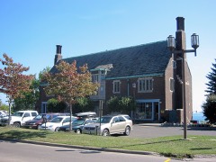
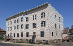
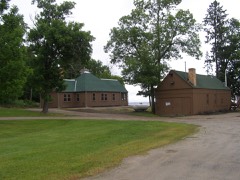
126 properties here are on the National Register of Historic Places: 82 buildings, 25 districts, 13 structures, 5 sites and 1 object.
21 of the 126 listings were added during the 1970s.
The Geographic Names Information System records 196 populated places in this county; 196 are covered by at least one topographic sheet.
1 public-domain county history, 1921, supplies 231,703 words of narrative reproduced here.
What happened here
5 accounts
Among them: Duluth And St. Louis County 611; Duluth And St. Louis County 633; Duluth And St. Louis County 637. These passages come from the
identified county-history source books. Each inset names its own source
and opens the exact section it comes from.
April 13, * * * Washington was deeply moved by the intelligence that Fort Sumter * * * had been attacked * * * and * * * had surrendered. Early Sunday morning, accompanied by two citizens of Minnesota, I visited the War Department and found the secretary (Cameron) with his hat on and papers in his hand, about to leave his office.
Carl Bowman, who was killed in aerial combat in France on July 25, 1918, was a native of Seattle, Washington, although he was in business in Duluth when war came. He enlisted at Duluth in June, 1917, being accepted for assignment to the Aviation Corps, He became an observer, and was early sent to France.
Edgar Eubanks, who was killed in action in France in October, 1918, and who prior to entering service lived in St. Louis County, was born in 1897 in Rice Lake, Wisconsin, where his parents still live. He was called to service in 1917, and assigned to the Machine Gun Company, Third Wisconsin Regiment, which eventually became a unit of the A.
Charles R. Gustafson, of Duluth, elected to give service in one of the most dangerous branches of the army, the Air Service. He was early in France, and as a lieutenant of the Twenty-Fifth Aero Scjuad, Fourth Pursuit Corps, was on the French front during the e!arly days of the German drive of 1918. He was killed in action on April 9, 1918.
He was in front-line trenches in the Vosges Mountains; was present in the battle of St. Mihiel, and passed through terrible fighting in the Meuse-Argonne offensive. On November 10, 1918, just one day before the signing of the Armistice, he was wounded in action at Haudimont, and died of those wounds twelve days later, on November 22.
Every wildfire the federal occurrence
database records inside this county: 5,323 of them, burning
about 32,040 acres. 362 started naturally and 1,036 were recorded as arson. Each settlement page carries the fires within
five miles of it.
Reported cause
Fires
Debris and open burning
1345
Arson/incendiarism
1036
Missing data/not specified/undetermined
688
Railroad operations and maintenance
531
Equipment and vehicle use
526
Recreation and ceremony
431
Natural
362
Power generation/transmission/distribution
150
Smoking
138
Misuse of fire by a minor
61
Other causes
30
Fireworks
25
The five largest, by the area the report
gives. One of them was set deliberately.
Date
Cause
Size
Reported by
Name on the report
10 May 1992
Arson/incendiarism
5,200 acres
Minnesota Department of Natural Resources
not named
12 June 1996
Natural
4,750 acres
Superior National Forest
WHITEFEATHER LAKE
10 May 1992
Missing data/not specified/undetermined
2,200 acres
Minnesota Department of Natural Resources
not named
8 July 2004
Natural
1,435 acres
Voyageurs National Park
SECTION33
6 May 2016
Railroad operations and maintenance
973 acres
Superior National Forest
SKIBO
3 May 2000
Missing data/not specified/undetermined
953 acres
Minnesota Department of Natural Resources
ELBOW LAKE FIRE
25 April 1998
Railroad operations and maintenance
950 acres
Minnesota Department of Natural Resources
not named
19 May 2016
Debris and open burning
936 acres
Superior National Forest
FOSS LAKE
Every settlement page carries the fires within five
miles of it - see the settlement index below.
Storms,
1953 to 2026
60 of 1,335 shown
The
NOAA Storm Events Database holds
1,335 reports for this county, causing 4 deaths, 61 injuries and about $62,160,560 in recorded property damage.
Each settlement page carries the reports that name it.
Kind of event
Reports
Thunderstorm Wind
633
Hail
523
Flash Flood
89
Tornado
42
Lightning
26
Flood
15
Funnel Cloud
4
Heavy Rain
3
The most serious of them, by death, then
injury, then recorded damage. The accounts are quoted exactly as the
forecast office filed them.
A 51-year-old father and his 4-year-old daughter were struck and injured by lightning around 2 pm near a baseball field in Cherry, MN, which is near the Iron Range. The father and daughter were watching the baseball game. The game was delayed because of the thunderstorm, and the father and daughter were struck as they were walking back to their van.
Campers were injured by a tree falling on their tent at a campsite on Lady Boot Bay on Lac La Croix Lake. One young teenager was seriously injured with a broken pelvis and a dislocated shoulder. A middle-aged man suffered a dislocated shoulder.
Lightening struck a hilltop soccer field, injuring a 13-year-old player and his adult coach. The boy was taken to the hospital and initially listed in critical condition. He was subsequently released. His coach was treated at the hospital and released.
A 12-year-old boy was critically injured after being struck by lightning at Enger Park Golf Course in Duluth, near the fairway, at about 3:50 pm. The boy was a spectator at a tournament being held at the golf course.
A 16 year old boy was struck by lightning along West Skyline Parkway near Spirit Mountain. The boy was knocked unconscious by the strike, and after coming to, was treated for third-degree burns on his right ankle and second-degree burns down the back of his legs.
Above normal snowfall for the 2021-2022 season was observed across northern portions of Koochiching and St. Louis counties and much of that remained on the ground into April. Heavy rainfall then fell on top of that above normal snowpack at the end of April and sent abnormally high amounts of runoff into the Rainy River Basin leading to rises on Rainy Lake. International Falls experienced their wettest April on record, helping to set the stage for the flooding. By June 15th, the level of Rainy Lake reached 1113.2 feet which was 22 inches above the 2014 peak level and 2.5 inches above the all-time record set in 1950. Having crested and setting a new all-time high, the lake level fell over the remainder of the month to 1112.4 feet (13 inches above 2014 peak and slightly below the 1950 record) by the start of July having fallen 11 inches since peaking on June 15. As for Namakan Lake and Kabetogama Lake, they crested at 1122.4 feet (22 inches above the 2014 peak and 6 inches below the record 1916 peak) June 1st and then fell over the remainder of June reaching 1119.6 feet (below the 2014 peak) by July 1st, having fallen 37 inches since peaking on June 1st. The high lake levels led to extensive damage to properties adjacent to the water along with damage to docks and other infrastructure. Lake levels would continue to fall over the first two weeks of July with the Flood Warning being canceled on July 11th as Namakan and Kabetogama Lakes had returned to their normal regulated levels. Levels on Rainy Lake remained above normal at this time, but were receding and the threat for additional flooding had ended. State and Federal disasters were declared for the event with millions of dollars in infrastructure damage and property loss.
Streets and yards in the city of Cook were under water. Low spots of Highway 24 were under water with up to 6 to 12 inches of water across roads. This was following the heavy rainfall on the 18th where 3 to 7 inches of rainfall fell across the region. This led to major flooding occurring along the Littlefork River in the city of Cook, where floodwaters inundated downtown, surrounding residences and businesses with several feet of water, closing dozens of roads, and prompting sandbagging efforts and evacuation of parts of the city. Federal and state disasters were declared once the water receded nearly a week later.
Thunderstorms over parts of Duluth dropped upwards of 3 to 6 inches of rain over a localized area focused on the Chester Creek basin over a period of 2 to 3 hours. The highest rainfall totals were located at the top of the hill in the College of St. Scholastica area. Flash flooding was reported upstream from this location along Arrowhead Road where 3 to 6 inches of water was flowing over the road where Chester Creek passed under the road. As the surge of water flowed downstream, it damaged walkways along the creek and sent 2 to 5 inches of water onto side streets and Kenwood Avenue. Chester Creek runs through tunnels for much of its trip down the Duluth hillside and this volume of water overwhelmed the tunnels sending a large stream of rapidly flowing water 3 to 10 inches deep down the hill. This affected a few apartment buildings in the vicinity of 7th Avenue and 3rd Street which required a few rescues/evacuations of lower level residents and pets in the buildings by the fire department. Interstate 35 runs through tunnels underground at the base of the hill and the water surging down the hillside began to collect in the tunnels. Standing and flowing water in the tunnels resulted in the closure of the tunnels for a period. Water of at least 4 to 6 inches in depth was covering the southbound lanes in spots. The water receded during the early morning hours of the 12th with cleanup occurring over the remainder of the week.
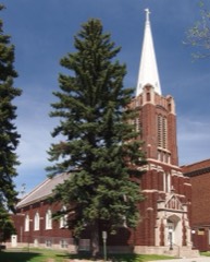
Fire crews were dispatched to the Hope City Church at approximately 7:45 PM on the evening of August 28th. One of the steeples of the church had taken a direct strike from a bolt of lightning and exploded, raining debris onto the street below and causing extensive damage to the steeple and the roof of the church that impacted the structural integrity of the building. In addition to the steeple damage, the lighting strike also led to a water main break at the intersection in front of the church. This sent a river of water down North 3rd Avenue East. Fortunately, the lightning strike did not start a fire at the church.
A supercell thunderstorm formed halfway between Meadowlands and Canyon, MN, between 4:35 to 4:40 PM on Thursday, September 19, 2024. As the strong thunderstorm continued to show potential for producing a tornado, the National Weather Service office in Duluth, MN, issued a Severe Thunderstorm Warning at 4:44 PM for this storm. The strong storm moved eastward over unpopulated marshes immediately north of Lake Nichols Road about 4 miles north-northwest of Canyon, MN, by 5:00 PM. Meteorologists at the National Weather Service issued a Tornado Warning for this storm at 4:55 PM as early signs of tornadic development appeared on radar, and a short time later a tornado was confirmed by trained spotters and law enforcement. Visible tree damage from the tornado, estimated to have begun at 5:05 PM CDT, was first observed on the west side of US Highway 53 about 4.5 miles south of Cotton, MN, with pine trees snapped at the base. The tornado continued to move northeastward to uproot trees along Three Lakes Road about one-half mile east of the U.S. Highway 53 intersection. The storm began to move more north-northeastward so the tornado track shifted more northward with the most widespread surveyed damage seen along Bug Creek Road about 2.5 miles east-southeast of Cotton, MN. Over 50 pine trees and numerous clusters of aspen trees were observed to be snapped at the base and/or uprooted, estimated to have occurred at around 5:15 PM. A few still-standing pine trees had metal sheets lofted and wrapped around them. Minor to moderate structure damage was reported by two property owners along Bug Creek Road before the tornado passed northward over the Whiteface River. Towards 5:18 PM, the tornado began to weaken and finally lifted off the ground. The last uprooted trees, 4 aspen, were last observed at the intersection of Comstock Lake Road and Melrude Road, 2.7 miles east of Cotton, MN. In total, the tornado was on the ground for a total of 5.9 miles and for around 13 minutes. The damage rating from the NWS Duluth Storm Survey team resulted in an EF-1 rating with winds estimated at 105 mph. There were a total of two Tornado Warning in effect from 4:55 PM to 5:45 PM for this tornadic supercell thunderstorm.
Heavy rainfall from backbuilding thunderstorms over Duluth led to 2 to 5 inches of rainfall in 2-3 hours. As the water rushed down the hillside to Lake Superior, it scoured out gravel alleys and sent around 1,000 cubic yards of construction debris, including sand, dirt, rock and other materials, onto Superior Street at the base of the hill. Superior Street at First Avenue East was closed for much of the 12th as crews worked to remove the piles of debris using heavy machinery.
Rainfall amounts of 5 to 7 inches were recorded across the Schmidt Creek basin on the 23rd and 24th with the vast majority of the rainfall occurring on the 24th. This amount of water was significantly more than the creek could handle and issues began near the headwaters. A small culvert carrying the creek under Pioneer Junction Road failed starting with a sinkhole in the road before the fast moving waters completely scoured a channel through the road. Further downstream just after passing under Minnesota Highway 61, the rapidly flowing water encountered another too small culvert that carried the creek under the tracks of the North Shore Scenic Railroad. The water proceeded to scour out this culvert as well exposing a bridge that was originally built by the railroad at this location over 100 years prior. An NSSR train had passed over the bridge about an hour before the culvert failed and noted the developing washout. The train was then stranded in Two Harbors until the washout could be repaired a few days later.
A church in the Piedmont neighborhood of Duluth was struck by lightning. The lightning started a fire in the cupola. The church's roof was damaged while damage inside was due to smoke and water.
Rainfall amounts of 4 to 6 inches were observed on the 23rd and 24th with the vast majority falling during the morning of the 24th. Tischer Creek was overwhelmed by the water across much of its run through Duluth. Water was backed up across a large portion of the Ridgeview Country Club damaging bridges along the course. Water was also flowing through neighborhoods across streets and open areas with water over a foot deep in places. The main affects were observed across the Woodland and Hunter's Park neighborhoods of Duluth.
Amity Creek was out of its banks following 3 to 5 inches of rainfall. The surging water damaged a gazebo along the creek along with numerous pedestrian bridges covering them with logs and other detritus.
Rainfall amounts of 5 to 7 inches were reported across much of Lakewood Township on the 24th leading to widespread flooding and flash flooding across the area. The Lester River was also out of its banks in the area. The flowing water washed out a few culverts and roads along Superior Street between Lakewood and McQuade roads. One spotter sent in photos of a river running through their normally dry yard that was 3 to 6 inches deep and moving quickly.
Photos and measurements were received of the downed trees in Whiteside Park. The two largest trees were elms with one uprooted that was 1 foot in diameter with the second being 27 inches in diameter and was completely snapped about 8 feet up. The Blueberry/Arts Fest was ongoing in the park at the time of the storm and the storm caused significant damage to temporary tents and booths along with the items for sale in the tents/booths. The remainder of the festival was subsequently canceled due to the damage.
A home on the 200 block of 5th Street South in Virginia was struck by lightning around 4:55AM CDT causing extensive damage. The home's electrical system was heavily damaged along with heavy damage to the exterior of the home. Firefighters were on scene for about 3 hours surveying the extent of the damage.
The large hail caused thousands of dollars in damage to vehicles. The hail put hundreds of large holes in the roof of the local building center and caused major damage at the local greenhouse.
Numerous large trees were uprooted and blown on to houses and garages. A mobile home was overturned, and the roof was blown off a barn. For the third morning in a row, a large complex of severe thunderstorms formed over the western Dakotas in the evening and moved into northeast Minnesota early the following morning. This time, the path of the squall line was a little farther south than the previous day. Brainerd received three-quarters inch diameter hail, otherwise, damaging winds were again the primary feature of this system. Some structural damage occurred, due either directly to the wind or to falling trees. The Minnesota Department of Natural Resources estimated nearly 200,000 acres of timber were destroyed by the storms of July 13 and 14. The estimate was based partly on aerial photography. The area of downed trees extended from west of Itasca State Park in Clearwater County, through Hubbard, Cass, and Itasca Counties, across the south half of St. Louis County. The DNR estimated that 6.5 million trees more than 35 feet high were tipped over, broken off, or knocked flat. The value of the timber lost or damaged was estimated at $22.5 million.
A roof was blown off of an addition to a home near Northwoods County Club.
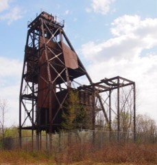
Mines and
quarries
765 recorded
The Survey's mineral resources record
lists 765 workings inside this county. 137 still produce and 628 are closed or unrecorded. Each
settlement page carries the workings within five miles of it.
Duluth and St. Louis County, Minnesota; Their Story and People; an Authentic Narrative of the Past, with Particular Attention to the Modern Era in the Commercial, Industrial, Educational, Civic and Social Development devotes a chapter to each township:
its boundaries and streams, who settled it and when, the mills, the
schools and the churches. The one chapter is reproduced here in full. Each row
shows the township's own shape and where it lies in the county, drawn from
the Census Bureau's boundary. Which settlements belong to which township
is computed from that same boundary, not taken from the book.
Named settlements recorded in the Geographic Names
Information System, each with the topographic sheets covering it. Villages,
hamlets and abandoned places alike. Each is shown with the nearest named
watercourse or landform and the survey quadrangle it falls on.
Topographic sheets. USGS Historical Topographic Map Collection, county index, measured from the bulk metadata.
Fire insurance maps. Library of Congress Sanborn collection, faceted to this county.
Photographs. Each place queried individually against the Library of Congress Prints and Photographs search.
Wildfire. Short, Karen C. 2022. Spatial wildfire occurrence data for the United States, 1992-2020 [FPA_FOD_20221014]. 6th Edition. Fort Collins, CO: Forest Service Research Data Archive. https://doi.org/10.2737/RDS-2013-0009.6 Collected with United States Government funding and usable without additional permissions or fees.
Mines and quarries. USGS Mineral Resources Data System (MRDS) https://mrdata.usgs.gov/mrds/ A work of the United States government, no copyright under 17 U.S.C. 105.
Storms. NOAA National Centers for Environmental Information, Storm Events Database https://www.ncei.noaa.gov/stormevents/ A work of the United States government, no copyright under 17 U.S.C. 105. Narratives are quoted verbatim from the National Weather Service report and are not edited or summarised.
 Block