 Block
Dumont, Minnesota
8 topographic sheets cover this place, the earliest surveyed in 1950 and the latest in 1985. It stands in Croke Township. It lies in ZIP code area 56236. The Survey maps it on the Dumont quadrangle. 75 people lived here at the 2020 count. It stands 1,040 feet above sea level.
Population over time
2 figuresDumont fell from 100 to 75 between 2010 and 2020. These are the recorded population figures Wikidata holds for this place, reached through the Geographic Names Information System number this page is keyed on rather than by name, so they belong to this place and not to another of the same name. Most are census counts, but not all are: an early figure may be a founding or settlement estimate, and an estimate published within five years of a census is left out. The change column is computed, and is left blank where more than 20 years separate a figure from the one before it, because a gap that long is not a change between two counts.
| Year | People | Change |
|---|---|---|
| 2010 | 100 | |
| 2020 | 75 | -25 (-25%) |
Topographic sheets covering this place
5 surveys from 8 printed sheetsMatched by testing this settlement's coordinate against the published boundary of every sheet in the United States Geological Survey's historical collection. Each opens the scanned sheet at the Survey.
- 1950 USGS Graceville quadrangle1:62500
- 1953 USGS Milbank quadrangle1:250000, 3 printings
- 1958 USGS Milbank quadrangle1:250000
- 1974 USGS Dumont quadrangle1:24000
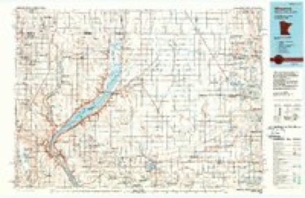
- 1985 USGS Wheaton quadrangle1:100000, 2 printings
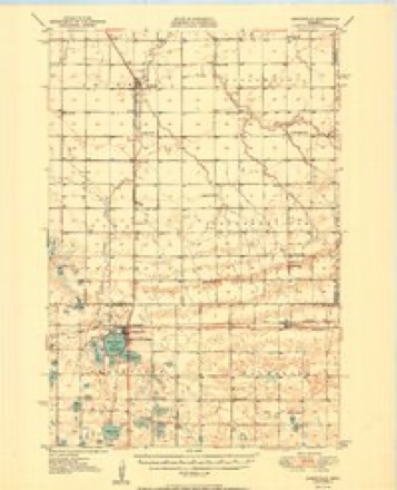
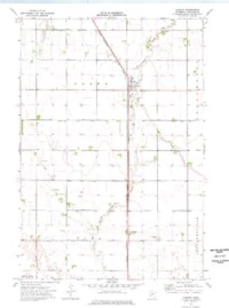
Storms near this place
34 since 1996Regional context, not property-specific evidence. The National Weather Service names Dumont in 34 storm reports between 1996 and 2024: 13 thunderstorm wind, 11 hail, 7 flood, 3 tornado. No death or injury is recorded in these reports. Each account below is quoted exactly as the forecast office filed it, from the NOAA Storm Events Database, and each date opens the federal record of that event.
| When | Event | Place named | Harm | What the report says |
|---|---|---|---|---|
| July 2024 | Hail | Dumont | - | The trained spotter also reported winds of 50 to 60 mph. |
| April 2023 | Flood | Dumont | - | Five Mile Creek above Herman went into flood on the afternoon of April 13th, cresting at 8.37 feet, or 0.87 feet above flood stage on the morning of April 14th. Mainly agricultural lands were impacted. |
| May 2022 | Tornado (EF1) | Dumont | - | A tornado developed 6 miles east of Dumont on the leading edge of|a line of severe thunderstorms, and then traveled quickly|northeast. An outbuilding took heavy damage, with debris strewn|northeast over half a mile. The majority of the 2x4 planks were|deposited directly to the east of the shed, while another single|2x4 was lodged into the ground at an angle not consistent with|straight-line winds. The tornado then destroyed several mostly|empty grain bins. Some tin from the property was thrown due west|into the trees. |
| May 2022 | Thunderstorm Wind | Dumont | - | Shingles were pealed off a roof, and at least two large trees were snapped by estimated 70 mph wind gusts. |
| June 2022 | Thunderstorm Wind | Dumont | - | One tree and a couple of poles holding a nine inch elk fence were snapped, and tree branches were downed. |
| June 2022 | Thunderstorm Wind | Dumont | - | A trained spotter estimated winds at 60 mph. |
| October 2021 | Tornado (EF0) | Dumont | - | Tornado damage was first observed to the northeast of the intersection of 620th St and 760th Ave, where a single cottonwood tree in a line of trees was snapped at the base. About a mile to the northeast on 770th Ave, another cottonwood tree had a large branch broken and sporadically scattered leaves and twigs. The tornado then damaged a farmstead where an empty grain bin was removed from the base and lofted, rolled roughly 0.4 miles. Additional metal debris was also noted along the northeast path. |
| October 2021 | Thunderstorm Wind | Dumont | - | An estimated wind gust of 70 mph caused damage to a barn, including a wall and roof. |
| October 2021 | Tornado (EF0) | Dumont | - | An eyewitness observed a tornado touch down in a corn stubble field east of MN Highway 27 and 760th Ave. The tornado tracked north across MN Highway 27, damaging a farmstead. A tree was uprooted and fell toward the house, damaging the deck. Minor shingle damage occurred to both houses on the property. Several farm implements were slid or moved several feet from their original locations. A large machine shed lost a quarter of the roof. Debris from the roof was tossed to the north, northwest about 80 yards. Damage was also evident in a corn crop field north of the farm, ending roughly a half-mile-long path. |
| July 2020 | Thunderstorm Wind | Dumont | - | Sixty mph winds were estimated. |
| July 2011 | Thunderstorm Wind | Dumont | - | Sixty mph winds were estimated east of Dumont. |
| July 2005 | Thunderstorm Wind | Dumont | - | Many large branches were downed by the high winds. |
| July 2024 | Hail | Dumont | - | no account filed |
| March 2022 | Flood | Dumont | - | no account filed |
| May 2022 | Hail | Dumont | - | no account filed |
| June 2022 | Thunderstorm Wind | Dumont | - | no account filed |
| July 2020 | Thunderstorm Wind | Dumont | - | no account filed |
| July 2019 | Flood | Dumont | - | no account filed |
| August 2019 | Flood | Dumont | - | no account filed |
| April 2019 | Flood | Dumont | - | no account filed |
| September 2019 | Flood | Dumont | - | no account filed |
| October 2019 | Flood | Dumont | - | no account filed |
| July 2016 | Hail | Dumont | - | no account filed |
| June 2015 | Hail | Dumont | - | no account filed |
| August 2013 | Hail | Dumont | - | no account filed |
| August 2013 | Hail | Dumont | - | no account filed |
| August 2013 | Hail | Dumont | - | no account filed |
| June 2007 | Hail | Dumont | - | no account filed |
| June 2005 | Thunderstorm Wind | Dumont | - | no account filed |
| June 2004 | Hail | Dumont | - | no account filed |
| June 2004 | Thunderstorm Wind | Dumont | - | no account filed |
| June 2003 | Hail | Dumont | - | no account filed |
| August 2002 | Thunderstorm Wind | Dumont | - | no account filed |
| May 1996 | Thunderstorm Wind | Dumont | - | no account filed |
Nearest settlements
The eight closest, with where each one stands in the county. Distances are straight-line, computed from the Geographic Names Information System coordinates.
| Map | Place | Distance | Sheets |
|---|---|---|---|
| Collis | 4.8 miles | 8 | |
| Wheaton | 7.2 miles | 9 | |
| Dakomin | 13.1 miles | 13 | |
| Boisberg | 15.8 miles | 13 | |
| Charlesville | 18.1 miles | 9 | |
| Tintah | 21.0 miles | 8 | |
| Browns Valley | 23.1 miles | 13 |
Elsewhere
Matched on this settlement's Geographic Names Information System number rather than its name, so it cannot be a different place of the same name in another state.
| Wikipedia article on Dumont | An encyclopaedic summary. Its text is share-alike, so it is linked here rather than copied. |
| Wikidata item Q616046 | The structured record the population and elevation above come from. Public domain (CC0). |
Provenance
This settlement is recorded in the Geographic Names Information System as feature 642974. The sheet list is computed by point-in-boundary test against the United States Geological Survey's historical topographic inventory. Both are works of the United States government and carry no copyright under 17 U.S.C. 105.
Storms. NOAA National Centers for Environmental Information, Storm Events Database https://www.ncei.noaa.gov/stormevents/ A work of the United States government, no copyright under 17 U.S.C. 105. Narratives are quoted verbatim from the National Weather Service report and are not edited or summarised.