 Block
Fergus Falls, Minnesota
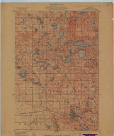
11 topographic sheets cover this place, the earliest surveyed in 1913 and the latest in 1989. It stands in Fergus Falls City. It lies in ZIP code area 56537. The Survey maps it on the Fergus Falls quadrangle. 14,119 people lived here at the 2020 count. It stands 1,181 feet above sea level.
On record in Fergus Falls
Buildings and businesses the archive holds for this place. Each opens its own page, with the source record it came from.
On the National Register 12 of 14 shown
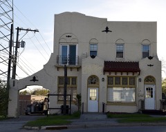 Barnard Mortuarylisted 1986
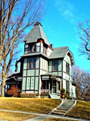 C. C. Clement Houselisted 1986
 Fergus Falls City Halllisted 1984
 Fergus Falls State Hospital Complexlisted 1986
 Hotel Kaddatzlisted 1983
 John W. Mason Houselisted 1986
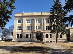 Otter Tail County Courthouselisted 1984
 Park Region Luther Collegelisted 1984
 River Innlisted 1988
 United States Post Office and Courthouselisted 2012
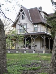 C. J. Wright Houselisted 1978
- Fergus Falls State Hospital (Boundary Increase)listed 2016
Population over time
2 figuresFergus Falls grew from 13,138 to 14,119 between 2010 and 2020. These are the recorded population figures Wikidata holds for this place, reached through the Geographic Names Information System number this page is keyed on rather than by name, so they belong to this place and not to another of the same name. Most are census counts, but not all are: an early figure may be a founding or settlement estimate, and an estimate published within five years of a census is left out. The change column is computed, and is left blank where more than 20 years separate a figure from the one before it, because a gap that long is not a change between two counts.
| Year | People | Change |
|---|---|---|
| 2010 | 13,138 | |
| 2020 | 14,119 | +981 (+7%) |
Topographic sheets covering this place
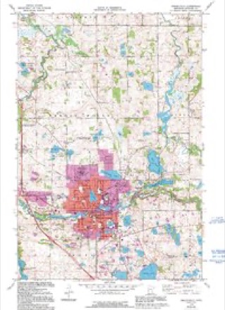
6 surveys from 11 printed sheetsMatched by testing this settlement's coordinate against the published boundary of every sheet in the United States Geological Survey's historical collection. Each opens the scanned sheet at the Survey.
- 1913 USGS Fergus Falls quadrangle1:62500, 3 printings
- 1953 USGS Fargo quadrangle1:250000, 2 printings
- 1956 USGS Fargo quadrangle1:250000
- 1973 USGS Fergus Falls quadrangle1:24000, 2 printings
- 1985 USGS Wahpeton quadrangle1:100000, 2 printings
- 1989 USGS Fargo quadrangle1:250000
Fires near this place
8 since 1992Regional context, not property-specific evidence. The federal wildfire occurrence database lists 8 fires within 5 miles of Fergus Falls between 1992 and 2017, burning about 65 acres in total. None started naturally. None was recorded as arson. Distance is straight-line from the map coordinates, so a fire counted here may appear on a neighbouring settlement's page as well.
| Reported cause | Fires |
|---|---|
| Missing data/not specified/undetermined | 5 |
| Debris and open burning | 2 |
| Smoking | 1 |
The most recent of them, most recent first, with the day each was reported and the service that recorded it.
| Date | Cause | Size | Reported by | Name on the report |
|---|---|---|---|---|
| 20 June 1992 | Smoking | 2.5 acres | Fergus Falls Wetland Management District | WILDUNG |
| 4 May 2004 | Missing data/not specified/undetermined | 1.0 acres | Fergus Falls Wetland Management District | HAUGEN WILDFIRE |
| 12 May 2001 | Missing data/not specified/undetermined | 1.0 acres | Fergus Falls Wetland Management District | RUSH LAKE |
| 8 April 1998 | Debris and open burning | 6.1 acres | Fergus Falls Wetland Management District | TOWNSEND |
| 29 April 1999 | Missing data/not specified/undetermined | 10 acres | Fergus Falls Wetland Management District | WILDUNG |
| 28 April 2017 | Missing data/not specified/undetermined | 11 acres | Fergus Falls Wetland Management District | HAUGEN WF |
| 18 April 2005 | Missing data/not specified/undetermined | 2.0 acres | Fergus Falls Wetland Management District | MAVIS WILDFIRE |
| 20 October 2003 | Debris and open burning | 31 acres | Fergus Falls Wetland Management District | RUSH LAKE WILDFIRE |
Settlements close enough to share some of these fires:
Mines and quarries near this place
2 within 5 milesRegional context, not property-specific evidence. The federal mineral resources record lists 2 workings within 5 miles of Fergus Falls: 2 producers. All of them still produce. What was taken out: Sand and Gravel, Construction. Distance is straight-line from the map coordinates, so a quarry counted here may appear on a neighbouring settlement's page as well.
| Where | Site | Commodity | Status | Recorded |
|---|---|---|---|---|
| Britt Pit and Mill | Sand and Gravel, Construction | Producer | ||
| Thunselle Pit and Mill | Sand and Gravel, Construction | Producer |
Storms near this place
60 of 112 shownRegional context, not property-specific evidence. The National Weather Service names Fergus Falls in 112 storm reports between 1996 and 2025: 51 thunderstorm wind, 35 hail, 10 flash flood, 5 funnel cloud. No death or injury is recorded in these reports. Each account below is quoted exactly as the forecast office filed it, from the NOAA Storm Events Database, and each date opens the federal record of that event.
| When | Event | Place named | Harm | What the report says |
|---|---|---|---|---|
| June 2001 | Thunderstorm Wind | Fergus Falls | $5,000,000 | The strong wind knocked down trees and power lines. The city of Fergus Falls was without power for several hours. 30 to 40 homes sustained damage and many signs were knocked over. |
| June 2001 | Lightning | Fergus Falls | $500,000 | Lightning struck a downtown Fergus Falls business, igniting a fire that destroyed the 3 story business. |
| June 2017 | Thunderstorm Wind | Fergus Falls | $250,000 | Trees and limbs were blown down around town, with some minor street flooding also reported. |
| April 2012 | Tornado (EF1) | Fergus Falls | $100,000 | This tornado touched down near a farmstead and tracked eastward for about two miles before lifting. The tornado popped three empty steel grain bins off their concrete pads and tumbled them around quite violently. The tornado also tore the doors off an enclosed pole shed, tore the roofing panels off, and uplifted and displaced the rafters. Two young men working at the farmstead witnessed the tornado approaching and sought shelter in the damaged pole shed but were not injured. Peak winds were estimated at 90 mph. |
| June 2008 | Tornado (EF1) | Fergus Falls | $100,000 | The tornado touched down west of Interstate 94 and tracked nearly due east for about 2 miles into the northeast corner of Fergus Falls by 6:20 PM CDT. The tornado knocked down power lines and numerous tree branches. It also scattered roofing materials through a field. Peak winds were estimated at 90 mph, and the tornado's maximum width reached 50 yards. |
| May 2022 | Thunderstorm Wind | Fergus Falls | $50,000 | Trees blown down, house and shed roofing torn off, and a pontoon boat flipped near Wall Lake. Winds gusts estimated from 70 to 80 mph. Time estimated based on radar. |
| June 2009 | Thunderstorm Wind | Fergus Falls | $50,000 | A semi tractor and trailer were blown off Interstate 94 near the Dalton exit. |
| June 2001 | Flash Flood | Fergus Falls | $50,000 | The roof on the Lake Region Hospital in Fergus Falls could not handle the heavy rain. Water seeped into a vent in the roof and caused two ceilings to cave in. Workers managed to save the hospital's main frame computer system from water damage. |
| June 1998 | Lightning | Fergus Falls | $40,000 | Lightning struck a barn, igniting a fire that completely destroyed the barn. |
| June 1999 | Thunderstorm Wind | Fergus Falls | $25,000 | An office building in Fergus Falls lost its roof in the strong wind and a dugout at the community college was wrecked. Several trees were also blown down. |
| June 2001 | Thunderstorm Wind | Fergus Falls | $20,000 | The strong wind blew a trailer home off a semi-truck into a ditch along Interstate 94, shattering the home into pieces. |
| June 1998 | Thunderstorm Wind | Fergus Falls | $10,000 | A tree was blown into a house, damaging the roof. Another tree fell on a garage. Power was out for a section of Fergus Falls for over an hour. |
| July 2019 | Flash Flood | Fergus Falls | $5,000 | Three to five inches of rain fell over the Fergus Falls area. Several cars were stuck in the high water that pooled in low spots. |
| June 2018 | Flash Flood | Fergus Falls | $5,000 | Three to five inches of rain fell, which resulted in the ponding of water in camp sites and nearby fields. |
| April 2002 | Lightning | Fergus Falls | $5,000 | Lightning struck a power pole and started a fire. This knocked out electrical service to a portion of Fergus Falls. |
| July 2002 | Thunderstorm Wind | Fergus Falls | $5,000 | Small outbuildings were destroyed. |
| August 2020 | Flood | Fergus Falls | $2,000 | Runoff from heavy rain near Swan Lake continued through most of the day. |
| August 2020 | Flash Flood | Fergus Falls | $2,000 | Street and parking lot flooding was reported near Swan Lake. |
| October 1997 | Thunderstorm Wind | Fergus Falls | $2,000 | Strong winds toppled trees. |
| May 2014 | Flash Flood | Fergus Falls | $1,000 | Water in some streets rose to two to three feet deep and caused storm sewers to overflow. |
| July 2000 | Thunderstorm Wind | Fergus Falls | $500 | Three inch diameter tree branches were blown down. |
| July 1999 | Thunderstorm Wind | Fergus Falls | $500 | Trees were downed. |
| August 1999 | Thunderstorm Wind | Fergus Falls | $500 | Several large branches were broken by the wind. |
| June 2025 | Thunderstorm Wind | Fergus Falls | - | Tree damage reported by public and relayed via broadcast media. |
| July 2024 | Thunderstorm Wind | Fergus Falls | - | Report from a Minnesota DOT site. |
| July 2024 | Thunderstorm Wind | Fergus Falls | - | Report from a RWIS site in Fergus Falls. |
| July 2024 | Hail | Fergus Falls | - | Broadcast Media relays report of quarter sized hail in Fergus Falls. |
| June 2024 | Thunderstorm Wind | Fergus Falls | - | RWIS reports a 65 mph gust on I-94. |
| May 2022 | Hail | Fergus Falls | - | The observer at Orwell Dam reported hail up to 1.75 inches in diameter. |
| May 2022 | Thunderstorm Wind | Fergus Falls | - | Motel signage was blown in. Numerous large ash and spruce tree branches broken around town. |
| May 2022 | Thunderstorm Wind | Fergus Falls | - | Billboard signage at the I-94 speedway was blown over. Metal supports bolted to concrete with bolts snapped. Numerous large tree branches and limbs broken. |
| October 2021 | Thunderstorm Wind | Fergus Falls | - | Report of several trees down and roads impassable due to branch debris in town. Time estimated based on radar. |
| May 2021 | Hail | Fergus Falls | - | Hail up to 0.75 inch was reported by a trained spotter. |
| July 2021 | Thunderstorm Wind | Fergus Falls | - | Tree branches of 3 inches in diameter snapped, winds estimated to 60 mph by trained spotter. |
| July 2020 | Thunderstorm Wind | Fergus Falls | - | The wind gust was measured by a personal weather station. |
| July 2020 | Thunderstorm Wind | Fergus Falls | - | A wind turbine blade was shattered. |
| July 2020 | Funnel Cloud | Fergus Falls | - | A funnel cloud was observed east of town moving toward Underwood. |
| July 2020 | Funnel Cloud | Fergus Falls | - | A funnel cloud tracked southeastward off the east edge of Fergus Falls, coming halfway to the ground at one point. |
| July 2020 | Funnel Cloud | Fergus Falls | - | A persistent funnel cloud dropped to between one-third and halfway to the ground. |
| June 2020 | Thunderstorm Wind | Fergus Falls | - | The wind gust was measured by a personal weather station. |
| June 2020 | Thunderstorm Wind | Fergus Falls | - | The wind gust was measured at the Prairie Wetlands Center. |
| July 2019 | Thunderstorm Wind | Fergus Falls | - | Tree limbs and power lines were blown down in Fergus Falls. Rotation was also reported with the storm. |
| June 2018 | Thunderstorm Wind | Fergus Falls | - | A power power and a light pole were blown down. Several miles away, the Fergus Falls airport reported a 55 mph wind gust. |
| June 2017 | Thunderstorm Wind | Fergus Falls | - | The wind gust was measured at the Fergus Falls airport. |
| June 2017 | Thunderstorm Wind | Fergus Falls | - | A vehicle was blown off the road. |
| June 2017 | Thunderstorm Wind | Fergus Falls | - | The wind gust was measured at the Prairie Wetlands Learning Center. |
| July 2017 | Hail | Fergus Falls | - | The hail ranged in size from 1.50 to 2.00 inches. |
| July 2017 | Hail | Fergus Falls | - | The hail varied in size. |
| August 2016 | Thunderstorm Wind | Fergus Falls | - | Strong winds knocked down several trees, one falling on the top of a car. Several roads were blocked by trees and large branches. Power outages also occurred. |
| August 2016 | Hail | Fergus Falls | - | Dime sized hail fell with winds estimated at 25 mph. |
| August 2013 | Thunderstorm Wind | Fergus Falls | - | The strong winds were measured at the Prairie Wetland Center. |
| September 2013 | Thunderstorm Wind | Fergus Falls | - | Power outages spread across portions of western Otter Tail County as large tree branches fell on power lines. |
| April 2012 | Hail | Fergus Falls | - | Pea to dime sized hail fell about one inch deep on the highway. |
| August 2012 | Thunderstorm Wind | Fergus Falls | - | The wind gust was measured by the AWOS at the Fergus Falls Airport. |
| July 2011 | Thunderstorm Wind | Fergus Falls | - | A tree was blown down. |
| August 2011 | Thunderstorm Wind | Fergus Falls | - | The roof of an open bay lumber storage building was uplifted and flipped eastward onto Junius Avenue. The section of roofing remained largely intact as it flipped and therefore it impacted and broke two adjacent power poles. |
| July 2010 | Hail | Fergus Falls | - | The hail began as pea sized but quickly got to golfball sized. |
| July 2010 | Hail | Fergus Falls | - | The hail was quite large, about three inches in diameter. |
| July 2010 | Funnel Cloud | Fergus Falls | - | A wall cloud with a funnel were viewed from exit 55 on Interstate 94, looking southeastward. |
| June 2009 | Thunderstorm Wind | Fergus Falls | - | Several trees were blown over in town. |
Nearest settlements
The eight closest, with where each one stands in the county. Distances are straight-line, computed from the Geographic Names Information System coordinates.
| Map | Place | Distance | Sheets |
|---|---|---|---|
| River Bluff Estates | 1.7 miles | 11 | |
| Lakeview Estates | 1.9 miles | 11 | |
| Parkdale | 4.9 miles | 9 | |
| Wall Lake | 6.0 miles | 12 | |
| French | 6.6 miles | 10 | |
| Elizabeth | 7.2 miles | 10 | |
| Carlisle | 8.4 miles | 10 | |
| Roberts (historical) | 8.7 miles | 9 |
Elsewhere
Matched on this settlement's Geographic Names Information System number rather than its name, so it cannot be a different place of the same name in another state.
| Wikipedia article on Fergus Falls | An encyclopaedic summary. Its text is share-alike, so it is linked here rather than copied. |
| Wikidata item Q1975464 | The structured record the population and elevation above come from. Public domain (CC0). |
Provenance
This settlement is recorded in the Geographic Names Information System as feature 643602. The sheet list is computed by point-in-boundary test against the United States Geological Survey's historical topographic inventory. Both are works of the United States government and carry no copyright under 17 U.S.C. 105.
Wildfire. Short, Karen C. 2022. Spatial wildfire occurrence data for the United States, 1992-2020 [FPA_FOD_20221014]. 6th Edition. Fort Collins, CO: Forest Service Research Data Archive. https://doi.org/10.2737/RDS-2013-0009.6 Collected with United States Government funding and usable without additional permissions or fees.
Mines and quarries. USGS Mineral Resources Data System (MRDS) https://mrdata.usgs.gov/mrds/ A work of the United States government, no copyright under 17 U.S.C. 105.
Storms. NOAA National Centers for Environmental Information, Storm Events Database https://www.ncei.noaa.gov/stormevents/ A work of the United States government, no copyright under 17 U.S.C. 105. Narratives are quoted verbatim from the National Weather Service report and are not edited or summarised.