Block
From the record
27 National Register listings published here.
Sources: the county history on the Internet Archive · the National Register database, National Park Service
81 topographic sheets cover 55 settlements here, and 27 properties are on the National Register of Historic Places.
27 National Register listings published here.
Sources: the county history on the Internet Archive · the National Register database, National Park Service
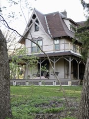
Every property in this county listed on the National Register of Historic Places, with the year it was listed and the federal nomination document.
Every wildfire the federal occurrence database records inside this county: 338 of them, burning about 6,727 acres. 4 started naturally and 48 were recorded as arson. Each settlement page carries the fires within five miles of it.
| Reported cause | Fires |
|---|---|
| Debris and open burning | 141 |
| Missing data/not specified/undetermined | 58 |
| Equipment and vehicle use | 49 |
| Arson/incendiarism | 48 |
| Smoking | 15 |
| Recreation and ceremony | 8 |
| Railroad operations and maintenance | 8 |
| Natural | 4 |
| Other causes | 2 |
| Power generation/transmission/distribution | 2 |
| Firearms and explosives use | 1 |
| Fireworks | 1 |
| Misuse of fire by a minor | 1 |
The five largest, by the area the report gives. One of them was set deliberately.
| Date | Cause | Size | Reported by | Name on the report |
|---|---|---|---|---|
| 24 March 2003 | Equipment and vehicle use | 470 acres | Minnesota Department of Natural Resources | not named |
| 2 April 1992 | Debris and open burning | 360 acres | Minnesota Department of Natural Resources | not named |
| 9 April 2006 | Recreation and ceremony | 326 acres | Fergus Falls Wetland Management District | PARKERS PRAIRIE FIRE |
| 22 October 2003 | Missing data/not specified/undetermined | 200 acres | Fergus Falls Wetland Management District | MICKELSON WILDFIRE |
| 28 March 2015 | Missing data/not specified/undetermined | 143 acres | Fergus Falls Wetland Management District | GRADY MANN |
| 19 April 2003 | Debris and open burning | 138 acres | Minnesota Department of Natural Resources | not named |
| 3 October 1997 | Debris and open burning | 132 acres | Fergus Falls Wetland Management District | AGASSIZ |
| 1 November 1994 | Arson/incendiarism | 130 acres | Minnesota Department of Natural Resources | not named |
Every settlement page carries the fires within five miles of it - see the settlement index below.
The NOAA Storm Events Database holds 1,051 reports for this county, causing 3 deaths, 42 injuries and about $30,402,380 in recorded property damage. Each settlement page carries the reports that name it.
| Kind of event | Reports |
|---|---|
| Hail | 458 |
| Thunderstorm Wind | 405 |
| Tornado | 87 |
| Flash Flood | 39 |
| Funnel Cloud | 39 |
| Flood | 11 |
| Lightning | 7 |
| Heavy Rain | 5 |
The most serious of them, by death, then injury, then recorded damage. The accounts are quoted exactly as the forecast office filed them.
| When | Event | Place named | Harm | What the report says |
|---|---|---|---|---|
| August 1987 | Tornado (F2) | not stated | 1 killed, 8 hurt, $2,500,000 | no account filed |
| June 2010 | Tornado (EF4) | Urbank | 1 killed, 5 hurt | This tornado began in Douglas County, Minnesota. It moved northward into Otter Tail County and produced an additional 38 miles of continuous damage path. The tornado destroyed numerous homes and farmsteads along its path, completely sweeping 7 homes from their foundations. At times, this multi-vortex tornado complex consisted of multiple tornadic tubes pivoting around a common center. Peak winds were estimated at 175 mph. |
| July 2020 | Tornado (EF4) | Dalton | 1 killed, 2 hurt, $1,500,000 | This tornado began in Grant County, but after about two miles, it crossed into Otter Tail County, where it ended about 5 miles east of Dalton. The total track through both counties was about 9 miles. Peak winds were estimated at 170 mph, based on available damage indicators. At least 10 farmsteads were impacted, with three homes, one pole shed, and one machine shed destroyed. |
| May 1964 | Tornado (F2) | not stated | 13 hurt, $250,000 | no account filed |
| August 1977 | Tornado (F2) | not stated | 8 hurt, $250,000 | no account filed |
| June 2001 | Tornado (F3) | Parkers Prairie | 3 hurt, $5,000,000 | The tornado caused quite a bit of damage along its path across southeast Otter Tail county before it crossed into Todd county. At one farmstead, 9 people huddled inside a house with no basement as its roof was torn off. Nobody was injured, but another trailer home nearby was completely destroyed. Many irrigation systems were overturned, trees, power poles, and lines snapped, and grain bins destroyed by the strong wind. An estimated 100 poles were broken off leaving nearly 1,100 people without power. At another farm, a 40x80 foot pole barn was wrecked. About 6 miles northeast of Parkers Prairie, a man and his two kids rode out the storm in their minivan inside a quonset. Trees all around them and the quonset were crumpled by the wind, yet they survived. Another farmstead lost a house, trailer home, and two silos. A turkey barn containing 12,000 turkeys was also hit, with an estimated 60 percent of the turkeys perishing. |
| October 1996 | Tornado (F2) | Henning | 1 hurt, $400,000 | This tornado followed a track through eastern Otter Tail county, with the first damage report along Highway 210. A man stopped his car along the road when he saw the threatening clouds. The tornado picked his car up and spun it around, with the man inside. The car windows were all broken, but the man only sustained cuts on his hands. The tornado destroyed several farm buildings, one full of dairy cows. 21 of the cows were killed. The last damage report was just west of New York Mills. Two deer hunters were in tree stands when the storm approached. One managed to get down to the ground and lay flat, but the other clung to the tree as the tornado passed. As the wind died down, the man found his tree was the only one left standing in a grove of 36 around him. Neither man was injured. |
| June 2005 | Thunderstorm Wind | Richville | 1 hurt | A 3-foot diameter tree fell on a mobile home, injuring the man inside. The mobile home was destroyed, and it took an hour to free the man. |
| July 2002 | Lightning | Perham | 1 hurt | A 33 year-old man was struck by lightning while riding his motorcycle westbound on U.S. Highway 10. His wife, who was also on the motorcycle, was uninjured. |
| June 2001 | Thunderstorm Wind | Fergus Falls | $5,000,000 | The strong wind knocked down trees and power lines. The city of Fergus Falls was without power for several hours. 30 to 40 homes sustained damage and many signs were knocked over. |
| September 1998 | Thunderstorm Wind | New York Mills | $4,000,000 | The strong winds hit New York Mills quite hard. 1,600 customers in the area lost power, with 50 power poles snapped in half. The city garage lost parts of its roof, as did the school gym and the school storage shed. A garage in the town was ripped in two, sending a portion of the roof into two vehicles parked two lots away. Numerous trees and signs were blown down. |
| September 1998 | Thunderstorm Wind | Ottertail | $2,000,000 | An 85,000 bushel grain bin was flattened against the Ottertail elevator. Another 90,000 bushel bin crumpled to the ground, and two other 45,000 bushel bins were damaged by the strong wind. Around the town, a storage shed was blown apart, a marine business was damaged, several irrigation systems were twisted, trees were uprooted, and many signs were damaged. A pontoon was picked up by the wind and thrown 150 feet into a spruce tree. |
| July 2020 | Tornado (EF1) | Maine | $750,000 | The tornado, wrapped in downburst winds and heavy rain, tracked intermittently to the east-northeast for nearly 18 miles. The tornado crossed Pickerel and Long lakes, and ended just before Rush Lake. It uprooted or snapped numerous trees and power poles. In the northeast corner of Long Lake, it tumbled several travel trailers, tore roof sections off a pole shed, and tumbled an irrigation system. Peak winds were estimated at 105 mph. |
| July 2004 | Tornado (F1) | Dunvilla | $600,000 | Intermittent tree damage occurred from the east side of Lake Lizzie to Dent. Power outages occurred from trees falling on power lines. On West McDonald Lake, a 30 foot mobile home was overturned against an oak tree that was split in half. A tree also fell on a boat, destroying it. At Spirit Lake, 20 trees were damaged at a resort, some falling on resort cabins. A dock was also damaged. At Hoffman Lake, property owners reportedly saw the tornado coming across the lake. Many trees fell on homes or other property. |
| July 2020 | Tornado (EF1) | French | $500,000 | This tornado began in Wilkin County, but ended in Otter Tail County, on the north side of Fergus Falls. The tornado was wrapped in downburst winds and rain, with a total track length of about 11 miles. The tornado uprooted or snapped numerous trees in shelterbelts along its path. It also snapped a few power poles and tore the roof off and collapsed the walls at a welding and manufacturing shop near the Fergus Falls airport. Peak winds were estimated at 100 mph. |
| July 2020 | Thunderstorm Wind | Western | $500,000 | Several large oak trees were snapped across the northern half of Western Township. A wide snarl was evident, indicating a weak embedded circulation in an otherwise downburst pattern. |
| June 2001 | Lightning | Fergus Falls | $500,000 | Lightning struck a downtown Fergus Falls business, igniting a fire that destroyed the 3 story business. |
| May 1999 | Lightning | Butler | $500,000 | A church was destroyed after lightning ignited a fire in the roof. |
| May 2022 | Thunderstorm Wind | Dalton | $400,000 | A detached garage was destroyed, house roofing torn off, trees snapped, and a center pivot irrigation system flipped over along or near the south shore of Ten Mile Lake. Numerous large ash and spruce trees were also snapped or uprooted on east and northeast edges of the lake, and across much of Tumuli and St. Olaf Townships. Information augmented by NWS Storm Damage Survey. Winds gusts estimated from 70 to 90 mph. Time estimated based on radar. |
| July 2004 | Tornado (F1) | Dunvilla | $400,000 | Many large trees were blown down and some blocked state highway 34. Four trees fell on a house on Tamarac Lake, where many other trees were blown down. On Pelican Lake, numerous oak trees were damaged. One oak tree fell on a roof. Trees also fell on a recreational vehicle and on several boats. |
| June 2017 | Thunderstorm Wind | Elizabeth | $300,000 | Roofs were blown off turkey barns, trees were uprooted, and a barn was leveled. |
| June 2010 | Thunderstorm Wind | Parkers Prairie | $300,000 | Peak 3 second wind gusts of from 128 to 145 mph were measured by 6 different wind sensors placed at heights of from 160 to 380 feet AGL at a temporary wind energy monitoring tower site. Peak 3 second wind gusts of 119 mph were measured at a height of 20 feet AGL at this same tower site. These measurements were made as a tornado struck the site, and just prior to the collapse of the tower. |
| July 2010 | Tornado (EF1) | New York Mills Arpt | $300,000 | This tornado was enshrouded in heavy rain, large hail, and damaging downburst winds. Numerous large trees were knocked down or uprooted along this path. At least 6 wooden power poles were snapped off. One farmstead lost a section of a large pole shed. A nearby farmstead had a concrete silo toppled. This tornado crossed part of the damage field from a larger June 17th tornado north of Bluffton in Bluffton Township. |
| June 2017 | Thunderstorm Wind | Fergus Falls | $250,000 | Trees and limbs were blown down around town, with some minor street flooding also reported. |
| September 2004 | Tornado (F2) | Perham | $250,000 | A tornado tracked through pasture, forest, and corn fields. Numerous trees were knocked down and one farmstead received extensive barn, shed, and home damage. Twelve head of cattle were killed. Several trees were toppled onto homes near Marion Lake. Farmyard debris was carried as far as Perham, about 7 miles northeast. |
| July 1974 | Tornado (F2) | not stated | $250,000 | no account filed |
| August 1973 | Tornado (F1) | not stated | $250,000 | no account filed |
| July 2020 | Tornado (EF2) | Vining | $200,000 | The tornado, wrapped in heavy rain and downburst winds, snapped multiple power poles at three points along its path. It also tossed calving sheds and flipped an irrigation system, while surrounding winds blew down trees in and around its path. Peak winds were estimated at 115 mph. |
| July 2020 | Thunderstorm Wind | Erhard | $200,000 | A microburst (downburst wind) likely initiated over the west end of Long Lake and moved rapidly eastward across Long Lake Point Road. A trailer home was blown over and demolished. Several large tree limbs were broken down by the wind, while a pontoon was flipped over by the combination of wave and wind action. |
| June 2017 | Thunderstorm Wind | Dent | $200,000 | Numerous trees and large tree branches were blown down mainly on northeast edges of numerous small lakes across Star Lake and Dead Lake townships. Numerous sections of county and township roads were blocked by downed trees and branches. |
| July 2010 | Flash Flood | Pelican Lake | $200,000 | Water covered county roads in the Dent area due to the heavy rainfall. |
| July 2008 | Tornado (EF1) | Luce | $200,000 | Irrigation system center pivots, trees, and power poles were heavily damaged in a roughly 2 mile path to about 7 miles north-northwest of Perham. A metal grain bin was blown down along with a small silo and several smaller farm buildings. Peak winds were estimated at around 105 mph. |
| August 2004 | Tornado (F1) | Ottertail | $200,000 | The tornado tracked from the Pickerel Lake area, across Ottertail Lake, to around 2 miles southwest of Ottertail. Numerous trees were uprooted or snapped off. Boat lifts and docks were strewn around the lake shores. Downed trees fell on the roofs of several homes. Power poles were snapped off causing widespread power outages. Several people reported a loud "freight train" sound. |
| May 2022 | Thunderstorm Wind | Dalton | $150,000 | A fifth wheel dual-axle camper was flipped over near Stalker Lake. Numerous large trees were snapped or uprooted around Stalker and Long Lakes. One pole shed had its south facing wall blown inward and sheet metal panels blown off. Information augmented by NWS Damage Survey. Winds gusts estimated from 70 to 90 mph. Time estimated based on radar. |
| May 2022 | Tornado (EF1) | Perham | $150,000 | This tornado was wrapped in damaging downburst winds and rain as it rapidly tracked to the north northeast, into and across Big Pine Lake. Numerous poplar, ash, spruce, and pine trees were snapped or uprooted. One garage had an overhead door blown in and the back wall blown out, though the roof remained intact. Peak wind estimated to 100 mph. Time estimated based on radar. |
| June 2017 | Thunderstorm Wind | Rothsay | $150,000 | Two tractor-trailers were blown over on Interstate 94 between Elizabeth and Rothsay. The Rothsay MNDOT RWIS also experienced a power outage during this time. |
| July 2008 | Hail | Pelican Lake | $150,000 | The hail broke cabin windows and dented decks near Pelican Lake. |
| April 2012 | Tornado (EF1) | Fergus Falls | $100,000 | This tornado touched down near a farmstead and tracked eastward for about two miles before lifting. The tornado popped three empty steel grain bins off their concrete pads and tumbled them around quite violently. The tornado also tore the doors off an enclosed pole shed, tore the roofing panels off, and uplifted and displaced the rafters. Two young men working at the farmstead witnessed the tornado approaching and sought shelter in the damaged pole shed but were not injured. Peak winds were estimated at 90 mph. |
| June 2008 | Tornado (EF1) | Fergus Falls | $100,000 | The tornado touched down west of Interstate 94 and tracked nearly due east for about 2 miles into the northeast corner of Fergus Falls by 6:20 PM CDT. The tornado knocked down power lines and numerous tree branches. It also scattered roofing materials through a field. Peak winds were estimated at 90 mph, and the tornado's maximum width reached 50 yards. |
| July 1998 | Flash Flood | Pelican Rapids | $100,000 | Rain falling across the same track produced a band of 3 to 5 inches of rain between Pelican Rapids and Dent. A section of the road bank along highway 108 east of Pelican Rapids washed out. Other mud slides occurred in the Lake Lida area on highway 108. The highway was closed for 2 days as the Minnesota DOT assessed the safety of the road. Resort lift stations failed, so vacationers could not use toilets and sinks. |
| September 1998 | Thunderstorm Wind | Basswood | $75,000 | A resort on Dead Lake was hit by the strong winds. Four cabins were damaged and a large propane tank was pushed off its foundation. A boat was picked up and thrown 3 cabins down, dragging the anchor. |
| July 1998 | Flash Flood | Pelican Rapids | $75,000 | Several basements in Pelican Rapids filled with up to 4 feet of water. |
| May 2022 | Thunderstorm Wind | Underwood | $70,000 | Large trees were blown down and a travel trailer was crushed by falling trees on South Turtle Lake. Time estimated based on radar. |
| May 2022 | Thunderstorm Wind | Fergus Falls | $50,000 | Trees blown down, house and shed roofing torn off, and a pontoon boat flipped near Wall Lake. Winds gusts estimated from 70 to 80 mph. Time estimated based on radar. |
| May 2022 | Tornado (EF1) | Urbank | $50,000 | This tornado was wrapped in damaging downburst winds and rain as it rapidly tracked to the north northeast. Numerous poplar, ash, and spruce trees were snapped or uprooted. Shingles and metal roofing panels were torn off of houses and farm buildings and were spread downwind. Peak wind estimated to 90 mph. Time estimated based on radar. |
| June 2017 | Thunderstorm Wind | Rothsay | $50,000 | A grain bin was blown over with numerous trees and branches also knocked down. |
| June 2009 | Thunderstorm Wind | Fergus Falls | $50,000 | A semi tractor and trailer were blown off Interstate 94 near the Dalton exit. |
| June 2008 | Thunderstorm Wind | Elizabeth | $50,000 | The wind knocked down ten inch diameter branches. |
| June 2001 | Flash Flood | Fergus Falls | $50,000 | The roof on the Lake Region Hospital in Fergus Falls could not handle the heavy rain. Water seeped into a vent in the roof and caused two ceilings to cave in. Workers managed to save the hospital's main frame computer system from water damage. |
| September 1998 | Thunderstorm Wind | Bluffton | $50,000 | In the Bluffton area, 5 miles of roads had to be reopened because of downed trees. Four barns were blown over and a tree fell on two cars. |
| July 2008 | Tornado (EF1) | Lyman | $40,000 | Several large trees were snapped off or blown over along a roughly one mile path. |
| June 1998 | Lightning | Fergus Falls | $40,000 | Lightning struck a barn, igniting a fire that completely destroyed the barn. |
| June 2014 | Hail | Ottertail | $30,000 | A few minutes of very large hail was reported along the northeast edge of Otter Tail Lake. |
| July 2014 | Flood | New York Mills | $25,000 | Water covered county road 67 near county roads 142 and 54. |
| August 2001 | Thunderstorm Wind | Pelican Rapids | $25,000 | Trees were blown down and a building under construction was destroyed. |
| June 1999 | Thunderstorm Wind | Fergus Falls | $25,000 | An office building in Fergus Falls lost its roof in the strong wind and a dugout at the community college was wrecked. Several trees were also blown down. |
| June 1968 | Tornado (F1) | not stated | $25,000 | no account filed |
| September 1964 | Tornado (F1) | not stated | $25,000 | no account filed |
| June 1961 | Tornado (F1) | not stated | $25,000 | no account filed |
| August 1960 | Tornado (F2) | not stated | $25,000 | no account filed |
The Survey's mineral resources record lists 11 workings inside this county. All of them still produce. Each settlement page carries the workings within five miles of it.
| Commodity | Workings |
|---|---|
| Sand and Gravel, Construction | 10 |
| Peat | 1 |
The least common of them first, because a county's hundredth gravel pit says nothing its first ten did not.
| Where | Site | Commodity | Status | Recorded |
|---|---|---|---|---|
| Otter Tail County Peat Bogs | Peat | Producer | Marl | |
| Britt Pit and Mill | Sand and Gravel, Construction | Producer | ||
| Eide Pit | Sand and Gravel, Construction | Producer | ||
| Mark Pit and Mill | Sand and Gravel, Construction | Producer | ||
| Pelican Ready Mix Pit and Mill | Sand and Gravel, Construction | Producer | ||
| Perham Ready Mix Pit and Mill | Sand and Gravel, Construction | Producer | ||
| Petersen Pit | Sand and Gravel, Construction | Producer | ||
| Steib Pit | Sand and Gravel, Construction | Producer | ||
| Thunselle Pit and Mill | Sand and Gravel, Construction | Producer | ||
| Weniger Pit | Sand and Gravel, Construction | Producer | ||
| Weniger Pit | Sand and Gravel, Construction | Producer |
History of Otter Tail County, Minnesota : Its People, Industries, and Institutions : with Biographical Sketches of Representative Citizens and Genealogical Records of Many of the Old Families devotes a chapter to each township: its boundaries and streams, who settled it and when, the mills, the schools and the churches. All 20 are reproduced here in full. Each row shows the township's own shape and where it lies in the county, drawn from the Census Bureau's boundary. Which settlements belong to which township is computed from that same boundary, not taken from the book.
| Shape and position in the county | Township | Settlements in it | Length | Sections |
|---|---|---|---|---|
| Aurdal Township | Wall Lake | 24 words | 1 | |
| Bluffton City | Bluffton, West Wind Estates | 85 words | 1 | |
| Butler Township | Butler | 50 words | 1 | |
| Clitherall City | Clitherall | 72 words | 2 | |
| Dead Lake Township | Basswood | 25 words | 0 | |
| Deer Creek City | Deer Creek | 95 words | 3 | |
| Dunn Township | Dunvilla | 47 words | 1 | |
| Elmo Township | Almora | 50 words | 1 | |
| Friberg Township | Edwards | 22 words | 0 | |
| Girard Township | Inglewood, Woodland Park | 24 words | 0 | |
| Gorman Township | Luce | 22 words | 0 | |
| Henning City | Henning | 23 words | 1 | |
| Homestead Township | Davies | 49 words | 0 | |
| Leaf Lake Township | Leaf City | 47 words | 2 | |
| Newton Township | Heinola, New York Mills, Topelius | 21 words | 0 | |
| Oak Valley Township | Lyman | 22 words | 0 | |
| Pelican Township | Pelican Rapids | 47 words | 1 | |
| Perham Township | Perham, Pine Cone Court | 22 words | 0 | |
| Pine Lake Township | Grand View Heights, Richdale | 97 words | 3 | |
| Scambler Township | Clear View | 67 words | 3 |
One book written about this county, cut here where the book itself is cut, at its printed chapters: 1 chapter in all. Every chapter is public domain, machine-read from the scan and reproduced complete. A chapter already given under one of the county's towns is not repeated in this list.
| Chapter | Length |
|---|---|
| Biographical sketches | 442,448 words in 28 parts |
Named settlements recorded in the Geographic Names Information System, each with the topographic sheets covering it. Villages, hamlets and abandoned places alike. Each is shown with the nearest named watercourse or landform and the survey quadrangle it falls on.
Scambler township · 56572 · On Spring Creek · Cormorant quadrangle
11 sheets, 1914 to 1989
Girard township · 56515 · On Blanche Creek · Battle Lake quadrangle
13 sheets, 1912 to 1986
Leaf Lake township · 56551 · Heinola quadrangle
9 sheets, 1953 to 1986
No longer a settlement
Parkers Prairie township · 56361 · Parkers Prairie quadrangle
9 sheets, 1953 to 1986
Parkers Prairie township · 56361 · Parkers Prairie quadrangle
9 sheets, 1953 to 1986
Fergus Falls city · 56537 · On Pelican River · Fergus Falls quadrangle
11 sheets, 1913 to 1989
Western township · 56537 · Orwell Lake quadrangle
9 sheets, 1910 to 1989
No longer a settlement
Newton township · 56567 · Deer Creek quadrangle
9 sheets, 1953 to 1986
No longer a settlement
Girard township · 56551 · On Brandborg Creek · Vining quadrangle
13 sheets, 1912 to 1986
The vanished settlements of Otter Tail County: the places named above that are no longer on the map.