 Block
Forest Lake, Minnesota
14 topographic sheets cover this place, the earliest surveyed in 1953 and the latest in 1985. It stands in Forest Lake City. It lies in ZIP code area 55025. It lies near Allina Medical Clinic - Forest Lake. The Survey maps it on the Forest Lake quadrangle. 20,611 people lived here at the 2020 count. It stands 912 feet above sea level.
Population over time
2 figuresForest Lake grew from 18,375 to 20,611 between 2010 and 2020. These are the recorded population figures Wikidata holds for this place, reached through the Geographic Names Information System number this page is keyed on rather than by name, so they belong to this place and not to another of the same name. Most are census counts, but not all are: an early figure may be a founding or settlement estimate, and an estimate published within five years of a census is left out. The change column is computed, and is left blank where more than 20 years separate a figure from the one before it, because a gap that long is not a change between two counts.
| Year | People | Change |
|---|---|---|
| 2010 | 18,375 | |
| 2020 | 20,611 | +2,236 (+12%) |
Topographic sheets covering this place
8 surveys from 14 printed sheetsMatched by testing this settlement's coordinate against the published boundary of every sheet in the United States Geological Survey's historical collection. Each opens the scanned sheet at the Survey.
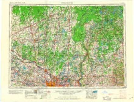
- 1953 USGS Stillwater quadrangle1:250000
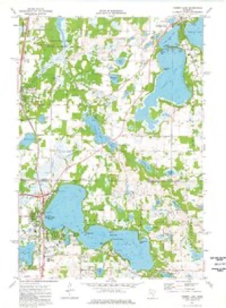
- 1955 USGS Forest Lake quadrangle1:62500, 3 printings
- 1955 USGS Stillwater quadrangle1:250000
- 1958 USGS Stillwater quadrangle1:250000, 2 printings
- 1965 USGS Stillwater quadrangle1:250000
- 1974 USGS Forest Lake quadrangle1:24000, 2 printings
- 1975 USGS Stillwater quadrangle1:250000, 2 printings
- 1985 USGS Stillwater quadrangle1:100000, 2 printings
In the county-history sources
2,422 words on this townshipHistory of Washington County and the St. Croix Valley Including the Explorers and Pioneers of Minnesota, published 1881 names this settlement in its chapter on Forest Lake City. These are the passages that mention it, exactly as the scans read.
Forest Lake Lodge No. 179, 1. O. G. T., was organized in June, 1879. They hold their meetr ings every two weeks in the school house. The charter members were A. C. York, Elizabeth Spickler, R. H. McGee, I. M. Banty, Estella Bush, A. W. Simmons, William Angevine, John Banty, M. A. York, Minnie York, 8. B. Howell, Sarah Angevine, Mary Poston, David Banty, Richard Poston, John Erickson.
Passage source: History of Washington County and the St. Croix Valley Including the Explorers and Pioneers of Minnesota, published 1881.
Ole Aim, a native of Sweden, was bom in 1860, and is the son of Andrew Aim, the first Swedish settler in Forest Lake. Coming to Ame¬ rica in 1869 with bis sister, he proceeded directly to his parents, who had preceded him. In 1873, he located at Forest Lake with his father, and three years later, opened a store in company with his brother. They sold the following year and devoted their time and attention solely to farm¬ ing. Mr. Aim was married in 1876 to Gustina Erickson, a native of Sweden, who died in 1879, leaving two children.
Passage source: History of Washington County and the St. Croix Valley Including the Explorers and Pioneers of Minnesota, published 1881.
A. P. Halsey was born at Elizabeth, New Jersey, 1845, where he remained until twenty-two years of age. Wishing to see the west, he came to Davenport, Iowa, thence to Waterloo, which place he made his home for four years. In 1871, he went to Le Sueur, Minnesota, and carried on an extensive business in the mercantile line, hav¬ ing a large general stock. Finally disposing of his goods, he came to Minneapolis, and being at¬ tracted to Forest Lake, purchased fifty acres of land very pleasantly located on the shores-of the lake. His residence commands a beautiful view of the waters and surrounding wood-lands. He was married January 2d, 1871.
Passage source: History of Washington County and the St. Croix Valley Including the Explorers and Pioneers of Minnesota, published 1881.
Machine-read from a century-old scan, so expect the errors a machine makes: misspelled names, dropped words, stray characters.
Read the whole chapter on Forest Lake City - it names this place 13 more 13 times.
Fires near this place
79 since 1993Regional context, not property-specific evidence. The federal wildfire occurrence database lists 79 fires within 5 miles of Forest Lake between 1993 and 2020, burning about 232 acres in total. None started naturally. 11 were recorded as arson. Distance is straight-line from the map coordinates, so a fire counted here may appear on a neighbouring settlement's page as well.
| Reported cause | Fires |
|---|---|
| Debris and open burning | 31 |
| Missing data/not specified/undetermined | 13 |
| Arson/incendiarism | 11 |
| Equipment and vehicle use | 10 |
| Recreation and ceremony | 6 |
| Smoking | 4 |
| Power generation/transmission/distribution | 2 |
| Other causes | 1 |
| Fireworks | 1 |
The most recent of them, most recent first, with the day each was reported and the service that recorded it.
| Date | Cause | Size | Reported by | Name on the report |
|---|---|---|---|---|
| 30 September 2012 | Equipment and vehicle use | 62 acres | Minnesota Department of Natural Resources | not named |
| 24 September 2012 | Debris and open burning | 3.0 acres | Minnesota Department of Natural Resources | not named |
| 18 September 1994 | Missing data/not specified/undetermined | under an acre | Minnesota Department of Natural Resources | not named |
| 17 June 2020 | Missing data/not specified/undetermined | under an acre | Minnesota Department of Natural Resources | not named |
| 17 June 1994 | Debris and open burning | under an acre | Minnesota Department of Natural Resources | not named |
| 1 June 2002 | Debris and open burning | under an acre | Minnesota Department of Natural Resources | not named |
| 8 May 2018 | Debris and open burning | under an acre | Minnesota Department of Natural Resources | not named |
| 7 May 2016 | Missing data/not specified/undetermined | under an acre | Minnesota Department of Natural Resources | not named |
Mines and quarries near this place
2 within 5 milesRegional context, not property-specific evidence. The federal mineral resources record lists 2 workings within 5 miles of Forest Lake: 2 producers. All of them still produce. What was taken out: Sand and Gravel, Construction. Distance is straight-line from the map coordinates, so a quarry counted here may appear on a neighbouring settlement's page as well.
| Where | Site | Commodity | Status | Recorded |
|---|---|---|---|---|
| Bracht Pit and Mill | Sand and Gravel, Construction | Producer | ||
| Lindgren Pit and Mill | Sand and Gravel, Construction | Producer |
Storms near this place
49 since 1994Regional context, not property-specific evidence. The National Weather Service names Forest Lake in 49 storm reports between 1994 and 2022: 24 hail, 17 thunderstorm wind, 6 tornado, 2 flash flood. No death or injury is recorded in these reports. Each account below is quoted exactly as the forecast office filed it, from the NOAA Storm Events Database, and each date opens the federal record of that event.
| When | Event | Place named | Harm | What the report says |
|---|---|---|---|---|
| May 1998 | Hail | Forest Lake | $10,000,000 | Scattered house and vehicle damage from wind driven hail. Damage estimate for entire county. |
| July 2011 | Thunderstorm Wind | Forest Lake | $250,000 | Straight line winds caused a large area of northern Washington County to lose power. The hardest hit area was Forest Lake, where several large trees fell on cars and homes. |
| May 2011 | Tornado (EF0) | Forest Lake | $50,000 | An EF-0 tornado touched down near 200th Street and Imperial Avenue, or about three miles southeast of Forest Lake, Minnesota. It moved north-northeast, and dissipated on the north side of Forest Lake, near Shadeland Point. Damaged was confined to trees, roof shingles, and a large metal shed. The tornado was viewed by multiple spotters, chasers, law enforcement officers, and was seen on a MNDOT camera. |
| July 2010 | Tornado (EF0) | Forest Lake | $50,000 | Hundreds of trees were broken or toppled, including some that fell on sheds and houses. Shingles and soffits were removed from some houses. |
| July 2011 | Thunderstorm Wind | Forest Lake | $5,000 | Several large trees and power lines were blown down around Forest Lake, Minnesota. |
| June 2017 | Hail | Forest Lake | - | Report submitted via social media. |
| July 2017 | Thunderstorm Wind | Forest Lake | - | A storm survey determined that the damage across Forest Lake was due to a downburst that occurred after a tornado dissipated in far southwest Chisago County. The tornado damage had been narrow, but the downburst damage broadened into a 2.5 mile wide swath as winds toppled trees, starting just west of North Shore Drive (just north of downtown Forest Lake), and continuing southeast, knocking down trees and causing other damage on both the north and south sides of the lake, all the way to what is referred to as third lake, or the southeastern portion of the lake Forest Lake. |
| July 2017 | Tornado (EF1) | Forest Lake | - | After exiting Anoka County just northeast of the junction of Interstates 35E and 35W in Columbus, the tornado continued across the far southwestern part of the city of Forest Lake, where it downed numerous trees and hit one farm. It dissipated about one mile east of Horseshoe Lake in the far northern portion of Hugo. |
| July 2016 | Flash Flood | Forest Lake | - | Vehicles near the intersection of Everton and Falcon in Forest Lake had flood waters as high as their roofs. |
| June 2015 | Hail | Forest Lake | - | Several reports of half dollar size hail around the town of Forest Lake. |
| June 2013 | Thunderstorm Wind | Forest Lake | - | Several large tree limbs were blown onto power lines, causing scattered outages in Forest Lake. |
| August 2010 | Thunderstorm Wind | Forest Lake | - | A large tree was uprooted near Forest Lake, Minnesota. |
| July 2008 | Thunderstorm Wind | Forest Lake | - | Two to three inch diameter branches severed on Lake Drive. |
| July 2008 | Thunderstorm Wind | Forest Lake | - | Tree toppled across road. |
| May 2008 | Hail | Forest Lake | - | Occurred near Highways 61 and 97. |
| July 2007 | Hail | Forest Lake | - | Occurred at I-35 rest area. |
| July 2007 | Thunderstorm Wind | Forest Lake | - | Several trees down one mile NW of Scandia. |
| May 2007 | Hail | Forest Lake | - | Occurred at Manning Avenue and Highway 97. |
| August 2007 | Thunderstorm Wind | Forest Lake | - | Many large trees down around school. |
| July 2005 | Thunderstorm Wind | Forest Lake | - | Several trees were downed on the south and east side of Third Lake. The hardest hit area was near the intersection of North Shore Trail (County Road 2) and Jeffrey Avenue. A number of downed trees damaged homes and blocked roads. Blown in windows were also reported. In addition, downed trees were reported at Castlewood Golf Course. A large tree branch was also downed onto County Road 47 near Highway 61. At the Forest Lake Airport several doors were torn from a hangar and one third of the roof of another hangar was blown off. Six planes housed in these hangars were damaged. |
| September 2005 | Thunderstorm Wind | Forest Lake | - | A dock was flipped and twisted on First Lake. |
| May 2004 | Thunderstorm Wind | Forest Lake | - | An automated weather sensor recorded a wind gust of 60 MPH. The time was estimated. |
| July 2003 | Tornado (F0) | Forest Lake | - | Tornado touched down on Forest Lake, then briefly moved ashore before dissipating. A boat lift was flipped and several large branches were downed. |
| June 2003 | Flash Flood | Forest Lake | - | County wide flooding. Three to five inches of rain caused many roads and basements to flood in the Forest Lake and Hugo areas. |
| June 2001 | Thunderstorm Wind | Forest Lake | - | Few trees down, including some on power lines. |
| August 2000 | Thunderstorm Wind | Forest Lake | - | Dozens of docks and boats damaged. |
| July 1997 | Tornado (F1) | Forest Lake | - | Touchdown on south shore of Forest Lake. |
| June 1994 | Thunderstorm Wind | Forest Lake | - | Several trees were blown down from strong thunderstorm winds. |
| April 2022 | Hail | Forest Lake | - | no account filed |
| July 2020 | Hail | Forest Lake | - | no account filed |
| July 2020 | Hail | Forest Lake | - | no account filed |
| July 2020 | Hail | Forest Lake | - | no account filed |
| August 2019 | Hail | Forest Lake | - | no account filed |
| August 2019 | Hail | Forest Lake | - | no account filed |
| August 2019 | Hail | Forest Lake | - | no account filed |
| August 2016 | Hail | Forest Lake | - | no account filed |
| May 2011 | Hail | Forest Lake | - | no account filed |
| May 2008 | Hail | Forest Lake | - | no account filed |
| May 2008 | Hail | Forest Lake | - | no account filed |
| May 2008 | Hail | Forest Lake | - | no account filed |
| May 2008 | Hail | Forest Lake | - | no account filed |
| July 2007 | Hail | Forest Lake | - | no account filed |
| May 2006 | Hail | Forest Lake | - | no account filed |
| June 2005 | Hail | Forest Lake | - | no account filed |
| August 2002 | Thunderstorm Wind | Forest Lake | - | no account filed |
| June 1999 | Hail | Forest Lake | - | no account filed |
| May 1996 | Hail | Forest Lake | - | no account filed |
| September 1996 | Tornado (F0) | Forest Lake | - | no account filed |
| July 1994 | Thunderstorm Wind | Forest Lake | - | no account filed |
Nearest settlements
The eight closest, with where each one stands in the county. Distances are straight-line, computed from the Geographic Names Information System coordinates.
| Map | Place | Distance | Sheets |
|---|---|---|---|
| Weston | 6.2 miles | 18 | |
| Hugo | 8.2 miles | 18 | |
| Scandia | 9.7 miles | 15 | |
| Maple Island | 10.0 miles | 17 | |
| Withrow | 11.6 miles | 21 | |
| Otisville | 11.9 miles | 17 | |
| Copas | 12.1 miles | 17 | |
| Marine on St. Croix | 12.6 miles | 17 |
Elsewhere
Matched on this settlement's Geographic Names Information System number rather than its name, so it cannot be a different place of the same name in another state.
| Wikipedia article on Forest Lake | An encyclopaedic summary. Its text is share-alike, so it is linked here rather than copied. |
| Wikidata item Q1978857 | The structured record the population and elevation above come from. Public domain (CC0). |
Provenance
This settlement is recorded in the Geographic Names Information System as feature 643806. The sheet list is computed by point-in-boundary test against the United States Geological Survey's historical topographic inventory. Both are works of the United States government and carry no copyright under 17 U.S.C. 105.
Wildfire. Short, Karen C. 2022. Spatial wildfire occurrence data for the United States, 1992-2020 [FPA_FOD_20221014]. 6th Edition. Fort Collins, CO: Forest Service Research Data Archive. https://doi.org/10.2737/RDS-2013-0009.6 Collected with United States Government funding and usable without additional permissions or fees.
Mines and quarries. USGS Mineral Resources Data System (MRDS) https://mrdata.usgs.gov/mrds/ A work of the United States government, no copyright under 17 U.S.C. 105.
Storms. NOAA National Centers for Environmental Information, Storm Events Database https://www.ncei.noaa.gov/stormevents/ A work of the United States government, no copyright under 17 U.S.C. 105. Narratives are quoted verbatim from the National Weather Service report and are not edited or summarised.