Block
From the record
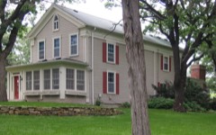
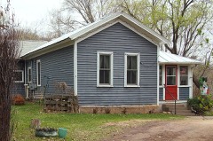
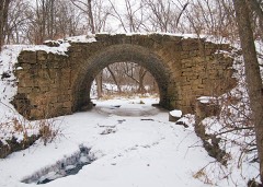
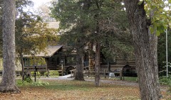
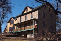
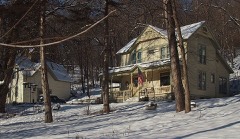
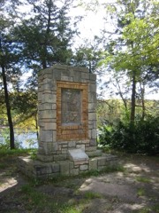
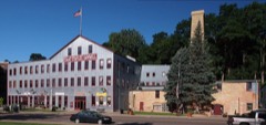
42 National Register listings published here, 2 of them National Historic Landmarks.
Sources: the county history on the Internet Archive · the National Register database, National Park Service
110 topographic sheets cover 39 settlements here, and 42 properties are on the National Register of Historic Places.
42 National Register listings published here, 2 of them National Historic Landmarks.
Sources: the county history on the Internet Archive · the National Register database, National Park Service
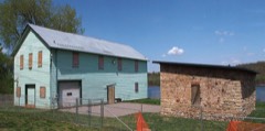
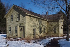
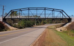
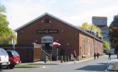
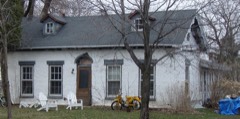
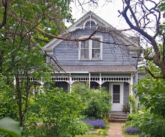
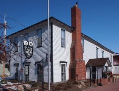
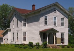
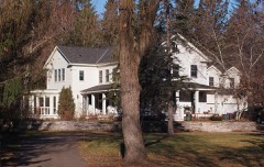
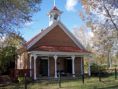
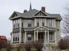
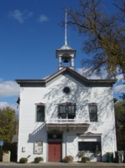
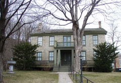
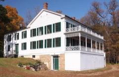
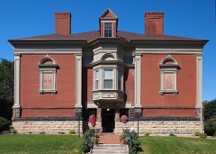
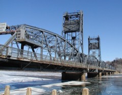
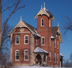
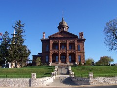
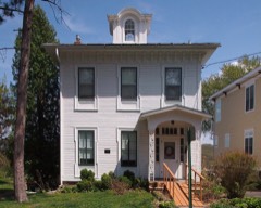
Every property in this county listed on the National Register of Historic Places, with the year it was listed and the federal nomination document.
Every wildfire the federal occurrence database records inside this county: 92 of them, burning about 440 acres. 3 started naturally and 11 were recorded as arson. Each settlement page carries the fires within five miles of it.
| Reported cause | Fires |
|---|---|
| Debris and open burning | 33 |
| Missing data/not specified/undetermined | 14 |
| Arson/incendiarism | 11 |
| Equipment and vehicle use | 9 |
| Recreation and ceremony | 8 |
| Smoking | 5 |
| Railroad operations and maintenance | 3 |
| Natural | 3 |
| Power generation/transmission/distribution | 3 |
| Other causes | 2 |
| Fireworks | 1 |
The five largest, by the area the report gives. One of them was set deliberately.
| Date | Cause | Size | Reported by | Name on the report |
|---|---|---|---|---|
| 2 May 1992 | Equipment and vehicle use | 80 acres | Minnesota Department of Natural Resources | not named |
| 25 April 2018 | Missing data/not specified/undetermined | 75 acres | Minnesota Valley National Wildlife Refuge | GREY CLOUD |
| 9 March 2012 | Equipment and vehicle use | 22 acres | Minnesota Department of Natural Resources | not named |
| 25 March 2000 | Equipment and vehicle use | 18 acres | Minnesota Department of Natural Resources | not named |
| 19 April 2020 | Equipment and vehicle use | 17 acres | Minnesota Department of Natural Resources | not named |
| 14 March 2015 | Debris and open burning | 14 acres | Minnesota Department of Natural Resources | not named |
| 16 May 2013 | Arson/incendiarism | 14 acres | Minnesota Department of Natural Resources | not named |
| 5 May 2018 | Other causes | 14 acres | Minnesota Department of Natural Resources | not named |
Every settlement page carries the fires within five miles of it - see the settlement index below.
The NOAA Storm Events Database holds 416 reports for this county, causing 2 deaths, 32 injuries and about $71,613,500 in recorded property damage. Each settlement page carries the reports that name it.
| Kind of event | Reports |
|---|---|
| Hail | 198 |
| Thunderstorm Wind | 160 |
| Tornado | 27 |
| Lightning | 11 |
| Flash Flood | 8 |
| Funnel Cloud | 6 |
| Heavy Rain | 6 |
The most serious of them, by death, then injury, then recorded damage. The accounts are quoted exactly as the forecast office filed them.
| When | Event | Place named | Harm | What the report says |
|---|---|---|---|---|
| May 2008 | Tornado (EF3) | Hugo | 1 killed, 17 hurt, $25,000,000 | The tornado touched down on the eastern side of Lino Lakes, at the eastern shore of Peltier Lake. The tornado felled trees and lifted boat docks, then tracked east and crossed Interstate 35E. As this occurred, a few barns, grain bins, and silos were damaged. The tornado then intensified as it moved into northwestern Washington County and a subdivision (Creekview Preserve), about two miles north of downtown Hugo. It was at this point (around 16:01), that the twister caused EF-3 damage. The tornado dissipated in the eastern portion of Hugo, just north of Irish Avenue and 140th Street. Seven hundred and ninety four homes, including mobile homes, were affected by the storm in some way. A total of 91 homes sustained minor structural damage, numerous broken windows, and damage to small sections of roof. Twenty seven homes were destroyed, totally collapsed, or not economically feasible to repair. A two year old boy died after being blown out of the first floor of his home in Creekview Preserve. A 62 year old woman died an indirect death when she suffered a heart attack during cleanup in Hugo a few days later. Some important information provided by the Pioneer Press, Star Tribune, and other local newspapers. |
| July 2009 | Lightning | Stillwater | 1 killed | A 14 year old girl was struck by lightning as she played under a tree during a thunderstorm. She later died at a hospital from her injuries. |
| May 1958 | Tornado (F3) | not stated | 6 hurt, $250,000 | no account filed |
| June 2008 | Thunderstorm Wind | Langdon | 2 hurt | Tents and stage items blown over at Cottage Grove City Festival. Two people received minor injuries when a tent struck them. Tree down across a nearby road. |
| October 2005 | Lightning | Cottage Grove | 2 hurt | A lightning strike hit a home in the 7900 Block of 71st Street. The bolt caused an immediate explosion, and injured two 50 year olds who owned the home. The individuals were transported to Regions Hospital, where they were listed in fair and stable condition on the 5th. The fire destroyed the residence and caused some damage to neighboring residences. |
| July 1996 | Lightning | Marine On St. Croix | 2 hurt | no account filed |
| April 1994 | Tornado (F2) | Stillwater | 1 hurt, $5,000,000 | Strong thunderstorm winds blew down several trees and damaged a home in Maplewood. Several trees were blown down in the Lake Elmo area. A tornado touched down west of Stillwater and caused an estimated $3 million damage to 17 homes. Ten of the homes were severely damaged and a 3-year-boy was injured by flying debris. |
| August 2021 | Lightning | Lake Elmo | 1 hurt | Lightning struck a moviegoer at an east metro drive-in theater as storms moved through the area. The man was struck about 10:25 p.m CDT, Thursday, August, 5th at the Vali-Hi Drive-In just north of Interstate 94 in Lake Elmo. |
| July 2005 | Thunderstorm Wind | Stillwater | 1 hurt | Many trees, a light pole, and 6 power lines were downed. A woman riding her bike at Lowell Park along the St. Croix River just south of the historic Stillwater Lift Bridge sustained a serious arm injury when a tree crashed down and pinned her to the ground. Several outdoor event tents nearby were blown into the St. Croix River. |
| May 1998 | Thunderstorm Wind | Woodbury | $14,000,000 | Roofs off houses. Estimated windspeed. |
| May 1998 | Hail | Forest Lake | $10,000,000 | Scattered house and vehicle damage from wind driven hail. Damage estimate for entire county. |
| September 2005 | Thunderstorm Wind | Oakdale | $5,000,000 | Numerous trees and power lines down, including some on vehicles. |
| May 1996 | Hail | Woodbury | $1,700,000 | no account filed |
| July 2019 | Tornado (EF1) | Scandia | $1,500,000 | An EF1 tornado spun up on the southwest side of Sylvan Lake and continued northeast in a broken path through Bone Lake, and moved into Chisago County on 240th Street North, east of Morgan Avenue. The path length was approximately 4.4 miles across Washington County, with a maximum width of 440 yards. The worst damage occurred on Bone Lake where numerous large trees were uprooted or blown down. Some roof damage was noted, but most of the trees fell away from homes. Other damage along the path was associated with flattened corn, tree damage, a storage shed that had its roof blown off, and damage to a solar panel farm. |
| August 2000 | Thunderstorm Wind | Lake Elmo | $1,500,000 | Wind measured at Lake Elmo Airport. Thirtytwo aircraft damaged, structural damage to several hangars at the Lake Elmo Airport. Estimated damage of one million dollars at the airport, according to the Metropolitan Airports Commission. Forty homes damaged just west of the airport with another 0.5 million damage estimated. Most damage involved dislodged shingles, siding, garage doors damaged. Many large trees in the old village area of Lake Elmo suffered heavy damage, or were blown down. Some corn also flattened. Twenty thousand electrical customers out of power for several hours across Woodbury, Afton, and Lake Elmo. |
| May 2001 | Hail | Afton | $1,000,000 | Damage incurred to vehicles, buildings and trailers at a Washington County park. |
| June 1998 | Thunderstorm Wind | Stillwater | $1,000,000 | Marina damaged. Pier broke lose from shore with 25 boats, some still occupied. Two other piers heavily damaged. Wind damage also reported in Oak Park Heights, Lake Elmo and Oakdale. Large tree limbs and power lines down. |
| June 1998 | Thunderstorm Wind | Oakdale | $1,000,000 | 40 homes damaged. Some roofs ripped off homes. One house shifted off foundation. Estimated windspeed. |
| May 1996 | Thunderstorm Wind | Cottage Grove | $800,000 | no account filed |
| September 2007 | Tornado (EF0) | Woodbury | $500,000 | A National Weather Service storm survey confirmed an EF-0 tornado touched down in the southwestern portion of Woodbury, along Bailey Road.|It dissipated when it reached Woodlane Drive. The tornado caused damage to multiple townhouses, trees, and road signs. |
| July 2000 | Thunderstorm Wind | Oakdale | $500,000 | Numerous trees down, some on houses and vehicles. Three mobile homes in Whispering Oaks Park in Oakdale were severely damaged by falling trees, while two other mobile homes sustained moderate damage. |
| May 2017 | Lightning | Woodbury | $450,000 | A home in Woodbury was struck by lightning and caused enough damage to make the home unlivable. No injuries were reported as the homeowner was not at home. |
| June 2012 | Lightning | Withrow | $350,000 | The Stillwater Fire Department spent more than three hours extinguishing a pole barn fire on the 12000 block of Lockridge Avenue North Sunday night due to a lightning strike. Damage to a 40-foot-by-50-foot pole barn was estimated at $350,000. ||Fire crews worked on the fire until 1:30 a.m. Monday. No injuries were reported. |
| May 2008 | Tornado (EF0) | Marine On St Croix | $300,000 | The tornado developed in the northern edge of Marine on St. Croix. It crossed the St. Croix River, and marched into St. Croix County and then Polk County. It dissipated 3.5 miles southwest of East Farmington in Polk County. Damage from the tornado included a few hundred trees felled, with several homes damaged by falling trees in Marine on St. Croix. |
| May 2017 | Hail | Newport | $250,000 | Another continuous swath of large hail, up to golf ball size, fell from Newport to near the intersection of I-94 and Highway 95. |
| July 2011 | Thunderstorm Wind | Forest Lake | $250,000 | Straight line winds caused a large area of northern Washington County to lose power. The hardest hit area was Forest Lake, where several large trees fell on cars and homes. |
| July 2005 | Lightning | Stillwater | $250,000 | A home on Penfield Avenue North in Stillwater Township was struck by lightning and caught fire. The blaze caused $250,000 damage to the structure. Another home on Ozark Avenue North in May Township was damaged by a lightning strike. The time was estimated. |
| November 2012 | Tornado (EF0) | Mahtomedi | $200,000 | Hundreds of trees were toppled or snapped. Some trees fell on cars, houses and sheds. The tornado touched down in Mahtomedi, just east of the White Bear Lake shore, and it moved northeast into the northeastern part of Grant. The most significant damage was shortly after touchdown, near the intersection of Hazel and Moccasin in far northern Mahtomedi, where strong EF-0 damage was noted. |
| July 2020 | Tornado (EF1) | Cottage Grove | $100,000 | A NWS Storm Survey indicated that an EF1 tornado occurred in far southern Washington County, in a rural area, north of Hastings, Minnesota. ||The tornado spun up 5 miles north of Hastings, Minnesota, and tracked eastward for 3.2 miles until it moved across the St. Croix River, and into Wisconsin. Extensive tree damage occurred along its path, with the heaviest damage on top of the bluff as it moved across the St. Croix River into Wisconsin. A few farm outbuildings were also damaged. The tornado had a maximum speed of 100 mph, with a maximum width of 400 yards. |
| May 2012 | Hail | Woodbury | $100,000 | The public reported golf ball hail near the intersection of Bailey Road, and Woodlane in Woodbury, Minnesota. In addition, roof and car damage was reported around Woodbury due to the large hail stones. |
| August 2009 | Tornado (EF1) | Point Douglas | $100,000 | A National Weather Service Storm Survey determined that an EF-1 torando tracked from near U.S. Highway 61 and 122nd Street South, to near Lehigh Avenue South on the far southeast periphery of Cottage Grove, Minnesota. ||The local law enforcement officials observed the tornado as it moved through the residential area. The majority of the damage occurred in the 11700 block of Lockridge Avenue. This is where the tornado was rated an EF-1 based on large trees uprooted and winds estimated near 90 mph. Some structural damage occurred in the residential area where a garage door collapsed inward, wooden fences blown down, and a metal shed blown across the street. |
| June 2013 | Thunderstorm Wind | Pine Spgs | $50,000 | There were numerous power lines downed, mainly caused by trees falling on the lines. The area along Olson Lake Road from 50th St N to 40th St N was particularly impacted by fallen trees on the lines. There were also a number of trees uprooted, some over 10 inches in diameter, in the area from 50th St N to Stillwater Blvd. Some of the portable tents at the Oakdale Summerfest held at a584 Hadley Ave N. were destroyed by wind. |
| May 2011 | Tornado (EF0) | Forest Lake | $50,000 | An EF-0 tornado touched down near 200th Street and Imperial Avenue, or about three miles southeast of Forest Lake, Minnesota. It moved north-northeast, and dissipated on the north side of Forest Lake, near Shadeland Point. Damaged was confined to trees, roof shingles, and a large metal shed. The tornado was viewed by multiple spotters, chasers, law enforcement officers, and was seen on a MNDOT camera. |
| July 2010 | Tornado (EF0) | Forest Lake | $50,000 | Hundreds of trees were broken or toppled, including some that fell on sheds and houses. Shingles and soffits were removed from some houses. |
| July 2010 | Thunderstorm Wind | Copas | $50,000 | Several large trees were blown over in William O Brien State Park. One large tree fell on a camper and destroyed it. |
| August 2009 | Thunderstorm Wind | Woodbury | $50,000 | A NWS Skywarn Instructor, who is a broadcast meteorologist, surveyed an area of that was associated with straight-line wind damage that occurred in a new subdivision in Stonemill Farms in Woodbury, Minnesota. The damage was mainly to trees blown down and some siding blown off homes around Aster Lane, Windmill Curve, Walden Drive and Sawmill Curve. |
| June 1994 | Thunderstorm Wind | St. James | $50,000 | Damaging thunderstorm winds ripped a roof off of a home in the northwest portion of the city of St. James. |
| May 2012 | Lightning | Oakdale | $25,000 | A lightning strike caused a house fire in Oakdale, Minnesota during the afternoon of Saturday May 5th. The fire was confined to the attic and was quickly extinguished. |
| June 2012 | Thunderstorm Wind | Cottage Grove | $25,000 | Scattered trees were downed across the southern part of Washington County from south of Cottage Grove, northeast to near Afton. In addition, there were sporadic reports of power outages due to power lines downed. |
| August 2009 | Tornado (EF0) | Marine On St Croix | $25,000 | Scattered trees and large limbs were downed as a tornado moved from southeast to northwest across western sections of Marine on St. Croix. |
| June 1974 | Tornado (F1) | not stated | $25,000 | no account filed |
| July 1965 | Tornado (F2) | not stated | $25,000 | no account filed |
| June 1954 | Tornado (F2) | not stated | $25,000 | no account filed |
| June 2010 | Thunderstorm Wind | Cottage Grove | $20,000 | Several large trees and power lines were blown down in Cottage Grove, Minnesota. |
| August 1999 | Lightning | Stillwater | $20,000 | Lightning strike fried radio, phone, and computer systems at City Hall. |
| November 2012 | Thunderstorm Wind | Grant | $5,000 | There were isolated trees, large branches and power lines down from the northeastern corner of Grant into the southern part of May Township near Big Carnelian Lake (about six miles north of Stillwater). The wind also peeled heavy gauge steel off of a barn roof and took the large doors off. The south end up of a farm shop was lifted up a few inches, pushing the west wall out and displacing the roof. Power poles were down as well. |
| June 2012 | Thunderstorm Wind | Stillwater | $5,000 | Several trees and power lines were blown down in the area. |
| July 2011 | Thunderstorm Wind | Forest Lake | $5,000 | Several large trees and power lines were blown down around Forest Lake, Minnesota. |
| August 2021 | Thunderstorm Wind | Mahtomedi | $3,000 | A couple of storms merged near Mahtomedi and intensified. This caused a dozen trees to be blown down around Mahtomedi. |
| July 1971 | Tornado (F0) | not stated | $2,500 | no account filed |
| July 2016 | Thunderstorm Wind | Oakdale | $2,000 | A Best Buy store in Oakdale had their front door blown in from severe wind gusts. |
| July 2014 | Tornado (EF0) | Point Douglas | $1,000 | An EF0 tornado touchdown outside the St. Croix Bluffs Regional Park, and moved through the park causing damage to trees and a tennis court. Most of the damage was rated low end EF0 based on hardwood tree damage. The tornado continued to move eastward into Pierce County, Wisconsin. |
| July 2025 | Thunderstorm Wind | Marine On St Croix | - | Photo provided via social media of a large tree down on a structure in Marine on St. Croix. |
| July 2025 | Thunderstorm Wind | Lake Elmo | - | Three-to-four-inch branches broken off of healthy trees. |
| August 2025 | Thunderstorm Wind | Point Douglas | - | Trees and power lines were downed just north of Hastings. |
| September 2025 | Hail | Woodbury | - | Report received via mPING. |
| September 2025 | Hail | Woodbury | - | Report received via mPING. |
| June 2025 | Thunderstorm Wind | Woodbury | - | Measured just southeast of Radio Dr and Lake Rd. |
| September 2025 | Hail | Woodbury | - | Report received via mPING. |
| September 2025 | Hail | Woodbury | - | Report received via mPING. |
The Survey's mineral resources record lists 25 workings inside this county. 24 still produce and 1 is closed or unrecorded. Each settlement page carries the workings within five miles of it.
| Commodity | Workings |
|---|---|
| Sand and Gravel, Construction | 17 |
| Stone, Crushed/Broken | 6 |
| Silica | 1 |
| Sulfur | 1 |
The least common of them first, because a county's hundredth gravel pit says nothing its first ten did not.
| Where | Site | Commodity | Status | Recorded |
|---|---|---|---|---|
| (Facility) Northwestern Refinery | Sulfur | Plant | ||
| Twincities Silica Pit & Mill | Silica | Past Producer | ||
| Barton 769 Quarry & Mill | Stone, Crushed/Broken | Producer | ||
| Bryan Smith Quarry and Mill | Stone, Crushed/Broken | Producer | ||
| Davies Quarry | Stone, Crushed/Broken | Producer | ||
| Moelter Quarry | Stone, Crushed/Broken | Producer | ||
| Moelter Quarry and Mill | Stone, Crushed/Broken | Producer | ||
| Shiely Larson Quarry & Plant | Stone, Crushed/Broken | Producer | ||
| Afton Road Pit | Sand and Gravel, Construction | Producer | ||
| Barton Pit No 713 | Sand and Gravel, Construction | Producer | ||
| Barton Pit No 766 and Mill | Sand and Gravel, Construction | Producer | ||
| Bracht Pit and Mill | Sand and Gravel, Construction | Producer | ||
| Cottage Grove Pit and Mill | Sand and Gravel, Construction | Producer | ||
| Hudson Pit No 714 | Sand and Gravel, Construction | Producer | ||
| Lakeland Pit and Mill | Sand and Gravel, Construction | Producer | ||
| Larson Pit and Mill | Sand and Gravel, Construction | Producer | ||
| Lindgren Pit and Mill | Sand and Gravel, Construction | Producer | ||
| Nelson Pit and Mill | Sand and Gravel, Construction | Producer | ||
| Noltiemeyer Pit and Mill | Sand and Gravel, Construction | Producer | ||
| Noltiemeyer Pit and Mill | Sand and Gravel, Construction | Producer | ||
| Pete Miller Pit No 2 | Sand and Gravel, Construction | Producer | ||
| Pete Miller Pit and Mill No 1 | Sand and Gravel, Construction | Producer | ||
| Pete Miller's Highway 94 Pit | Sand and Gravel, Construction | Producer | ||
| Riggs Pit and Mill | Sand and Gravel, Construction | Producer | ||
| Scandia Crushing & Wash Plant | Sand and Gravel, Construction | Producer |
History of Washington County and the St. Croix Valley Including the Explorers and Pioneers of Minnesota devotes a chapter to each township: its boundaries and streams, who settled it and when, the mills, the schools and the churches. All 7 are reproduced here in full. Each row shows the township's own shape and where it lies in the county, drawn from the Census Bureau's boundary. Which settlements belong to which township is computed from that same boundary, not taken from the book.
| Shape and position in the county | Township | Settlements in it | Length | Sections |
|---|---|---|---|---|
| Denmark Township | Basswood Grove, Point Douglas | 241 words | 2 | |
| Forest Lake City | Forest Lake | 2,422 words | 1 | |
| Grant City | Duluth Junction, Grant | 27 words | 1 | |
| Newport City | Newport | 2,084 words | 0 | |
| Oakdale City | Oakdale | 102 words | 1 | |
| Stillwater City | Stillwater | 37,980 words | 22 | |
| Woodbury City | Oakbury, Woodbury | 118 words | 1 |
One book written about this county, cut here where the book itself is cut, at its printed chapters: 71 chapters in all. Every chapter is public domain, machine-read from the scan and reproduced complete. A chapter already given under one of the county's towns is not repeated in this list.
Named settlements recorded in the Geographic Names Information System, each with the topographic sheets covering it. Villages, hamlets and abandoned places alike. Each is shown with the nearest named watercourse or landform and the survey quadrangle it falls on.
Scandia city · 55047 · Near Greenburg Island · Marine on St. Croix quadrangle
17 sheets, 1948 to 1985
Forest Lake city · 55025 · Near Allina Medical Clinic - Forest Lake · Forest Lake quadrangle
14 sheets, 1953 to 1985
Lake St. Croix Beach city · 55043 · On Valley Branch · Hudson quadrangle
18 sheets, 1946 to 1990
Marine on St. Croix city · 55047 · Near Greenburg Island · Marine on St. Croix quadrangle
17 sheets, 1948 to 1985
Denmark township · 55033 · On Saint Croix River · Prescott quadrangle
18 sheets, 1946 to 1990
St. Marys Point city · 55043 · On Valley Branch · Hudson quadrangle
18 sheets, 1946 to 1990
Stillwater city · 55082 · On Browns Creek · Stillwater quadrangle
22 sheets, 1948 to 1985