 Block
Genoa, Minnesota
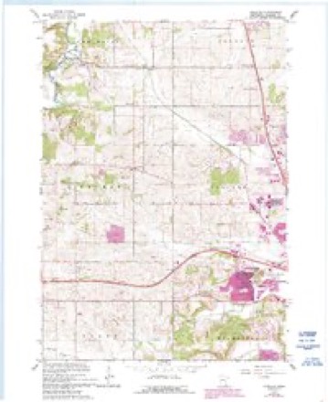
12 topographic sheets cover this place, the earliest surveyed in 1953 and the latest in 1989. It stands in New Haven Township. It lies in ZIP code area 55920. The Survey maps it on the Douglas quadrangle.
Topographic sheets covering this place
7 surveys from 12 printed sheetsMatched by testing this settlement's coordinate against the published boundary of every sheet in the United States Geological Survey's historical collection. Each opens the scanned sheet at the Survey.
- 1953 USGS Saint Paul quadrangle1:250000, 3 printings
- 1953 USGS St. Paul quadrangle1:250000
- 1959 USGS Saint Paul quadrangle1:250000
- 1959 USGS St. Paul quadrangle1:250000
- 1966 USGS Douglas quadrangle1:24000, 3 printings
- 1985 USGS Rochester quadrangle1:100000
- 1989 USGS Rochester quadrangle1:100000, 2 printings




Fires near this place
1 since 1992Regional context, not property-specific evidence. The federal wildfire occurrence database lists 1 fire within 5 miles of Genoa in 1992, burning about 1 acre in total. None started naturally. None was recorded as arson. Distance is straight-line from the map coordinates, so a fire counted here may appear on a neighbouring settlement's page as well.
| Reported cause | Fires |
|---|---|
| Smoking | 1 |
The most recent of them, most recent first, with the day each was reported and the service that recorded it.
| Date | Cause | Size | Reported by | Name on the report |
|---|---|---|---|---|
| 31 May 1992 | Smoking | 1.0 acres | Minnesota Department of Natural Resources | not named |
Settlements close enough to share some of these fires:
Storms near this place
26 since 2000Regional context, not property-specific evidence. The National Weather Service names Genoa in 26 storm reports between 2000 and 2022: 11 hail, 9 thunderstorm wind, 3 flash flood, 1 heavy rain. No death or injury is recorded in these reports. Each account below is quoted exactly as the forecast office filed it, from the NOAA Storm Events Database, and each date opens the federal record of that event.
| When | Event | Place named | Harm | What the report says |
|---|---|---|---|---|
| June 2019 | Flash Flood | Genoa | $320,000 | Flash flooding occurred across the western sections of Olmsted County after thunderstorms dropped 3 to 7 inches of rain. The Rochester International airport was closed after water covered the runways. Along the South Branch of the Middle Fork of the Zumbro River, between 40 and 60 cows were swept away north of Byron with about 15 of these cows drowning. The campground at Oxbow County Park was flooded with the water damaging at least one car. U.S. Highways 52 and 63 and numerous other roads had water over them. Some business on the southwest side of Rochester suffered water damage when flood waters entered the buildings. |
| July 2019 | Lightning | Genoa | $150,000 | A fire was started by a lightning strike in Genoa. A garage was initially hit with the resulting fire spreading to the house. Both structures were destroyed by the fire. Two off-duty police officers had to rescue a person trapped in burning house. |
| July 2019 | Flash Flood | Genoa | $15,000 | Rainfall amounts of 2 to 4 inches were common across the northwest part of Olmsted County. Runoff from this rain caused water to go over several rural roads. Oxbow Park and Zollman Zoo had to be closed because of flood waters from the South Branch of the Middle Fork Zumbro River. |
| March 2017 | Thunderstorm Wind | Genoa | $10,000 | Large trees were blown down and pole building roofs were damaged near Pine Island. |
| August 2014 | Hail | Genoa | $10,000 | Golf ball sized hail fell north of Genoa that damaged vehicles. |
| March 2017 | Thunderstorm Wind | Genoa | $8,000 | Several trees were blown down with one landing on a garage southwest of Pine Island. |
| March 2017 | Thunderstorm Wind | Genoa | $5,000 | A small portion of a roof was removed from a house and a tree was blown down near Pine Island. |
| July 2016 | Thunderstorm Wind | Genoa | $4,000 | A peak wind gust of 75 mph was measured northwest of Genoa. Several power lines and lots of trees were blown down. |
| June 2012 | Thunderstorm Wind | Genoa | $3,000 | Trees were blown down in Genoa. |
| September 2016 | Flash Flood | Genoa | $2,000 | Flood waters covered County Road 105 near Oxbow Park north of Byron and County Road 126 east of Rock Dell. |
| May 2022 | Hail | Genoa | - | Quarter sized hail was reported northwest of Genoa. |
| July 2022 | Hail | Genoa | - | Quarter sized hail fell west of Oronoco. |
| June 2019 | Flood | Genoa | - | After the heavy rain earlier in the day, flooding continued across portions of Olmsted County. Flood waters from Salem Creek covered County Road 25 south of Byron. |
| April 2017 | Hail | Genoa | - | Quarter sized hail fell near Oxbow County Park. |
| July 2016 | Thunderstorm Wind | Genoa | - | An estimated 60 mph wind gust occurred northwest of Genoa. |
| June 2014 | Thunderstorm Wind | Genoa | - | A measured 65 mph wind gust occurred just outside Genoa. |
| August 2014 | Hail | Genoa | - | Quarter sized hail fell north of Genoa. |
| April 2013 | Heavy Rain | Genoa | - | A rainfall reported of 2.9 inches was reported by the public northwest of Rochester. |
| May 2022 | Hail | Genoa | - | no account filed |
| June 2014 | Hail | Genoa | - | no account filed |
| July 2007 | Thunderstorm Wind | Genoa | - | no account filed |
| August 2007 | Hail | Genoa | - | no account filed |
| April 2004 | Hail | Genoa | - | no account filed |
| May 2002 | Hail | Genoa | - | no account filed |
| June 2001 | Thunderstorm Wind | Genoa | - | no account filed |
| August 2000 | Hail | Genoa | - | no account filed |
Nearest settlements
The eight closest, with where each one stands in the county. Distances are straight-line, computed from the Geographic Names Information System coordinates.
| Map | Place | Distance | Sheets |
|---|---|---|---|
| Douglas | 1.8 miles | 12 | |
| Post Town | 2.1 miles | 11 | |
| Danesville | 3.9 miles | 11 | |
| Oronoco Estates | 4.9 miles | 12 | |
| Oronoco | 5.5 miles | 11 | |
| Byron | 5.7 miles | 11 | |
| Hallmark Terrace | 8.2 miles | 18 | |
| Cedar Beach | 8.4 miles | 16 |
Provenance
This settlement is recorded in the Geographic Names Information System as feature 644070. The sheet list is computed by point-in-boundary test against the United States Geological Survey's historical topographic inventory. Both are works of the United States government and carry no copyright under 17 U.S.C. 105.
Wildfire. Short, Karen C. 2022. Spatial wildfire occurrence data for the United States, 1992-2020 [FPA_FOD_20221014]. 6th Edition. Fort Collins, CO: Forest Service Research Data Archive. https://doi.org/10.2737/RDS-2013-0009.6 Collected with United States Government funding and usable without additional permissions or fees.
Storms. NOAA National Centers for Environmental Information, Storm Events Database https://www.ncei.noaa.gov/stormevents/ A work of the United States government, no copyright under 17 U.S.C. 105. Narratives are quoted verbatim from the National Weather Service report and are not edited or summarised.