Block
From the record
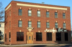
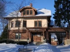
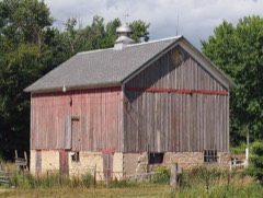
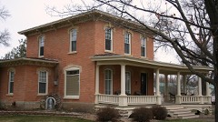
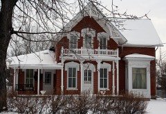
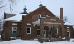
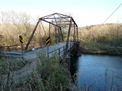
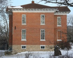
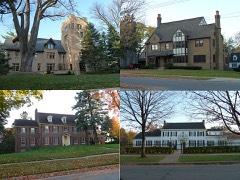
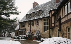
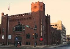
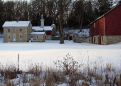
26 National Register listings published here, 1 of them a National Historic Landmark.
Sources: the county history on the Internet Archive · the National Register database, National Park Service
55 topographic sheets cover 32 settlements here, and 26 properties are on the National Register of Historic Places.
26 National Register listings published here, 1 of them a National Historic Landmark.
Sources: the county history on the Internet Archive · the National Register database, National Park Service
Every property in this county listed on the National Register of Historic Places, with the year it was listed and the federal nomination document.
Every wildfire the federal occurrence database records inside this county: 15 of them, burning about 45 acres. None started naturally and none was recorded as arson. Each settlement page carries the fires within five miles of it.
| Reported cause | Fires |
|---|---|
| Debris and open burning | 5 |
| Missing data/not specified/undetermined | 4 |
| Smoking | 4 |
| Equipment and vehicle use | 2 |
The five largest, by the area the report gives. None of them was recorded as arson.
| Date | Cause | Size | Reported by | Name on the report |
|---|---|---|---|---|
| 10 May 1997 | Debris and open burning | 20 acres | Minnesota Department of Natural Resources | not named |
| 28 April 2007 | Missing data/not specified/undetermined | 8.5 acres | Minnesota Department of Natural Resources | not named |
| 13 April 1997 | Debris and open burning | 6.0 acres | Minnesota Department of Natural Resources | not named |
| 17 April 2007 | Smoking | 2.0 acres | Minnesota Department of Natural Resources | not named |
| 9 May 1992 | Equipment and vehicle use | 2.0 acres | Minnesota Department of Natural Resources | not named |
| 12 March 2016 | Missing data/not specified/undetermined | 1.2 acres | Minnesota Department of Natural Resources | not named |
| 2 September 1996 | Smoking | 1.0 acres | Minnesota Department of Natural Resources | not named |
| 4 May 1997 | Debris and open burning | 1.0 acres | Minnesota Department of Natural Resources | not named |
Every settlement page carries the fires within five miles of it - see the settlement index below.
The NOAA Storm Events Database holds 839 reports for this county, causing 2 deaths, 48 injuries and about $114,491,150 in recorded property damage. Each settlement page carries the reports that name it.
| Kind of event | Reports |
|---|---|
| Hail | 370 |
| Thunderstorm Wind | 315 |
| Tornado | 40 |
| Flood | 37 |
| Heavy Rain | 27 |
| Lightning | 20 |
| Flash Flood | 17 |
| Funnel Cloud | 13 |
The most serious of them, by death, then injury, then recorded damage. The accounts are quoted exactly as the forecast office filed them.
| When | Event | Place named | Harm | What the report says |
|---|---|---|---|---|
| May 1953 | Tornado (F4) | not stated | 1 killed, 6 hurt, $2,500,000 | no account filed |
| December 2021 | Thunderstorm Wind | Rochester | 1 killed, $10,000 | One person was killed east of Rochester when a 40 foot pine tree was snapped off, fell and landed on the individual and his pickup truck. |
| September 1962 | Tornado (F4) | not stated | 34 hurt, $250,000 | no account filed |
| April 2026 | Tornado (EF2) | Oslo | 3 hurt, $8,190,000 | This strong EF-2 tornado began on the northeast side of Stewartville resulting in damage to several homes. The tornado then moved northeast through rural areas of Olmsted County while being highly visible on MNDOT cameras and from Rochester. This tornado eventually crossed I-90, hitting a semi-trailer and injuring the occupant, before moving northwest of Simpson. A farmstead near Simpson took a direct hit from the tornado where a single-wide manufactured home was rolled and farm outbuildings were destroyed. The tornado continued northeast into a neighborhood along Marion Road where several homes were rendered uninhabitable due to a collapse of their exterior walls and roof. Numerous other residences sustained window, roof, and outbuilding damage as well. The tornado continued through this neighborhood before dissipating along Timberidge Court between Rochester and Marion. Two more individuals were also injured in this area while sheltering in their home from the tornado. |
| April 1981 | Tornado (F2) | not stated | 2 hurt, $2,500,000 | no account filed |
| June 1974 | Tornado (F1) | not stated | 2 hurt, $25,000 | no account filed |
| September 1973 | Tornado (F1) | not stated | 1 hurt, $25,000 | no account filed |
| August 2007 | Flash Flood | Rochester | $35,000,000 | Heavy thunderstorm rains caused widespread flash flooding in Rochester and surrounding areas across the county. Extensive damage was caused to sewer systems, water wells, roadways, parks, and flood control reservoirs.||Highway 14 was closed east of Rochester due to wash outs and flash flooding. A mudslide hit the Ronald McDonald house in Rochester with evacuations around 6 a.m. Red Cross shelters were set up. Flooding reports began around 915 p.m. Saturday August 18. |
| April 1967 | Tornado (F2) | not stated | $25,000,000 | no account filed |
| August 2007 | Flash Flood | Eyota | $9,600,000 | Numerous streets were flooded. Sand bagging was needed with some street closures. Several nearby bridges were badly damaged and railroad tracks were bent out of place. Highway 14 was closed at Highway 42 due to flooding and residents of the Eyota trailer park were evacuated.||In Eyota specifically, 16 of 20 business had damage, 600 of 716 homes had at least water damage, and in most basements there was 18 inches to 5 feet of water. |
| September 2010 | Flash Flood | Oronoco | $7,000,000 | The approach on the north side of the County Road 18 bridge going through Oronoco washed out as the Middle Fork of the Zumbro River flooded. The Lake Shady Dam was also damaged. |
| September 2010 | Flood | Cummingsville | $3,550,000 | Flooding occurred on most of the rivers, streams, and creeks throughout the county. Water caused at least 20 road closures throughout the county, which included U.S. Highway 52 north of Oronoco as well as County Roads 105, 14, 31, 18, 5 and 133. Seven of the roads were damaged, 3 of which saw extensive damage. Two vehicles tried driving across a water covered road in Oronoco and were swept away. The people in the vehicles were rescued safely. Across the county, 81 homes incurred major damage, while 10 homes had minor damage. Of those 91 homes with damage, 50 occurred in the city of Oronoco. In the city of Eyota, the sewer system was full and many homes had water in their basements. A small subdivision in Rochester was evacuated due to rising water, while the majority of the Meadow Lakes Golf Course in southeast Rochester was underwater. The rain began the afternoon of the 22nd, with the majority falling by 6 a.m. CST on the 23rd. Rainfall amounts across the county as of 6 a.m. CST on the 23rd included 4.68 inches in Rochester, 4.54 inches near the Rochester Airport, 3.66 inches at the Maple Valley Golf Course, 3.47 inches at Dover, and 3.24 inches near Elgin. |
| July 1979 | Tornado (F2) | not stated | $2,500,000 | no account filed |
| June 2010 | Tornado (EF1) | Douglas | $1,900,000 | An EF1 tornado produced intermittent damage starting near 50th Ave NW just south of the Northern Hills Golf Course northeast almost to the intersection of 55th St NW and and 23rd Ave NW in the city of Rochester. The path of the tornado took it through a residential area where several homes were damaged. It also struck a Menards store doing extensive damage before dissipating a few minutes later. According to media reports, the tornado damaged at least 30 homes, one of which was destroyed. |
| July 2005 | Lightning | Byron | $1,600,000 | no account filed |
| August 1999 | Hail | Rochester | $1,500,000 | no account filed |
| August 1999 | Hail | Rochester | $1,250,000 | no account filed |
| August 1999 | Hail | Rochester | $1,000,000 | no account filed |
| May 1996 | Thunderstorm Wind | Byron | $900,000 | no account filed |
| March 2012 | Thunderstorm Wind | Byron | $800,000 | Winds ripped the lids off four 50,000 bushel galvanized steel bins and pushed them over. An empty 30,000 gallon fuel tank was also toppled. Some grain semi-trailers were also likely damaged when the bins landed on them. |
| August 1999 | Hail | Rochester | $750,000 | no account filed |
| April 2026 | Tornado (EF2) | Viola | $546,000 | This strong EF-2 tornado began in rural portions of Olmsted County east of Viola where it damaged some farm outbuildings as it moved northeast. As the tornado approached the Wabasha County line, it strengthened and significantly damaged a farmstead, removing large sections of the roof and other portions of the home and outbuildings. It then continued northeast into Wabasha County. |
| September 2012 | Thunderstorm Wind | Rochester | $500,000 | Over 175 trees were blown down across Rochester. Numerous homes and cars were damaged when the trees landed on them. Power lines were also blown down or came down with the fallen trees, knocking out the power to 4,800 customers across the city. |
| August 1999 | Hail | Rochester | $500,000 | no account filed |
| August 2013 | Flash Flood | Rochester | $400,000 | Locally heavy rains in Rochester produced flash flooding that inundated several street intersections causing numerous vehicles to become stranded. Some of the stranded vehicles had water up to their windows. The heavy rain also caused water to cascade into a below ground entrance of a Mayo Health building. Trash cans put out to be picked up floated down the streets, often spilling their contents. |
| June 2019 | Flash Flood | Genoa | $320,000 | Flash flooding occurred across the western sections of Olmsted County after thunderstorms dropped 3 to 7 inches of rain. The Rochester International airport was closed after water covered the runways. Along the South Branch of the Middle Fork of the Zumbro River, between 40 and 60 cows were swept away north of Byron with about 15 of these cows drowning. The campground at Oxbow County Park was flooded with the water damaging at least one car. U.S. Highways 52 and 63 and numerous other roads had water over them. Some business on the southwest side of Rochester suffered water damage when flood waters entered the buildings. |
| June 1998 | Thunderstorm Wind | Rochester | $320,000 | no account filed |
| June 2017 | Hail | Chester | $310,000 | Golfball sized hail was reported in Chester. |
| May 2022 | Hail | Oronoco | $280,000 | Golf ball sized hail was reported west of Oronoco. |
| March 1998 | Hail | Rochester | $250,000 | no account filed |
| June 1984 | Tornado (F1) | not stated | $250,000 | no account filed |
| June 1980 | Tornado (F1) | not stated | $250,000 | no account filed |
| April 1964 | Tornado (F2) | not stated | $250,000 | no account filed |
| July 2022 | Thunderstorm Wind | Rochester | $160,000 | Numerous trees were blown down across Rochester. Power poles were snapped, creating several power outages across the city that affected more than 3,500 customers. One tree fell on a church, causing roof damage that allowed water to leak into the building. |
| April 2026 | Hail | Rochester | $150,000 | A trained spotter reported golf ball sized hail 4 miles north of Rochester. |
| July 2019 | Lightning | Genoa | $150,000 | A fire was started by a lightning strike in Genoa. A garage was initially hit with the resulting fire spreading to the house. Both structures were destroyed by the fire. Two off-duty police officers had to rescue a person trapped in burning house. |
| May 2022 | Hail | Potsdam | $105,000 | Golf ball sized hail fell just west of Potsdam. |
| May 2022 | Hail | Potsdam | $100,000 | Golf ball sized hail fell northeast of Potsdam. |
| September 2021 | Tornado (EF0) | Chatfield Jct | $100,000 | An EF0 tornado moved across rural sections of Olmsted County northwest of Dover. The tornado damaged some buildings and equipment at two farms along its path. |
| June 2017 | Hail | Rochester | $100,000 | Golfball sized hail was reported on the southeast side of Rochester. |
| June 1999 | Thunderstorm Wind | Rochester | $100,000 | no account filed |
| April 2026 | Tornado (EF1) | Rochester | $87,000 | This EF-1 tornado began in northeast portions of Rochester resulting in minor roof damage to a couple of homes before moving northeast through rural portions of Olmsted County, damaging trees and a few electrical poles before moving into Wabasha County. |
| December 2021 | Thunderstorm Wind | Cummingsville | $80,000 | A large farm building was blown down southwest of Cummingsville. |
| August 2000 | Hail | Rochester | $75,000 | no account filed |
| May 1998 | Thunderstorm Wind | Rochester | $75,000 | no account filed |
| June 2022 | Thunderstorm Wind | Rochester | $70,000 | Trees were blown down on the southwest side of Rochester that also brought down some power lines. Over 1,200 customers lost power. The frame of a house was broken by the impact of a tree falling on it. |
| August 1995 | Tornado (F0) | Rochester | $70,000 | Brief tornado touchdown resulted in extensive damage to office plaza roof. Several large trees uprooted. Numerous power lines down. |
| June 1999 | Thunderstorm Wind | Rochester | $70,000 | no account filed |
| May 1998 | Thunderstorm Wind | Dover | $65,000 | no account filed |
| July 1997 | Thunderstorm Wind | Rochester | $55,000 | no account filed |
| December 2021 | Thunderstorm Wind | Marion | $50,000 | A barn was destroyed southwest of Eyota. |
| December 2021 | Thunderstorm Wind | Pleasant Grove | $50,000 | An open air farm outbuilding was destroyed and a quarter of the roof was removed from a barn east of Stewartville. |
| September 2019 | Thunderstorm Wind | (Rst)Rochester Muni | $50,000 | A large section of a roof was blown off a horse show barn northwest of Stewartville. None of the 15 horses inside the barn were injured. |
| June 2008 | Flood | Viola | $50,000 | Highway 56 became flooded after additional rounds of thunderstorms moved through. |
| June 2005 | Hail | Rochester | $50,000 | no account filed |
| June 2005 | Hail | Rochester | $50,000 | no account filed |
| June 2005 | Hail | Rochester | $50,000 | no account filed |
| May 1998 | Tornado (F1) | Eyota | $50,000 | no account filed |
| March 1998 | Hail | Rochester | $50,000 | no account filed |
| September 2012 | Lightning | Rochester | $45,000 | The roof of a home on the southeast side of Rochester was destroyed by a fire that was ignited by a lightning strike. |
The Survey's mineral resources record lists 23 workings inside this county. 16 still produce and 7 are closed or unrecorded. Each settlement page carries the workings within five miles of it.
| Commodity | Workings |
|---|---|
| Stone, Crushed/Broken | 12 |
| Iron | 6 |
| Sand and Gravel, Construction | 5 |
The least common of them first, because a county's hundredth gravel pit says nothing its first ten did not.
| Where | Site | Commodity | Status | Recorded |
|---|---|---|---|---|
| Q & A Club Mill | Sand and Gravel, Construction | Producer | ||
| Quarve & Anderson Club M | Sand and Gravel, Construction | Producer | ||
| Rochester Sand & Gravel Pit | Sand and Gravel, Construction | Producer | ||
| Rochester Sand and Gravel Pit | Sand and Gravel, Construction | Producer | ||
| South Pit & Mill | Sand and Gravel, Construction | Producer | ||
| Baker A Mine | Iron | Past Producer | ||
| Baker B Mine | Iron | Past Producer | ||
| Baker Mine | Iron | Unknown | ||
| Bernard Mine | Iron | Past Producer | ||
| D O Dar<Tello | Iron | Past Producer | ||
| Lowrie Mine | Iron | Past Producer | ||
| Goldberg Quarry | Stone, Crushed/Broken | Unknown | ||
| Maywood Quarry & Mill | Stone, Crushed/Broken | Producer | ||
| Nereson Qsuarry | Stone, Crushed/Broken | Producer | ||
| Quarve #63 Quarry & Mill | Stone, Crushed/Broken | Producer | ||
| Quarve Morse and Ganrude Quarry | Stone, Crushed/Broken | Producer | ||
| Schoenfelder Quarry | Stone, Crushed/Broken | Producer | ||
| Stewartville Quarry | Stone, Crushed/Broken | Producer | ||
| T H 82 South Quarry | Stone, Crushed/Broken | Producer | ||
| Walsh Quarry & Mill | Stone, Crushed/Broken | Producer | ||
| Welch Quarry | Stone, Crushed/Broken | Producer | ||
| West River Road Quarry | Stone, Crushed/Broken | Producer | ||
| Willey Quarry | Stone, Crushed/Broken | Producer |
History of Olmsted County, Minnesota devotes a chapter to each township: its boundaries and streams, who settled it and when, the mills, the schools and the churches. All 2 are reproduced here in full. Each row shows the township's own shape and where it lies in the county, drawn from the Census Bureau's boundary. Which settlements belong to which township is computed from that same boundary, not taken from the book.
| Shape and position in the county | Township | Settlements in it | Length | Sections |
|---|---|---|---|---|
| Rochester City | Golden Hill, Oak Terrace Estates, Rochester, Rocky Creek Estates | 51,537 words | 5 | |
| Viola Township | Viola | 42,390 words | 9 |
Named settlements recorded in the Geographic Names Information System, each with the topographic sheets covering it. Villages, hamlets and abandoned places alike. Each is shown with the nearest named watercourse or landform and the survey quadrangle it falls on.
Oronoco township · 55960 · On South Fork Zumbro River · Zumbro Lake quadrangle
16 sheets, 1935 to 1989
Cascade township · 55906 · Near Hadley Valley · Rochester quadrangle
18 sheets, 1935 to 1989
Rochester city · 55904 · On Badger Run · Rochester quadrangle
18 sheets, 1935 to 1989
Oronoco city · 55960 · On South Branch Middle Fork Zumbro River · Oronoco quadrangle
11 sheets, 1953 to 1989
Rochester city · 55906 · On Cascade Creek · Rochester quadrangle
18 sheets, 1935 to 1989
High Forest township · 55976 · On Carey Creek · Stewartville quadrangle
9 sheets, 1954 to 1985
Cascade township · 55906 · Near Hadley Valley · Rochester quadrangle
18 sheets, 1935 to 1989