 Block
Goodhue, Minnesota
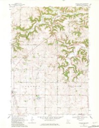
11 topographic sheets cover this place, the earliest surveyed in 1953 and the latest in 1989. It stands in Goodhue City. It lies in ZIP code area 55027. The Survey maps it on the Goodhue East quadrangle. 1,250 people lived here at the 2020 count. It stands 1,125 feet above sea level.
Population over time
2 figuresGoodhue grew from 1,176 to 1,250 between 2010 and 2020. These are the recorded population figures Wikidata holds for this place, reached through the Geographic Names Information System number this page is keyed on rather than by name, so they belong to this place and not to another of the same name. Most are census counts, but not all are: an early figure may be a founding or settlement estimate, and an estimate published within five years of a census is left out. The change column is computed, and is left blank where more than 20 years separate a figure from the one before it, because a gap that long is not a change between two counts.
| Year | People | Change |
|---|---|---|
| 2010 | 1,176 | |
| 2020 | 1,250 | +74 (+6%) |
Topographic sheets covering this place
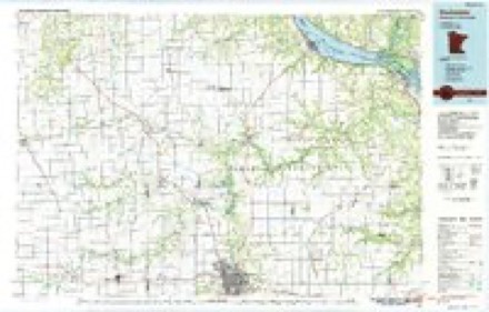
7 surveys from 11 printed sheetsMatched by testing this settlement's coordinate against the published boundary of every sheet in the United States Geological Survey's historical collection. Each opens the scanned sheet at the Survey.
- 1953 USGS Saint Paul quadrangle1:250000, 3 printings
- 1953 USGS St. Paul quadrangle1:250000
- 1959 USGS Saint Paul quadrangle1:250000
- 1959 USGS St. Paul quadrangle1:250000
- 1968 USGS Goodhue East quadrangle1:24000, 2 printings
- 1985 USGS Rochester quadrangle1:100000
- 1989 USGS Rochester quadrangle1:100000, 2 printings




In the county-history sources
4,005 words on this townshipHistory of Goodhue County, Including a Sketch of the Territory and State of Minnesota; Together with an Account of the Early French Discoveries, Indian Massacres, the Part Borne by Minnesota's Patriots in the War of the Great Rebellion, and a Full and Complete History of the County from the Time of Its Occupancy by Swiss Missionaries in 1838. Pioneer Incidents, Biographical Sketches of Early and Prominent Settlers and Representative Men, and of Its Cities, Towns, Churches, Schools, Secret Societies, Etc, published 1878 names this settlement in its chapter on Goodhue Township. These are the passages that mention it, exactly as the scans read.
This township was first settled in 1854 by Francis Yergens and John Mann. In 1855 David Hickock, John Ingerbretson, Harry Danielson, Oliver Knutson and Knut Knutson, came in, and selected lands and made claim. David Hickock and John Mann each built houses and opened them as hotels, and though the population in their immediate vicinity was small, travel was quite brisk, and the hotels were considered a success, so much so that when P. Easterly came the next year (1856) he also built a hotel, which he kept in operation for a number of years.
The first birth in Goodhue was in 1855, when a child was born to Mrs. Frances Yergens, which was christened Henry. The wife of Mr. David Hickock died in 1856, which was the first death in town. The funeral sermon preached on that occasion was the first religious service. Rev. Jabez Brooks officiated. The first school was taught by Miss Georgiette Easterly, in the summer of 1857.
There are five good school houses. Goodhue is one of the finest agricultural towns in the county, and all the farmers seem to think they cannot do better than to stick to their farms, some of whom have very large ones.
Machine-read from a century-old scan, so expect the errors a machine makes: misspelled names, dropped words, stray characters.
Read the whole chapter on Goodhue Township - it names this place 13 more 13 times.
Fires near this place
5 since 2012Regional context, not property-specific evidence. The federal wildfire occurrence database lists 5 fires within 5 miles of Goodhue between 2012 and 2015, burning about 11 acres in total. None started naturally. None was recorded as arson. Distance is straight-line from the map coordinates, so a fire counted here may appear on a neighbouring settlement's page as well.
| Reported cause | Fires |
|---|---|
| Equipment and vehicle use | 3 |
| Debris and open burning | 2 |
The most recent of them, most recent first, with the day each was reported and the service that recorded it.
| Date | Cause | Size | Reported by | Name on the report |
|---|---|---|---|---|
| 24 September 2012 | Equipment and vehicle use | 1.5 acres | Minnesota Department of Natural Resources | not named |
| 28 April 2013 | Equipment and vehicle use | 2.5 acres | Minnesota Department of Natural Resources | not named |
| 14 April 2015 | Debris and open burning | 3.0 acres | Minnesota Department of Natural Resources | not named |
| 5 October 2012 | Equipment and vehicle use | 3.0 acres | Minnesota Department of Natural Resources | not named |
| 16 October 2015 | Debris and open burning | 1.0 acres | Minnesota Department of Natural Resources | not named |
Settlements close enough to share some of these fires:
Mines and quarries near this place
5 within 5 milesRegional context, not property-specific evidence. The federal mineral resources record lists 5 workings within 5 miles of Goodhue: 3 past producers, 2 producers. 2 still produce. What was taken out: Clay, Stone, Crushed/Broken. Distance is straight-line from the map coordinates, so a quarry counted here may appear on a neighbouring settlement's page as well.
| Where | Site | Commodity | Status | Recorded |
|---|---|---|---|---|
| Ryan Quarry | Stone, Crushed/Broken | Producer | ||
| Clay Bank Pits | Clay | Producer | 1875 | |
| Red Wing Sewer Pipe Clay Pit No 2 | Clay | Past Producer | ||
| Thomeorde Pits | Clay | Past Producer | ||
| Thomforde Pits | Clay | Past Producer | 1875 |
Storms near this place
22 since 1997Regional context, not property-specific evidence. The National Weather Service names Goodhue in 22 storm reports between 1997 and 2026: 9 thunderstorm wind, 8 hail, 2 heavy rain, 1 tornado. No death or injury is recorded in these reports. Each account below is quoted exactly as the forecast office filed it, from the NOAA Storm Events Database, and each date opens the federal record of that event.
| When | Event | Place named | Harm | What the report says |
|---|---|---|---|---|
| May 2014 | Thunderstorm Wind | Goodhue | $250,000 | Severe thunderstorm winds caused damage to several roofs, included one barn destroyed and another barn damaged. The rafters and walls of a building under construction were blown off between Goodhue and Red Wing. |
| July 2016 | Thunderstorm Wind | Goodhue | $100,000 | A storm survey revealed significant wind damage from straight line winds to a roof and siding east of Goodhue. It also blew down several trees and damaged agricultural buildings. |
| July 2024 | Thunderstorm Wind | Goodhue | - | A radio antenna at the Goodhue Fire Department was damaged. |
| June 2016 | Thunderstorm Wind | Goodhue | - | Several trees were blown down in Goodhue. |
| June 2012 | Heavy Rain | Goodhue | - | A measured rainfall report of 4.43 inches occurred in less than 18 hours. |
| September 2010 | Heavy Rain | Goodhue | - | A cooperative observer measured 4.50 inches of rainfall in 4.5 hours. |
| July 2008 | Flash Flood | Goodhue | - | Road washed out in the city of Goodhue. |
| July 2008 | Thunderstorm Wind | Goodhue | - | More then 30 trees lost limbs up to two feet in diameter. Roof torn off building used to house chicken and sheep. Fifty foot flagpole cemented into ground bent down to ground. |
| July 2006 | Thunderstorm Wind | Goodhue | - | Tree down. |
| May 2004 | Funnel Cloud | Goodhue | - | A funnel cloud was reported just east of Goodhue by the fire department. The funnel cloud touched down later about 6 miles east of Zumbrota. |
| June 1999 | Thunderstorm Wind | Goodhue | - | Squad car nearly blown off road. Estimated windspeed. |
| May 1998 | Thunderstorm Wind | Goodhue | - | Estimated wind. |
| May 1998 | Thunderstorm Wind | Goodhue | - | Power lines down. Estimated windspeed. |
| June 1998 | Hail | Goodhue | - | Large trees and sign also blown down. Heavy rain flooded basements. |
| April 2026 | Hail | Goodhue | - | no account filed |
| June 2021 | Hail | Goodhue | - | no account filed |
| June 2006 | Hail | Goodhue | - | no account filed |
| May 2002 | Hail | Goodhue | - | no account filed |
| May 2002 | Hail | Goodhue | - | no account filed |
| May 2001 | Hail | Goodhue | - | no account filed |
| June 2001 | Hail | Goodhue | - | no account filed |
| August 1997 | Tornado (F0) | Goodhue | - | no account filed |
Nearest settlements
The eight closest, with where each one stands in the county. Distances are straight-line, computed from the Geographic Names Information System coordinates.
| Map | Place | Distance | Sheets |
|---|---|---|---|
| Claybank | 2.9 miles | 10 | |
| White Willow | 2.9 miles | 11 | |
| Ryan | 5.1 miles | 10 | |
| Bellechester | 6.4 miles | 11 | |
| Belvidere Mills | 7.0 miles | 11 | |
| Forest Mills | 7.1 miles | 11 | |
| Hay Creek | 7.6 miles | 11 | |
| Zumbrota | 7.7 miles | 11 |
Elsewhere
Matched on this settlement's Geographic Names Information System number rather than its name, so it cannot be a different place of the same name in another state.
| Wikipedia article on Goodhue | An encyclopaedic summary. Its text is share-alike, so it is linked here rather than copied. |
| Wikidata item Q1924434 | The structured record the population and elevation above come from. Public domain (CC0). |
Provenance
This settlement is recorded in the Geographic Names Information System as feature 644219. The sheet list is computed by point-in-boundary test against the United States Geological Survey's historical topographic inventory. Both are works of the United States government and carry no copyright under 17 U.S.C. 105.
Wildfire. Short, Karen C. 2022. Spatial wildfire occurrence data for the United States, 1992-2020 [FPA_FOD_20221014]. 6th Edition. Fort Collins, CO: Forest Service Research Data Archive. https://doi.org/10.2737/RDS-2013-0009.6 Collected with United States Government funding and usable without additional permissions or fees.
Mines and quarries. USGS Mineral Resources Data System (MRDS) https://mrdata.usgs.gov/mrds/ A work of the United States government, no copyright under 17 U.S.C. 105.
Storms. NOAA National Centers for Environmental Information, Storm Events Database https://www.ncei.noaa.gov/stormevents/ A work of the United States government, no copyright under 17 U.S.C. 105. Narratives are quoted verbatim from the National Weather Service report and are not edited or summarised.