 Block
Hader, Minnesota
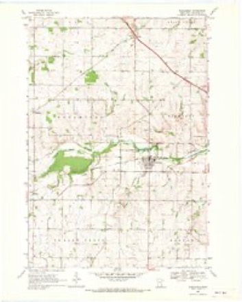
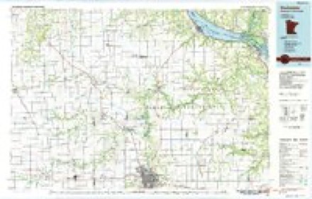
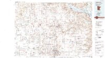
11 topographic sheets cover this place, the earliest surveyed in 1953 and the latest in 1989. It stands in Wanamingo Township. It lies in ZIP code area 55992. The Survey maps it on the Wanamingo quadrangle.
Topographic sheets covering this place
7 surveys from 11 printed sheetsMatched by testing this settlement's coordinate against the published boundary of every sheet in the United States Geological Survey's historical collection. Each opens the scanned sheet at the Survey.
- 1953 USGS Saint Paul quadrangle1:250000, 3 printings
- 1953 USGS St. Paul quadrangle1:250000
- 1959 USGS Saint Paul quadrangle1:250000
- 1959 USGS St. Paul quadrangle1:250000
- 1968 USGS Wanamingo quadrangle1:24000, 2 printings
- 1985 USGS Rochester quadrangle1:100000
- 1989 USGS Rochester quadrangle1:100000, 2 printings




In the county-history sources
2,075 words on this townshipGoodhue County, Minnesota, Past and Present, published 1893 names this settlement in its chapter on Wanamingo Township. These are the passages that mention it, exactly as the scans read.
A few American families came to this town in 1855, and made claims in the southern portion, on the Zumbro river. One of these settlers, Mr. James Brown, platted and laid into lots, forty acres of land, for village purposes, and called the place Wanamiiigo, the name of a heroine in a novel. The first store was built in this village by J. T. AVright. There are now several stores, one hotel, two blacksmith shops, a public school house, a fine church edifice, and a number of neat private dwellings. The American settlers have nearly all sold out and gone, and the village is occupied by the Norwegians and their descendants. There is another village in the northeast corner of the tovv^uship, called Hader, where there is a hotel, a public school house, several stores and shops.
Passage source: Goodhue County, Minnesota, Past and Present, published 1893.
Machine-read from a century-old scan, so expect the errors a machine makes: misspelled names, dropped words, stray characters.
Fires near this place
9 since 1994Regional context, not property-specific evidence. The federal wildfire occurrence database lists 9 fires within 5 miles of Hader between 1994 and 2019, burning about 24 acres in total. None started naturally. None was recorded as arson. Distance is straight-line from the map coordinates, so a fire counted here may appear on a neighbouring settlement's page as well.
| Reported cause | Fires |
|---|---|
| Missing data/not specified/undetermined | 5 |
| Equipment and vehicle use | 2 |
| Smoking | 1 |
| Recreation and ceremony | 1 |
The most recent of them, most recent first, with the day each was reported and the service that recorded it.
| Date | Cause | Size | Reported by | Name on the report |
|---|---|---|---|---|
| 14 August 2003 | Missing data/not specified/undetermined | 1.0 acres | Minnesota Department of Natural Resources | not named |
| 8 July 2018 | Missing data/not specified/undetermined | under an acre | Minnesota Department of Natural Resources | not named |
| 13 July 2019 | Missing data/not specified/undetermined | under an acre | Minnesota Department of Natural Resources | not named |
| 30 April 2013 | Missing data/not specified/undetermined | under an acre | Minnesota Department of Natural Resources | not named |
| 21 April 1994 | Smoking | 1.0 acres | Minnesota Department of Natural Resources | not named |
| 13 April 1994 | Equipment and vehicle use | 5.0 acres | Minnesota Department of Natural Resources | not named |
| 17 November 2012 | Recreation and ceremony | 10 acres | Minnesota Department of Natural Resources | not named |
| 18 October 2015 | Equipment and vehicle use | 5.0 acres | Minnesota Department of Natural Resources | not named |
Settlements close enough to share some of these fires:
Mines and quarries near this place
7 within 5 milesRegional context, not property-specific evidence. The federal mineral resources record lists 7 workings within 5 miles of Hader: 7 producers. All of them still produce. What was taken out: Stone, Crushed/Broken, Sand and Gravel, Construction. Distance is straight-line from the map coordinates, so a quarry counted here may appear on a neighbouring settlement's page as well.
| Where | Site | Commodity | Status | Recorded |
|---|---|---|---|---|
| Dierke Pit & Mill | Sand and Gravel, Construction | Producer | ||
| Baringer Quarry | Stone, Crushed/Broken | Producer | ||
| County Quarry | Stone, Crushed/Broken | Producer | ||
| Hader Quarry & Mill | Stone, Crushed/Broken | Producer | ||
| Roscoe Quarry | Stone, Crushed/Broken | Producer | ||
| Spring Garden Quarry | Stone, Crushed/Broken | Producer | ||
| Tougen Quarry | Stone, Crushed/Broken | Producer |
Storms near this place
6 since 2005Regional context, not property-specific evidence. The National Weather Service names Hader in 6 storm reports between 2005 and 2015: 4 hail, 2 thunderstorm wind. No death or injury is recorded in these reports. Each account below is quoted exactly as the forecast office filed it, from the NOAA Storm Events Database, and each date opens the federal record of that event.
| When | Event | Place named | Harm | What the report says |
|---|---|---|---|---|
| July 2015 | Thunderstorm Wind | Hader | $500,000 | A storm survey indicated a significant downburst caused damage west of Goodhue. Severe downburst winds initially caused damage to a barn and outbuildings at a farm about 9 miles west of Goodhue. Farther east, about 7.5 miles west of Goodhue, there were numerous trees blown down, an empty grain bin was destroyed, tin was blown off some outbuildings, doors were blown off a machine shed, and some corn was destroyed. These were the two hardest hit locations. Between the two locations, there were just a few trees or large branches taken down. Both locations exhibited divergent damage patterns indicative of a downburst. Based on the survey damage, the highest winds were around 80 to 85 mph. |
| August 2010 | Thunderstorm Wind | Hader | - | Several trees were blown down at the intersection of 410th street and County Road 8. |
| April 2007 | Hail | Hader | - | Information relayed by Rochester TV station. |
| May 2006 | Hail | Hader | - | no account filed |
| June 2006 | Hail | Hader | - | no account filed |
| June 2005 | Hail | Hader | - | no account filed |
Nearest settlements
The eight closest, with where each one stands in the county. Distances are straight-line, computed from the Geographic Names Information System coordinates.
| Map | Place | Distance | Sheets |
|---|---|---|---|
| Wastedo | 3.8 miles | 11 | |
| Wanamingo | 4.3 miles | 11 | |
| Belle Creek | 5.3 miles | 11 | |
| Ryan | 6.1 miles | 10 | |
| White Rock | 6.5 miles | 11 | |
| Nansen | 7.0 miles | 11 | |
| Sogn | 7.3 miles | 11 | |
| Bombay | 7.4 miles | 11 |
Provenance
This settlement is recorded in the Geographic Names Information System as feature 654739. The sheet list is computed by point-in-boundary test against the United States Geological Survey's historical topographic inventory. Both are works of the United States government and carry no copyright under 17 U.S.C. 105.
Wildfire. Short, Karen C. 2022. Spatial wildfire occurrence data for the United States, 1992-2020 [FPA_FOD_20221014]. 6th Edition. Fort Collins, CO: Forest Service Research Data Archive. https://doi.org/10.2737/RDS-2013-0009.6 Collected with United States Government funding and usable without additional permissions or fees.
Mines and quarries. USGS Mineral Resources Data System (MRDS) https://mrdata.usgs.gov/mrds/ A work of the United States government, no copyright under 17 U.S.C. 105.
Storms. NOAA National Centers for Environmental Information, Storm Events Database https://www.ncei.noaa.gov/stormevents/ A work of the United States government, no copyright under 17 U.S.C. 105. Narratives are quoted verbatim from the National Weather Service report and are not edited or summarised.