 Block
Hector, Minnesota
9 topographic sheets cover this place, the earliest surveyed in 1953 and the latest in 1986. It stands in Hector City. It lies in ZIP code area 55342. The Survey maps it on the Hector quadrangle. 1,012 people lived here at the 2020 count. It stands 1,079 feet above sea level.
Population over time
2 figuresHector fell from 1,151 to 1,012 between 2010 and 2020. These are the recorded population figures Wikidata holds for this place, reached through the Geographic Names Information System number this page is keyed on rather than by name, so they belong to this place and not to another of the same name. Most are census counts, but not all are: an early figure may be a founding or settlement estimate, and an estimate published within five years of a census is left out. The change column is computed, and is left blank where more than 20 years separate a figure from the one before it, because a gap that long is not a change between two counts.
| Year | People | Change |
|---|---|---|
| 2010 | 1,151 | |
| 2020 | 1,012 | -139 (-12%) |
Topographic sheets covering this place
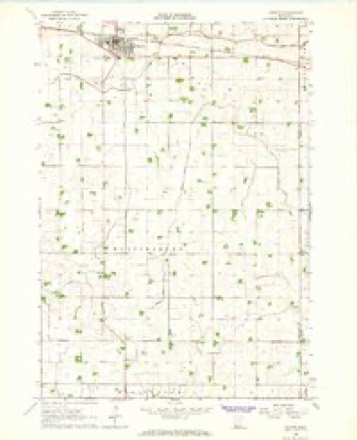
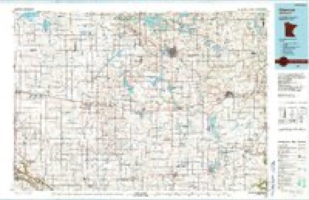
6 surveys from 9 printed sheetsMatched by testing this settlement's coordinate against the published boundary of every sheet in the United States Geological Survey's historical collection. Each opens the scanned sheet at the Survey.
- 1953 USGS New Ulm quadrangle1:250000, 3 printings
- 1957 USGS New Ulm quadrangle1:250000
- 1958 USGS New Ulm quadrangle1:250000
- 1964 USGS Hector quadrangle1:24000
- 1967 USGS New Ulm quadrangle1:250000
- 1986 USGS Glencoe quadrangle1:100000, 2 printings




In the county-history sources
1,945 words on this townshipThe History of Renville County, Minnesota, published 1916 names this settlement in its chapter on Hector City. These are the passages that mention it, exactly as the scans read.
Hector township embraces Congressional township 115, range 32. It is bounded on the north by Brookfield township, on the east by Preston Lake township, on the south by Martinsburg township, and the west by Melville township. The C, M. & St. P. crosses it in the southern part and the village of Hector is within its borders.
Passage source: The History of Renville County, Minnesota, published 1916.
The first settler in Hector township was John E. Lewis, who secured land in section 2 in 1S72. The next settlers came in the spring of 1873. They were W. H. Graham. J. J. Clark and Allen Parks, and they likewise settled on section 2. About this time a Mrs. Perry located on section 12. A little later in the year came John Baker. He also settled in section 2. Julia Graham and G. W. Calwell settled in section 4. T. S. Benson and F. U. Baker settled in section 10. O. H. Baker settled in section 14.
Passage source: The History of Renville County, Minnesota, published 1916.
John Baker was the first postmaster. He arrived July 1, 1S73, with his wife and their four children. O. H.. F. U., S. D. and Tsis R. Baker. He was appointed postmaster and kept the office at his home in section 2. The mail route from Glencoe to Beaver Falls served this office. When Hector village was started, Mr. Baker resigned, and W. D. Griffith became postmaster in the new village.
Passage source: The History of Renville County, Minnesota, published 1916.
Machine-read from a century-old scan, so expect the errors a machine makes: misspelled names, dropped words, stray characters.
Read the whole chapter on Hector City - it names this place 5 more 5 times.
Mines and quarries near this place
1 within 5 milesRegional context, not property-specific evidence. The federal mineral resources record lists 1 working within 5 miles of Hector: 1 producer. All of them still produce. What was taken out: Sand and Gravel, Construction. Distance is straight-line from the map coordinates, so a quarry counted here may appear on a neighbouring settlement's page as well.
| Where | Site | Commodity | Status | Recorded |
|---|---|---|---|---|
| Heil Pit | Sand and Gravel, Construction | Producer |
Storms near this place
29 since 1994Regional context, not property-specific evidence. The National Weather Service names Hector in 29 storm reports between 1994 and 2022: 17 hail, 11 thunderstorm wind, 1 funnel cloud. No death or injury is recorded in these reports. Each account below is quoted exactly as the forecast office filed it, from the NOAA Storm Events Database, and each date opens the federal record of that event.
| When | Event | Place named | Harm | What the report says |
|---|---|---|---|---|
| August 2022 | Thunderstorm Wind | Hector | - | The Minnesota Department of Transportation wind sensor measured a wind gust of 70 knots. |
| August 2022 | Thunderstorm Wind | Hector | - | A private airport wind sensor measured a wind gust of 53 knots. |
| July 2020 | Thunderstorm Wind | Hector | - | Several large tree branches, some 18 inches in diameter were blown down near Hector. |
| June 2019 | Thunderstorm Wind | Hector | - | There was a measured wind gust of 58 mph at the Hector regional airport. |
| June 2016 | Hail | Hector | - | The hail continued for nearly 10 minutes. |
| June 2013 | Thunderstorm Wind | Hector | - | Scattered large tree branches were blown down in Hector. |
| July 2008 | Thunderstorm Wind | Hector | - | Tree down across County Road 4. Several other trees toppled in town. |
| June 2007 | Thunderstorm Wind | Hector | - | Fifteen to twenty inch diameter pine trees blown down. |
| July 2006 | Thunderstorm Wind | Hector | - | Several trees felled. |
| June 2003 | Thunderstorm Wind | Hector | - | Several trees down. |
| June 2002 | Thunderstorm Wind | Hector | - | Grain bins blown over, numerous trees down. |
| April 2000 | Hail | Hector | - | No damage reported. |
| June 1998 | Thunderstorm Wind | Hector | - | Power lines down. Estimated windspeed. |
| May 1998 | Hail | Hector | - | Swath of large hail from 3 miles east of Fairfax to Buffalo Lake and Hector to Lakeside. Trees also blown down resulting in power outages. |
| October 1997 | Hail | Hector | - | Hail covered ground. Some cars and airplanes damaged. |
| August 2020 | Funnel Cloud | Hector | - | no account filed |
| July 2017 | Hail | Hector | - | no account filed |
| September 2014 | Hail | Hector | - | no account filed |
| September 2014 | Hail | Hector | - | no account filed |
| June 2012 | Hail | Hector | - | no account filed |
| August 2009 | Hail | Hector | - | no account filed |
| April 2007 | Hail | Hector | - | no account filed |
| April 2002 | Hail | Hector | - | no account filed |
| April 2002 | Hail | Hector | - | no account filed |
| August 2002 | Hail | Hector | - | no account filed |
| July 2000 | Hail | Hector | - | no account filed |
| May 1998 | Hail | Hector | - | no account filed |
| June 1997 | Hail | Hector | - | no account filed |
| June 1994 | Hail | Hector | - | no account filed |
Nearest settlements
The eight closest, with where each one stands in the county. Distances are straight-line, computed from the Geographic Names Information System coordinates.
| Map | Place | Distance | Sheets |
|---|---|---|---|
| Buffalo Lake | 5.2 miles | 9 | |
| Churchill | 5.7 miles | 9 | |
| Bird Island | 9.7 miles | 10 | |
| Lakeside | 10.4 miles | 9 | |
| Olivia | 14.7 miles | 10 | |
| Fairfax | 14.8 miles | 9 | |
| Countryview Estates | 15.6 miles | 9 | |
| Franklin | 17.3 miles | 12 |
Elsewhere
Matched on this settlement's Geographic Names Information System number rather than its name, so it cannot be a different place of the same name in another state.
| Wikipedia article on Hector | An encyclopaedic summary. Its text is share-alike, so it is linked here rather than copied. |
| Wikidata item Q1991412 | The structured record the population and elevation above come from. Public domain (CC0). |
Provenance
This settlement is recorded in the Geographic Names Information System as feature 644825. The sheet list is computed by point-in-boundary test against the United States Geological Survey's historical topographic inventory. Both are works of the United States government and carry no copyright under 17 U.S.C. 105.
Mines and quarries. USGS Mineral Resources Data System (MRDS) https://mrdata.usgs.gov/mrds/ A work of the United States government, no copyright under 17 U.S.C. 105.
Storms. NOAA National Centers for Environmental Information, Storm Events Database https://www.ncei.noaa.gov/stormevents/ A work of the United States government, no copyright under 17 U.S.C. 105. Narratives are quoted verbatim from the National Weather Service report and are not edited or summarised.