 Block
Lawndale, Minnesota
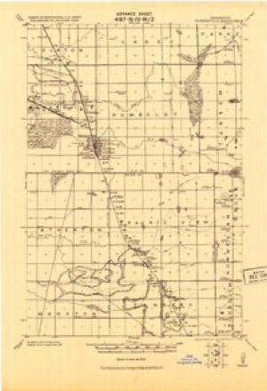
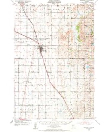
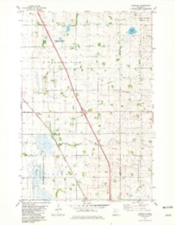
9 topographic sheets cover this place, the earliest surveyed in 1919 and the latest in 1989. It stands in Prairie View Township. It lies in ZIP code area 56579. The Survey maps it on the Lawndale quadrangle.
Topographic sheets covering this place
7 surveys from 9 printed sheetsMatched by testing this settlement's coordinate against the published boundary of every sheet in the United States Geological Survey's historical collection. Each opens the scanned sheet at the Survey.
- 1919 USGS Barnesville quadrangle1:62500
- 1952 USGS Barnesville quadrangle1:62500
- 1953 USGS Fargo quadrangle1:250000, 2 printings
- 1956 USGS Fargo quadrangle1:250000
- 1981 USGS Lawndale quadrangle1:24000
- 1985 USGS Fargo quadrangle1:100000, 2 printings
- 1989 USGS Fargo quadrangle1:250000
Fires near this place
5 since 2003Regional context, not property-specific evidence. The federal wildfire occurrence database lists 5 fires within 5 miles of Lawndale between 2003 and 2018, burning about 3,836 acres in total. None started naturally. None was recorded as arson. Distance is straight-line from the map coordinates, so a fire counted here may appear on a neighbouring settlement's page as well.
| Reported cause | Fires |
|---|---|
| Equipment and vehicle use | 3 |
| Missing data/not specified/undetermined | 2 |
The most recent of them, most recent first, with the day each was reported and the service that recorded it.
| Date | Cause | Size | Reported by | Name on the report |
|---|---|---|---|---|
| 7 May 2018 | Equipment and vehicle use | 55 acres | Fergus Falls Wetland Management District | BELLMORE WF |
| 21 May 2012 | Equipment and vehicle use | 900 acres | Fergus Falls Wetland Management District | FFR DNR ASSIST |
| 10 May 2013 | Equipment and vehicle use | 5.0 acres | Minnesota Department of Natural Resources | not named |
| 18 April 2015 | Missing data/not specified/undetermined | 21 acres | Fergus Falls Wetland Management District | HAUGRUD WF |
| 7 October 2003 | Missing data/not specified/undetermined | 2,855 acres | Minnesota Department of Natural Resources | ROTHSAY |
Settlements close enough to share some of these fires:
Mines and quarries near this place
2 within 5 milesRegional context, not property-specific evidence. The federal mineral resources record lists 2 workings within 5 miles of Lawndale: 2 producers. All of them still produce. What was taken out: Sand and Gravel, Construction. Distance is straight-line from the map coordinates, so a quarry counted here may appear on a neighbouring settlement's page as well.
| Where | Site | Commodity | Status | Recorded |
|---|---|---|---|---|
| Quinnild Pit No 1 | Sand and Gravel, Construction | Producer | ||
| Rasmussen Pit | Sand and Gravel, Construction | Producer |
Storms near this place
31 since 1998Regional context, not property-specific evidence. The National Weather Service names Lawndale in 31 storm reports between 1998 and 2023: 16 hail, 10 thunderstorm wind, 4 flash flood, 1 funnel cloud. No death or injury is recorded in these reports. Each account below is quoted exactly as the forecast office filed it, from the NOAA Storm Events Database, and each date opens the federal record of that event.
| When | Event | Place named | Harm | What the report says |
|---|---|---|---|---|
| July 2010 | Flash Flood | Lawndale | $1,000 | Roughly 1.50 inches of rain fell in 15 minutes. |
| September 2014 | Flash Flood | Lawndale | $500 | Numerous fields and farm access roads were flooded across Atherton and Prairie View townships. |
| August 2023 | Thunderstorm Wind | Lawndale | - | Delayed report: Tree damage to grove in Lawndale. Time estimated from radar. Wind gust estimated. |
| May 2022 | Thunderstorm Wind | Lawndale | - | Large tree uprooted. Time estimated based on radar. |
| July 2020 | Thunderstorm Wind | Lawndale | - | The wind gust was measured by a personal weather station. |
| July 2017 | Hail | Lawndale | - | Some large hail fell along with strong winds and heavy rain. |
| June 2016 | Thunderstorm Wind | Lawndale | - | Several twelve inch diameter poplar trees and an eighteen inch diameter cottonwood tree were snapped in shelterbelts near the Wilkin and Clay county line. |
| July 2015 | Funnel Cloud | Lawndale | - | The funnel was observed from two and a half miles south-southeast of Barnesville. |
| July 2015 | Hail | Lawndale | - | The large hail was accompanied by strong winds. |
| June 2014 | Hail | Lawndale | - | Dime to quarter sized hail fell in very heavy rain. |
| June 2013 | Thunderstorm Wind | Lawndale | - | A few trees and several large branches were blown down in various shelterbelts in northern Deerhorn Township. |
| August 2012 | Thunderstorm Wind | Lawndale | - | A large enclosed horse trailer was blown off Interstate 94 near mile point 30. The time and location were based on preliminary state patrol reports. |
| August 2012 | Thunderstorm Wind | Lawndale | - | Several sections of corn, soybeans, and other crops were flattened by damaging winds affecting portions of Manston, Tanbers, Atherton, and Prairie View Townships in northeast Wilkin County. Most shelterbelts had numerous large tree branches broken down and an occasional tree snapped near ground level. Peak winds were estimated in excess of 75 mph. |
| July 2011 | Thunderstorm Wind | Lawndale | - | Several 3 to 5 inch diameter tree branches were blown down. |
| June 2007 | Thunderstorm Wind | Lawndale | - | Trees were blown down in a shelterbelt near the Clay and Wilkin County line. |
| June 2006 | Thunderstorm Wind | Lawndale | - | Several large tree limbs were blown down. |
| August 2005 | Flash Flood | Lawndale | - | Numerous township roads were flooded over the northeast portion of Wilkin county. |
| May 2004 | Flash Flood | Lawndale | - | [A surface low tracked across northern South Dakota, southeast North Dakota, and into northern Minnesota. A strong thermal gradient set up across eastern ND and the northwest quarter of MN. Temperatures rose into the lower 80s across southeast ND and west central MN (with low 60 dew points) by the afternoon of the 11th. Afternoon highs on the 11th along the Canadian border only peaked out in the upper 30s and lower 40s. Strong south-southeast winds surged plenty of moisture into the system. Severe weather broke out by early evening (11th) over southeast ND and it progressed north and east. The largest hail and scattered tornadoes formed in the four county corners of Clay, western Becker, western Otter Tail, and Wilkin. Training thunderstorms along this four county corridor dropped heavy amounts of rain (4-6 inches), causing some flash flooding across the Barnesville, Cormorant, Lawndale, Pelican Rapids, and Detroit Lakes areas. Streets were flooded and barricaded in the larger towns and lakes rose over docks. There were also reports of stalled cars due to high water levels on roadways. As temperatures fell to the middle to upper 20s overnight into the morning of the 12th, accumulating ice and snow occurred in counties along the Canadian border in northeast ND. One-half to one inch of ice accumulated on exposed surfaces, wrecking havoc on rural electrical lines and trees. Roughly 1200 customers in Cavalier and Ramsey counties lost power. As estimated 750 power poles were downed, causing $1.5 million in damages. Strong winds behind the cold front helped cause a domino-effect in snapping stretches of power poles. Power restoration efforts took up to 2 weeks for some customers. Most power pole damage occurred east of highway 1 from from Canada to Fairdale. An official from Cavalier county estimated 25 percent of the trees in the county were damaged or destroyed. Emerging crops also were damaged. Long duration county and river flooding also became an issue across extreme northwest MN, with 3-6 inches of rain also falling in these areas toward midnight on the 11th. Flood warnings were issued for Roseau and Marshall counties, the Roseau River at Roseau, and the Two Rivers River at Hallock. The city of Roseau was only hit by record flooding two years ago, in 2002.] |
| July 2017 | Hail | Lawndale | - | no account filed |
| July 2010 | Hail | Lawndale | - | no account filed |
| July 2010 | Hail | Lawndale | - | no account filed |
| May 2010 | Hail | Lawndale | - | no account filed |
| August 2005 | Hail | Lawndale | - | no account filed |
| May 2004 | Hail | Lawndale | - | no account filed |
| May 2004 | Hail | Lawndale | - | no account filed |
| May 2004 | Hail | Lawndale | - | no account filed |
| August 2002 | Hail | Lawndale | - | no account filed |
| July 2000 | Hail | Lawndale | - | no account filed |
| September 1998 | Hail | Lawndale | - | no account filed |
| June 1998 | Hail | Lawndale | - | no account filed |
| June 1998 | Hail | Lawndale | - | no account filed |
Nearest settlements
The eight closest, with where each one stands in the county. Distances are straight-line, computed from the Geographic Names Information System coordinates.
| Map | Place | Distance | Sheets |
|---|---|---|---|
| Rothsay | 7.1 miles | 11 | |
| Kent | 19.1 miles | 9 | |
| Foxhome | 19.5 miles | 11 | |
| Wolverton | 19.8 miles | 22 | |
| Brushvale | 19.8 miles | 11 | |
| McCauleyville | 20.1 miles | 9 | |
| Everdell | 20.1 miles | 11 | |
| Breckenridge | 23.6 miles | 11 |
Provenance
This settlement is recorded in the Geographic Names Information System as feature 646532. The sheet list is computed by point-in-boundary test against the United States Geological Survey's historical topographic inventory. Both are works of the United States government and carry no copyright under 17 U.S.C. 105.
Wildfire. Short, Karen C. 2022. Spatial wildfire occurrence data for the United States, 1992-2020 [FPA_FOD_20221014]. 6th Edition. Fort Collins, CO: Forest Service Research Data Archive. https://doi.org/10.2737/RDS-2013-0009.6 Collected with United States Government funding and usable without additional permissions or fees.
Mines and quarries. USGS Mineral Resources Data System (MRDS) https://mrdata.usgs.gov/mrds/ A work of the United States government, no copyright under 17 U.S.C. 105.
Storms. NOAA National Centers for Environmental Information, Storm Events Database https://www.ncei.noaa.gov/stormevents/ A work of the United States government, no copyright under 17 U.S.C. 105. Narratives are quoted verbatim from the National Weather Service report and are not edited or summarised.