 Block
Lynd, Minnesota
9 topographic sheets cover this place, the earliest surveyed in 1953 and the latest in 1986. It stands in Lynd City. It lies in ZIP code area 56157. The Survey maps it on the Lynd quadrangle. 436 people lived here at the 2020 count. It stands 1,319 feet above sea level.
On record in Lynd
Buildings and businesses the archive holds for this place. Each opens its own page, with the source record it came from.
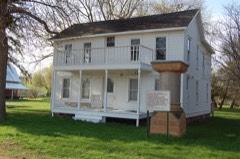
On the National Register 2 records

Population over time
2 figuresLynd fell from 448 to 436 between 2010 and 2020. These are the recorded population figures Wikidata holds for this place, reached through the Geographic Names Information System number this page is keyed on rather than by name, so they belong to this place and not to another of the same name. Most are census counts, but not all are: an early figure may be a founding or settlement estimate, and an estimate published within five years of a census is left out. The change column is computed, and is left blank where more than 20 years separate a figure from the one before it, because a gap that long is not a change between two counts.
| Year | People | Change |
|---|---|---|
| 2010 | 448 | |
| 2020 | 436 | -12 (-3%) |
Topographic sheets covering this place
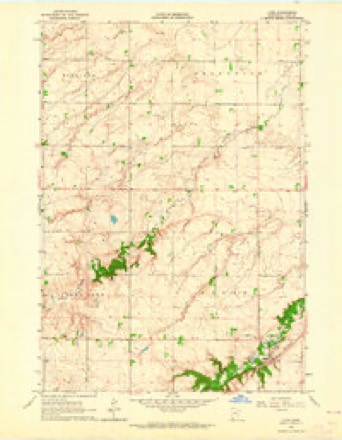
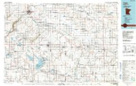
6 surveys from 9 printed sheetsMatched by testing this settlement's coordinate against the published boundary of every sheet in the United States Geological Survey's historical collection. Each opens the scanned sheet at the Survey.
- 1953 USGS New Ulm quadrangle1:250000, 3 printings
- 1957 USGS New Ulm quadrangle1:250000
- 1958 USGS New Ulm quadrangle1:250000
- 1963 USGS Lynd quadrangle1:24000
- 1967 USGS New Ulm quadrangle1:250000
- 1986 USGS Tracy quadrangle1:100000, 2 printings




What happened here
An account from the chapter on Lynd city. The inset identifies its exact source book and publication year.
Town Of Custer
The Cottonwood river flows aci'oss the north end ot the town irom west to east, and had some years ago considerable timber along its banks. This fact, which is an attraction m all new prairie countries, brought white traders to this section before the Indian massacre of 1862. A German some time before this opened an Indian trading station on the Cottonwood river it is said on section 1.
In the county-history sources
7,810 words on this townshipHistory of Lyon County, published 1884 names this settlement in its chapter on Lynd City. These are the passages that mention it, exactly as the scans read.
Lyons, which is town 110, range 42, lies south of Lyad, and is six miles from the west and south lines of the county. The east and south portions of the town are open prairie countrv with the usual rich soil and meadow lands of the count) generally. The northwest corner of Lyons is cut by the Redwood river, giving it some timber groves and also some rough land It is probable, as stated in the article on Lynd, that the first white men in the county located in Lyons. Tlie remains of an old log house, supposed to have been Lynd's trading post was found by the settlers in 1867 on section 6 of Lyons. The station was afterward moved to Lynd, however, if this theoiy is correct, probably after a Uurn out.
Passage source: History of Lyon County, published 1884.
The first pt-rinanentsettler in the town was C. E. Goodell, who located oa section 5 in 18G7. He was in the woods as a chopper before this time, a scheme having neen hatched to cut logs there and float them to Redwood Falls duriuo: high water. It i3_claimed by some that he was the first man ia the county after the Indian trading posts of the period before the Indian massacre. Later in the spring ol 18(58 E. E. Taylor settled in the town. Soon after C Hiidreth, W. S. Adams and H. L. Pierce settled iu the town.
Passage source: History of Lyon County, published 1884.
There was a trading station for the Indian trade established here by James W. Lynd probably as eai'ly as 185") or \57. His store was located, it is said, on the norllieast quarter of section Ik!. This statement is contradicted by some who claim tliut it was on the southeast quarter of section 5 in Lyons. In I lie latter place the early settlers foimd the remains of a building that had been bui'ned, and in the spring ot 1880 Mr. (roodell in plowing his garden half a mile north of this spot plowed up a tub full of tools, consisting of handsaws, chisels, an auger, hoes, a hand axe, a f.at iron, a tea cup and saucer. Tho tub was wholly rotted, leaving oidy the impression, and the tools were nearly destroyed by use. The ludian.s, it is said, point out section five of Lyons as the first trading post. On section 3;'. the lirst settlers found a log building still standincr, which L. Tickner u>ed as a residence for a short time. It was later used as a scliool house; then as a store by G. VV^. Whitney. It is (piite probable that Lynd's post may liav" been moved to this ()oinl from si^elion 5 iu Lyons after a burn out, or for other reasons.
Passage source: History of Lyon County, published 1884.
Machine-read from a century-old scan, so expect the errors a machine makes: misspelled names, dropped words, stray characters.
Read the whole chapter on Lynd City - it names this place 25 more 25 times.
Fires near this place
2 since 2009Regional context, not property-specific evidence. The federal wildfire occurrence database lists 2 fires within 5 miles of Lynd between 2009 and 2012, burning about 127 acres in total. None started naturally. None was recorded as arson. Distance is straight-line from the map coordinates, so a fire counted here may appear on a neighbouring settlement's page as well.
| Reported cause | Fires |
|---|---|
| Missing data/not specified/undetermined | 2 |
The most recent of them, most recent first, with the day each was reported and the service that recorded it.
| Date | Cause | Size | Reported by | Name on the report |
|---|---|---|---|---|
| 11 May 2009 | Missing data/not specified/undetermined | 46 acres | Minnesota Department of Natural Resources | not named |
| 8 October 2012 | Missing data/not specified/undetermined | 81 acres | Minnesota Department of Natural Resources | not named |
Settlements close enough to share some of these fires:
Mines and quarries near this place
1 within 5 milesRegional context, not property-specific evidence. The federal mineral resources record lists 1 working within 5 miles of Lynd: 1 producer. All of them still produce. What was taken out: Sand and Gravel, Construction. Distance is straight-line from the map coordinates, so a quarry counted here may appear on a neighbouring settlement's page as well.
| Where | Site | Commodity | Status | Recorded |
|---|---|---|---|---|
| Marshall Pit and Mill | Sand and Gravel, Construction | Producer |
Storms near this place
43 since 2002Regional context, not property-specific evidence. The National Weather Service names Lynd in 43 storm reports between 2002 and 2024: 26 hail, 9 flood, 6 thunderstorm wind, 2 flash flood. No death or injury is recorded in these reports. Each account below is quoted exactly as the forecast office filed it, from the NOAA Storm Events Database, and each date opens the federal record of that event.
| When | Event | Place named | Harm | What the report says |
|---|---|---|---|---|
| July 2018 | Flash Flood | Lynd | $155,000 | Excessive rainfall rates overloaded culverts on County Road 5 north of Lynd and County Road 7 south of State Highway 23 near Marshall, each washing out large sections of roadway. Other county roads (60, 63 and 65) lost culverts as well, with road damage across the county totaling around 155 thousand dollars. Rainfall at Marshall was 4.81 inches, 4.02 inches just south of Marshall, 5.77 inches at Tracy and 6.50 inches at Ghent. |
| September 2019 | Flood | Lynd | $10,000 | After excessive two-day rainfall during September 10-12 (5.70 inches at Marshall), the Redwood River at Marshall (gage site MSHM5) reached the ninth highest stage on record of 1.14 feet above flood stage on September 12. Significant agricultural land was flooded, with numerous county roads under water. |
| June 2012 | Hail | Lynd | $2,000 | Large hail damaged a camper. |
| June 2024 | Thunderstorm Wind | Lynd | - | Multiple trees were blown down by thunderstorm winds, some as large as 4 feet in diameter. |
| June 2024 | Flood | Lynd | - | The Redwood River at Marshall rose above flood stage the morning of June 22nd, cresting around 1.87 feet above flood stage (15.87 feet) on June 24th. This crest is in the Moderate stage. The river then fell below flood stage on the morning of June 26th. For a more comprehensive description of flood damage, please see other entries for Lyon County. |
| June 2024 | Hail | Lynd | - | Quarter size hail stripped leaves from trees. Crop damage is an estimate from insured losses. Information provided by the United States Department of Agriculture. |
| May 2022 | Thunderstorm Wind | Lynd | - | Thunderstorm winds downed trees in Camden State Park. |
| May 2022 | Thunderstorm Wind | Lynd | - | A second floor balcony of a historic hotel building was removed by a large tree limb displaced by thunderstorm wind gusts. |
| March 2020 | Flood | Lynd | - | The Redwood River at Marshall (gage site MSHM5) rose briefly above flood stage and crested at 1.19 feet above flood stage on March 7. Minor flooding of agricultural areas occurred outside Marshall. |
| June 2019 | Hail | Lynd | - | Drifts of pea-sized hail at Camden State Park. There were a few as large as nickel to quarter size. Rainfall was 2.50 inches. |
| June 2019 | Hail | Lynd | - | Multiple quarter-sized hailstones with some up to half-dollar size. Many leaves were stripped due to abundant hail. |
| March 2019 | Flood | Lynd | - | Snow melt and heavy rainfall (measured 1.56 inches at Marshall) resulted in significant flooding of agricultural lands and several county roads around Marshall. The Redwood River at Marshall (gage site MSHM5) reached the highest stage on record cresting 5.71 feet above flood stage on March 24. |
| July 2019 | Flood | Lynd | - | Runoff from heavy rainfall of 2 to 3 inches in the Redwood River basin from July 4 into July 5 (2.70 inches at Marshall) produced brief flooding of agricultural land. The Redwood River near Marshall (gage site MSHM5) crested at 0.60 feet above flood stage on July 5. |
| April 2019 | Flood | Lynd | - | Runoff following the major winter storm in mid-April produced brief flooding of agricultural land. The Redwood River near Marshall (gage site MSHM5) crested at 0.77 feet above flood stage on April 18. |
| April 2018 | Flood | Lynd | - | Snow melt and runoff from periods of heavier rainfall briefly produced moderate flooding with impact to lowland agricultural areas. River levels reached 1.9 feet above flood stage on the Redwood River at Marshall (gage site MSHM5) on April 24. |
| June 2018 | Flood | Lynd | - | A week of periodic heavy rainfall ending June 26 resulted in a widespread 2 to 5 inches of rainfall, much of which occurred on June 20 and 24. Weekly rainfall totals reached 4.08 inches 6 miles east of Ivanhoe, 2.79 inches at Minneota and 1.84 inches at Marshall. Minor flooding occurred with significant amounts of crop and pasture land inundated as the Redwood River at Marshall (gage site MSHM5) briefly crested 0.4 feet above flood stage on June 25. |
| July 2018 | Flood | Lynd | - | The event began as a flash flood, with historical flooding of areas around Marshall. Numerous motorists were in need of rescue when their vehicles became stalled in the flood waters which ran 2 to 4 feet deep in places around the city. Significant amounts of crop and pasture land were severely impacted near the Redwood River, as well as a few county and township roads inundated by major flooding as river levels climbed to 3.4 feet above flood stage near Marshall (gage site MSHM5) on July 3. This is the highest crest on record for the gage site. |
| August 2017 | Hail | Lynd | - | Also road flooding being reported in Lynd, MN via Social Media. |
| June 2017 | Hail | Lynd | - | Trees were damaged as well. |
| June 2017 | Hail | Lynd | - | Windows were broke. |
| September 2013 | Thunderstorm Wind | Lynd | - | Thunderstorm winds caused tree damage. The winds were accompanied by small hail and heavy rain. |
| June 2013 | Thunderstorm Wind | Lynd | - | Thunderstorm winds caused tree damage, including a large tree uprooted. |
| June 2012 | Hail | Lynd | - | Large hail caused an unknown amount of damage to vehicles and crops. |
| August 2012 | Thunderstorm Wind | Lynd | - | Thunderstorm winds caused tree damage and flattened corn crops. |
| September 2010 | Flash Flood | Lynd | - | Heavy rain caused flash flooding of numerous roads in the Marshall area, including Highway 59. |
| September 2024 | Hail | Lynd | - | no account filed |
| June 2019 | Hail | Lynd | - | no account filed |
| June 2017 | Hail | Lynd | - | no account filed |
| August 2012 | Hail | Lynd | - | no account filed |
| August 2012 | Hail | Lynd | - | no account filed |
| July 2011 | Hail | Lynd | - | no account filed |
| July 2011 | Hail | Lynd | - | no account filed |
| July 2011 | Hail | Lynd | - | no account filed |
| July 2011 | Hail | Lynd | - | no account filed |
| June 2010 | Hail | Lynd | - | no account filed |
| June 2010 | Hail | Lynd | - | no account filed |
| June 2010 | Hail | Lynd | - | no account filed |
| June 2010 | Hail | Lynd | - | no account filed |
| July 2004 | Hail | Lynd | - | no account filed |
| July 2004 | Hail | Lynd | - | no account filed |
| May 2002 | Hail | Lynd | - | no account filed |
| April 2002 | Hail | Lynd | - | no account filed |
| April 2002 | Hail | Lynd | - | no account filed |
Nearest settlements
The eight closest, with where each one stands in the county. Distances are straight-line, computed from the Geographic Names Information System coordinates.
| Map | Place | Distance | Sheets |
|---|---|---|---|
| Russell | 5.6 miles | 9 | |
| Village Park | 6.6 miles | 11 | |
| Marshall | 6.8 miles | 11 | |
| Garvin Park | 6.9 miles | 11 | |
| Ghent | 8.7 miles | 9 | |
| Burchard | 10.4 miles | 9 | |
| Balaton | 10.6 miles | 10 | |
| Dudley | 10.9 miles | 10 |
Elsewhere
Matched on this settlement's Geographic Names Information System number rather than its name, so it cannot be a different place of the same name in another state.
| Wikipedia article on Lynd | An encyclopaedic summary. Its text is share-alike, so it is linked here rather than copied. |
| Wikidata item Q2230088 | The structured record the population and elevation above come from. Public domain (CC0). |
Provenance
This settlement is recorded in the Geographic Names Information System as feature 647328. The sheet list is computed by point-in-boundary test against the United States Geological Survey's historical topographic inventory. Both are works of the United States government and carry no copyright under 17 U.S.C. 105.
Wildfire. Short, Karen C. 2022. Spatial wildfire occurrence data for the United States, 1992-2020 [FPA_FOD_20221014]. 6th Edition. Fort Collins, CO: Forest Service Research Data Archive. https://doi.org/10.2737/RDS-2013-0009.6 Collected with United States Government funding and usable without additional permissions or fees.
Mines and quarries. USGS Mineral Resources Data System (MRDS) https://mrdata.usgs.gov/mrds/ A work of the United States government, no copyright under 17 U.S.C. 105.
Storms. NOAA National Centers for Environmental Information, Storm Events Database https://www.ncei.noaa.gov/stormevents/ A work of the United States government, no copyright under 17 U.S.C. 105. Narratives are quoted verbatim from the National Weather Service report and are not edited or summarised.