 Block
Melrose, Minnesota
10 topographic sheets cover this place, the earliest surveyed in 1953 and the latest in 1986. It stands in Melrose City. It lies in ZIP code area 56352. The Survey maps it on the Melrose quadrangle. 3,602 people lived here at the 2020 count. It stands 1,204 feet above sea level.
On record in Melrose
Buildings and businesses the archive holds for this place. Each opens its own page, with the source record it came from.
On the National Register 1 record
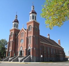 Church of St. Bonifacelisted 1993
Population over time
2 figuresMelrose grew from 3,598 to 3,602 between 2010 and 2020. These are the recorded population figures Wikidata holds for this place, reached through the Geographic Names Information System number this page is keyed on rather than by name, so they belong to this place and not to another of the same name. Most are census counts, but not all are: an early figure may be a founding or settlement estimate, and an estimate published within five years of a census is left out. The change column is computed, and is left blank where more than 20 years separate a figure from the one before it, because a gap that long is not a change between two counts.
| Year | People | Change |
|---|---|---|
| 2010 | 3,598 | |
| 2020 | 3,602 | +4 (+0%) |
Topographic sheets covering this place
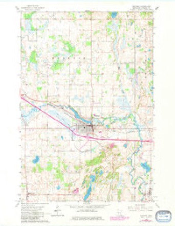
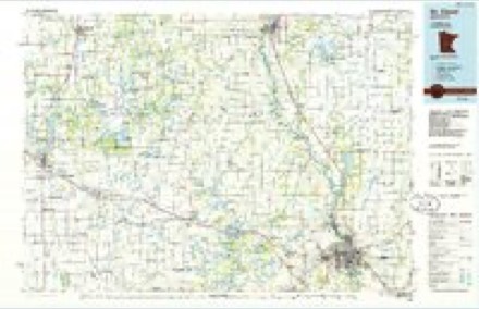
5 surveys from 10 printed sheetsMatched by testing this settlement's coordinate against the published boundary of every sheet in the United States Geological Survey's historical collection. Each opens the scanned sheet at the Survey.
- 1953 USGS Saint Cloud quadrangle1:250000, 3 printings
- 1957 USGS Saint Cloud quadrangle1:250000
- 1958 USGS Saint Cloud quadrangle1:250000
- 1965 USGS Melrose quadrangle1:24000, 3 printings
- 1986 USGS St. Cloud quadrangle1:100000, 2 printings
In the county-history sources
1,540 words on this townshipHistory of Stearns County, Minnesota, published 1915 names this settlement in its chapter on Melrose City. These are the passages that mention it, exactly as the scans read.
Melrose is situated in the northeast part of the county, and has an area of 26,880 acres. The Sauk river enters the town at the southwest corner and flows in an easterly direction, leaving the town near the southeast corner. This part is mostly a level prairie, having a light sandy soil. The Adley branch runs in a southeasterly direction through the eastern part of the town, and forms a junction with the Sauk river on section thirty-six. Aside from the strip of prairie above mentioned, the surface was originally covered with timber and brush of the varieties peculiar to the locality.
Passage source: History of Stearns County, Minnesota, published 1915.
The first four settlers in Melrose were Moses W. Adley and his brother, Warren M., and the brothers Robert and E. C. Wheeler, all natives of Maine. Moses W. Adley arrived at this place on January 10, 1856, but did not settle until the following year, when he took a claim on section thirty-four, which included the' greater portion of the present village of Melrose. Warren M. Adley made a claim a few months later on section thirty-three. E, C. Wheeler settled near the others the
Passage source: History of Stearns County, Minnesota, published 1915.
Melrose township was organized in 1866, and the first election held on January 22. The first records are very incomplete, and a full list of the first oflftcers cannot be obtained. The supervisors were: W. Chambers (chairman), Chas. W, Taylor, and Charles G. Lamb; and clerk, Augustus Lindberg.
Passage source: History of Stearns County, Minnesota, published 1915.
Machine-read from a century-old scan, so expect the errors a machine makes: misspelled names, dropped words, stray characters.
Read the whole chapter on Melrose City - it names this place 5 more 5 times.
Fires near this place
1 since 2007Regional context, not property-specific evidence. The federal wildfire occurrence database lists 1 fire within 5 miles of Melrose in 2007, burning about 20 acres in total. None started naturally. None was recorded as arson. Distance is straight-line from the map coordinates, so a fire counted here may appear on a neighbouring settlement's page as well.
| Reported cause | Fires |
|---|---|
| Debris and open burning | 1 |
The most recent of them, most recent first, with the day each was reported and the service that recorded it.
| Date | Cause | Size | Reported by | Name on the report |
|---|---|---|---|---|
| 9 August 2007 | Debris and open burning | 20 acres | Minnesota Department of Natural Resources | not named |
Settlements close enough to share some of these fires:
Mines and quarries near this place
1 within 5 milesRegional context, not property-specific evidence. The federal mineral resources record lists 1 working within 5 miles of Melrose: 1 producer. All of them still produce. What was taken out: Sand and Gravel, Construction. Distance is straight-line from the map coordinates, so a quarry counted here may appear on a neighbouring settlement's page as well.
| Where | Site | Commodity | Status | Recorded |
|---|---|---|---|---|
| Smith Pit | Sand and Gravel, Construction | Producer |
Storms near this place
16 since 1994Regional context, not property-specific evidence. The National Weather Service names Melrose in 16 storm reports between 1994 and 2024: 9 hail, 4 thunderstorm wind, 1 heavy rain, 1 flash flood. The reports record 1 injury. Each account below is quoted exactly as the forecast office filed it, from the NOAA Storm Events Database, and each date opens the federal record of that event.
| When | Event | Place named | Harm | What the report says |
|---|---|---|---|---|
| June 2015 | Flash Flood | Melrose | 1 hurt, $1,000 | Local officials in Stearns County reported flooding southeast of Freeport on County Road 172 and 157 after midnight. A few cars and a party bus floated off the road into a ditch at that location. One person was injured when the party bus tipped over in the ditch. Part of the road was damaged due to flood waters flowing over that roadway. The town of Albany also had street flooding. |
| August 2024 | Tornado (EF1) | Melrose | $2,000,000 | A tornado moved south-southeast through the west side of Melrose. The worst structural damage took place in the northwest side of town. The tornado destroyed a large metal building system and peeled the roof off of several other buildings. Portions of the roof were torn off some townhomes. Hundreds of trees were uprooted or broken. The tornado moved across a golf course, taking down many dozens of trees. In the far southern part of Melrose, more homes sustained damage and the tornado completely destroyed a large machine shed at a farm. After exiting town, the tornado moved across fields and damaged a few more farms. One turkey barn had much of its roof removed and the roof was blown off a large shed shortly before the tornado dissipated. |
| July 2011 | Thunderstorm Wind | Melrose | $25,000 | A garage roof was blown off in northwest Melrose. |
| June 2013 | Heavy Rain | Melrose | - | Storm total rainfall amount of 4.00 inches was measured near Melrose. |
| August 2010 | Thunderstorm Wind | Melrose | - | A truck on County Road 65, east of Melrose, Minnesota was blown off the road. |
| June 2004 | Hail | Melrose | - | Penny sized hail fell between Melrose and Belgrade. |
| July 1997 | Thunderstorm Wind | Melrose | - | Damage to turkey barn. |
| August 1995 | Thunderstorm Wind | Melrose | - | Tree damage. |
| July 2023 | Hail | Melrose | - | no account filed |
| June 2016 | Hail | Melrose | - | no account filed |
| May 2012 | Hail | Melrose | - | no account filed |
| June 2009 | Hail | Melrose | - | no account filed |
| June 2008 | Hail | Melrose | - | no account filed |
| September 2007 | Hail | Melrose | - | no account filed |
| July 2007 | Hail | Melrose | - | no account filed |
| July 1994 | Hail | Melrose | - | no account filed |
Nearest settlements
The eight closest, with where each one stands in the county. Distances are straight-line, computed from the Geographic Names Information System coordinates.
| Map | Place | Distance | Sheets |
|---|---|---|---|
| New Munich | 4.2 miles | 10 | |
| Meire Grove | 4.5 miles | 10 | |
| Greenwald | 5.8 miles | 8 | |
| Saint Rosa | 6.2 miles | 10 | |
| Freeport | 6.3 miles | 10 | |
| Sauk Centre | 8.8 miles | 9 | |
| Saint Anthony | 10.4 miles | 9 | |
| Spring Hill | 10.4 miles | 8 |
Elsewhere
Matched on this settlement's Geographic Names Information System number rather than its name, so it cannot be a different place of the same name in another state.
| Wikipedia article on Melrose | An encyclopaedic summary. Its text is share-alike, so it is linked here rather than copied. |
| Wikidata item Q2528717 | The structured record the population and elevation above come from. Public domain (CC0). |
Provenance
This settlement is recorded in the Geographic Names Information System as feature 647757. The sheet list is computed by point-in-boundary test against the United States Geological Survey's historical topographic inventory. Both are works of the United States government and carry no copyright under 17 U.S.C. 105.
Wildfire. Short, Karen C. 2022. Spatial wildfire occurrence data for the United States, 1992-2020 [FPA_FOD_20221014]. 6th Edition. Fort Collins, CO: Forest Service Research Data Archive. https://doi.org/10.2737/RDS-2013-0009.6 Collected with United States Government funding and usable without additional permissions or fees.
Mines and quarries. USGS Mineral Resources Data System (MRDS) https://mrdata.usgs.gov/mrds/ A work of the United States government, no copyright under 17 U.S.C. 105.
Storms. NOAA National Centers for Environmental Information, Storm Events Database https://www.ncei.noaa.gov/stormevents/ A work of the United States government, no copyright under 17 U.S.C. 105. Narratives are quoted verbatim from the National Weather Service report and are not edited or summarised.