 Block
Millersburg, Minnesota
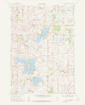
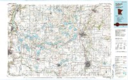
10 topographic sheets cover this place, the earliest surveyed in 1953 and the latest in 1985. It stands in Forest Township. It lies in ZIP code area 55021. The Survey maps it on the Little Chicago quadrangle.
Topographic sheets covering this place
6 surveys from 10 printed sheetsMatched by testing this settlement's coordinate against the published boundary of every sheet in the United States Geological Survey's historical collection. Each opens the scanned sheet at the Survey.
- 1953 USGS Saint Paul quadrangle1:250000, 3 printings
- 1953 USGS St. Paul quadrangle1:250000
- 1959 USGS Saint Paul quadrangle1:250000
- 1959 USGS St. Paul quadrangle1:250000
- 1960 USGS Little Chicago quadrangle1:24000, 2 printings
- 1985 USGS Faribault quadrangle1:100000, 2 printings




In the county-history sources
10,405 words on this townshipHistory of Rice County, published 1882 names this settlement in its chapter on Forest Township. These are the passages that mention it, exactly as the scans read.
In the fall of that year ( 185.5) a number of arrivals were marked ou the corner stakes of claims. Leonard and Jacob Balyet, Joseph and Elijah Houck, and John Craven, came together, and all took claims near Millersburg, a little south of the settlement mentioned above. Of this party only two now remain in the town, they are Leonard and Jacob Balyet who are still on their original claims.
Passage source: History of Rice County, published 1882.
Early in 1856, Albert Fillmore and family, and the following week, H. A. White, arrived and located near Millersburg; and crowding after them came James Fitzimmons and commenced layiifg plans for the village of Millersburg. At the same time should be chronicled the arrival of George and Milo J. Sellon, John Wood, and E. F. Taylor, who were brought in by ,T. W. Thompson, and all took claims, most of them in the neighborhood of Millersburg.
Passage source: History of Rice County, published 1882.
The town of Fi.Te^ t was not behind the m ighboring towns iu organizing and starting the local goverumental wheels. The first meeting was held on that inevitable 11th of M-iy, 1858, at the residence of James Fitzimmons, now tlie Millersburg Hotel, and alter organization the following officiiils were elected : Su]>ervisor.s, Elias F. Taylor, Zebulou Sargent, and Charles I5rand; Clerk, Alexander Smith; Assess Joseph L. Houck ; Justices of the Peace, (leorg. Miller and John R. Bartlett; Constables, Milo T. Sellon and John W. Sargent; Overseer of the Poor, John .Tones. The clerk of this meeting was J. F. Donaldson, and S. A. Hen derson, moderator. Three of the first officers are still residents of the township.
Passage source: History of Rice County, published 1882.
Machine-read from a century-old scan, so expect the errors a machine makes: misspelled names, dropped words, stray characters.
Read the whole chapter on Forest Township - it names this place 9 more 9 times.
Fires near this place
3 since 2003Regional context, not property-specific evidence. The federal wildfire occurrence database lists 3 fires within 5 miles of Millersburg between 2003 and 2012, burning about 6 acres in total. None started naturally. None was recorded as arson. Distance is straight-line from the map coordinates, so a fire counted here may appear on a neighbouring settlement's page as well.
| Reported cause | Fires |
|---|---|
| Equipment and vehicle use | 1 |
| Recreation and ceremony | 1 |
| Missing data/not specified/undetermined | 1 |
The most recent of them, most recent first, with the day each was reported and the service that recorded it.
| Date | Cause | Size | Reported by | Name on the report |
|---|---|---|---|---|
| 6 December 2012 | Recreation and ceremony | 1.0 acres | Minnesota Valley National Wildlife Refuge | SORENSON LANDING 2 |
| 6 October 2003 | Missing data/not specified/undetermined | 2.0 acres | Minnesota Department of Natural Resources | not named |
| 12 October 2012 | Equipment and vehicle use | 3.0 acres | Minnesota Valley National Wildlife Refuge | CO RD 101 |
Settlements close enough to share some of these fires:
Mines and quarries near this place
3 within 5 milesRegional context, not property-specific evidence. The federal mineral resources record lists 3 workings within 5 miles of Millersburg: 3 producers. All of them still produce. What was taken out: Sand and Gravel, Construction. Distance is straight-line from the map coordinates, so a quarry counted here may appear on a neighbouring settlement's page as well.
| Where | Site | Commodity | Status | Recorded |
|---|---|---|---|---|
| Camp Pit | Sand and Gravel, Construction | Producer | ||
| Concrete Materials Pit No 2 | Sand and Gravel, Construction | Producer | ||
| Elwood Pit | Sand and Gravel, Construction | Producer |
Nearest settlements
The eight closest, with where each one stands in the county. Distances are straight-line, computed from the Geographic Names Information System coordinates.
| Map | Place | Distance | Sheets |
|---|---|---|---|
| Little Chicago | 3.6 miles | 10 | |
| Trondjem | 4.8 miles | 10 | |
| Comus | 4.9 miles | 10 | |
| Shieldsville | 5.9 miles | 12 | |
| Lonsdale | 6.3 miles | 10 | |
| Dundas | 6.9 miles | 11 | |
| Hazelwood | 7.0 miles | 11 | |
| Webster | 7.1 miles | 11 |
Provenance
This settlement is recorded in the Geographic Names Information System as feature 654828. The sheet list is computed by point-in-boundary test against the United States Geological Survey's historical topographic inventory. Both are works of the United States government and carry no copyright under 17 U.S.C. 105.
Wildfire. Short, Karen C. 2022. Spatial wildfire occurrence data for the United States, 1992-2020 [FPA_FOD_20221014]. 6th Edition. Fort Collins, CO: Forest Service Research Data Archive. https://doi.org/10.2737/RDS-2013-0009.6 Collected with United States Government funding and usable without additional permissions or fees.
Mines and quarries. USGS Mineral Resources Data System (MRDS) https://mrdata.usgs.gov/mrds/ A work of the United States government, no copyright under 17 U.S.C. 105.