 Block
Webster, Minnesota
11 topographic sheets cover this place, the earliest surveyed in 1953 and the latest in 1985. It stands in Webster Township. It lies in ZIP code area 55088. The Survey maps it on the New Market quadrangle.
On record in Webster
Buildings and businesses the archive holds for this place. Each opens its own page, with the source record it came from.
On the National Register 1 record
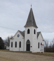 Trondhjem Norwegian Lutheran Churchlisted 2001
Topographic sheets covering this place
7 surveys from 11 printed sheetsMatched by testing this settlement's coordinate against the published boundary of every sheet in the United States Geological Survey's historical collection. Each opens the scanned sheet at the Survey.
- 1953 USGS Saint Paul quadrangle1:250000, 3 printings
- 1953 USGS St. Paul quadrangle1:250000
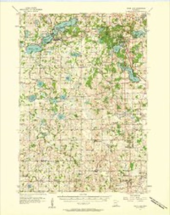
- 1957 USGS Prior Lake quadrangle1:62500, 2 printings
- 1959 USGS Saint Paul quadrangle1:250000
- 1959 USGS St. Paul quadrangle1:250000
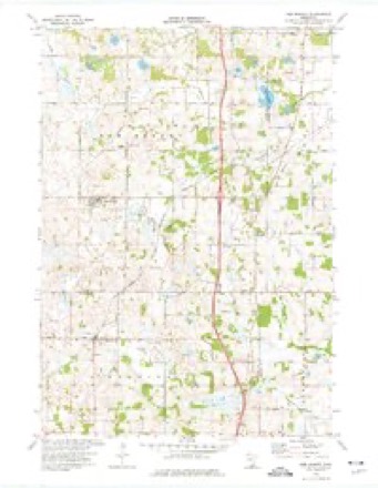
- 1974 USGS New Market quadrangle1:24000
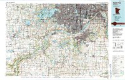
- 1985 USGS Saint Paul quadrangle1:100000, 2 printings




In the county-history sources
7,969 words on this townshipHistory of Rice County, published 1882 names this settlement in its chapter on Webster Township. These are the passages that mention it, exactly as the scans read.
Webster Township is the companion town of Wheatland in extending the boundary line of the county northward. It is in the northwestern jiart of Rice county; its contiguous surroundings are the counties of Scott and Dakota on the north and east, with Bridgewater township forming an eastem boundary to section thirty-six; on the south Forest and on the west Wheatland.
Passage source: History of Rice County, published 1882.
Webster is not so well watered as most of its contiguous neighbors, in fact it has no lakes of any importance wholly within its borders, nor is its surface traversed by streams of any note. Union Lake is the largest body of water in the town, entering from Forest and covering about 200 acres in section thirty-five. Kuowles Lake is the next in size, located in the western part of the town, almost wholly in section nineteen. These two lakes are connected by a stream flowing from the latter, called Chub Creek. Another little stream rises in the northwestern part of the township and crosses sections five and six as it leaves and enters Scott county. Still another small brook rises in the eastern part of section eleven, and crossing section thirteen in a soutlieasterly direction, enters Dakota county.
Passage source: History of Rice County, published 1882.
A small majority of the citizens at the present writing are of German, Irisli, and other foreign origin, although the American population is growing more rapidly than the foreign-born. A report of the township published a few years ago states that the township contained "640 acres of unsold school laud.s, 520 acres still belonging to the government, and nearly 5,000 acres to thi; raih'oad. Wild lands may be purchased from $2.00 to .'$5.00 per acre, etc." This, however, is now changed and almost all lands aliove mentioned have been sold to, and are now occupied by actual settlers, while the wild lands have doubled the price mentioned.
Passage source: History of Rice County, published 1882.
Machine-read from a century-old scan, so expect the errors a machine makes: misspelled names, dropped words, stray characters.
Read the whole chapter on Webster Township - it names this place 37 more 37 times.
Fires near this place
2 since 2003Regional context, not property-specific evidence. The federal wildfire occurrence database lists 2 fires within 5 miles of Webster between 2003 and 2012, burning about 3 acres in total. None started naturally. None was recorded as arson. Distance is straight-line from the map coordinates, so a fire counted here may appear on a neighbouring settlement's page as well.
| Reported cause | Fires |
|---|---|
| Recreation and ceremony | 1 |
| Missing data/not specified/undetermined | 1 |
The most recent of them, most recent first, with the day each was reported and the service that recorded it.
| Date | Cause | Size | Reported by | Name on the report |
|---|---|---|---|---|
| 6 December 2012 | Recreation and ceremony | 1.0 acres | Minnesota Valley National Wildlife Refuge | SORENSON LANDING 2 |
| 6 October 2003 | Missing data/not specified/undetermined | 2.0 acres | Minnesota Department of Natural Resources | not named |
Settlements close enough to share some of these fires:
Mines and quarries near this place
2 within 5 milesRegional context, not property-specific evidence. The federal mineral resources record lists 2 workings within 5 miles of Webster: 2 producers. All of them still produce. What was taken out: Sand and Gravel, Construction. Distance is straight-line from the map coordinates, so a quarry counted here may appear on a neighbouring settlement's page as well.
| Where | Site | Commodity | Status | Recorded |
|---|---|---|---|---|
| Camp Pit | Sand and Gravel, Construction | Producer | ||
| Concrete Materials Pit No 2 | Sand and Gravel, Construction | Producer |
Storms near this place
10 since 1998Regional context, not property-specific evidence. The National Weather Service names Webster in 10 storm reports between 1998 and 2021: 8 hail, 1 tornado, 1 thunderstorm wind. No death or injury is recorded in these reports. Each account below is quoted exactly as the forecast office filed it, from the NOAA Storm Events Database, and each date opens the federal record of that event.
| When | Event | Place named | Harm | What the report says |
|---|---|---|---|---|
| June 2021 | Hail | Webster | - | Social media had a picture of golf ball size hail near Webster. |
| June 2021 | Hail | Webster | - | Social media had a picture of tennis ball size hail in Webster. |
| May 2014 | Thunderstorm Wind | Webster | - | A large tree was snapped in half near Webster. |
| June 1998 | Tornado (F0) | Webster | - | Remained in open field. Grain bin blown into woods 2 SE of Webster. |
| August 2020 | Hail | Webster | - | no account filed |
| June 2016 | Hail | Webster | - | no account filed |
| June 2012 | Hail | Webster | - | no account filed |
| May 2011 | Hail | Webster | - | no account filed |
| August 2006 | Hail | Webster | - | no account filed |
| August 2006 | Hail | Webster | - | no account filed |
Nearest settlements
The eight closest, with where each one stands in the county. Distances are straight-line, computed from the Geographic Names Information System coordinates.
| Map | Place | Distance | Sheets |
|---|---|---|---|
| Hazelwood | 3.6 miles | 11 | |
| Little Chicago | 3.8 miles | 10 | |
| Trondjem | 4.1 miles | 10 | |
| Lonsdale | 5.3 miles | 10 | |
| Veseli | 5.8 miles | 11 | |
| Millersburg | 7.1 miles | 10 | |
| Wheatland | 8.3 miles | 10 | |
| Dundas | 10.6 miles | 11 |
Provenance
This settlement is recorded in the Geographic Names Information System as feature 653881. The sheet list is computed by point-in-boundary test against the United States Geological Survey's historical topographic inventory. Both are works of the United States government and carry no copyright under 17 U.S.C. 105.
Wildfire. Short, Karen C. 2022. Spatial wildfire occurrence data for the United States, 1992-2020 [FPA_FOD_20221014]. 6th Edition. Fort Collins, CO: Forest Service Research Data Archive. https://doi.org/10.2737/RDS-2013-0009.6 Collected with United States Government funding and usable without additional permissions or fees.
Mines and quarries. USGS Mineral Resources Data System (MRDS) https://mrdata.usgs.gov/mrds/ A work of the United States government, no copyright under 17 U.S.C. 105.
Storms. NOAA National Centers for Environmental Information, Storm Events Database https://www.ncei.noaa.gov/stormevents/ A work of the United States government, no copyright under 17 U.S.C. 105. Narratives are quoted verbatim from the National Weather Service report and are not edited or summarised.