 Block
Stanton, Minnesota
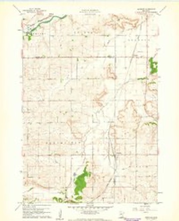
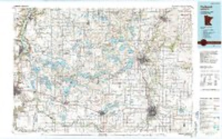
9 topographic sheets cover this place, the earliest surveyed in 1953 and the latest in 1985. It stands in Stanton Township. It lies in ZIP code area 55018. The Survey maps it on the Dennison quadrangle.
On record in Stanton
Buildings and businesses the archive holds for this place. Each opens its own page, with the source record it came from.
On the National Register 1 record
- Carleton Airportlisted 2004
Topographic sheets covering this place
6 surveys from 9 printed sheetsMatched by testing this settlement's coordinate against the published boundary of every sheet in the United States Geological Survey's historical collection. Each opens the scanned sheet at the Survey.
- 1953 USGS Saint Paul quadrangle1:250000, 3 printings
- 1953 USGS St. Paul quadrangle1:250000
- 1959 USGS Saint Paul quadrangle1:250000
- 1959 USGS St. Paul quadrangle1:250000
- 1960 USGS Dennison quadrangle1:24000
- 1985 USGS Faribault quadrangle1:100000, 2 printings




In the county-history sources
3,796 words on this townshipHistory of Goodhue County, Including a Sketch of the Territory and State of Minnesota; Together with an Account of the Early French Discoveries, Indian Massacres, the Part Borne by Minnesota's Patriots in the War of the Great Rebellion, and a Full and Complete History of the County from the Time of Its Occupancy by Swiss Missionaries in 1838. Pioneer Incidents, Biographical Sketches of Early and Prominent Settlers and Representative Men, and of Its Cities, Towns, Churches, Schools, Secret Societies, Etc, published 1878 names this settlement in its chapter on Stanton Township. These are the passages that mention it, exactly as the scans read.
This township is located in the extreme northwestern portion of the county. It is bounded on the north by Cannon River; on the east by Cannon Falls township ; south by Warsaw ; and west by Sciota, in Dakota county. In the early days the territory was called Prairie Creek, subsequently organized into the township of Lillian. It is not a full-sized government township, being only four section deep from north to south, and the usual six sections the other way. The Cannon River affords a magnificent water power, presenting a succession of falls, or more properly rapids, not excelled by any similar stream in the Northwest.
The first settlement was made in 1855, by a party of emigrants from Dodge county, Wisconsin, consisting of Wm. Stanton, sen., John Stanton, Norman Daniels, Robert Deakin, Wm. Stanton, jr.. Samuel Daniels, George Gould and others. These men with their families located claims near the southwest corner of the township, and the settlement was called Stanton in honor of the oldest settler, Mr. Wm. Stanton, senior. This section of country is a beautiful valley, surrounded by high lands, rendering the place picturesque in the extreme, full of native beauty and marvelous scenic loveliness.
In the fall of 1855, Mr. George Gould was married to a daughter of Samuel Daniels, being the first marriage celebrated in the township. In 1856, their first child was born, being the first child born in the township. In the fall of the same year Peter Fagan, and Hugh Woden, with his father and two sisters, came to the settlement and made claims. Of the latter family, all have since died.
Machine-read from a century-old scan, so expect the errors a machine makes: misspelled names, dropped words, stray characters.
Read the whole chapter on Stanton Township - it names this place 13 more 13 times.
Mines and quarries near this place
2 within 5 milesRegional context, not property-specific evidence. The federal mineral resources record lists 2 workings within 5 miles of Stanton: 1 producer, 1 unknown. 1 still produces. What was taken out: Stone, Crushed/Broken, Sand and Gravel, Construction. Distance is straight-line from the map coordinates, so a quarry counted here may appear on a neighbouring settlement's page as well.
| Where | Site | Commodity | Status | Recorded |
|---|---|---|---|---|
| Faith Quarry | Stone, Crushed/Broken | Producer | ||
| Gergen Pit | Sand and Gravel, Construction | Unknown |
Storms near this place
12 since 1998Regional context, not property-specific evidence. The National Weather Service names Stanton in 12 storm reports between 1998 and 2021: 6 hail, 2 flash flood, 1 lightning, 1 tornado. No death or injury is recorded in these reports. Each account below is quoted exactly as the forecast office filed it, from the NOAA Storm Events Database, and each date opens the federal record of that event.
| When | Event | Place named | Harm | What the report says |
|---|---|---|---|---|
| May 2001 | Tornado (F2) | Stanton | $4,000,000 | The Northfield tornado (which originated in Rice County) dissipated on the south side of Lake Byllesby, but not before destroying several sheds and causing minor damage to 12 homes. |
| June 2021 | Hail | Stanton | $3,000,000 | Hailstone was measured and emailed to the weather service. The hail stone was 3 inches in diameter and fell east of Stanton. |
| June 2012 | Flash Flood | Stanton | - | Excessive rainfall in a short period of time caused Highway 19 to close between Stanton and Northfield due to high water. |
| June 2012 | Heavy Rain | Stanton | - | A measured rainfall report of 8.40 inches occurred in less than 18 hours. |
| August 2007 | Flash Flood | Stanton | - | Roads barricaded at the intersection of County Roads 1 and 9, as well as at Highway 52 and 100th. Numerous township roads were also flooded. Near Stanton, Prairie Creek overflowed its banks and flooded a pasture. Rainfall measurements include 5.30 inches in Goodhue and 5.90 inches in Wanamingo. |
| October 2004 | Thunderstorm Wind | Stanton | - | A roof was blown off a small building. A quarter mile long irrigator was blown over and a corn field was flattened. |
| May 1998 | Lightning | Stanton | - | 2 horses killed by falling tree hit which was hit by lightning. |
| June 2021 | Hail | Stanton | - | no account filed |
| June 2021 | Hail | Stanton | - | no account filed |
| August 2006 | Hail | Stanton | - | no account filed |
| July 2002 | Hail | Stanton | - | no account filed |
| May 2002 | Hail | Stanton | - | no account filed |
Nearest settlements
The eight closest, with where each one stands in the county. Distances are straight-line, computed from the Geographic Names Information System coordinates.
| Map | Place | Distance | Sheets |
|---|---|---|---|
| Dennison | 4.6 miles | 9 | |
| Wangs | 5.1 miles | 11 | |
| Cannon Falls | 6.7 miles | 11 | |
| Sogn | 6.8 miles | 11 | |
| Nansen | 9.7 miles | 11 | |
| Wastedo | 10.2 miles | 11 | |
| Belle Creek | 13.6 miles | 11 | |
| White Rock | 13.6 miles | 11 |
Provenance
This settlement is recorded in the Geographic Names Information System as feature 652546. The sheet list is computed by point-in-boundary test against the United States Geological Survey's historical topographic inventory. Both are works of the United States government and carry no copyright under 17 U.S.C. 105.
Mines and quarries. USGS Mineral Resources Data System (MRDS) https://mrdata.usgs.gov/mrds/ A work of the United States government, no copyright under 17 U.S.C. 105.
Storms. NOAA National Centers for Environmental Information, Storm Events Database https://www.ncei.noaa.gov/stormevents/ A work of the United States government, no copyright under 17 U.S.C. 105. Narratives are quoted verbatim from the National Weather Service report and are not edited or summarised.