 Block
Stillwater, Minnesota
22 topographic sheets cover this place, the earliest surveyed in 1948 and the latest in 1985. It stands in Stillwater City. It lies in ZIP code area 55082. It stands on Browns Creek. The Survey maps it on the Stillwater quadrangle. 19,394 people lived here at the 2020 count. It stands 696 feet above sea level.
On record in Stillwater
Buildings and businesses the archive holds for this place. Each opens its own page, with the source record it came from.
On the National Register 12 of 21 shown
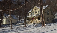 St. Croix Boom Company House and BarnNational Historic Landmark · listed 1980
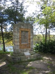 St. Croix Boom SiteNational Historic Landmark · listed 1966
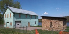 Moritz Bergstein Shoddy Mill and Warehouselisted 2008
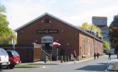 Chicago, Milwaukee and St. Paul Freight Houselisted 1977
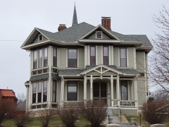 Roscoe Hersey Houselisted 1982
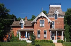 Capt. Austin Jenks Houselisted 1982
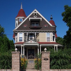 Albert Lammers Houselisted 1982
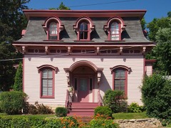 Ivory McKusick Houselisted 1982
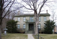 Minnesota Territorial-State Prison Warden's Houselisted 1974
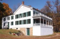 John and Martin Mower House and Arcola Mill Sitelisted 1980
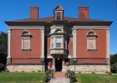 Nelson Schoollisted 1979
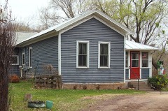 Pest Houselisted 1980
Population over time
2 figuresStillwater grew from 18,225 to 19,394 between 2010 and 2020. These are the recorded population figures Wikidata holds for this place, reached through the Geographic Names Information System number this page is keyed on rather than by name, so they belong to this place and not to another of the same name. Most are census counts, but not all are: an early figure may be a founding or settlement estimate, and an estimate published within five years of a census is left out. The change column is computed, and is left blank where more than 20 years separate a figure from the one before it, because a gap that long is not a change between two counts.
| Year | People | Change |
|---|---|---|
| 2010 | 18,225 | |
| 2020 | 19,394 | +1,169 (+6%) |
Topographic sheets covering this place
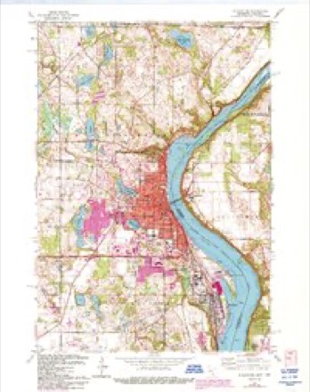
10 surveys from 22 printed sheetsMatched by testing this settlement's coordinate against the published boundary of every sheet in the United States Geological Survey's historical collection. Each opens the scanned sheet at the Survey.
- 1948 USGS Stillwater quadrangle1:62500, 2 printings
- 1949 USGS Stillwater quadrangle1:62500, 2 printings
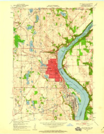
- 1951 USGS Stillwater quadrangle1:24000, 4 printings
- 1953 USGS Stillwater quadrangle1:250000
- 1955 USGS Stillwater quadrangle1:250000
- 1958 USGS Stillwater quadrangle1:250000, 2 printings
- 1965 USGS Stillwater quadrangle1:250000
- 1967 USGS Stillwater quadrangle1:24000, 5 printings
- 1975 USGS Stillwater quadrangle1:250000, 2 printings
- 1985 USGS Stillwater quadrangle1:100000, 2 printings
In the county-history sources
37,980 words on this townshipHistory of Washington County and the St. Croix Valley Including the Explorers and Pioneers of Minnesota, published 1881 names this settlement in its chapter on Stillwater City. These are the passages that mention it, exactly as the scans read.
It is drained by Lake St. Croix, which washes its entire eastern shore from north to south; its average width is about three-quarters of a mile, with a curve in it opposite South Stillwater. From this curve extends a bay into the land, run¬ ning north-westerly about half a mile. The narrow neck or point of land extending between the bay and main lake, is known as Kittson's^ Point. It is covered with a thin growth of oak. On section three are some fine springs, from which flows a small creek, which, extending in a south-eastern direction, and called Perro creek, ^ enters the lake on section 11. The water of this creek is conducted through a race for some distance, supplying the power which runs the Baytown flour-mill. In the western part of the_ town, located on sections 7 and 8 is a fine lake, % covering about fifty acres, called McDonald's lake, in honor of R. McDonald, one of the oldest settlers in that part of town..
Passage source: History of Washington County and the St. Croix Valley Including the Explorers and Pioneers of Minnesota, published 1881.
Annual town meeting called at school-house No. 14, Marchllth, 1873, Charles 13. Fisk, in the chair. Voted a tax of three mills for current ex¬ penses; elected A. Secrest, J. Whalen and E. Mackey, supervisors; David Cover, clerk. The question of license was again voted on, with one for and twenty-seven against. Annual town meeting called at the school-house in South Still¬ water, March 9th, 1875. Voted to authorize the treasurer to transfer the bounty money in hand, to the road fund; voted a tax of one mill for cur¬ rent expenses; voted two mills for road purposes: elected J. Whalen, A. Secrest and Joseph Perro, supervisors; David Cover, clerk. Annual town meeting was called at the school house, in South Stillwater, Murch 14th, 1876, O. R. Buckman in the chair. Voted a tax of one mill for current expenses, and one and a quarter mills for road purposes; elected J. Whalen, A. Forbes and Joseph Perro, supervisors. Annual town meet¬ ing was called at the old school-house, in South Stillwater, March 13th, 1877, A. W. Smith in the chair. Voted a tax of one and a half mills for current expenses, and two mills for roads; elected J. Whalen, Frederick Albrecht and William Pea¬ body, supervisors. Annual town meeting was called at the old school-house, in South Still¬ water, March 12th, 1878, A. Secrest in the chair. Voted a tax of two mills for roads and one and a half for current expenses; elected A. Secrest, J. Whalen and F. Albrecht, supervisors; 104 votes against license and forty-two for it. Annual town meeting was called at the old school-house, in South Stillwater, March 11th, 1879, Edward Mackey in the chair. Voted a tax of two mills for roads and one and a half for current expenses; elected A. Secrest, F. Albrecht and J. Whalen, supervisors. A vote of sixty-six against license and thirty-two for it. Annual town meeting was called at the old school-house, in South Still¬ water, March 9th, 1880, T. B. Ilopkins in the chair. Voted a tax of two and a quarter mills for roads and one and a quarter for current ex¬ penses; sixty-four votes against license and thirty
Passage source: History of Washington County and the St. Croix Valley Including the Explorers and Pioneers of Minnesota, published 1881.
A spirit of patriotism was manifested by the people of Baytown during the great struggle to suppress the retiellion and hold the union of states intact. At the call for men and means, they re¬ sponded with alacrity. The first call was promptly met. At the second call, a draft was permitted, and the following names were drafted: Ambrose Secrest, David Cover, J. B. II. Mitchell, Nicholas Snell, Luther Cobb, Aaron Garrison, Alexander Underwood. All were men of years, and, with a single exception, having families de¬ pendent upon them, and yielding to the dictates of a noble consanguinity, they all furnished sub¬ stitutes. At the next call the town made ample provision, by calling a special meeting of the voters of the town at the Oak Park school-house, August lltli, 1864, to take steps to raise all the funds necessary to pay bounties to men to fill the quota; they promptly voted to raise $3,000 for that purpose. It was also voted to circulate a paper for subscriptions to said fund, and that the monies be paid into the hands of David Cover, town treasurer. Also at the annual town meeting held at South Stillwater August 4th, 1865, a tax of $2,700 was voted to be levied upon the taxable property of the town, for 1865, to apply on town bonds and the money to be used to pay volunteers. A special meeting was called at the school-house in Oak Park, June 24th, 1865, and the following resolution was passed :
Passage source: History of Washington County and the St. Croix Valley Including the Explorers and Pioneers of Minnesota, published 1881.
Machine-read from a century-old scan, so expect the errors a machine makes: misspelled names, dropped words, stray characters.
Read the whole chapter on Stillwater City - it names this place 162 more 162 times.
Fires near this place
10 since 2000Regional context, not property-specific evidence. The federal wildfire occurrence database lists 10 fires within 5 miles of Stillwater between 2000 and 2020, burning about 48 acres in total. None started naturally. 1 was recorded as arson. Distance is straight-line from the map coordinates, so a fire counted here may appear on a neighbouring settlement's page as well.
| Reported cause | Fires |
|---|---|
| Debris and open burning | 4 |
| Equipment and vehicle use | 1 |
| Missing data/not specified/undetermined | 1 |
| Recreation and ceremony | 1 |
| Arson/incendiarism | 1 |
| Misuse of fire by a minor | 1 |
| Railroad operations and maintenance | 1 |
The most recent of them, most recent first, with the day each was reported and the service that recorded it.
| Date | Cause | Size | Reported by | Name on the report |
|---|---|---|---|---|
| 18 September 2000 | Arson/incendiarism | under an acre | Saint Croix National Scenic River | HECKOFADAY |
| 8 May 2017 | Recreation and ceremony | 6.5 acres | Minnesota Department of Natural Resources | not named |
| 4 May 2018 | Missing data/not specified/undetermined | under an acre | Wisconsin Department of Natural Resources | 46 |
| 30 April 2007 | Debris and open burning | under an acre | Minnesota Department of Natural Resources | not named |
| 28 April 2003 | Railroad operations and maintenance | 2.0 acres | Minnesota Department of Natural Resources | not named |
| 19 April 2020 | Equipment and vehicle use | 17 acres | Minnesota Department of Natural Resources | not named |
| 14 March 2015 | Debris and open burning | 14 acres | Minnesota Department of Natural Resources | not named |
| 9 October 2020 | Misuse of fire by a minor | 1.0 acres | Wisconsin Department of Natural Resources | 20337 |
Settlements close enough to share some of these fires:
Mines and quarries near this place
10 of 22 shownRegional context, not property-specific evidence. The federal mineral resources record lists 22 workings within 5 miles of Stillwater: 12 occurrences, 5 producers, 5 past producers. 5 still produce. What was taken out: Sand and Gravel, Construction, Stone, Crushed/Broken. Distance is straight-line from the map coordinates, so a quarry counted here may appear on a neighbouring settlement's page as well.
| Where | Site | Commodity | Status | Recorded |
|---|---|---|---|---|
| Moelter Quarry | Stone, Crushed/Broken | Producer | ||
| Moelter Quarry and Mill | Stone, Crushed/Broken | Producer | ||
| Houlton Gravel Deposit | Sand and Gravel, Construction | Occurrence | ||
| Houlton Gravel Pit | Sand and Gravel, Construction | Past Producer | ||
| North Hudson Gravel Pit | Sand and Gravel, Construction | Past Producer | ||
| North Hudson Sand Pit | Sand and Gravel, Construction | Past Producer | ||
| Pete Miller Pit No 2 | Sand and Gravel, Construction | Producer | ||
| Pete Miller Pit and Mill No 1 | Sand and Gravel, Construction | Producer | ||
| Pete Miller's Highway 94 Pit | Sand and Gravel, Construction | Producer | ||
| St. Croix River Gravel Deposit | Sand and Gravel, Construction | Occurrence |
Storms near this place
35 since 1994Regional context, not property-specific evidence. The National Weather Service names Stillwater in 35 storm reports between 1994 and 2025: 16 thunderstorm wind, 12 hail, 3 lightning, 2 heavy rain. The reports record 1 death and 2 injuries. Each account below is quoted exactly as the forecast office filed it, from the NOAA Storm Events Database, and each date opens the federal record of that event.
| When | Event | Place named | Harm | What the report says |
|---|---|---|---|---|
| July 2009 | Lightning | Stillwater | 1 killed | A 14 year old girl was struck by lightning as she played under a tree during a thunderstorm. She later died at a hospital from her injuries. |
| April 1994 | Tornado (F2) | Stillwater | 1 hurt, $5,000,000 | Strong thunderstorm winds blew down several trees and damaged a home in Maplewood. Several trees were blown down in the Lake Elmo area. A tornado touched down west of Stillwater and caused an estimated $3 million damage to 17 homes. Ten of the homes were severely damaged and a 3-year-boy was injured by flying debris. |
| July 2005 | Thunderstorm Wind | Stillwater | 1 hurt | Many trees, a light pole, and 6 power lines were downed. A woman riding her bike at Lowell Park along the St. Croix River just south of the historic Stillwater Lift Bridge sustained a serious arm injury when a tree crashed down and pinned her to the ground. Several outdoor event tents nearby were blown into the St. Croix River. |
| June 1998 | Thunderstorm Wind | Stillwater | $1,000,000 | Marina damaged. Pier broke lose from shore with 25 boats, some still occupied. Two other piers heavily damaged. Wind damage also reported in Oak Park Heights, Lake Elmo and Oakdale. Large tree limbs and power lines down. |
| July 2005 | Lightning | Stillwater | $250,000 | A home on Penfield Avenue North in Stillwater Township was struck by lightning and caught fire. The blaze caused $250,000 damage to the structure. Another home on Ozark Avenue North in May Township was damaged by a lightning strike. The time was estimated. |
| August 1999 | Lightning | Stillwater | $20,000 | Lightning strike fried radio, phone, and computer systems at City Hall. |
| June 2012 | Thunderstorm Wind | Stillwater | $5,000 | Several trees and power lines were blown down in the area. |
| June 2016 | Heavy Rain | Stillwater | - | A rainfall report of 2.89 inches occurred southeast of Stillwater in less than 6 hours. |
| June 2016 | Heavy Rain | Stillwater | - | A rainfall report of 3.44 inches occurred east of Stillwater in less than 6 hours. |
| June 2013 | Thunderstorm Wind | Stillwater | - | A few trees and power lines were blown down in Stillwater. |
| July 2010 | Thunderstorm Wind | Stillwater | - | Several six inch diameter trees were blown down north of Stillwater, Minnesota. |
| July 2008 | Thunderstorm Wind | Stillwater | - | Trees and power lines downed. |
| August 2007 | Hail | Stillwater | - | Estimated wind speeds of 50 mph at 845pm LST. No damage reported. |
| October 2006 | Hail | Stillwater | - | Hail occurred near Big Carnelian Lake. |
| June 2005 | Thunderstorm Wind | Stillwater | - | At least 12 trees up to 50 feet tall and 20 inches in diameter were downed in the Norcrest Avenue area. |
| September 2005 | Thunderstorm Wind | Stillwater | - | Numerous trees were downed. |
| September 2004 | Thunderstorm Wind | Stillwater | - | A power line was downed along Highway 96 at Norrel Ave. |
| August 2000 | Thunderstorm Wind | Stillwater | - | Trees and power lines toppled. |
| June 1998 | Thunderstorm Wind | Stillwater | - | Trees down. Estimated windspeed. |
| June 1997 | Thunderstorm Wind | Stillwater | - | Power lines and large branches down. Estimated windspeed. |
| July 1995 | Thunderstorm Wind | Stillwater | - | Large tree limbs down. |
| May 1994 | Thunderstorm Wind | Stillwater | - | A large tree was blown down by strong thunderstorm winds. Hennepin County Brooklyn Park,30,1610CST,,,0,0,?,0,Thunderstorm Winds Several satellite dishes were reported to be blown over. |
| April 2025 | Hail | Stillwater | - | no account filed |
| May 2022 | Hail | Stillwater | - | no account filed |
| June 2012 | Hail | Stillwater | - | no account filed |
| June 2012 | Hail | Stillwater | - | no account filed |
| October 2006 | Hail | Stillwater | - | no account filed |
| June 2001 | Hail | Stillwater | - | no account filed |
| July 1999 | Hail | Stillwater | - | no account filed |
| June 1999 | Funnel Cloud | Stillwater | - | no account filed |
| March 1998 | Hail | Stillwater | - | no account filed |
| May 1996 | Hail | Stillwater | - | no account filed |
| May 1996 | Hail | Stillwater | - | no account filed |
| August 1996 | Thunderstorm Wind | Stillwater | - | no account filed |
| July 1994 | Thunderstorm Wind | Stillwater | - | no account filed |
Nearest settlements
The eight closest, with where each one stands in the county. Distances are straight-line, computed from the Geographic Names Information System coordinates.
| Map | Place | Distance | Sheets |
|---|---|---|---|
| Oak Park Heights | 1.9 miles | 22 | |
| Bayport | 2.8 miles | 22 | |
| Siegel | 2.8 miles | 22 | |
| Carnelian Junction | 4.9 miles | 22 | |
| Arcola | 5.1 miles | 22 | |
| Duluth Junction | 5.2 miles | 21 | |
| Lake Elmo | 5.7 miles | 17 | |
| Grant | 5.9 miles | 21 |
Elsewhere
Matched on this settlement's Geographic Names Information System number rather than its name, so it cannot be a different place of the same name in another state.
| Wikipedia article on Stillwater | An encyclopaedic summary. Its text is share-alike, so it is linked here rather than copied. |
| Wikidata item Q862658 | The structured record the population and elevation above come from. Public domain (CC0). |
Provenance
This settlement is recorded in the Geographic Names Information System as feature 652642. The sheet list is computed by point-in-boundary test against the United States Geological Survey's historical topographic inventory. Both are works of the United States government and carry no copyright under 17 U.S.C. 105.
Wildfire. Short, Karen C. 2022. Spatial wildfire occurrence data for the United States, 1992-2020 [FPA_FOD_20221014]. 6th Edition. Fort Collins, CO: Forest Service Research Data Archive. https://doi.org/10.2737/RDS-2013-0009.6 Collected with United States Government funding and usable without additional permissions or fees.
Mines and quarries. USGS Mineral Resources Data System (MRDS) https://mrdata.usgs.gov/mrds/ A work of the United States government, no copyright under 17 U.S.C. 105.
Storms. NOAA National Centers for Environmental Information, Storm Events Database https://www.ncei.noaa.gov/stormevents/ A work of the United States government, no copyright under 17 U.S.C. 105. Narratives are quoted verbatim from the National Weather Service report and are not edited or summarised.