 Block
Wacouta, Minnesota
16 topographic sheets cover this place, the earliest surveyed in 1940 and the latest in 1990. It stands in Wacouta Township. It lies in ZIP code area 55066. It stands on Bullard Creek. The Survey maps it on the Bay City quadrangle.
On record in Wacouta
Buildings and businesses the archive holds for this place. Each opens its own page, with the source record it came from.
On the National Register within a mile 1 record
The National Register names another town for these. They stand within one mile of this settlement's coordinate.
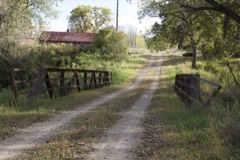 Bridge No. 12listed 1989 · 0.3 miles away
Topographic sheets covering this place
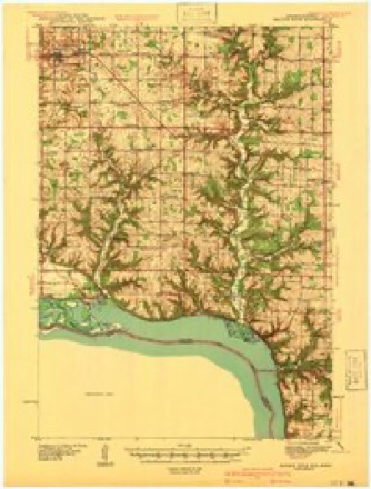
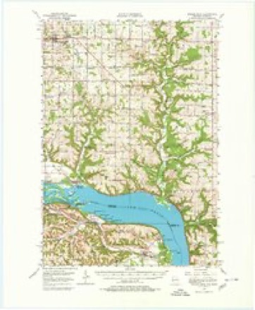
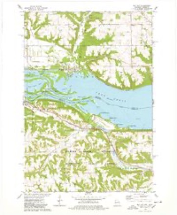
9 surveys from 16 printed sheetsMatched by testing this settlement's coordinate against the published boundary of every sheet in the United States Geological Survey's historical collection. Each opens the scanned sheet at the Survey.
- 1940 USGS Maiden Rock quadrangle1:62500, 2 printings
- 1950 USGS Maiden Rock quadrangle1:62500, 4 printings
- 1953 USGS Saint Paul quadrangle1:250000, 3 printings
- 1953 USGS St. Paul quadrangle1:250000
- 1959 USGS Saint Paul quadrangle1:250000
- 1959 USGS St. Paul quadrangle1:250000
- 1974 USGS Bay City quadrangle1:24000, 2 printings
- 1985 USGS Hastings quadrangle1:100000
- 1990 USGS Hastings quadrangle1:100000




In the county-history sources
1,208 words on this townshipGoodhue County, Minnesota, Past and Present, published 1893 names this settlement in its chapter on Wacouta Township. These are the passages that mention it, exactly as the scans read.
The first settlement was made by George W. Bullard who came in 1850, and with the authority of a license to trade with the Indians began his improve- luents. Abner W. Post came soon after and built the first house for Mr. Bullard. Post and Bullard put up a saw-mill and began the manufacture of lumber in 1853. Several families came and settled here about that time. A town site was surveyed and platted; building lots put on the market with some expectation of a future city. As early as 1854 hotels were built by Daniel Sanders and J. B. Smith ; both were well patronized, as a large number of men were employed in the lumber business. Rafting logs, which wei'^e from the pineries further north, was done here at that time. Wacouta contended with the village of Red Wing for the location of the county seat. It continued a busy and growing place up to the breaking out of the civil war.
Passage source: Goodhue County, Minnesota, Past and Present, published 1893.
Mrs. Julia B. Nelson, a well known lecturer and platform speaker, was for several years a resident of Wacouta. She was the first person in Goodhue county who took a first grade teacher's certificate. After teaching in the country a few years, she married Mr. Ole Nelson, who had just returned from the war, depleted in health. In about two years she was left a widow, and also bereft of her only child. She thenceforth dedicated her life to the cause of humanity ; was for several years teaching among the freedmen in the South. A few facts of her early history will be interesting to the reader, as related by herself at a meeting of the old settlers in Lake Pepin valley :
Passage source: Goodhue County, Minnesota, Past and Present, published 1893.
One darkish night in the June of 1857, the steamer Henry Clay landed at the town of Wacouta and from that boat stepped my father, Edward BuUard, who had been down the river and brought back with him some horses, some cattle, and two awkward school girls, one of whom was myself. Although it was late at night, I saw a good many lights in the darkness, and thought I had really come to town. Passing to my new home, I
Passage source: Goodhue County, Minnesota, Past and Present, published 1893.
Machine-read from a century-old scan, so expect the errors a machine makes: misspelled names, dropped words, stray characters.
Read the whole chapter on Wacouta Township - it names this place 1 more 1 time.
Fires near this place
12 since 1992Regional context, not property-specific evidence. The federal wildfire occurrence database lists 12 fires within 5 miles of Wacouta between 1992 and 2020, burning about 63 acres in total. None started naturally. 1 was recorded as arson. Distance is straight-line from the map coordinates, so a fire counted here may appear on a neighbouring settlement's page as well.
| Reported cause | Fires |
|---|---|
| Debris and open burning | 3 |
| Missing data/not specified/undetermined | 3 |
| Railroad operations and maintenance | 2 |
| Smoking | 1 |
| Recreation and ceremony | 1 |
| Equipment and vehicle use | 1 |
| Arson/incendiarism | 1 |
The most recent of them, most recent first, with the day each was reported and the service that recorded it.
| Date | Cause | Size | Reported by | Name on the report |
|---|---|---|---|---|
| 23 September 2012 | Debris and open burning | under an acre | Minnesota Department of Natural Resources | not named |
| 7 May 2018 | Recreation and ceremony | 5.5 acres | Minnesota Department of Natural Resources | not named |
| 3 May 1992 | Arson/incendiarism | under an acre | Minnesota Department of Natural Resources | not named |
| 2 May 1995 | Smoking | under an acre | Minnesota Department of Natural Resources | not named |
| 24 April 2019 | Missing data/not specified/undetermined | under an acre | Minnesota Department of Natural Resources | not named |
| 14 April 1998 | Debris and open burning | 9.0 acres | Minnesota Department of Natural Resources | not named |
| 30 March 2010 | Railroad operations and maintenance | 10 acres | Minnesota Department of Natural Resources | not named |
| 21 March 1994 | Railroad operations and maintenance | 1.0 acres | Minnesota Department of Natural Resources | not named |
Settlements close enough to share some of these fires:
Mines and quarries near this place
10 of 12 shownRegional context, not property-specific evidence. The federal mineral resources record lists 12 workings within 5 miles of Wacouta: 6 producers, 3 past producers, 3 occurrences. 6 still produce. What was taken out: Sand and Gravel, Construction, Clay, Silica, Stone, Crushed/Broken. Distance is straight-line from the map coordinates, so a quarry counted here may appear on a neighbouring settlement's page as well.
| Where | Site | Commodity | Status | Recorded |
|---|---|---|---|---|
| Bay City Limestone Deposit | Stone, Crushed/Broken | Occurrence | ||
| Bay City Sand Co Bay City Mine | Silica | Producer | ||
| Red Wing Sewer Pipe Clay Pit No 1 | Clay | Past Producer | ||
| Frontenac Mill | Sand and Gravel, Construction | Producer | ||
| Funk Sand and Gravel Pit | Sand and Gravel, Construction | Past Producer | ||
| Possell Pit | Sand and Gravel, Construction | Past Producer | ||
| Red Wing Pit | Sand and Gravel, Construction | Producer | ||
| Red Wing Ready Mix Mill | Sand and Gravel, Construction | Producer | ||
| Red Wing Ready Mix Pit | Sand and Gravel, Construction | Producer | ||
| Steffen Hagen Pit & Mill | Sand and Gravel, Construction | Producer |
Storms near this place
7 since 2008Regional context, not property-specific evidence. The National Weather Service names Wacouta in 7 storm reports between 2008 and 2026: 4 thunderstorm wind, 3 hail. No death or injury is recorded in these reports. Each account below is quoted exactly as the forecast office filed it, from the NOAA Storm Events Database, and each date opens the federal record of that event.
| When | Event | Place named | Harm | What the report says |
|---|---|---|---|---|
| May 2014 | Thunderstorm Wind | Wacouta | $75,000 | Substantial damage occurred to a home south of Red Wing, east of the intersection of County Road 5, and Highway 58. The roof of the home was blown off to the north with debris noted across County Road 5. |
| June 2013 | Thunderstorm Wind | Wacouta | - | A large tree was blown down on County Road 5. |
| May 2013 | Thunderstorm Wind | Wacouta | - | A few trees were blown down southwest of Red Wing, Minnesota. |
| July 2011 | Thunderstorm Wind | Wacouta | - | A large tree blew down east of Red Wing, Minnesota. |
| July 2008 | Hail | Wacouta | - | Nickel sized hail covered the ground at the Red Wing High School. |
| April 2026 | Hail | Wacouta | - | no account filed |
| April 2026 | Hail | Wacouta | - | no account filed |
Nearest settlements
The eight closest, with where each one stands in the county. Distances are straight-line, computed from the Geographic Names Information System coordinates.
| Map | Place | Distance | Sheets |
|---|---|---|---|
| Wacouta Beach | 1.3 miles | 16 | |
| Frontenac | 4.8 miles | 15 | |
| Red Wing | 5.4 miles | 15 | |
| Old Frontenac | 5.6 miles | 15 | |
| Hay Creek | 6.8 miles | 11 | |
| Belvidere Mills | 7.5 miles | 11 | |
| Harliss | 12.0 miles | 15 | |
| Claybank | 12.6 miles | 10 |
Provenance
This settlement is recorded in the Geographic Names Information System as feature 653706. The sheet list is computed by point-in-boundary test against the United States Geological Survey's historical topographic inventory. Both are works of the United States government and carry no copyright under 17 U.S.C. 105.
Wildfire. Short, Karen C. 2022. Spatial wildfire occurrence data for the United States, 1992-2020 [FPA_FOD_20221014]. 6th Edition. Fort Collins, CO: Forest Service Research Data Archive. https://doi.org/10.2737/RDS-2013-0009.6 Collected with United States Government funding and usable without additional permissions or fees.
Mines and quarries. USGS Mineral Resources Data System (MRDS) https://mrdata.usgs.gov/mrds/ A work of the United States government, no copyright under 17 U.S.C. 105.
Storms. NOAA National Centers for Environmental Information, Storm Events Database https://www.ncei.noaa.gov/stormevents/ A work of the United States government, no copyright under 17 U.S.C. 105. Narratives are quoted verbatim from the National Weather Service report and are not edited or summarised.