 Block
Westbrook, Minnesota
10 topographic sheets cover this place, the earliest surveyed in 1953 and the latest in 1986. It stands in Westbrook City. It lies in ZIP code area 56183. The Survey maps it on the Westbrook quadrangle. 758 people lived here at the 2020 count. It stands 1,427 feet above sea level.
On record in Westbrook
Buildings and businesses the archive holds for this place. Each opens its own page, with the source record it came from.
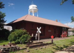
On the National Register 1 record
Population over time
2 figuresWestbrook grew from 739 to 758 between 2010 and 2020. These are the recorded population figures Wikidata holds for this place, reached through the Geographic Names Information System number this page is keyed on rather than by name, so they belong to this place and not to another of the same name. Most are census counts, but not all are: an early figure may be a founding or settlement estimate, and an estimate published within five years of a census is left out. The change column is computed, and is left blank where more than 20 years separate a figure from the one before it, because a gap that long is not a change between two counts.
| Year | People | Change |
|---|---|---|
| 2010 | 739 | |
| 2020 | 758 | +19 (+3%) |
Topographic sheets covering this place
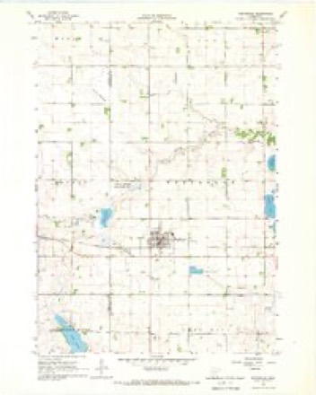
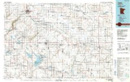
6 surveys from 10 printed sheetsMatched by testing this settlement's coordinate against the published boundary of every sheet in the United States Geological Survey's historical collection. Each opens the scanned sheet at the Survey.
- 1953 USGS New Ulm quadrangle1:250000, 3 printings
- 1957 USGS New Ulm quadrangle1:250000
- 1958 USGS New Ulm quadrangle1:250000
- 1967 USGS New Ulm quadrangle1:250000
- 1967 USGS Westbrook quadrangle1:24000, 2 printings
- 1986 USGS Tracy quadrangle1:100000, 2 printings




Storms near this place
60 of 68 shownRegional context, not property-specific evidence. The National Weather Service names Westbrook in 68 storm reports between 1997 and 2024: 21 flood, 20 thunderstorm wind, 17 hail, 5 flash flood. The reports record 3 injuries. Each account below is quoted exactly as the forecast office filed it, from the NOAA Storm Events Database, and each date opens the federal record of that event.
| When | Event | Place named | Harm | What the report says |
|---|---|---|---|---|
| March 1998 | Tornado (F3) | Westbrook | 3 hurt, $30,000,000 | no account filed |
| June 2024 | Flood | Westbrook | $20,700,000 | Rainfall amounts across Cottonwood County from June 20-22 ranged from 6 to 9 inches. Overland flooding ensued with additional major to record flooding along the West Fork Des Moines River.||County-wide, there were significant impacts to personal property with an estimated 1,000 plus homes affected by flood waters. Five homes were declared destroyed and approximately 50 that received major damage. Fifty-two individuals were displaced at peak flooding. A voluntary evacuation order was issued for parts of Windom due to rising waters along the West Fork Des Moines River. Flood waters spared most businesses, but 7 in-home daycares had to close for some amount of time. Damage to private homes and businesses is estimated to be 18 million dollars. ||There was also significant damage to public infrastructure. Numerous county and township roads succumbed to gravel wash. Two bridge abutments required emergency repair. In Windom, State Highway 62 was closed for roughly a week and State Highway 60/U.S. Highway 71 was closed for 3 days. Flood waters also damaged numerous parks and inundated the Windom swimming pool. Preliminary damage assessments estimate loss to public infrastructure to be 2.7 million dollars. ||For additional information on river flooding, please see other flood entries for Cottonwood County. |
| April 2004 | Thunderstorm Wind | Westbrook | $500,000 | Thunderstorm winds blew the roof off a barn and destroyed a machine shed. Two cars, a combine, and a field sprayer in the machine shed were damaged. The winds destroyed a barn on another farm, damaging a tractor and a van inside. The winds blew over a sign anchored in cement, with two tractors being damaged when the sign fell on them. Widespread tree and power line damage was also reported. |
| March 2019 | Flood | Westbrook | $172,000 | Flooding of numerous county and township roads resulted in damage to road beds and culverts. Several towns reported street flooding and water impacting lower and poor drainage areas. The property damage costs include estimates for public property losses. |
| August 2005 | Thunderstorm Wind | Westbrook | $100,000 | Thunderstorm winds blew off the roof of an apartment building, and damaged buildings at a lumber yard and at a school bus yard. The winds also caused widespread tree damage, including several trees uprooted. |
| June 1997 | Thunderstorm Wind | Westbrook | $100,000 | no account filed |
| June 2014 | Flood | Westbrook | $50,000 | Persistent moderate to heavy rain caused flooding of fields and other lowlands, including several roads, homes, and businesses. This flooding lasted for two days, and was aggravated locally by additional storms during that time. Some roads were damaged or washed out. |
| April 2004 | Thunderstorm Wind | Westbrook | $50,000 | Thunderstorm winds caused tree damage, including several trees blown down. The winds also blew down power lines. |
| August 2000 | Thunderstorm Wind | Westbrook | $50,000 | Thunderstorm winds tore the roof off a garage and concession stand at a high school football field, and damaged the scoreboard, bleachers, and the baseball dugout at the school. |
| May 2004 | Thunderstorm Wind | Westbrook | $30,000 | Thunderstorm winds caused tree damage, including numerous trees blown down. One pine tree penetrated the roof of a house. The house suffered other wind damage, including to the porch. The garage was heavily damaged and farm equipment was damaged. |
| August 2021 | Thunderstorm Wind | Westbrook | $20,000 | Thunderstorm winds damaged a grain bin one-half mile south of Westbrook, and an old barn 1 mile south of Westbrook. Property damage costs are a rough estimate. |
| August 2000 | Hail | Westbrook | $20,000 | Large hail broke windows in two school busses and a few other vehicles. |
| June 1997 | Thunderstorm Wind | Westbrook | $20,000 | no account filed |
| September 2019 | Flood | Westbrook | $10,000 | After excessive two-day rainfall during September 10-12 (5.35 inches at Slayton), the West Fork of the Des Moines River near Avoca (gage site AVOM5) reached the third highest stage on record of 2.71 feet above flood stage on September 16. Significant agricultural land was flooded, with numerous county roads under water. |
| August 2002 | Thunderstorm Wind | Westbrook | $10,000 | Thunderstorm winds caused tree damage, including many branches down. The winds also blew down power lines. |
| June 2002 | Lightning | Westbrook | $5,000 | Lightning damaged electronic equipment at a grain elevator, and stripped a large part of the bark from a tree. |
| July 2004 | Lightning | Westbrook | $3,000 | Lightning struck and destroyed a large tree. The lightning also damaged a computer and a television set in the adjoining house. |
| July 2024 | Flood | Westbrook | - | Flooding continued from June on the Des Moines River near Avoca, with declining river levels. The river fell below flood stage on the morning of July 8th. |
| June 2024 | Flood | Westbrook | - | The West Fork of the Des Moines River near Avoca rose above flood stage the morning of June 21st, cresting around 4.64 feet above flood stage (1429.64 feet) on June 24th. This crest is in the Major Stage. The river stayed above flood stage into July. For a more comprehensive description of flood damage, please see other entries for Cottonwood County. |
| April 2023 | Flood | Westbrook | - | The West Fork of the Des Moines River near Avoca, MN rose above flood stage on the afternoon of April 12th before cresting around 0.67 feet above flood stage (1425.67 feet) on April 15th. The river then fell below flood stage on the morning of April 17th. |
| July 2023 | Hail | Westbrook | - | Crop damage is an estimate from insured losses. Information provided by the United States Department of Agriculture. |
| August 2023 | Thunderstorm Wind | Westbrook | - | Numerous small branches up to 2 inches in diameter were broken off by thunderstorm wind gusts. |
| October 2023 | Hail | Westbrook | - | Ground was covered by various sizes of hail up to quarter size. Crop damage is an estimate from insured losses. Information provided by the United States Department of Agriculture. |
| May 2022 | Thunderstorm Wind | Westbrook | - | Thunderstorm winds lofted two corn cribs onto adjacent bins, as well as snapped a large pine tree. |
| May 2022 | Thunderstorm Wind | Westbrook | - | Thunderstorm winds blew out part of a hoop barn, damaged fencing, and damaged a portion of the roof on a home. |
| May 2022 | Thunderstorm Wind | Westbrook | - | A 20 foot by 60 foot cattle barn, which was open to the south, was lofted to the north and destroyed. |
| July 2022 | Flash Flood | Westbrook | - | County Road 7 was flooded by over a foot of flowing water one mile north of County Road 11. |
| May 2022 | Tornado (EF0) | Westbrook | - | This tornado formed 5 miles east-northeast of Fulda in Murray County, and entered Cottonwood County around 6 miles south-southwest of Westbrook. The tornado tracked northeast over open fields for less than a minute before dissipating. While in Murray County, it was rated EF1, but was rated EFU in Cottonwood County. Average path width in Cottonwood County was 50 yards. |
| August 2021 | Hail | Westbrook | - | Dime to quarter sized hail was falling at the intersection of County Road 7 and County Road 13. |
| August 2021 | Thunderstorm Wind | Westbrook | - | A narrow path of crop damage, possibly related to a miso vortex within a broader wind field, was identified using Sentinel satellite imagery. |
| August 2021 | Thunderstorm Wind | Westbrook | - | Thunderstorm winds caused damage to the Westbrook Lumber building. |
| August 2021 | Thunderstorm Wind | Westbrook | - | Numerous trees were downed across County Highway 7. |
| March 2020 | Flood | Westbrook | - | The West Fork of the Des Moines River near Avoca (gage site AVOM5) rose above flood stage on March 4, and crested 1.71 feet above flood stage on March 6. A significant amount of agricultural land was flooded. |
| June 2019 | Flood | Westbrook | - | During crop planting season, prolonged flooding led to the loss of or inability to plant crops across the area. Crop loss estimates provided by the United States Department of Agriculture. |
| June 2019 | Flood | Westbrook | - | A continuation of flooding from May, the West Des Moines River near Avoca (gage site AVOM5) began the month at 0.87 feet above flood stage. Significant amounts of agricultural land remained flooded, and further impeded spring planting. |
| May 2019 | Flood | Westbrook | - | The Des Moines River near Avoca (gage site AVOM5) reached a peak of 0.97 feet above flood stage on May 31. The main impact was inundation of agricultural land and additional delays to spring planting in the flood plain. Minor flooding continued at the end of the month. |
| May 2019 | Flood | Westbrook | - | This is a continuation of flooding from April. The Des Moines River near Avoca (gage site AVOM5) had an early month crest at 1.04 feet above flood stage on May 1, before falling below flood stage on May 13. Significant agricultural flooding persisted, with no opportunity for spring planting throughout the flood plain. |
| March 2019 | Flood | Westbrook | - | Snow melt and heavy rainfall (measured 1.50 inches at Tracy and 1.15 inches at Windom) resulted in significant flooding of agricultural lands. County Roads 6 and 44 were inundated with flood water for several days. The Des Moines River near Avoca (gage site AVOM5) reached the second highest stage on record cresting 3.56 feet above flood stage on March 16. The river remained in moderate flood stage at the end of the month. |
| September 2019 | Flood | Westbrook | - | Flooding resulted in crop losses across the area. Crop loss estimates provided by the United States Department of Agriculture. |
| April 2019 | Flood | Westbrook | - | Runoff from occasional precipitation in late March and April maintained significant flooding of agricultural and pasture lands near the Des Moines River. The Des Moines River near Avoca (gage site AVOM5) crested twice at moderate flood stage during the month. The first crest was at 2.14 feet above flood stage on April 1. The second crest occurred on April 19 at 2.53 feet above flood stage. Moderate flooding continued at the end of the month. |
| June 2018 | Flood | Westbrook | - | A week of periodic heavy rainfall ending June 26 resulted in a widespread 4 to 8 inches of rainfall, much of which occurred on June 20 and 24. Weekly rainfall totals included 7.30 inches at Lake Wilson and 5.60 inches at Windom. Moderate flooding occurred with significant amounts of crop and pasture land inundated, as well as numerous township and county roads, as the Des Moines River near Avoca (gage site AVOM5) crested 3.9 feet above flood stage on June 27. The river remained in moderate flood stage at the end of the month. |
| July 2018 | Flash Flood | Westbrook | - | A township road was underwater due to heavy rainfall. Report received by social media. |
| July 2018 | Flood | Westbrook | - | Numerous county and township roads, including county highway 6 and 44 were inundated for almost a week. Significant amounts of crop and pasture land near the Des Moines River were severely impacted by major flooding as river levels climbed to 5.2 feet above flood stage near Avoca (gage site AVOM5) on July 5. |
| September 2018 | Flood | Westbrook | - | Heavy rainfall on September 18-20 brought a widespread 2 to 4 inches of rainfall resulting in minor flooding of agricultural land. The Des Moines River near Avoca (gage site AVOM5) crested 0.7 feet above flood stage at 0500LST on September 25. |
| October 2018 | Flood | Westbrook | - | Low-lying crop and pasture land was inundated as levels on the Des Moines River near Avoca (gage site AVOM5) crested 0.5 feet above flood stage on October 13. |
| June 2017 | Hail | Westbrook | - | Social Media Report. |
| June 2016 | Thunderstorm Wind | Westbrook | - | Thunderstorm winds lifted up a tin roof. |
| August 2015 | Heavy Rain | Westbrook | - | Rainfall of 5.70 inches was reported. |
| August 2015 | Flash Flood | Westbrook | - | Heavy rain of over 5 inches caused a path of water to run up to 3 feet deep over the area. |
| April 2011 | Flood | Westbrook | - | Flooding of lakes and lowlands, including some farmland, continued in the county through April. While flooding of small streams abated, lake and lowland flooding continued with very slow improvement. Several roads remained flooded. High water and groundwater levels resulting from record precipitation in the previous year was the main reason that the flooding either grew worse or improved so slowly. |
| March 2011 | Flood | Westbrook | - | Melting of a heavy winter snow cover caused flooding of the Des Moines River, as well as flooding of lowlands, lakes, and streams. The Des Moines River crested at 2.79 feet above flood stage at Windom on March 25th. There was considerable flooding of farmland. Numerous roads in the county were flooded. Some of the roads were closed, and some were washed out in spots. The flooding onset was rapid for a snow melt flood due to high water and groundwater levels from record precipitation in the year 2010. |
| June 2011 | Flash Flood | Westbrook | - | Heavy rain on saturated ground caused flash flooding of several county roads. |
| June 2005 | Flash Flood | Westbrook | - | Heavy rain caused flooding of streets and low areas. |
| May 2004 | Thunderstorm Wind | Westbrook | - | Thunderstorm winds caused tree damage, including several 6 inch diameter limbs blown down. |
| July 2002 | Thunderstorm Wind | Westbrook | - | Thunderstorm winds blew down tree branches. |
| June 2022 | Hail | Westbrook | - | no account filed |
| May 2014 | Hail | Westbrook | - | no account filed |
| August 2013 | Hail | Westbrook | - | no account filed |
| June 2008 | Hail | Westbrook | - | no account filed |
| June 2008 | Hail | Westbrook | - | no account filed |
Nearest settlements
The eight closest, with where each one stands in the county. Distances are straight-line, computed from the Geographic Names Information System coordinates.
| Map | Place | Distance | Sheets |
|---|---|---|---|
| Storden | 6.2 miles | 9 | |
| Jeffers | 12.7 miles | 10 | |
| Delft | 18.8 miles | 7 | |
| Windom | 20.8 miles | 7 | |
| Bingham Lake | 22.7 miles | 7 | |
| Mountain Lake | 27.8 miles | 7 |
Elsewhere
Matched on this settlement's Geographic Names Information System number rather than its name, so it cannot be a different place of the same name in another state.
| Wikipedia article on Westbrook | An encyclopaedic summary. Its text is share-alike, so it is linked here rather than copied. |
| Wikidata item Q2227746 | The structured record the population and elevation above come from. Public domain (CC0). |
Provenance
This settlement is recorded in the Geographic Names Information System as feature 654028. The sheet list is computed by point-in-boundary test against the United States Geological Survey's historical topographic inventory. Both are works of the United States government and carry no copyright under 17 U.S.C. 105.
Storms. NOAA National Centers for Environmental Information, Storm Events Database https://www.ncei.noaa.gov/stormevents/ A work of the United States government, no copyright under 17 U.S.C. 105. Narratives are quoted verbatim from the National Weather Service report and are not edited or summarised.