 Block
From the record
One of 60 National Register listings published here for Goodhue County · listed in 2000 · category: District.
Sources: the case file at the National Archives · the National Register database, National Park Service
Listed on the National Register of Historic Places in 2000.
One of 60 National Register listings published here for Goodhue County · listed in 2000 · category: District.
Sources: the case file at the National Archives · the National Register database, National Park Service
The chapter on Holden Township in History of Goodhue County, Including a Sketch of the Territory and State of Minnesota; Together with an Account of the Early French Discoveries, Indian Massacres, the Part Borne by Minnesota's Patriots in the War of the Great Rebellion, and a Full and Complete History of the County from the Time of Its Occupancy by Swiss Missionaries in 1838. Pioneer Incidents, Biographical Sketches of Early and Prominent Settlers and Representative Men, and of Its Cities, Towns, Churches, Schools, Secret Societies, Etc, published 1878 names Holden. This is what it says, exactly as the scans read.
In the fall of 1854 Jens Ottun made a claim and built a sod hut on section 33, where he in the month of May, 1855, commenced breaking, and at the same time the building of a log cabin ; but on the 27th of the same month A. K. Finseth, K. K. Finseth, H. K. Finseth and Ole J. Bakke arrived at the claim of Mr. Ottun ; the Finseths bought Mr. Ottun's claim and he returned to Wanamingo township, where he had previously made a claim; thus the Finseths became the first permanent settlers of Holden township, as the two mentioned at the first of this sketch had not yet made a claim.
In the month of June, the same year, Ole O. Huset settled on sec. 23, Halvor Ennerson Vraalstad on sec. 27, and Thorbjorn Ennerson Vraalstad on sec. 35 ; and in Sept., Mrs. T. Ennerson Vraalstad gave birth to the first native-born citizen of the United States, in Holden township.
Machine-read from a century-old scan, so expect the errors a machine makes: misspelled names, dropped words, stray characters.
Read the whole chapter on Holden Township - 2,996 words on its settlement, mills, schools and churches.
Regional context, not property-specific evidence. The federal mineral resources record lists 3 workings within 5 miles of Nansen Agricultural Historic District: 3 producers. All of them still produce. What was taken out: Stone, Crushed/Broken, Sand and Gravel, Construction. Distance is straight-line from the map coordinates, so a quarry counted here may appear on a neighbouring settlement's page as well.
| Where | Site | Commodity | Status | Recorded |
|---|---|---|---|---|
| Anderson Sand & Gravel Pit | Sand and Gravel, Construction | Producer | ||
| County Quarry | Stone, Crushed/Broken | Producer | ||
| Wacobson Quarry | Stone, Crushed/Broken | Producer |
No historic map-sheet match is published for this property yet. That does not mean no map exists. This record needs a coordinate-quality review before it can be joined to a sheet boundary. Browse the county's mapped places while that work is pending.
Other National Register properties close enough to walk or drive between, ordered by distance from this one. Both positions come from the same geocoding pass that matched these properties to their map sheets.
| Photograph | Property | Distance | Listed |
|---|---|---|---|
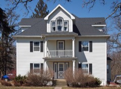 | Holden Lutheran Church Parsonage | 3.8 miles | 1980 |
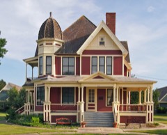 | Martin T. Gunderson House | 6.4 miles | 1975 |
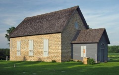 | Hauge Lutheran Church | 7.9 miles | 1980 |
| National Archives record | The nomination case file for reference 00001372 in Record Group 79. |
| Goodhue County | All 60 listed properties in this county. |