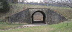
Photograph by Mazzmn at English Wikipedia, Public domain. Via
Wikimedia Commons.
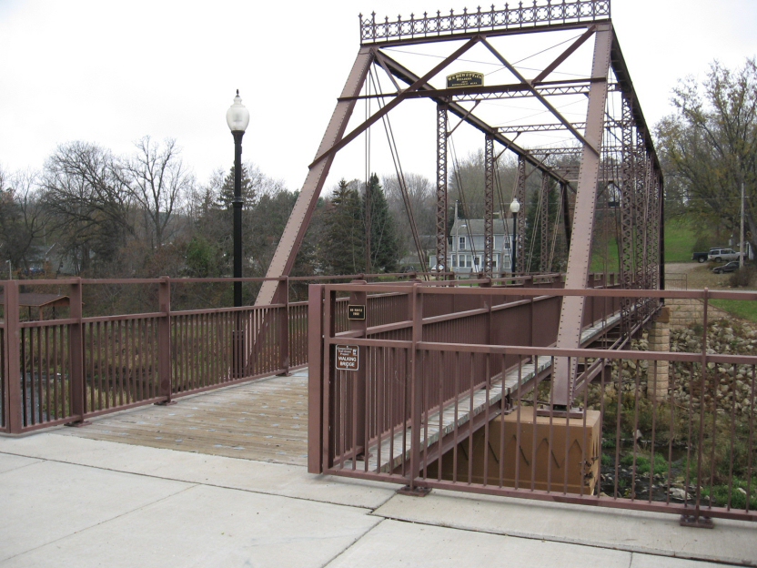
Walnut Street Bridge
Listed on the National Register of Historic Places in 2003.
From the record
“The Walnut Street Bridge is a historic Pratt through truss bridge over the North Fork of the Zumbro River in Mazeppa, Minnesota, United States. It was built as a highway bridge in 1904 but has been restricted to pedestrian use since 1980.”
Wikipedia article Walnut Street Bridge (Mazeppa, Minnesota), CC BY-SA 4.0.
One of 26 National Register listings published here for Wabasha County · listed in 2003 · category: Structure.
National Register reference number.02001705- the number the National Park Service assigned this property when it was listed, and the key its nomination file is catalogued under at the National Archives.
The credit of the first settlement within the limits of this township is unanimously ascribed to Ira O. Seeley, now a prominent citizen of Appleton, this state. It is said that Mr. Seeley visited tlie locality in the fall of 1854, and being pleased with the valley where Mazeppa village now stands, decided to squat upon a claim there, and to that end erected a bark shant}' on the west side of the river, not far from the present site of the milldam. Keturning to "Wabasha for his familj^, he became convinced, on reflection, that the valley of Trout Brook afforded greater advantages for general farming purposes ; so when he came on with his family' next spring he located on section .5, where Daniel Mack now resides. Immediately after Mr. Seeley came Enoch Young, Joseph Fuller and G. C. Sleeper, all making claims on sections 4 and 5. In April of the same year came Joseph Ford and his son, Orville D., and George Maxwell ; the last two named are still residents of the village, where O. D. Ford located at that time. During the same season the following located within the township : Anson L. Carrier, Nelson B. Smith, Turner Preble, Francis A. Stowell, John E. Hyde, Elijah Lont, J. B. Miller, James H. Sandford, Lewis Blunt, George Duncan, Charles Fox, Isaac NichoUs, George Bailey, and possibly others.
The advantages of the water-])ower and town site were at once perceived by the Fords, who made their claims thereon. All of the west half of section 6 lying east and north of the river was by them platted for a village. They offered the water-jjower to Mr. Nicholls if he would build a mill thereon. Tiie offer was at once accepted, and preparations were immediately made for the erection of a sawmill. This was set in operation during the winter, and timbers were at the same time prepared for a gristmill. William Amsbry became associated with Nichols in the construction of the gristmill, and subsequently bought out the latter. Amsbry & Barber completed it and began business in the fall of 1856. They were succeeded by Augustus Ambler, and the latter by the Forest Mills and Mazeppa Mill companies.
Regional context, not property-specific
evidence. The
federal wildfire occurrence database
lists 5 fires within 5 miles of Walnut Street Bridge
between 1995 and 2020, burning about 57 acres in total. None started naturally. None was recorded as arson.
Distance is straight-line from the map coordinates, so a fire counted
here may appear on a neighbouring settlement's page as well.
Reported cause
Fires
Smoking
2
Missing data/not specified/undetermined
1
Debris and open burning
1
Fireworks
1
The most recent of
them, most recent first, with the day each was reported and the service
that recorded it.
Regional context, not property-specific
evidence. The federal mineral resources record lists
3 workings within 5 miles of Walnut Street Bridge: 2 producers, 1 occurrence.
2 still produce. What was taken out: Stone, Crushed/Broken, Silica. Distance is straight-line from the
map coordinates, so a quarry counted here may appear on a neighbouring
settlement's page as well.
Regional context, not property-specific
evidence. The National Weather Service names
Mazeppa, the town this property stands in, in 15 storm reports between 1998 and 2025: 9 thunderstorm wind, 6 hail.
No death or injury is recorded in these reports. Each account below is quoted exactly as the forecast office
filed it, from the NOAA Storm Events Database, and each date
opens the federal record of that event.
No historic map-sheet match is published
for this property yet. That does not mean no map exists. This record needs
a coordinate-quality review before it can be joined to a sheet boundary.
Browse the county's mapped places while that work is
pending.
Listed places nearby
5 within 8 miles
Other National Register properties close
enough to walk or drive between, ordered by distance from this one. Both
positions come from the same geocoding pass that matched these properties
to their map sheets.
Listing record. National Park Service National Register of Historic Places, listed-properties dataset, current to 2026-05-22.
Map join. Address geocoded through the United States Census geocoder, then tested against the published boundary of every sheet in the USGS Historical Topographic Map Collection.
How this page is made. Listing fields come from federal records; map-sheet coverage is a labelled coordinate-to-boundary calculation, not a source-field claim.
Wildfire. Short, Karen C. 2022. Spatial wildfire occurrence data for the United States, 1992-2020 [FPA_FOD_20221014]. 6th Edition. Fort Collins, CO: Forest Service Research Data Archive. https://doi.org/10.2737/RDS-2013-0009.6 Collected with United States Government funding and usable without additional permissions or fees.
Mines and quarries. USGS Mineral Resources Data System (MRDS) https://mrdata.usgs.gov/mrds/ A work of the United States government, no copyright under 17 U.S.C. 105.
Storms. NOAA National Centers for Environmental Information, Storm Events Database https://www.ncei.noaa.gov/stormevents/ A work of the United States government, no copyright under 17 U.S.C. 105. Narratives are quoted verbatim from the National Weather Service report and are not edited or summarised.
 Block