 Block
From the record
One of 10 National Register listings published here for Koochiching County · listed in 2004 · category: Building.
Sources: the case file at the National Archives · the National Register database, National Park Service
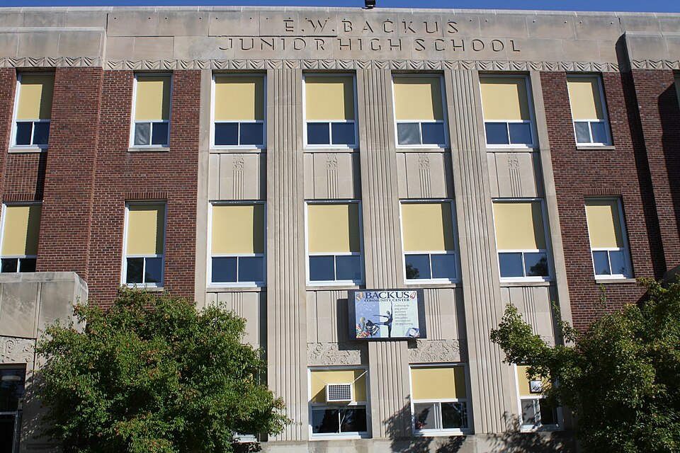
Listed on the National Register of Historic Places in 2004.
One of 10 National Register listings published here for Koochiching County · listed in 2004 · category: Building.
Sources: the case file at the National Archives · the National Register database, National Park Service
Regional context, not property-specific evidence. The federal wildfire occurrence database lists 44 fires within 5 miles of Alexander Baker School and E.W. Backus Junior High School between 1992 and 2019, burning about 71 acres in total. 1 started naturally. 6 were recorded as arson. Distance is straight-line from the map coordinates, so a fire counted here may appear on a neighbouring settlement's page as well.
| Reported cause | Fires |
|---|---|
| Debris and open burning | 18 |
| Arson/incendiarism | 6 |
| Missing data/not specified/undetermined | 6 |
| Railroad operations and maintenance | 5 |
| Smoking | 3 |
| Equipment and vehicle use | 3 |
| Recreation and ceremony | 2 |
| Natural | 1 |
The most recent of them, most recent first, with the day each was reported and the service that recorded it.
| Date | Cause | Size | Reported by | Name on the report |
|---|---|---|---|---|
| 8 September 2006 | Missing data/not specified/undetermined | under an acre | Minnesota Department of Natural Resources | not named |
| 18 September 2012 | Recreation and ceremony | under an acre | Minnesota Department of Natural Resources | not named |
| 24 August 2008 | Debris and open burning | 1.0 acres | Minnesota Department of Natural Resources | not named |
| 2 August 2014 | Debris and open burning | under an acre | Minnesota Department of Natural Resources | not named |
| 15 August 2006 | Natural | under an acre | Minnesota Department of Natural Resources | not named |
| 28 July 1995 | Missing data/not specified/undetermined | 2.5 acres | Minnesota Department of Natural Resources | not named |
| 12 July 2002 | Debris and open burning | under an acre | Minnesota Department of Natural Resources | not named |
| 3 June 2002 | Debris and open burning | under an acre | Minnesota Department of Natural Resources | not named |
Regional context, not property-specific evidence. The federal mineral resources record lists 9 workings within 5 miles of Alexander Baker School and E.W. Backus Junior High School: 9 producers. All of them still produce. What was taken out: Sand and Gravel, Construction, Stone, Crushed/Broken. Distance is straight-line from the map coordinates, so a quarry counted here may appear on a neighbouring settlement's page as well.
| Where | Site | Commodity | Status | Recorded |
|---|---|---|---|---|
| Ranier Quarry | Stone, Crushed/Broken | Producer | ||
| Boise Cascade Pit | Sand and Gravel, Construction | Producer | ||
| County Pit No 1 | Sand and Gravel, Construction | Producer | ||
| International Falls Pit | Sand and Gravel, Construction | Producer | ||
| Kolinski Pit and Mill | Sand and Gravel, Construction | Producer | ||
| Oveson Pit | Sand and Gravel, Construction | Producer | ||
| Peterson Pit | Sand and Gravel, Construction | Producer | ||
| Ranier Gravel Pit | Sand and Gravel, Construction | Producer | ||
| Ranier Pit and Mill | Sand and Gravel, Construction | Producer |
Regional context, not property-specific evidence. The National Weather Service names International Falls, the town this property stands in, in 37 storm reports between 1994 and 2022: 19 hail, 12 thunderstorm wind, 3 flood, 2 lightning. No death or injury is recorded in these reports. Each account below is quoted exactly as the forecast office filed it, from the NOAA Storm Events Database, and each date opens the federal record of that event.
| When | Event | Place named | Harm | What the report says |
|---|---|---|---|---|
| May 1998 | Hail | International Falls | $3,000,000 | no account filed |
| July 2022 | Flood | International Falls | $2,400,000 | Above normal snowfall for the 2021-2022 season was observed across northern portions of Koochiching and St. Louis counties and much of that remained on the ground into April. Heavy rainfall then fell on top of that above normal snowpack at the end of April and sent abnormally high amounts of runoff into the Rainy River Basin leading to rises on Rainy Lake. International Falls experienced their wettest April on record, helping to set the stage for the flooding. By June 15th, the level of Rainy Lake reached 1113.2 feet which was 22 inches above the 2014 peak level and 2.5 inches above the all-time record set in 1950. Having crested and setting a new all-time high, the lake level fell over the remainder of the month to 1112.4 feet (13 inches above 2014 peak and slightly below the 1950 record) by the start of July. The high lake levels led to extensive damage to properties adjacent to the water along with damage to docks and other infrastructure. Lake levels would continue to fall into July and the Flood Warning was canceled on July 11th. Levels on Rainy Lake remained above normal at this time, but were receding and the threat for additional flooding had ended. State and Federal disasters were declared for the event with millions of dollars in infrastructure damage and property loss. |
| August 1998 | Lightning | International Falls | $25,000 | no account filed |
| July 2014 | Thunderstorm Wind | International Falls | $1,000 | A carport and woodshed were blown down and destroyed. |
| May 2022 | Thunderstorm Wind | International Falls | - | A large pine tree was down in International Falls. |
| May 2022 | Flood | International Falls | - | Above normal snowfall for the 2021-2022 season was observed across northern portions of Koochiching and St. Louis counties and much of that remained on the ground into April. Heavy rainfall then fell on top of that above normal snowpack at the end of April and sent abnormally high amounts of runoff into the Rainy River Basin leading to rises on Namakan Lake and Kabetogama Lake. International Falls experienced their wettest April on record, helping to set the stage for the flooding. By the end of May, the level of Rainy Lake reached 1112.4 feet which was 12 inches above the 2014 peak level and 7 inches below the all-time record set in 1950. The high lake levels led to extensive damage to properties adjacent to the water along with damage to docks and other infrastructure. Lake levels would continue to rise into June. |
| July 2022 | Thunderstorm Wind | International Falls | - | Numerous trees and powerlines were downed by the winds. |
| June 2022 | Flood | International Falls | - | Above normal snowfall for the 2021-2022 season was observed across northern portions of Koochiching and St. Louis counties and much of that remained on the ground into April. Heavy rainfall then fell on top of that above normal snowpack at the end of April and sent abnormally high amounts of runoff into the Rainy River Basin leading to rises on Rainy Lake. International Falls experienced their wettest April on record, helping to set the stage for the flooding. By June 15th, the level of Rainy Lake reached 1113.2 feet which was 22 inches above the 2014 peak level and 2.5 inches above the all-time record set in 1950. Having crested and setting a new all-time high, the lake level fell over the remainder of the month to 1112.4 feet (13 inches above 2014 peak and slightly below the 1950 record) by the start of July. The high lake levels led to extensive damage to properties adjacent to the water along with damage to docks and other infrastructure. Lake levels would continue to fall into July. |
| June 2016 | Thunderstorm Wind | International Falls | - | There were trees down across town. Crews were dispatched to clear trees after 6 am. |
| July 2013 | Hail | International Falls | - | A thunderstorm dropped mostly pea sized hail, but there were a few nickel and dime sized hailstones. |
| July 2010 | Flash Flood | International Falls | - | Water was covering U.S. Highway 53 just south of International Falls. |
| July 2007 | Thunderstorm Wind | International Falls | - | The strong thudnerstorm winds blew down trees and caused damage to private homes. |
| July 2007 | Thunderstorm Wind | International Falls | - | Strong thunderstorm winds blew decks from homes and blew down many pine trees. One-quarter of a garage roof was blown off. |
| September 2005 | Lightning | International Falls | - | Lightning struck on insulator, which shut down power substations in International Falls and Kabetogama, leaving 1,800 residents without power until 7:30 am CST. |
| August 2001 | Thunderstorm Wind | International Falls | - | Downburst winds blew down many trees on Grindstone Island in Rainy Lake. A summer home and boathouse were severely damaged. |
| August 2001 | Thunderstorm Wind | International Falls | - | Trees were blown down. |
| August 1995 | Hail | International Falls | - | Numerous reports of broken windshields and glass. Sheetmetal and fiberglass damage to light buildings. |
| August 1995 | Hail | International Falls | - | Numerous reports of broken windshields and glass. Sheetmetal and fiberglass damage to light buildings. |
| August 1995 | Thunderstorm Wind | International Falls | - | Numerous reports of broken windshields and glass. Sheetmetal and fiberglass damage to light buildings. |
| August 1994 | Hail | International Falls | - | Dime size hail at the Voyageurs National Park Visitors Center. |
| June 2022 | Hail | International Falls | - | no account filed |
| June 2016 | Hail | International Falls | - | no account filed |
| May 2006 | Hail | International Falls | - | no account filed |
| April 2005 | Hail | International Falls | - | no account filed |
| July 2003 | Hail | International Falls | - | no account filed |
| April 2002 | Hail | International Falls | - | no account filed |
| June 2002 | Hail | International Falls | - | no account filed |
| July 2002 | Hail | International Falls | - | no account filed |
| June 2000 | Hail | International Falls | - | no account filed |
| June 2000 | Hail | International Falls | - | no account filed |
| August 1999 | Hail | International Falls | - | no account filed |
| July 1999 | Thunderstorm Wind | International Falls | - | no account filed |
| June 1999 | Thunderstorm Wind | International Falls | - | no account filed |
| June 1999 | Hail | International Falls | - | no account filed |
| May 1998 | Hail | International Falls | - | no account filed |
| August 1996 | Thunderstorm Wind | International Falls | - | no account filed |
| August 1996 | Hail | International Falls | - | no account filed |
No historic map-sheet match is published for this property yet. That does not mean no map exists. This record needs a coordinate-quality review before it can be joined to a sheet boundary. Browse the county's mapped places while that work is pending.
Other National Register properties close enough to walk or drive between, ordered by distance from this one. Both positions come from the same geocoding pass that matched these properties to their map sheets.
| Photograph | Property | Distance | Listed |
|---|---|---|---|
 | Koochiching County Courthouse | 0.1 miles | 1977 |
| Ranier Community Building | 3.1 miles | 2018 | |
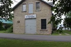 | Finstad's Auto Marine Shop | 3.2 miles | 1983 |
| National Archives record | The nomination case file for reference 04000538 in Record Group 79. |
| Koochiching County | All 10 listed properties in this county. |