 Block
From the record
One of 126 National Register listings published here for St. Louis County · listed in 2019 · category: District.
Sources: the National Register database, National Park Service
Listed on the National Register of Historic Places in 2019.
One of 126 National Register listings published here for St. Louis County · listed in 2019 · category: District.
Sources: the National Register database, National Park Service
Regional context, not property-specific evidence. The federal wildfire occurrence database lists 132 fires within 5 miles of Mesaba Co-operative Park between 1992 and 2020, burning about 678 acres in total. 2 started naturally. 19 were recorded as arson. Distance is straight-line from the map coordinates, so a fire counted here may appear on a neighbouring settlement's page as well.
| Reported cause | Fires |
|---|---|
| Debris and open burning | 64 |
| Equipment and vehicle use | 20 |
| Arson/incendiarism | 19 |
| Missing data/not specified/undetermined | 18 |
| Smoking | 5 |
| Natural | 2 |
| Misuse of fire by a minor | 1 |
| Power generation/transmission/distribution | 1 |
| Fireworks | 1 |
| Recreation and ceremony | 1 |
The most recent of them, most recent first, with the day each was reported and the service that recorded it.
| Date | Cause | Size | Reported by | Name on the report |
|---|---|---|---|---|
| 5 September 2001 | Missing data/not specified/undetermined | 8.0 acres | Minnesota Department of Natural Resources | not named |
| 15 September 2012 | Recreation and ceremony | under an acre | Minnesota Department of Natural Resources | not named |
| 13 September 2012 | Missing data/not specified/undetermined | under an acre | Minnesota Department of Natural Resources | not named |
| 10 September 2006 | Arson/incendiarism | under an acre | Minnesota Department of Natural Resources | not named |
| 1 September 1996 | Debris and open burning | under an acre | Minnesota Department of Natural Resources | not named |
| 22 August 2018 | Debris and open burning | 4.2 acres | Minnesota Department of Natural Resources | not named |
| 22 August 2006 | Equipment and vehicle use | under an acre | Minnesota Department of Natural Resources | not named |
| 18 August 2007 | Missing data/not specified/undetermined | under an acre | Minnesota Department of Natural Resources | not named |
Regional context, not property-specific evidence. The federal mineral resources record lists 1 working within 5 miles of Mesaba Co-operative Park: 1 past producer. None of them still produces. What was taken out: Iron. Distance is straight-line from the map coordinates, so a quarry counted here may appear on a neighbouring settlement's page as well.
| Where | Site | Commodity | Status | Recorded |
|---|---|---|---|---|
| Myers Mine | Iron | Past Producer |
Regional context, not property-specific evidence. The National Weather Service names Hibbing, the town this property stands in, in 46 storm reports between 1995 and 2025: 21 thunderstorm wind, 16 hail, 7 flash flood, 2 lightning. No death or injury is recorded in these reports. Each account below is quoted exactly as the forecast office filed it, from the NOAA Storm Events Database, and each date opens the federal record of that event.
| When | Event | Place named | Harm | What the report says |
|---|---|---|---|---|
| August 1996 | Lightning | Hibbing | $400,000 | no account filed |
| July 1999 | Thunderstorm Wind | Hibbing | $80,000 | no account filed |
| August 1998 | Lightning | Hibbing | $10,000 | no account filed |
| June 2025 | Flash Flood | North Hibbing | - | Water was flowing over a road and caused a washout on the road in Hibbing. |
| June 2025 | Thunderstorm Wind | Hibbing | - | An approximately 8-inch diameter pine tree was down along with multiple other branches. |
| July 2024 | Thunderstorm Wind | Hibbing | - | A photo was received of a large birch tree down over a road. |
| July 2024 | Thunderstorm Wind | Hibbing | - | A photo was received showing a large pine tree that was snapped approximately 5 feet up from the base. Other nearby trees were still standing. |
| July 2024 | Thunderstorm Wind | North Hibbing | - | A large maple tree was snapped and fell over a porch. |
| June 2024 | Flash Flood | Hibbing | - | A video was received showing streets completely covered with water at least a foot deep and perhaps deeper in some spots. |
| June 2024 | Flash Flood | Hibbing | - | A video was received showing Business Highway 169 completely covered with at least a foot of water, perhaps more in some spots. The water was up to the front steps of some homes. |
| June 2024 | Flash Flood | Hibbing | - | Minnesota Highway 37 and US Highway 169 were covered in water and closed near the roundabout from the church to the car wash. |
| June 2024 | Flash Flood | Hibbing | - | Water was covering a residential driveway to the top of the observer's rain boots. |
| May 2022 | Thunderstorm Wind | Hibbing | - | A large tree was down on the road at the spotter's location. |
| August 2020 | Flash Flood | Hibbing | - | Numerous reports of flooded roadways were received in Hibbing along US 169 along with many city streets as well. |
| August 2020 | Thunderstorm Wind | Hibbing | - | A few trees were down in Hibbing with at least one partially blocking a street. |
| August 2020 | Thunderstorm Wind | Hibbing | - | A power line was downed during the storm and laying across a portion of Townline Road. |
| June 2018 | Thunderstorm Wind | Hibbing | - | Numerous trees and power lines were blown down. |
| September 2017 | Thunderstorm Wind | Hibbing | - | Several large trees were knocked down with some falling onto a house, damaging its chimney and siding. |
| July 2012 | Thunderstorm Wind | Hibbing | - | Widespread wind damage occurred with many trees uprooted and snapped-off. |
| April 2002 | Thunderstorm Wind | Hibbing | - | Trees were blown down. |
| August 2001 | Thunderstorm Wind | Hibbing | - | Trees were blown down. |
| June 2000 | Hail | Hibbing | - | The hail was observed in Voyageurs National Park. |
| July 1995 | Thunderstorm Wind | Hibbing | - | Thunderstorm winds from 61 to 70 kts (70-80 mph) tipped over boats and caused power outages. |
| June 2025 | Hail | Hibbing | - | no account filed |
| May 2011 | Hail | Hibbing | - | no account filed |
| August 2010 | Flash Flood | North Hibbing | - | no account filed |
| June 2007 | Hail | Hibbing | - | no account filed |
| July 2003 | Hail | Hibbing | - | no account filed |
| April 2003 | Hail | Hibbing | - | no account filed |
| April 2002 | Hail | Hibbing | - | no account filed |
| April 2002 | Hail | Hibbing | - | no account filed |
| June 2002 | Hail | Hibbing | - | no account filed |
| June 2002 | Hail | Hibbing | - | no account filed |
| June 2002 | Thunderstorm Wind | Hibbing | - | no account filed |
| May 2001 | Hail | Hibbing | - | no account filed |
| July 1999 | Thunderstorm Wind | Hibbing | - | no account filed |
| July 1999 | Thunderstorm Wind | Hibbing | - | no account filed |
| July 1999 | Thunderstorm Wind | Hibbing | - | no account filed |
| June 1999 | Thunderstorm Wind | Hibbing | - | no account filed |
| July 1999 | Thunderstorm Wind | Hibbing | - | no account filed |
| June 1999 | Thunderstorm Wind | Hibbing | - | no account filed |
| August 1998 | Hail | Hibbing | - | no account filed |
| May 1998 | Hail | Hibbing | - | no account filed |
| June 1996 | Hail | Hibbing | - | no account filed |
| July 1996 | Hail | Hibbing | - | no account filed |
| August 1996 | Hail | Hibbing | - | no account filed |
No historic map-sheet match is published for this property yet. That does not mean no map exists. This record needs a coordinate-quality review before it can be joined to a sheet boundary. Browse the county's mapped places while that work is pending.
Other National Register properties close enough to walk or drive between, ordered by distance from this one. Both positions come from the same geocoding pass that matched these properties to their map sheets.
| Photograph | Property | Distance | Listed |
|---|---|---|---|
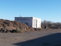 | Hibbing Disposal Plant | 6.3 miles | 1991 |
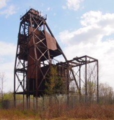 | Bruce Mine Headframe | 6.6 miles | 1978 |
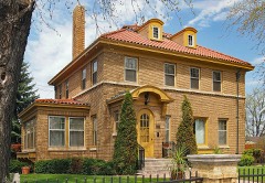 | Andrew G. Anderson House | 7.0 miles | 1980 |
 | Hibbing High School | 7.0 miles | 1980 |
 | Sons of Italy Hall | 7.1 miles | 1980 |
 | Androy Hotel | 7.2 miles | 1986 |
| National Archives record | The nomination case file for reference 100003961 in Record Group 79. |
| St. Louis County | All 126 listed properties in this county. |