 Block
From the record
One of 126 National Register listings published here for St. Louis County · listed in 2020 · category: Building.
Sources: the National Register database, National Park Service
Listed on the National Register of Historic Places in 2020.
One of 126 National Register listings published here for St. Louis County · listed in 2020 · category: Building.
Sources: the National Register database, National Park Service
Regional context, not property-specific evidence. The federal wildfire occurrence database lists 148 fires within 5 miles of Sigurd F. Olson Writing Shack between 1992 and 2020, burning about 245 acres in total. 7 started naturally. 16 were recorded as arson. Distance is straight-line from the map coordinates, so a fire counted here may appear on a neighbouring settlement's page as well.
| Reported cause | Fires |
|---|---|
| Debris and open burning | 37 |
| Missing data/not specified/undetermined | 29 |
| Recreation and ceremony | 22 |
| Power generation/transmission/distribution | 18 |
| Arson/incendiarism | 16 |
| Misuse of fire by a minor | 10 |
| Natural | 7 |
| Fireworks | 4 |
| Smoking | 3 |
| Equipment and vehicle use | 2 |
The most recent of them, most recent first, with the day each was reported and the service that recorded it.
| Date | Cause | Size | Reported by | Name on the report |
|---|---|---|---|---|
| 7 September 2011 | Power generation/transmission/distribution | under an acre | Superior National Forest | RIVARD ROAD |
| 5 September 2007 | Natural | under an acre | Superior National Forest | MITCHELL LAKE |
| 5 September 2005 | Arson/incendiarism | under an acre | Superior National Forest | MUSHROOM ISLAND ROAD |
| 3 September 2011 | Missing data/not specified/undetermined | 24 acres | Superior National Forest | HIGH LAKE |
| 24 September 1997 | Missing data/not specified/undetermined | under an acre | Superior National Forest | SAWDUST |
| 23 September 2014 | Debris and open burning | under an acre | Superior National Forest | FROG POND |
| 12 September 2011 | Power generation/transmission/distribution | under an acre | Superior National Forest | CLOQUET LINE |
| 9 August 2018 | Missing data/not specified/undetermined | under an acre | Superior National Forest | SILVER RAPIDS |
Regional context, not property-specific evidence. The federal mineral resources record lists 10 workings within 5 miles of Sigurd F. Olson Writing Shack: 7 past producers, 2 producers, 1 unknown. 2 still produce. What was taken out: Iron, Sand and Gravel, Construction, Gold, Zinc, Lead, Copper. Distance is straight-line from the map coordinates, so a quarry counted here may appear on a neighbouring settlement's page as well.
| Where | Site | Commodity | Status | Recorded |
|---|---|---|---|---|
| Ely Prospect | Gold, Zinc, Lead, Copper | Unknown | Gold | |
| Lake County Highway Dept Pit | Sand and Gravel, Construction | Producer | ||
| Leustek Pit | Sand and Gravel, Construction | Producer | ||
| Chandler Mine-North | Iron | Past Producer | 1891 | |
| Chandler Mine-South | Iron | Past Producer | 1888 | |
| Pioneer Mine | Iron | Past Producer | Hematite, Magnetite | |
| Savoy Mine | Iron | Past Producer | 1899 | |
| Section 30 Mine | Iron | Past Producer | 1910 | |
| Sibley Mine | Iron | Past Producer | 1899 | |
| Zenith Mine | Iron | Past Producer | 1892 |
Regional context, not property-specific evidence. The National Weather Service names Ely, the town this property stands in, in 22 storm reports between 1996 and 2025: 14 thunderstorm wind, 4 flash flood, 3 hail, 1 lightning. The reports record 3 injuries. Each account below is quoted exactly as the forecast office filed it, from the NOAA Storm Events Database, and each date opens the federal record of that event.
| When | Event | Place named | Harm | What the report says |
|---|---|---|---|---|
| August 1996 | Thunderstorm Wind | Ely | 2 hurt | no account filed |
| July 1998 | Lightning | Ely | 1 hurt | no account filed |
| July 2021 | Thunderstorm Wind | Ely | $50,000 | Photos and measurements were received of the downed trees in Whiteside Park. The two largest trees were elms with one uprooted that was 1 foot in diameter with the second being 27 inches in diameter and was completely snapped about 8 feet up. The Blueberry/Arts Fest was ongoing in the park at the time of the storm and the storm caused significant damage to temporary tents and booths along with the items for sale in the tents/booths. The remainder of the festival was subsequently canceled due to the damage. |
| July 2025 | Flash Flood | Ely | - | Whiteside Park webcam showed curb to curb flooding on Sheridan St. |
| July 2025 | Flash Flood | Ely | - | Curb to curb flooding and water surrounding businesses was reported around North Central Ave. and West Sheridan St. |
| June 2024 | Flash Flood | Ely | - | The intersection of Pattison Street and 2nd Ave East was closed due to the rapidly rising water. Water was also flowing out of the storm drains. |
| June 2024 | Flash Flood | Ely | - | Photos were received showing East Pattison Street in Ely completely covered by a foot of water. |
| June 2022 | Thunderstorm Wind | Ely | - | A large tree was snapped at the reporter's location. |
| June 2022 | Thunderstorm Wind | Ely | - | A very large tree was snapped approximately eight feet above the base. |
| July 2021 | Thunderstorm Wind | Ely | - | Numerous reports were received of downed trees and blocked streets in Ely from the storm. |
| June 2018 | Thunderstorm Wind | Ely | - | Numerous trees and power lines were blown down in the Ely area and created power outages. |
| May 2018 | Thunderstorm Wind | Ely | - | Strong thunderstorm winds blew down several large trees and a few power lines. |
| July 2016 | Thunderstorm Wind | Ely | - | There were multiple trees and power lines blown down in and around Ely. A roof was blown off an enclosed softball shed at the school. |
| July 2016 | Thunderstorm Wind | Ely | - | A softball dugout was destroyed. |
| August 2015 | Hail | Ely | - | Most of the hail was pea-sized. |
| July 2006 | Thunderstorm Wind | Ely | - | Large tree branches were blown down in Whiteside Park. There was also nickel size hail. |
| July 2004 | Thunderstorm Wind | Ely | - | Fifteen to twenty large pine trees were blown down between along the road between Ely and four miles north of babbitt. The winds last 5 to 8 minutes. |
| July 2000 | Thunderstorm Wind | Ely | - | Trees were blown down. Wind speed is estimated. |
| September 2012 | Hail | Ely | - | no account filed |
| July 2000 | Hail | Ely | - | no account filed |
| May 1998 | Thunderstorm Wind | Ely | - | no account filed |
| July 1998 | Thunderstorm Wind | Ely | - | no account filed |
No historic map-sheet match is published for this property yet. That does not mean no map exists. This record needs a coordinate-quality review before it can be joined to a sheet boundary. Browse the county's mapped places while that work is pending.
Other National Register properties close enough to walk or drive between, ordered by distance from this one. Both positions come from the same geocoding pass that matched these properties to their map sheets.
| Photograph | Property | Distance | Listed |
|---|---|---|---|
 | Ely Community Center | 0.3 miles | 2016 |
 | Ely State Theater | 0.5 miles | 2015 |
 | Tanner's Hospital | 0.6 miles | 1980 |
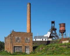 | Pioneer Mine Buildings and A Headframe | 1.2 miles | 1978 |
 | Burntside Lodge Historic District | 4.5 miles | 1988 |
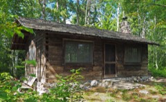 | Listening Point | 6.9 miles | 2007 |
| National Archives record | The nomination case file for reference 100005249 in Record Group 79. |
| St. Louis County | All 126 listed properties in this county. |