 Block
From the record
One of 40 National Register listings published here for Dakota County · listed in 2021 · category: Building.
Sources: the National Register database, National Park Service
Listed on the National Register of Historic Places in 2021.
One of 40 National Register listings published here for Dakota County · listed in 2021 · category: Building.
Sources: the National Register database, National Park Service
The chapter on Hastings City in Dakota County, published 1868 names Hastings. This is what it says, exactly as the scans read.
The first bank in Hastings was merely a bank of exchange, and operated by Thorne 6z FoUett, in 1856. In lSo9 Mr. Thorne made it a bank of issue, with a capital of 825,000, called Thome's Bank. On the same day that the bills were issued, Messrs. Follett 6: Eennick issued bills on the Bank of Hastings. The Bank of Hastings is now known as the First National, and Thome's Bank as the Merchants' JSTational.
Passage source: Dakota County, published 1868.
As early as 1S5G, Hon. W. G. LeDuc succeeded in getting a bill passed by tlie Territorial Legislature ojranting a charter for the building of the Hastings, Minnesota Kiver and Red River of the Xorth Railroad. A company was organized under the provisons of tlie charter and the organization maintained up till the time of the breaking out of the war, when all local enterprises were forgotten or lai'd aside to attend to the demands of the country in its hour of peril, and railroads that had been projected but not commenced Avere all at a stand-still. Meantime the Minnesota Central, now Milwaukee, St. Paul and Minneapolis Railroad, was built through nearly the centre of the county, and consequently drew largely from the trade and business of Hastings. The business men of the city were somewhat depressed in spirit on account of the reaction and the cutting oil of the rich agricultural rea'ion which had heretofore been tributary thereto, and resolved to make another effort to put themselves in railroad coniniunication with the outside world, and during the session of the Legislature of 18C)G, Gen. LeDuc, who had just returned from the war, succeeded in getting a renewal of the charter for that road, as well as legislative authority for the city of Hastings to issue bonds to aid in the construction of the road. A memorial to C(r.]gres3 asking a grant of lands for this road was also V'assed by the Legislature. Mr. LeDuc, immediately upon the adjournment of the Legislature, repaired to Washirgton, and with the aid of the Hon. I. Donnelly, member- of Congress from Hastings, sustained by the whole delegation from Minnesota, a grant was obtained of tQii sections per mile. A competent engineer was employed to run a preliminary survey from Big Stone Lake to Hastings. The survey was pushed forward as fast as possible. As the first snows of winter whitened the landscape the last stake was stuck on the banks of the Mississippi. Early the following spring grading was commenced, and as the city had voted to issue bonds to the amount of $100,000 to aid the enterprise, people began to have some confidence in its ultimate success, feeling assured that the road would at least be built as far as Farmington, to connect with the Milwaukee, St. Paul and Minneapolis Railway, and thus give them a railroad connection with the East. AVork was pushed forward as rapidly as funds could 'be jn-oeured, and in 1867 nearly twenty miles of the road was graded.
Passage source: Dakota County, published 1868.
Machine-read from a century-old scan, so expect the errors a machine makes: misspelled names, dropped words, stray characters.
Read the whole chapter on Hastings City - 18,078 words on its settlement, mills, schools and churches.
Regional context, not property-specific evidence. The federal wildfire occurrence database lists 2 fires within 5 miles of Hudson Manufacturing Company Factory between 2012 and 2020, burning about 10 acres in total. None started naturally. None was recorded as arson. Distance is straight-line from the map coordinates, so a fire counted here may appear on a neighbouring settlement's page as well.
| Reported cause | Fires |
|---|---|
| Missing data/not specified/undetermined | 1 |
| Equipment and vehicle use | 1 |
The most recent of them, most recent first, with the day each was reported and the service that recorded it.
| Date | Cause | Size | Reported by | Name on the report |
|---|---|---|---|---|
| 24 March 2020 | Missing data/not specified/undetermined | under an acre | Wisconsin Department of Natural Resources | 200021 |
| 17 March 2012 | Equipment and vehicle use | 10 acres | Minnesota Valley National Wildlife Refuge | INNOVATION |
Regional context, not property-specific evidence. The federal mineral resources record lists 2 workings within 5 miles of Hudson Manufacturing Company Factory: 1 unknown, 1 past producer. None of them still produces. What was taken out: Stone, Sand and Gravel, Construction. Distance is straight-line from the map coordinates, so a quarry counted here may appear on a neighbouring settlement's page as well.
| Where | Site | Commodity | Status | Recorded |
|---|---|---|---|---|
| Christenson Quarry | Stone | Unknown | ||
| Prescott Gravel Pit | Sand and Gravel, Construction | Past Producer |
Regional context, not property-specific evidence. The National Weather Service names Hastings, the town this property stands in, in 42 storm reports between 1996 and 2026: 20 hail, 17 thunderstorm wind, 2 tornado, 2 funnel cloud. No death or injury is recorded in these reports. Each account below is quoted exactly as the forecast office filed it, from the NOAA Storm Events Database, and each date opens the federal record of that event.
| When | Event | Place named | Harm | What the report says |
|---|---|---|---|---|
| June 2007 | Hail | Hastings | $12,000,000 | Hail was reported to be the size of hockey pucks. Many houses and vehicles were damaged in and around Hastings. Damage amount reported by the Hastings Star-Gazette. |
| June 2005 | Hail | Hastings | $1,000,000 | A car dealership suffered significant hail damage losses. Widespread roof and siding damage was also reported. |
| June 2017 | Thunderstorm Wind | Hastings | $100,000 | There were 8 homes that had trees fall onto their roofs and cause damage, and about 1500 people lost power. All this damage occurred in a small area of town (about a 6-8 block radius) from 15th Street south to the Vermillion River. |
| August 2021 | Thunderstorm Wind | Hastings | $50,000 | In the Industrial Park, on Spiral Blvd, there was a storage building leveled, and other assorted trees snapped. Most of the tree damage was on the south end of Hastings. |
| June 2012 | Thunderstorm Wind | Hastings | $50,000 | An 18 inch diameter tree was uprooted in Hastings. Plus, an assistant living apartment complex building in Hastings had part of its roof blown off. |
| July 2009 | Thunderstorm Wind | Hastings | $10,000 | The Emergency Manager of Dakota County reported several pine trees blown down along with 8 diameter tree branches on the south side of Highway 316 in Hastings. |
| July 2010 | Thunderstorm Wind | Hastings | $3,000 | A two foot diameter tree was snapped in half at 19th street and Vermillion in the southern part of Hastings, Minnesota. In addition, a tree was sheared in half and blocked part of Fraser Street in the northeast part of Hastings. |
| April 2026 | Hail | Hastings | - | Photo measurement provided via Facebook. |
| August 2025 | Heavy Rain | Hastings | - | Cocorahs station MN-DK-281 Hastings 5.3 SE. 72 hour total of 5.35 inches. |
| May 2022 | Hail | Hastings | - | There was a social media picture of 1 inch hail. |
| May 2022 | Thunderstorm Wind | Hastings | - | A two foot diameter tree was blown down south of Hastings. This was additional damage from the severe thunderstorm that produced a tornado south of this location. |
| July 2014 | Thunderstorm Wind | Hastings | - | Several large tree limbs were blown down in Hastings. |
| May 2013 | Thunderstorm Wind | Hastings | - | Several trees were blown down in Hastings, Minnesota. Plus, power outages were reported in the town of Hastings. |
| June 2010 | Thunderstorm Wind | Hastings | - | Several large tree limbs were blown down in Hastings, Minnesota. |
| August 2007 | Thunderstorm Wind | Hastings | - | Tree down on house. |
| June 2005 | Thunderstorm Wind | Hastings | - | Several power lines and trees up to 2 feet in diameter were downed. A few downed trees damaged homes. The hardest hit area was just north of County Road 47 and south of Highway 55. |
| June 2001 | Hail | Hastings | - | At Highways 61 and 316. |
| May 1998 | Thunderstorm Wind | Hastings | - | Trees down and buildings damaged. Barn destroyed near Vermillion. Estimated windspeed. |
| May 1998 | Thunderstorm Wind | Hastings | - | 400 trees blown over. Estimated windspeed. |
| July 1997 | Thunderstorm Wind | Hastings | - | Tree blown down onto road. Estimated windspeed. |
| July 2023 | Hail | Hastings | - | no account filed |
| July 2020 | Hail | Hastings | - | no account filed |
| July 2020 | Hail | Hastings | - | no account filed |
| July 2020 | Hail | Hastings | - | no account filed |
| August 2019 | Hail | Hastings | - | no account filed |
| August 2016 | Hail | Hastings | - | no account filed |
| June 2014 | Funnel Cloud | Hastings | - | no account filed |
| June 2014 | Funnel Cloud | Hastings | - | no account filed |
| August 2013 | Hail | Hastings | - | no account filed |
| August 2013 | Hail | Hastings | - | no account filed |
| August 2013 | Hail | Hastings | - | no account filed |
| May 2012 | Hail | Hastings | - | no account filed |
| May 2011 | Hail | Hastings | - | no account filed |
| May 2011 | Hail | Hastings | - | no account filed |
| July 2009 | Hail | Hastings | - | no account filed |
| May 2004 | Hail | Hastings | - | no account filed |
| March 1998 | Tornado (F0) | Hastings | - | no account filed |
| May 1998 | Thunderstorm Wind | Hastings | - | no account filed |
| June 1996 | Thunderstorm Wind | Hastings | - | no account filed |
| June 1996 | Hail | Hastings | - | no account filed |
| June 1996 | Thunderstorm Wind | Hastings | - | no account filed |
| July 1996 | Tornado (F0) | Hastings | - | no account filed |
No historic map-sheet match is published for this property yet. That does not mean no map exists. This record needs a coordinate-quality review before it can be joined to a sheet boundary. Browse the county's mapped places while that work is pending.
Other National Register properties close enough to walk or drive between, ordered by distance from this one. Both positions come from the same geocoding pass that matched these properties to their map sheets.
| Photograph | Property | Distance | Listed |
|---|---|---|---|
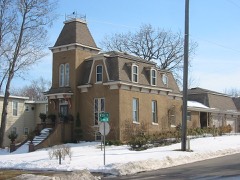 | West Second Street Residential Historic District | 0.1 miles | 1978 |
 | East Second Street Commercial Historic District | 0.1 miles | 1978 |
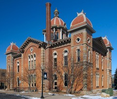 | Dakota County Courthouse | 0.2 miles | 1978 |
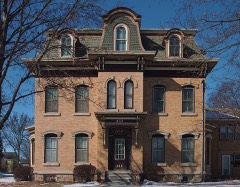 | VanDyke-Libby House | 0.3 miles | 1978 |
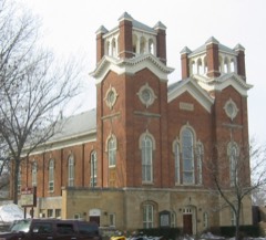 | First Presbyterian Church | 0.3 miles | 1995 |
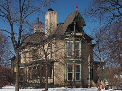 | Rudolph Latto House | 0.3 miles | 1978 |
| National Archives record | The nomination case file for reference 100006002 in Record Group 79. |
| Dakota County | All 40 listed properties in this county. |