 Block
From the record
One of 28 National Register listings published here for Le Sueur County · listed in 2021 · category: District.
Sources: the National Register database, National Park Service
Listed on the National Register of Historic Places in 2021.
One of 28 National Register listings published here for Le Sueur County · listed in 2021 · category: District.
Sources: the National Register database, National Park Service
Regional context, not property-specific evidence. The National Weather Service names Montgomery, the town this property stands in, in 19 storm reports between 1995 and 2025: 9 hail, 8 thunderstorm wind, 1 flash flood, 1 funnel cloud. No death or injury is recorded in these reports. Each account below is quoted exactly as the forecast office filed it, from the NOAA Storm Events Database, and each date opens the federal record of that event.
| When | Event | Place named | Harm | What the report says |
|---|---|---|---|---|
| July 2025 | Thunderstorm Wind | Montgomery | - | Report of multiple trees down near the high school in Montgomery. |
| July 2025 | Thunderstorm Wind | Montgomery | - | Large healthy pine tree snapped about 15 feet above ground, with its top resting on a house. This was near the intersection of 3rd Street NE and Linden Avenue. Large limbs snapped nearby. |
| August 2025 | Funnel Cloud | Montgomery | - | A trained spotter reported a brief funnel cloud near the intersection of MN-99 and 145th Ave in eastern Le Sueur county. |
| September 2019 | Thunderstorm Wind | Montgomery | - | Several trees were uprooted north of Montgomery. |
| July 2010 | Thunderstorm Wind | Montgomery | - | Several trees and power lines were blown down in Montgomery, and southeast of Montgomery, Minnesota. |
| August 2002 | Thunderstorm Wind | Montgomery | - | Numerous trees and power lines were downed. Six sheds at a lumber company collapsed. |
| May 1998 | Thunderstorm Wind | Montgomery | - | Trees down. Windows blown out. Estimated windspeed. |
| July 1995 | Thunderstorm Wind | Montgomery | - | Large number of mature trees snapped and uprooted. Farm buildings and severe crop damage reported six miles southeast of Montgomery. |
| May 2022 | Hail | Montgomery | - | no account filed |
| May 2022 | Hail | Montgomery | - | no account filed |
| July 2020 | Hail | Montgomery | - | no account filed |
| September 2019 | Hail | Montgomery | - | no account filed |
| May 2008 | Hail | Montgomery | - | no account filed |
| May 2004 | Hail | Montgomery | - | no account filed |
| July 2002 | Hail | Montgomery | - | no account filed |
| August 2002 | Hail | Montgomery | - | no account filed |
| June 1998 | Hail | Montgomery | - | no account filed |
| July 1997 | Flash Flood | Montgomery | - | no account filed |
| June 1996 | Thunderstorm Wind | Montgomery | - | no account filed |
No historic map-sheet match is published for this property yet. That does not mean no map exists. This record needs a coordinate-quality review before it can be joined to a sheet boundary. Browse the county's mapped places while that work is pending.
Other National Register properties close enough to walk or drive between, ordered by distance from this one. Both positions come from the same geocoding pass that matched these properties to their map sheets.
| Photograph | Property | Distance | Listed |
|---|---|---|---|
 | Westerman Lumber Office and House | under 500 feet | 1982 |
 | Hilltop Hall | 0.2 miles | 1982 |
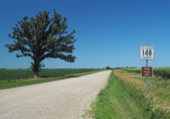 | Dodd Road Discontiguous District | 4.7 miles | 2003 |
 | Hotel Broz | 7.3 miles | 1982 |
 | First National Bank | 7.3 miles | 1982 |
| National Archives record | The nomination case file for reference 100006360 in Record Group 79. |
| Le Sueur County | All 28 listed properties in this county. |