 Block
From the record
28 National Register listings published here.
Sources: the National Register database, National Park Service
44 topographic sheets cover 22 settlements here, and 28 properties are on the National Register of Historic Places.
28 National Register listings published here.
Sources: the National Register database, National Park Service
Every property in this county listed on the National Register of Historic Places, with the year it was listed and the federal nomination document.
| Photograph | Property | Type | Listed | Reference |
|---|---|---|---|---|
| John R. Andrews House | building | 1978 | 78003123 | |
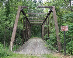 | Bridge No. 4846 (1) | structure | 1981 | 81000681 |
 | Broadway Bridge | structure | 1999 | 99000934 |
| Carson H. Cosgrove House | building | 1982 | 82004694 | |
| Arthur Dehn House | building | 1982 | 82000561 | |
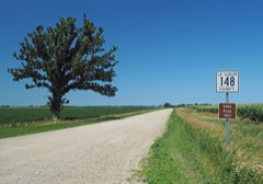 | Dodd Road Discontiguous District | district | 2003 | 03000520 |
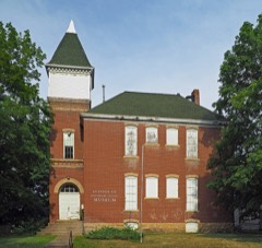 | Elysian Public School | building | 1981 | 81000677 |
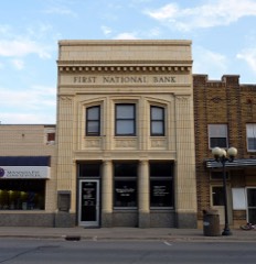 | First National Bank | building | 1982 | 82004703 |
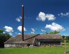 | Geldner Sawmill | structure | 1975 | 75000991 |
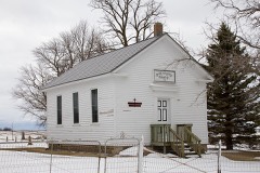 | German Evangelical Salem Church | building | 1982 | 82004696 |
 | Hilltop Hall | building | 1982 | 82004701 |
 | Hotel Broz | building | 1982 | 82004704 |
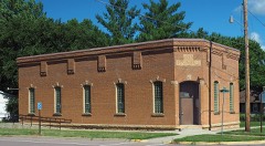 | Kasota Township Hall | building | 1981 | 81000679 |
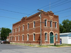 | Kasota Village Hall | building | 1981 | 81000680 |
 | Le Sueur County Courthouse and Jail | building | 1981 | 81000682 |
| Le Sueur Public School | building | 2026 | 100012689 | |
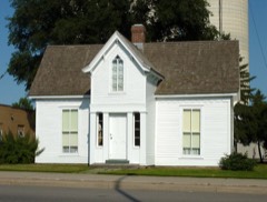 | Dr. William W. Mayo House | building | 1969 | 69000074 |
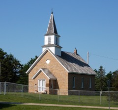 | Methodist Episcopal Church | building | 1982 | 82004697 |
| Montgomery Commercial Historic District | district | 2021 | 100006360 | |
| Needham-Hayes House | building | 1982 | 82004698 | |
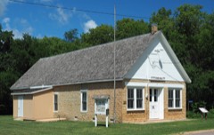 | Ottawa Township Hall | building | 1982 | 82004705 |
| John Rinshed House | building | 1982 | 82004707 | |
| Charles Schwartz House and Barn | building | 1982 | 82004708 | |
| Smith-Cosgrove House | building | 1982 | 82004700 | |
| George W. Taylor House | building | 1975 | 75000992 | |
 | Trinity Chapel-Episcopal | building | 1982 | 82004695 |
| Union Hotel | building | 1982 | 82004709 | |
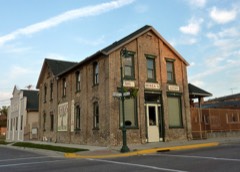 | Westerman Lumber Office and House | building | 1982 | 82004702 |
Every wildfire the federal occurrence database records inside this county: 6 of them, burning about 696 acres. None started naturally and 2 were recorded as arson. Each settlement page carries the fires within five miles of it.
| Reported cause | Fires |
|---|---|
| Arson/incendiarism | 2 |
| Missing data/not specified/undetermined | 1 |
| Debris and open burning | 1 |
| Smoking | 1 |
| Recreation and ceremony | 1 |
The five largest, by the area the report gives. Two of them were set deliberately.
| Date | Cause | Size | Reported by | Name on the report |
|---|---|---|---|---|
| 10 March 2012 | Debris and open burning | 400 acres | Minnesota Department of Natural Resources | LECENTER FIRE |
| 3 November 1996 | Arson/incendiarism | 290 acres | Minnesota Department of Natural Resources | not named |
| 15 October 1993 | Smoking | 4.0 acres | Minnesota Department of Natural Resources | not named |
| 2 November 2006 | Arson/incendiarism | 2.0 acres | Minnesota Department of Natural Resources | not named |
| 7 August 2012 | Recreation and ceremony | under an acre | Minnesota Valley National Wildlife Refuge | BLAKELY |
| 20 October 2003 | Missing data/not specified/undetermined | under an acre | Minnesota Department of Natural Resources | not named |
Every settlement page carries the fires within five miles of it - see the settlement index below.
The NOAA Storm Events Database holds 266 reports for this county, causing 1 death, 58 injuries and about $67,344,830 in recorded property damage. Each settlement page carries the reports that name it.
| Kind of event | Reports |
|---|---|
| Hail | 105 |
| Thunderstorm Wind | 104 |
| Tornado | 26 |
| Flash Flood | 11 |
| Flood | 7 |
| Heavy Rain | 7 |
| Funnel Cloud | 6 |
The most serious of them, by death, then injury, then recorded damage. The accounts are quoted exactly as the forecast office filed them.
| When | Event | Place named | Harm | What the report says |
|---|---|---|---|---|
| August 2006 | Tornado (F3) | Kasota | 1 killed, 30 hurt, $20,000,000 | The F3 tornado that began in Nicollet County at 1630 CST moved into Le Sueur County near the northern city limits of Kasota. Over 100 homes suffered some damage, dozens of homes had major damage, and three were completely leveled. The tornado moved east-northeast for about ten miles in Le Sueur County, then turned and moved east-southeast until dissipation. Hundreds of farm animals were killed, including 200 cows at a large dairy. Approximately five thousand acres of corn and soybeans were estimated to be ruined across the county. A State Farm spokeswoman said the company expected 4,500 homeowner claims and 8,000 auto claims from the storm. Some information provided by the Star Tribune newspaper. A 91 year old man perished in the upper floor of his home when a tree crashed through the roof. |
| April 1991 | Tornado (F1) | not stated | 9 hurt, $250,000 | no account filed |
| June 1981 | Tornado (F2) | not stated | 8 hurt, $250,000 | no account filed |
| June 1952 | Tornado (F2) | not stated | 6 hurt, $2,500,000 | no account filed |
| March 1998 | Tornado (F2) | Cleveland | 2 hurt, $20,000,000 | Tornado tracked through Le Center and adjoining rural areas. Most of the businesses in the southern part of town were damaged. Buildings destroyed at county fairgrounds. 15 mobiles homes at a trailer park destroyed, another 26 suffering major damage. Over 100 farm buildings destroyed. |
| June 2005 | Thunderstorm Wind | Greenland | 2 hurt | Two cabins at a resort between East Jefferson Lake and German Lake, Section 5 in Elysian Township, were destroyed when trees fell on them. One cabin was unoccupied. Two people in the second cabin sustained bumps and bruises when a large tree fell on top of the bedroom they were staying in. The tree fell right on top of the bed where they were sleeping moments before. They were standing nearby when the tree "split the ceiling open" above them. A nearby trailer home was also damaged by the tree that fell onto the unoccupied cabin. One witness said that wind was blowing so hard that water was "flying off the lake." Power crews had to replace several electricity poles between East Jefferson Lake and German Lake that were damaged by downed trees. |
| June 2005 | Thunderstorm Wind | Waterville | 1 hurt | Trees were downed across the city. The roof of a trailer home and an attached garage was ripped off and a picture window was blown out. A man in the trailer home was cut on the leg by flying glass from a shattered window and required 14 stitches. A camper in the back yard of the home was blown into Whitewater Creek along with roof and tree debris. Damage was reported to other houses in the vicinity, including one home that was impaled by a 2x4 that came from a damaged building across the street. A tree was downed onto a power truck on Highway 60. |
| May 1998 | Hail | New Prague | $20,000,000 | Numerous houses and vehicles damaged by wind-driven hail. Damage estimate for entire county. |
| June 2014 | Flood | Kasota | $1,100,000 | There were multiple reports of road closures due to high water and debris along the Minnesota River. In the southeast part of Le Sueur County, some residents in the town of Waterville, Minnesota had to evacuate their homes along Lillian Street due to rising waters of the local lake. The city council declared the town a disaster area and had volunteers help them fill sandbags to stop further damage to homes. As lake levels rose, several homes were surrounded by water from the nearby lakes, and a few will be completely destroyed. The city closed four streets and parts of three others due to the flooding. |
| August 2006 | Hail | New Prague | $1,000,000 | Vehicles, homes and businesses damaged on the south side of New Prague. |
| August 1999 | Tornado (F1) | Cleveland | $610,000 | Dairy barn and machine shop destroyed three miles northwest of Cleveland. Four miles east of Cleveland, machine shed, two old cattle barns, and a garage leveled on family farm. Many acres of corn flattened along the twister's path. Damages county wide only included machinery and property values. No estimates on livestock lost though several cattle were killed. |
| June 2014 | Flash Flood | Henderson Station | $500,000 | A mud slide, along Henderson Road, destroyed a home. |
| March 2012 | Tornado (EF0) | Elysian | $250,000 | The EF-0 tornado that formed in northern Waseca County continued to move northward across the western sections of Elysian in Le Sueur County, where two small empty grain bins were blown into a field. Also, a small metal shed was blown across Highway 60 in the same area. ||As the tornado continued to track north of Lake Francis, the damage pattern became more complex, and some damage signatures were associated with downburst winds. However, the damage pattern was such that it impossible to discern between the tornado damage and any downburst damage. Therefore there is no separate entry for thunderstorm wind damage at this point. ||The path length of the tornado in Le Sueur County was approximately 3.7 miles, which ended at the St. Peters Church two miles north of Lake Francis. Although most of the damage was associated with uprooted trees and roof damage to homes, numerous boat docks and lifts along the northern shore of Lake Francis were picked up and tossed into the adjacent properties. ||Based on damage, winds were estimated at 80 mph, and the total path length across Waseca and Le Sueur Counties was 6.54 miles. |
| May 1977 | Tornado (F2) | not stated | $250,000 | no account filed |
| June 2016 | Thunderstorm Wind | Elysian | $100,000 | The city of Elysian had significant wind damage as power lines and big trees were blown down throughout the city. Some of the trees landed on homes and on vehicles, producing damage. The storm was also to blame for boats overturning on Lake Francis. |
| July 2015 | Thunderstorm Wind | Cleveland | $100,000 | Several trees were blown down near Cleveland. The trees landed on homes, sheds and a car and caused substantial damage. |
| June 2014 | Thunderstorm Wind | Elysian | $100,000 | There was lots of damage in Elysian, including numerous large trees down, including 7 that were blocking the main roads. Other reports included; shingles off two homes, broke rafters in garage, and damage to three boat docks on Lake Francis. |
| May 2022 | Thunderstorm Wind | Kasota | $50,000 | Scattered trees were blown down from just east of St. Peter to the Cleveland area. |
| June 2016 | Thunderstorm Wind | Le Center | $50,000 | A swath of downed trees and power lines occurred from Le Center to Montgomery. At one point, the local utility company had near 150 members working on the power outages. |
| May 2022 | Thunderstorm Wind | Elysian | $25,000 | Several trees and power lines were blown down in Elysian. Waterville had roof damage to a business and a home had its garage door blown off. The severe winds were related to the initial outflow from the squall line. |
| June 2016 | Thunderstorm Wind | Kasota | $25,000 | Several six to eight inch diameter trees were blown down across southwest Le Sueur County between the towns of Kasota, St. Peter and Cleveland. One tree landed on a house. Power lines were also blown down which knocked out power to several hundred customers throughout the southwest part of the county. |
| July 2016 | Thunderstorm Wind | Henderson Station | $25,000 | Many trees and large tree branches were blown down across the county, with the most concentrated area between Henderson and Montgomery. |
| July 2011 | Thunderstorm Wind | Le Sueur | $25,000 | Several large trees and power lines were blown down. In addition, some structural damage occurred to a building. |
| May 1965 | Tornado (F0) | not stated | $25,000 | no account filed |
| May 2022 | Thunderstorm Wind | Kasota | $15,000 | There was roof damage east of Kasota, on the south side of Lake Emily, along with trees blown down near Kasota. |
| June 2019 | Thunderstorm Wind | Heidelberg | $15,000 | A large tree was blown down, and landed on a home in Heidelberg. |
| June 2019 | Thunderstorm Wind | Le Center | $15,000 | A tree blew down on a trailer in Le Center. |
| June 2019 | Thunderstorm Wind | Union Hill | $15,000 | A measured wind gust of 85 mph occurred near Union Hill. A barn roof was also blown off near the measured wind gust. In addition, a NWS storm survey concluded that straight-line winds produced the damage in the area. |
| July 2021 | Thunderstorm Wind | Waterville | $10,000 | A few trees were blown over, along with approximately 20 feet of corn flattened on the north side of Lake Tetonka. |
| July 2017 | Thunderstorm Wind | Waterville | $10,000 | There were reports of trees and power lines blown down in Waterville. One house in Waterville lost its roof due to the severe winds. |
| September 2010 | Thunderstorm Wind | Marysburg | $10,000 | A local private weather station measured a wind gust of 62 mph northwest of Elysian, Minnesota. In addition, several trees were uprooted around Elysian Township. |
| December 2021 | Thunderstorm Wind | Cleveland | $5,000 | Between Cleveland and Le Center, isolated trees were blown down, with broken windows and roof damage to a garage. |
| June 2019 | Thunderstorm Wind | Henderson Station | $5,000 | Several trees, a road sign, and power poles were blown down near, and along Highway 169, and 19, east to around 271st. |
| June 2012 | Tornado (EF0) | Henderson Station | $5,000 | An EF-0 tornado formed approximately 6.5 miles south of Belle Plaine...just south of the Le Sueur, Scott County line, and moved northeast into Scott County. Damage was associated with down trees, some shingles blown off, plus a chimney toppled at a house. Maximum width was 50 yards. |
| June 2016 | Thunderstorm Wind | Waterville | $2,000 | A home had siding damage in Waterville. Numerous trees were also blown downed across the city, some were blocking city streets. |
| August 2021 | Thunderstorm Wind | Le Sueur | $1,000 | There were a number of large tree limbs blown down near Le Sueur. One that was 12 inches in diameter. |
| November 2012 | Thunderstorm Wind | New Prague | $1,000 | Roof and siding damage occurred at a home in New Prague. |
| May 2012 | Hail | Le Center | $500 | Some of the hail broke windows. |
| June 1976 | Tornado (F2) | not stated | $250 | no account filed |
| June 1994 | Hail | LeCenter | $50 | no account filed |
| July 1957 | Tornado | not stated | $30 | no account filed |
| April 2026 | Hail | Kasota | - | Report received via NWS Chat. |
| April 2026 | Hail | Kilkenny | - | Report received via NWS Chat. |
| July 2025 | Thunderstorm Wind | Montgomery | - | Report of multiple trees down near the high school in Montgomery. |
| July 2025 | Thunderstorm Wind | Montgomery | - | Large healthy pine tree snapped about 15 feet above ground, with its top resting on a house. This was near the intersection of 3rd Street NE and Linden Avenue. Large limbs snapped nearby. |
| July 2025 | Thunderstorm Wind | Cleveland | - | Report of a tree down in the town of Cleveland or four miles west of St. Peter. |
| July 2025 | Thunderstorm Wind | Le Center | - | Report of a tree down in Le Center. |
| August 2025 | Funnel Cloud | Montgomery | - | A trained spotter reported a brief funnel cloud near the intersection of MN-99 and 145th Ave in eastern Le Sueur county. |
| August 2025 | Heavy Rain | Ottawa | - | Cocorahs station MN-LS-23 Le Sueur 5.8 S. 72 hour total of 5.55 inches. |
| July 2024 | Thunderstorm Wind | Le Center | - | A large pine tree was down on a power line. |
| July 2024 | Thunderstorm Wind | Le Sueur | - | Multiple large trees were blown down. |
| June 2024 | Heavy Rain | Le Sueur | - | Nearly 3 inches of rain fell in northern Le Sueur county. |
| June 2024 | Heavy Rain | New Prague | - | A total of 3 to 6 inches of rain fell from multiple rounds of thunderstorms. CoCoRaHS observers measured 5.80 inches near Waterville. |
| May 2022 | Hail | New Prague | - | There was a Facebook picture of golf ball size hail in New Prague. |
| April 2022 | Thunderstorm Wind | Heidelberg | - | A couple of miles south of New Prague, a few large trees were blown down which was associated with a collapsing storm that moved from southern Le Sueur, to near the Le Sueur and Scott county border. |
| May 2021 | Tornado (EF0) | Henderson Station | - | A brief touchdown was reported east-northeast of Henderson as it crossed Highway 19, moving from Le Sueur County into Scott County. It blew a trampoline and damaged a play set on the Le Sueur County side before moving north and damaging some trees in a grove in Scott County per a NWS damage survey. |
| June 2021 | Hail | New Prague | - | Social media had a picture of golf ball size hail near new Prague. |
| June 2021 | Hail | St Thomas | - | Social media had a picture of 2 inch hail in northern Le Sueur County. |
| June 2020 | Heavy Rain | Kasota | - | There was a 18 hour rainfall report near Kasota of 5.94 inches. |
| July 2020 | Thunderstorm Wind | Cleveland | - | A few large tree limbs were blown down south of Cleveland. |
The Survey's mineral resources record lists 19 workings inside this county. 18 still produce and 1 is closed or unrecorded. Each settlement page carries the workings within five miles of it.
| Commodity | Workings |
|---|---|
| Sand and Gravel, Construction | 9 |
| Stone, Crushed/Broken | 7 |
| Silica | 2 |
| Limestone, Dimension | 2 |
The least common of them first, because a county's hundredth gravel pit says nothing its first ten did not.
| Where | Site | Commodity | Status | Recorded |
|---|---|---|---|---|
| Caroline & Moses Qsuarry | Limestone, Dimension | Producer | ||
| Gopher State Sandstone Mill | Silica | Producer | ||
| Gopher State Silica Pit | Silica | Producer | Sandstone | |
| North Quarry | Stone, Crushed/Broken, Limestone, Dimension | Producer | ||
| Ed Swarthout Inc | Stone, Crushed/Broken | Producer | ||
| Ed Swarthout Inc | Stone, Crushed/Broken | Producer | ||
| Gopher State Sandstone Quarry No 2 | Stone, Crushed/Broken | Producer | ||
| Gopher State Sandstone Quarry No1 | Stone, Crushed/Broken | Producer | ||
| Henroy Komstz Pit | Stone, Crushed/Broken | Producer | ||
| Lundin Quarry | Stone, Crushed/Broken | Producer | ||
| Blue Earth Co Sand & Gravel Pit | Sand and Gravel, Construction | Producer | ||
| Brown Pit | Sand and Gravel, Construction | Producer | ||
| J V White Pit & Mill | Sand and Gravel, Construction | Producer | ||
| Johnson Pit | Sand and Gravel, Construction | Producer | ||
| Kasota Pit | Sand and Gravel, Construction | Producer | ||
| Le Sueur Co Hwy Dept | Sand and Gravel, Construction | Producer | ||
| Mullenaheur Pit | Sand and Gravel, Construction | Unknown | ||
| State Pit No 3118 A | Sand and Gravel, Construction | Producer | ||
| Wolff Pit | Sand and Gravel, Construction | Producer |
Named settlements recorded in the Geographic Names Information System, each with the topographic sheets covering it. Villages, hamlets and abandoned places alike. Each is shown with the nearest named watercourse or landform and the survey quadrangle it falls on.
Waterville township · 56096 · Kilkenny quadrangle
10 sheets, 1953 to 1985
No longer a settlement
Le Sueur city · 56058 · On Forest Prairie Creek · Le Sueur quadrangle
12 sheets, 1953 to 1985
Le Sueur city · 56058 · On Forest Prairie Creek · Le Sueur quadrangle
12 sheets, 1953 to 1985
Waterville township · 56096 · On White Water Creek · Waterville quadrangle
10 sheets, 1953 to 1985
The vanished settlements of Le Sueur County: the places named above that are no longer on the map.