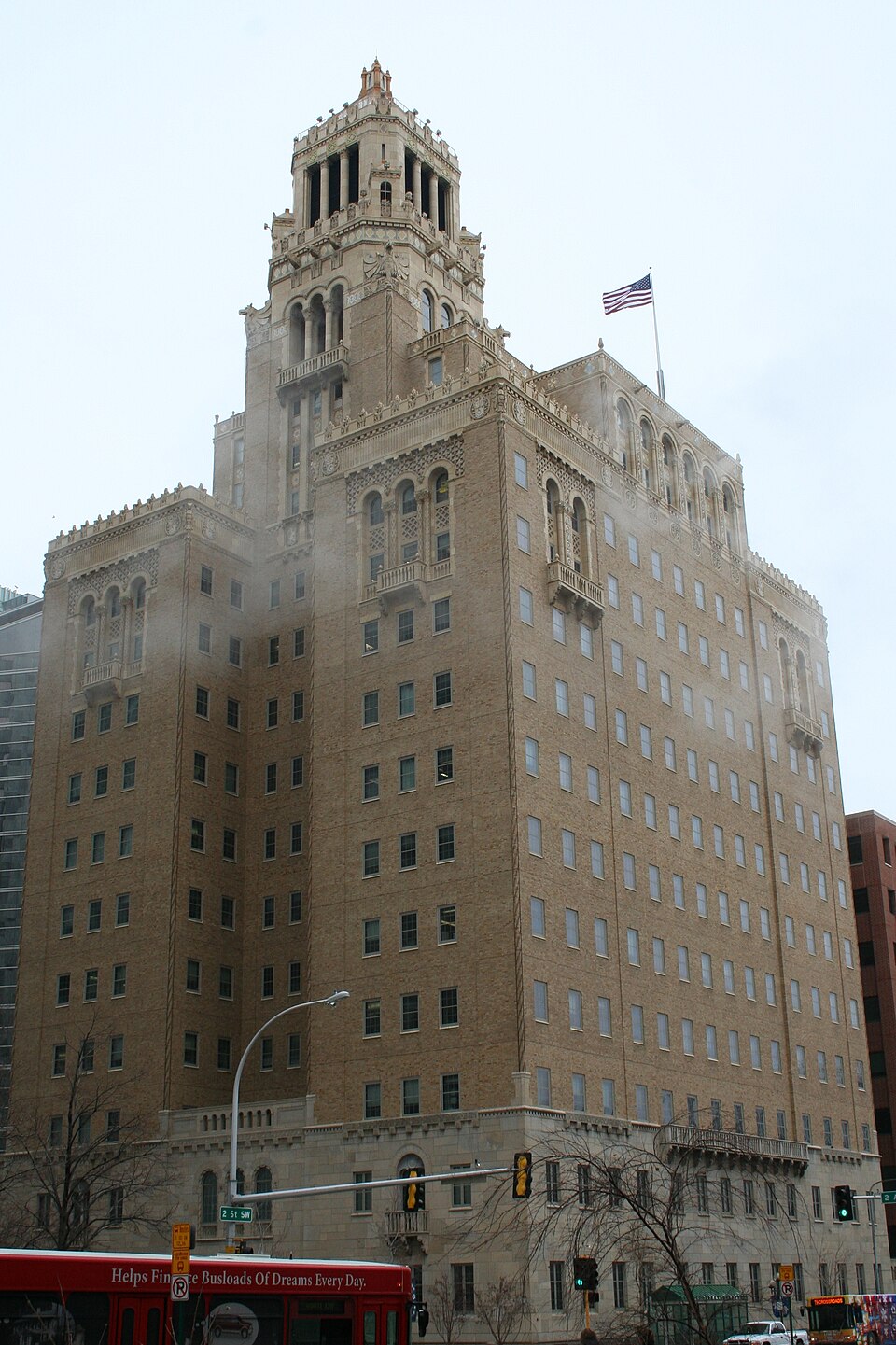
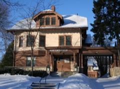
A National Historic Landmark. Listed on the National Register of Historic Places in 1969.
From the record
“The Plummer Building in Rochester, Minnesota, is one of the many architecturally significant buildings on the Mayo Clinic campus. This new "Mayo Clinic" building, opened in 1928, added much needed space to the ever-expanding Mayo practice.”
Wikipedia article Plummer Building, CC BY-SA 4.0.
One of 26 National Register listings published here for Olmsted County · listed in 1969 · category: Building · a National Historic Landmark.
National Register reference number. 69000075 - assigned by the National Park Service when the property was listed.
The ground it stands on
51,537 words
The chapter on Rochester City in History of Olmsted County, Minnesota, published 1910 names Rochester. This is what it says, exactly as the scans read.
THE first known discovery of the site of Rochester was by a party of United States surveyors, under charge of Thomas Simpson, a well-known resident, for years, of Winona, who were running the line and setting the stakes marking the townships, but not subdividing them into sections. Mr. Simpson says :
That same spring, but probably later than the discovery by the surveying party, Robert H. McReady, with his family, and Thomas C. Cummings, both from Herkimer county, New York, looking for new homes on the frontier, located farms of a quarter section each on what is now the western edge of the city of Rochester, McReady's being outside the city, afterward the home of M. VV. Leland, and recently of Philip D. Manley. Cunimings' claim was south of McReady's, and part of it was, later, platted as Cummings' addition to the city, and includes the district extending from the court house to the Chicago & Northwestern Railroad and west to the city limits.
Regional context, not property-specific
evidence. The
federal wildfire occurrence database
lists 1 fire within 5 miles of Mayo Clinic Buildings
in 2000, burning under an acre in total. None started naturally. None was recorded as arson.
Distance is straight-line from the map coordinates, so a fire counted
here may appear on a neighbouring settlement's page as well.
Reported cause
Fires
Missing data/not specified/undetermined
1
The most recent of
them, most recent first, with the day each was reported and the service
that recorded it.
Regional context, not property-specific
evidence. The federal mineral resources record lists
7 workings within 5 miles of Mayo Clinic Buildings: 7 producers.
All of them still produce. What was taken out: Sand and Gravel, Construction, Stone, Crushed/Broken. Distance is straight-line from the
map coordinates, so a quarry counted here may appear on a neighbouring
settlement's page as well.
Regional context, not property-specific
evidence. The National Weather Service names
Rochester, the town this property stands in, in 218 storm reports between 1993 and 2026: 104 hail, 64 thunderstorm wind, 15 flood, 13 lightning.
The reports record 1 death. Each account below is quoted exactly as the forecast office
filed it, from the NOAA Storm Events Database, and each date
opens the federal record of that event.
Heavy thunderstorm rains caused widespread flash flooding in Rochester and surrounding areas across the county. Extensive damage was caused to sewer systems, water wells, roadways, parks, and flood control reservoirs.||Highway 14 was closed east of Rochester due to wash outs and flash flooding. A mudslide hit the Ronald McDonald house in Rochester with evacuations around 6 a.m. Red Cross shelters were set up. Flooding reports began around 915 p.m. Saturday August 18.
Over 175 trees were blown down across Rochester. Numerous homes and cars were damaged when the trees landed on them. Power lines were also blown down or came down with the fallen trees, knocking out the power to 4,800 customers across the city.
Locally heavy rains in Rochester produced flash flooding that inundated several street intersections causing numerous vehicles to become stranded. Some of the stranded vehicles had water up to their windows. The heavy rain also caused water to cascade into a below ground entrance of a Mayo Health building. Trash cans put out to be picked up floated down the streets, often spilling their contents.
Numerous trees were blown down across Rochester. Power poles were snapped, creating several power outages across the city that affected more than 3,500 customers. One tree fell on a church, causing roof damage that allowed water to leak into the building.
This EF-1 tornado began in northeast portions of Rochester resulting in minor roof damage to a couple of homes before moving northeast through rural portions of Olmsted County, damaging trees and a few electrical poles before moving into Wabasha County.
Trees were blown down on the southwest side of Rochester that also brought down some power lines. Over 1,200 customers lost power. The frame of a house was broken by the impact of a tree falling on it.
A short-lived tornado moved through the southwest portions of Rochester. The roof of one home was partially removed and numerous trees were damaged along the path of the tornado.
A house on the southeast side of Rochester was struck by lightning which started a fire in the attic. The fire was quickly brought under control but the lightning strike created a serious electrical problem in the house and two firefighters received minor shocks but were not injured.
An estimated 60 mph wind gust occurred in the Apache Mall area in Rochester. Numerous trees and power lines were blown down across the southwest part of the city. At one point, up to 2,000 customers were without power.
A fire was started in a house on the northwest side of Rochester from a lightning strike. The fire caused damaged to the roof and trusses of the house.
Cascade Creek and the South Fork of the Zumbro River responded to excessive rainfall by rising quickly above flood stage. Cascade Creek reached a crest of 16.52 feet. Flood stage is 13.0 feet. The Zumbro River crested at 16.64 feet. Flood stage is 14.0 feet.
No historic map-sheet match is published
for this property yet. That does not mean no map exists. This record needs
a coordinate-quality review before it can be joined to a sheet boundary.
Browse the county's mapped places while that work is
pending.
Listed places nearby
6 within 8 miles
Other National Register properties close
enough to walk or drive between, ordered by distance from this one. Both
positions come from the same geocoding pass that matched these properties
to their map sheets.
Listing record. National Park Service National Register of Historic Places, listed-properties dataset, current to 2026-05-22.
Map join. Address geocoded through the United States Census geocoder, then tested against the published boundary of every sheet in the USGS Historical Topographic Map Collection.
How this page is made. Listing fields come from federal records; map-sheet coverage is a labelled coordinate-to-boundary calculation, not a source-field claim.
Wildfire. Short, Karen C. 2022. Spatial wildfire occurrence data for the United States, 1992-2020 [FPA_FOD_20221014]. 6th Edition. Fort Collins, CO: Forest Service Research Data Archive. https://doi.org/10.2737/RDS-2013-0009.6 Collected with United States Government funding and usable without additional permissions or fees.
Mines and quarries. USGS Mineral Resources Data System (MRDS) https://mrdata.usgs.gov/mrds/ A work of the United States government, no copyright under 17 U.S.C. 105.
Storms. NOAA National Centers for Environmental Information, Storm Events Database https://www.ncei.noaa.gov/stormevents/ A work of the United States government, no copyright under 17 U.S.C. 105. Narratives are quoted verbatim from the National Weather Service report and are not edited or summarised.
 Block