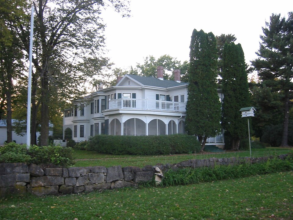
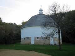
Listed on the National Register of Historic Places in 1973.
From the record
“Frontenac is an unincorporated community and census-designated place (CDP) in Florence Township, Goodhue County, Minnesota, United States, on the Mississippi River. As of the 2020 census, its population was 249.”
Wikipedia article Frontenac, Minnesota, CC BY-SA 4.0.
One of 60 National Register listings published here for Goodhue County · listed in 1973 · category: District.
Also known as. Rural Goodhue County MRA (AD); Rural Goodhue County MRA
Township. Florence township
National Register reference number.73000978- the number the National Park Service assigned this property when it was listed, and the key its nomination file is catalogued under at the National Archives.
SARGENT, E. A., farmer, sec. 23, P. 0. Red Wing. Born in Caledonia county, Vt., Jan. 18, 1823. Moved to Massachusetts with parents when three years old, where he maintained a continued residence for thirty years. Emigrated to Dixon, 111., and came to Red Wing in 1856. Moved to Wastedo in the spring of 185T, and after two years' returned to Red Wing. After two years residence in that city moved to his present farm of 800 acres. Married Abba Currier in 1847. She was born in Salem, N. Y., May 15, 1822, and died at the age of fifty-six. Mr. S. married for his second wife Electa M. Williams. The subject of this sketch was commissioned colonel of the 11th Minnesota State Militia. Has five living children, Charles A., Harry C, Carrie A., William H. and Minnie May. Lost three, Hattie, Amos and Rose.
TENGNARR, THOMAS N., farmer, sec. 28, P. 0. Red Wing. Born in Sweden, May 1, 1844. Arrived in New. York city, Sept. 1, 1868, and in Red Wing, Sept. 11, 1868, and has maintained a continued residence in this county ever since. Married Segrea Phres, who was born in Sweden, April 22, 1842. They have five living children. Hattie, Frank, Matilda, Annette and Selma; one dead - Nelse.
Regional context, not property-specific
evidence. The
federal wildfire occurrence database
lists 12 fires within 5 miles of Old Frontenac Historic District
between 1992 and 2019, burning about 41 acres in total. None started naturally. 1 was recorded as arson.
Distance is straight-line from the map coordinates, so a fire counted
here may appear on a neighbouring settlement's page as well.
Reported cause
Fires
Debris and open burning
5
Missing data/not specified/undetermined
2
Railroad operations and maintenance
2
Smoking
1
Arson/incendiarism
1
Equipment and vehicle use
1
The most recent of
them, most recent first, with the day each was reported and the service
that recorded it.
Regional context, not property-specific
evidence. The federal mineral resources record lists
20 workings within 5 miles of Old Frontenac Historic District: 7 past producers, 7 occurrences, 5 producers, 1 prospect.
5 still produce. What was taken out: Sand and Gravel, Construction, Stone, Crushed/Broken, Silica, Sand and Gravel, Industrial/Frac Sand. Distance is straight-line from the
map coordinates, so a quarry counted here may appear on a neighbouring
settlement's page as well.
Regional context, not property-specific
evidence. The National Weather Service names
Red Wing, the town this property stands in, in 44 storm reports between 1996 and 2026: 22 thunderstorm wind, 18 hail, 2 lightning, 1 flash flood.
The reports record 1 death and 1 injury. Each account below is quoted exactly as the forecast office
filed it, from the NOAA Storm Events Database, and each date
opens the federal record of that event.
Numerous trees were blown down between Red Wing and Wacouta. An individual was injured during this storm from a fallen tree that landed on a detached garage, and trapped him as the garage collapsed.
There were numerous trees blown down around and in the city of Red Wing. Some of the trees caused damage as they landed on power lines, roofs and vehicles. As the storms moved east into Wisconsin, the Red Wing airport had a measured wind gust of 75 mph.
There was lots of wind damage in Red Wing where many trees and branches were blown down, including damage to roofs, and power outages throughout the city. There was a measured wind report from a private weather station of 61 mph west of Red Wing at 1635 LST.
Early morning thunderstorms caused a house fire in Red Wing. The home was located on 1175 Golf Ridge Circle. Most of the structural damage was to the outside of the house with some charring of some flooring and walls, and some water damage from a water pipe that was in contact with the gas line. There was also a hole in the gas line from the electrical current passing through.
The owner of Bill's Bay Marina in Red Wing, Minnesota, received damage to their |dock fingers, as severe winds caused these dock fingers to twist and mangle up.
The Red Wing Fire Department reported a bolt of lightning caused a small fire of the exterior of a home at 1141 East Ave in Red Wing. The small fire was extinguished within minutes and no injuries were reported.
A storm survey of two neighborhoods in Red Wing determined damage was due to a downburst. The roof of a home was partially removed, the garage door to a large machine shed was blown in, and a few dozen trees were uprooted.
Scattered trees down in Red Wing. This was the last report in Minnesota from a mesocyclone and complex of storms that produced its first severe weather in Swift County (9 N Kerkhoven) at 1427.
No historic map-sheet match is published
for this property yet. That does not mean no map exists. This record needs
a coordinate-quality review before it can be joined to a sheet boundary.
Browse the county's mapped places while that work is
pending.
Listed places nearby
4 within 8 miles
Other National Register properties close
enough to walk or drive between, ordered by distance from this one. Both
positions come from the same geocoding pass that matched these properties
to their map sheets.
Listing record. National Park Service National Register of Historic Places, listed-properties dataset, current to 2026-05-22.
Map join. Address geocoded through the United States Census geocoder, then tested against the published boundary of every sheet in the USGS Historical Topographic Map Collection.
How this page is made. Listing fields come from federal records; map-sheet coverage is a labelled coordinate-to-boundary calculation, not a source-field claim.
Wildfire. Short, Karen C. 2022. Spatial wildfire occurrence data for the United States, 1992-2020 [FPA_FOD_20221014]. 6th Edition. Fort Collins, CO: Forest Service Research Data Archive. https://doi.org/10.2737/RDS-2013-0009.6 Collected with United States Government funding and usable without additional permissions or fees.
Mines and quarries. USGS Mineral Resources Data System (MRDS) https://mrdata.usgs.gov/mrds/ A work of the United States government, no copyright under 17 U.S.C. 105.
Storms. NOAA National Centers for Environmental Information, Storm Events Database https://www.ncei.noaa.gov/stormevents/ A work of the United States government, no copyright under 17 U.S.C. 105. Narratives are quoted verbatim from the National Weather Service report and are not edited or summarised.
 Block