 Block
From the record
One of 16 National Register listings published here for Pipestone County · listed in 1977 · category: District.
Sources: the case file at the National Archives · the National Register database, National Park Service
Listed on the National Register of Historic Places in 1977.
One of 16 National Register listings published here for Pipestone County · listed in 1977 · category: District.
Sources: the case file at the National Archives · the National Register database, National Park Service
The chapter on Pipestone City in An Illustrated History of the Counties of Rock and Pipestone, Minnesota, published 1911 names Pipestone. This is what it says, exactly as the scans read.
ON THE mountains of the prairie, 4G west). The elevation of Pipestone on the great red l'ipest(jne quarry, above sea level is 1740 feet.' As a railroad where, the poet tells us, in ages center it takes high rank, four .separate past the Great Spirit stood and called the systems having lines to the city. In the tribes of men together, is the city of state of Minnesota are only two cities - - Pipestone, capital of Pipestone county. Minneapolis and St. Paul - that have History records that wherever the North greater railroad facilities, and only two American Indians were in the habit of others - ilankato and Albert Lea - that gathering in large numbers, for places of have as many railroads as Pipestone. The residence, council, or worship, those spots railroad com]>anies that operate lines to have invariably Ijeen selected by white Pipestone are tlie Great Northern, the Chimen on which to locate their centers of cago, Milwaukee & St. P'aul, the Chipopulation. There is scarce an instance cago. Rock Island & Pacific, and the Chito the contrary, and, indeed, it would cago, St. Paul, Minneapolis & Omaha, have been remarkable had a city not been The city, therefore, enjoys excellent shipfounded at the famous quarries. For ping facilities, a circumstance to which wliere is now the modern city of Pipestone, is due much of Pipestone's ]>rosperity and the aborigines were wont to gather to re- growth.
Passage source: An Illustrated History of the Counties of Rock and Pipestone, Minnesota, published 1911.
Centennial streets. On June 4 nf tlie same year D. E. Sweet, his wife and little son, and John Lowry took up their residence at the point where it was determined to found the town, a point fortyfive miles from the nearest railroad and also a long distance from the nearest white settlement. ]\rr. Sweet tore down the Bennett cabin, wliich had been donated him l)y Jlr. Bennett, and erected a more substantial home, and in December Mr. Jmwry erected the town's second building - a small cabin. In August, 1874, when there was only one building in Pipestone (and in Pipestone county), through the instrumentality of Mr. Sweet, the Pipestone postoffice was established and Mr. Sweet received the commission as postmaster.-
Passage source: An Illustrated History of the Counties of Rock and Pipestone, Minnesota, published 1911.
Machine-read from a century-old scan, so expect the errors a machine makes: misspelled names, dropped words, stray characters.
Read the whole chapter on Pipestone City - 7,107 words on its settlement, mills, schools and churches.
Regional context, not property-specific evidence. The federal wildfire occurrence database lists 1 fire within 5 miles of Pipestone Commercial Historic District in 2017, burning about 40 acres in total. None started naturally. None was recorded as arson. Distance is straight-line from the map coordinates, so a fire counted here may appear on a neighbouring settlement's page as well.
| Reported cause | Fires |
|---|---|
| Smoking | 1 |
The most recent of them, most recent first, with the day each was reported and the service that recorded it.
| Date | Cause | Size | Reported by | Name on the report |
|---|---|---|---|---|
| 28 November 2017 | Smoking | 40 acres | Pipestone National Monument | PIPESTONE LH40 |
Regional context, not property-specific evidence. The federal mineral resources record lists 1 working within 5 miles of Pipestone Commercial Historic District: 1 producer. All of them still produce. What was taken out: Clay. Distance is straight-line from the map coordinates, so a quarry counted here may appear on a neighbouring settlement's page as well.
| Where | Site | Commodity | Status | Recorded |
|---|---|---|---|---|
| Pipestone Quarry | Clay | Producer |
Regional context, not property-specific evidence. The National Weather Service names Pipestone, the town this property stands in, in 70 storm reports between 1993 and 2025: 36 hail, 20 thunderstorm wind, 8 flood, 3 flash flood. No death or injury is recorded in these reports. Each account below is quoted exactly as the forecast office filed it, from the NOAA Storm Events Database, and each date opens the federal record of that event.
| When | Event | Place named | Harm | What the report says |
|---|---|---|---|---|
| June 1997 | Hail | Pipestone | $100,000 | no account filed |
| September 2019 | Flash Flood | Pipestone | $75,000 | Within three hours of the start of heavy rainfall, the river gage on Pipestone Creek at Pipestone rose quickly over flood stage. Several homes on the northeast side of Pipestone were inundated with flood water. |
| May 2012 | Flood | Pipestone | $30,000 | Heavy rain caused brief but record flooding of Pipestone Creek. Fields, parkland, and roads were flooded, including the Pipestone County fairgrounds. One street in the city of Pipestone caved in. The creek crested at 5.71 feet above flood stage on May 6th. |
| June 2011 | Lightning | Pipestone | $25,000 | Lightning struck an apartment building, starting a fire in the attic which heavily damaged an upstairs apartment. Another upstairs apartment suffered water damage, while two basement apartments were undamaged. Six residents home in the apartments at the time of the lightning strike escaped uninjured. |
| June 1996 | Hail | Pipestone | $10,000 | no account filed |
| May 2004 | Thunderstorm Wind | Pipestone | $5,000 | Thunderstorm winds blew down power lines near state highway 30 just east of the South Dakota state line. |
| September 2025 | Thunderstorm Wind | Pipestone | - | Thunderstorm wind gusts blew down a large tree and knocked out power across much of Pipestone. There was not much rain, but a couple minutes of very strong wind. |
| September 2021 | Thunderstorm Wind | Pipestone | - | Thunderstorm winds were measured by the Redstone RAWS site RPPM5 1 miles north of Pipestone. Crop damage is an estimate from insured losses. Information provided by the United States Department of Agriculture. |
| June 2020 | Thunderstorm Wind | Pipestone | - | RAWS site 216901 (Redstn) 1 mile north northwest of Pipestone measured a peak wind gust of 65 mph. |
| June 2019 | Tornado (EF0) | Pipestone | - | A brief and small landspout occurred in the northwest side of Pipestone, causing minor damage to three buildings. Two metal sheds sustained damage to small sections of roof and door panels. The tornado then crossed a street and hit an apartment building where a 10 foot by 5 foot section of the south facing roof was removed. The average path width was 10 yards. |
| August 2019 | Thunderstorm Wind | Pipestone | - | Numerous power outages were reported around Pipestone with tree limbs down. |
| July 2017 | Thunderstorm Wind | Pipestone | - | A tree fell onto a car in town. |
| June 2014 | Flood | Pipestone | - | Repeated heavy rains caused brief moderate flooding of Pipestone Creek, with farmland and some roads flooded. The river crested at 2.15 feet above flood stage at Pipestone on June 15th. |
| June 2013 | Flood | Pipestone | - | Heavy rain caused Pipestone Creek to briefly flood on June 23rd, with lowlands including a few rural roads affected. The creek crested at 0.9 foot above flood stage at Pipestone on June 23rd. |
| May 2012 | Flood | Pipestone | - | Heavy rain caused moderate flooding of Pipestone Creek, with flooding of parkland and a few roads. The creek crested at 2.78 feet above flood stage on May 26th. |
| June 2011 | Flood | Pipestone | - | Heavy rain caused moderate flooding of Pipestone Creek, with lowlands along the creek and a few roads affected. The creek crested at 2.5 feet above flood stage at Pipestone on June 14th. |
| July 2011 | Flood | Pipestone | - | Runoff from heavy rain caused minor lowland flooding along Pipestone Creek. The creek crested at 1.2 feet above flood stage at Pipestone on July 11th. |
| March 2010 | Flood | Pipestone | - | Rapid melting of a heavy winter snowpack caused minor flooding of farmland and other lowlands along Pipestone Cree. The creek crested at 1.9 feet above flood stage on March 14th. |
| September 2010 | Flood | Pipestone | - | Heavy rain caused Pipestone Creek to rise quickly above flood stage to a record level. The creek fell quickly also, but some effects of the flooding including standing water continued. The flooding reached some homes and businesses in and near the town of Pipestone, and farmland was flooded. |
| July 2010 | Thunderstorm Wind | Pipestone | - | Thunderstorm winds caused tree damage, including several large trees blown down. |
| May 2007 | Hail | Pipestone | - | Large hail was mostly penny size with a few golf ball size stones. |
| August 2005 | Thunderstorm Wind | Pipestone | - | Thunderstorm winds caused tree damage, including at least two trees blown down. |
| July 2005 | Thunderstorm Wind | Pipestone | - | Thunderstorm winds caused tree damage, including several trees blown down. At least one fallen tree blocked a street. Trees falling on power lines caused a power outage. |
| May 2004 | Flash Flood | Pipestone | - | Rainfall of around 3 inches caused flooding of several roads and basements in Pipestone. |
| May 2004 | Hail | Pipestone | - | Large hail covered the ground and caused significant damage to corn, soybean, and other small grain crops. The amount of damage was unknown, because many of the early stage crops were expected to grow back, and others could be replanted. |
| May 2004 | Thunderstorm Wind | Pipestone | - | Thunderstorm winds caused tree damage, including several trees blown down. The amount of damage was not known. |
| July 2004 | Hail | Pipestone | - | Large hail fell in a swath from west central to south central Pipestone County. Towns affected included Pipestone and Trosky. The hail caused significant crop damage along its path, including stripping the leaves off corn and soybean plants and bruising the stems. A large loss of yield was expected in spite of some expected recovery of damaged crops. |
| June 2002 | Flash Flood | Pipestone | - | Heavy rain caused flooding of county roads and lowlands in the Pipestone area. |
| May 1993 | Thunderstorm Wind | Pipestone | - | Strong thunderstorm winds blew down several trees. |
| September 2025 | Hail | Pipestone | - | no account filed |
| May 2022 | Hail | Pipestone | - | no account filed |
| July 2019 | Thunderstorm Wind | Pipestone | - | no account filed |
| July 2014 | Hail | Pipestone | - | no account filed |
| May 2012 | Hail | Pipestone | - | no account filed |
| April 2011 | Hail | Pipestone | - | no account filed |
| April 2011 | Hail | Pipestone | - | no account filed |
| April 2011 | Hail | Pipestone | - | no account filed |
| July 2010 | Thunderstorm Wind | Pipestone | - | no account filed |
| July 2009 | Hail | Pipestone | - | no account filed |
| July 2009 | Hail | Pipestone | - | no account filed |
| August 2009 | Hail | Pipestone | - | no account filed |
| August 2009 | Hail | Pipestone | - | no account filed |
| August 2007 | Hail | Pipestone | - | no account filed |
| August 2007 | Hail | Pipestone | - | no account filed |
| May 2007 | Hail | Pipestone | - | no account filed |
| May 2007 | Hail | Pipestone | - | no account filed |
| May 2007 | Hail | Pipestone | - | no account filed |
| June 2006 | Hail | Pipestone | - | no account filed |
| June 2006 | Hail | Pipestone | - | no account filed |
| June 2006 | Hail | Pipestone | - | no account filed |
| September 2006 | Hail | Pipestone | - | no account filed |
| June 2005 | Hail | Pipestone | - | no account filed |
| June 2005 | Thunderstorm Wind | Pipestone | - | no account filed |
| June 2005 | Thunderstorm Wind | Pipestone | - | no account filed |
| May 2004 | Hail | Pipestone | - | no account filed |
| April 2004 | Hail | Pipestone | - | no account filed |
| June 2003 | Hail | Pipestone | - | no account filed |
| June 2003 | Hail | Pipestone | - | no account filed |
| June 2003 | Hail | Pipestone | - | no account filed |
| June 2003 | Thunderstorm Wind | Pipestone | - | no account filed |
No historic map-sheet match is published for this property yet. That does not mean no map exists. This record needs a coordinate-quality review before it can be joined to a sheet boundary. Browse the county's mapped places while that work is pending.
Other National Register properties close enough to walk or drive between, ordered by distance from this one. Both positions come from the same geocoding pass that matched these properties to their map sheets.
| Photograph | Property | Distance | Listed |
|---|---|---|---|
 | Calumet Hotel | under 500 feet | 1976 |
 | Pipestone Public Library | 0.2 miles | 1980 |
| Pipestone County Courthouse | 0.2 miles | 1980 | |
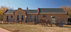 | Burlington Cedar Rapids and Northern Depot | 0.4 miles | 1980 |
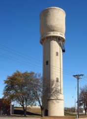 | Pipestone Water Tower | 0.4 miles | 1980 |
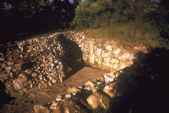 | Cannomok'e-Pipestone National Monument | 1.0 miles | 1966 |
| National Archives record | The nomination case file for reference 77000761 in Record Group 79. |
| Pipestone County | All 16 listed properties in this county. |