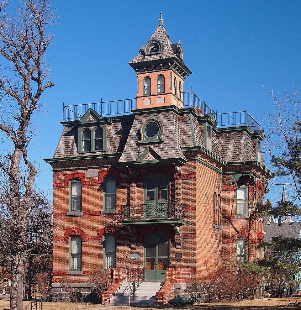
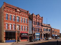
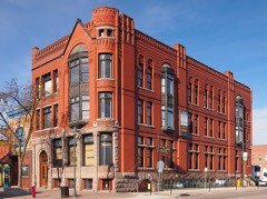
Listed on the National Register of Historic Places in 1978.
From the record
“The Michael Majerus House is a historic house in St. The Michael Majerus House was listed on the National Register of Historic Places in 1978 for its local significance in the theme of architecture.”
Wikipedia article Michael Majerus House, CC BY-SA 4.0.
One of 36 National Register listings published here for Stearns County · listed in 1978 · category: Building.
National Register reference number.78001564- the number the National Park Service assigned this property when it was listed, and the key its nomination file is catalogued under at the National Archives.
The ground it stands on
4,619 words
The chapter on St. Cloud City in History of Stearns County, Minnesota, published 1915 names St. Cloud. This is what it says, exactly as the scans read.
St. Cloud township lies on the east side of the county, being bounded on the east by the Mississippi river. It has an area of about 19,000 acres. The soil is a rich dark loam, and very productive. The northwest portion of the town is watered by Sauk river, which flows in a northeasterly direction, and crossing the extreme southeast corner of Le Sauk empties into the Mississippi.
In the earlier days the affairs of the township and the townsite v/ere so closely allied that it is at this date difficult to separate them. There was for a time not much outside the townsite to chronicle, yet it was in the township of St. Cloud that the first white child in Stearns county was born and that the first furrow was turned. John Becker came to St. Cloud, or to what afterwards came to be known as St. Cloud, October 7, 1851, to open up a farm for his cousin, Geo. L. Becker, of St. Paul, who afterwards was president of the first railroad built to St. Cloud. He broke about two hundred acres of land, selling to the Indians everything that was raised on the farm except what was consumed on the place. He occupied the Lowry house, to which he built an addition. In company with a man named Douglas he lived there, the two doing the housekeeping, until the spring of the following year, when Mr. Becker went to Ann Arbor, Mich., his former home, and June 1, 1852, married Merriam F. Barr, starting the same day for St. Cloud. It was while they lived on the Lowry place that their daughter, Ora Ella Becker, was born, February 24, 1854, the first white child in Stearns county. Charles Fillmore was the second. As there was no other means of crossing the Mississippi river, Mr. Becker brought a number of the settlers who followed in later years from the east to the west side in a wagon drawn by a yoke of oxen, afterwards running a ferry for two years. He took a claim where Waite Park is now located, and when he sold this in 1876 moved to the city. In 1879 his eldest daughter - there were two other children, Frank H. and Mary E. - was married to Geo. M. McLane, of Brown's Valley, and went there to live, that place being still her home. On account of Mrs. Becker's ill health Mr. and Mrs. Becker moved to Brown's Valley, where all their children were and where the mother died April 5, 1910. Mr. Becker is making his home there.
Regional context, not property-specific
evidence. The
federal wildfire occurrence database
lists 64 fires within 5 miles of Michael Majerus House
between 1992 and 2018, burning about 226 acres in total. None started naturally. 19 were recorded as arson.
Distance is straight-line from the map coordinates, so a fire counted
here may appear on a neighbouring settlement's page as well.
Reported cause
Fires
Debris and open burning
22
Arson/incendiarism
19
Railroad operations and maintenance
7
Equipment and vehicle use
6
Missing data/not specified/undetermined
4
Smoking
3
Recreation and ceremony
3
The most recent of
them, most recent first, with the day each was reported and the service
that recorded it.
Regional context, not property-specific
evidence. The federal mineral resources record lists
7 workings within 5 miles of Michael Majerus House: 7 producers.
All of them still produce. What was taken out: Sand and Gravel, Construction, Stone, Crushed/Broken, Granite. Distance is straight-line from the
map coordinates, so a quarry counted here may appear on a neighbouring
settlement's page as well.
No historic map-sheet match is published
for this property yet. That does not mean no map exists. This record needs
a coordinate-quality review before it can be joined to a sheet boundary.
Browse the county's mapped places while that work is
pending.
Listed places nearby
6 within 8 miles
Other National Register properties close
enough to walk or drive between, ordered by distance from this one. Both
positions come from the same geocoding pass that matched these properties
to their map sheets.
Listing record. National Park Service National Register of Historic Places, listed-properties dataset, current to 2026-05-22.
Map join. Address geocoded through the United States Census geocoder, then tested against the published boundary of every sheet in the USGS Historical Topographic Map Collection.
How this page is made. Listing fields come from federal records; map-sheet coverage is a labelled coordinate-to-boundary calculation, not a source-field claim.
Wildfire. Short, Karen C. 2022. Spatial wildfire occurrence data for the United States, 1992-2020 [FPA_FOD_20221014]. 6th Edition. Fort Collins, CO: Forest Service Research Data Archive. https://doi.org/10.2737/RDS-2013-0009.6 Collected with United States Government funding and usable without additional permissions or fees.
Mines and quarries. USGS Mineral Resources Data System (MRDS) https://mrdata.usgs.gov/mrds/ A work of the United States government, no copyright under 17 U.S.C. 105.
 Block