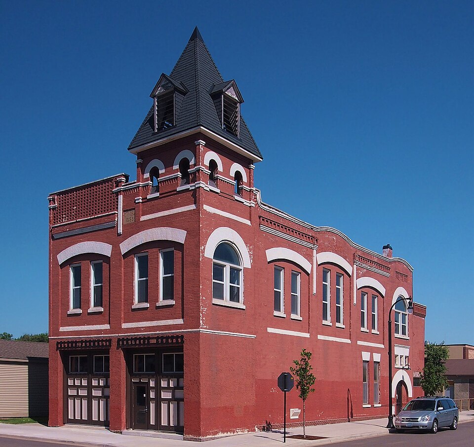
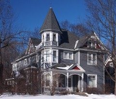
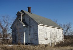
Built in 1888 (Romanesque Revival architecture). Listed on the National Register of Historic Places in 1979.
From the record
“The original Delano Village Hall is a historic government building in Delano, Minnesota, United States, now in development as the Delano Heritage Center. From its construction in 1888 through most of the 20th century the building housed municipal offices, the police and fire departments, and a public library, while the upper-floor meeting hall was a key venue for public and private events.”
Wikipedia article Delano Village Hall, CC BY-SA 4.0.
One of 22 National Register listings published here for Wright County · listed in 1979 · category: Building · built in 1888, Romanesque Revival architecture.
National Register reference number.79001264- the number the National Park Service assigned this property when it was listed, and the key its nomination file is catalogued under at the National Archives.
Delano is one of the largest and most prosperous of Wright county villages. It is well laid out, has many natural advantages, splendid public buildings, and sightly streets with shade trees, velvety lawns and good residences. There is an excellent system of waterworks, a limited sewer system which will soon be enlarged, good schools, the best of fire protection and a large public park, where a large grove gives opportunity for picnics and reunions, and a well-kept athletic field furnishes an arena for numerous exciting baseball contests. After long experimenting with municipal lighting the village has signed a contract with the General Electric Company of Minneapolis to furnish a continuous twenty-four hour service. The fire department is well equipped, and the fire protection of the village has beer highly praised. The village hall is ample for the purposes for which it is intended, and houses the jail, the fire department, the council chambers, the clerk's office, and a hall for public entertainments, equipped with a stage and good scenery. St. Peter's Catholic Church is considered in many ways the finest church building in the Northwest.
Delano is a good trading point, is noted for its progressive spirit and has a population of about 1,200. It is situated on the Great Northern, twenty-eight miles west of Minneapolis. It has Polish and German Catholie, Episcopal, German Lutheran and Methodist churches, two hotels, two banks, a flour mill, a ereamery, and other industries. The Eagle Printing Co. is widely known for its excellent printing and carries on a large business.
Regional context, not property-specific
evidence. The
federal wildfire occurrence database
lists 6 fires within 5 miles of Delano Village Hall
between 2000 and 2012, burning about 116 acres in total. None started naturally. None was recorded as arson.
Distance is straight-line from the map coordinates, so a fire counted
here may appear on a neighbouring settlement's page as well.
Reported cause
Fires
Railroad operations and maintenance
4
Missing data/not specified/undetermined
2
The most recent of
them, most recent first, with the day each was reported and the service
that recorded it.
Regional context, not property-specific
evidence. The federal mineral resources record lists
2 workings within 5 miles of Delano Village Hall: 2 producers.
All of them still produce. What was taken out: Granite, Sand and Gravel, Construction. Distance is straight-line from the
map coordinates, so a quarry counted here may appear on a neighbouring
settlement's page as well.
Regional context, not property-specific
evidence. The National Weather Service names
Delano, the town this property stands in, in 58 storm reports between 1993 and 2025: 27 hail, 24 thunderstorm wind, 2 tornado, 2 heavy rain.
No death or injury is recorded in these reports. Each account below is quoted exactly as the forecast office
filed it, from the NOAA Storm Events Database, and each date
opens the federal record of that event.
Tornado touched down briefly, knocking down trees and damaging two houses. One house had a roof blown off while the other had damage to siding and shingles.
A storm survey determined damaging winds accompanied a brief tornado. The damaging winds were offset south and east of the tornado path. At least two dozen trees were downed.
A brief tornado touched down just south of the intersection of Wright County Road 14 and 30th Street Southeast. The tornado tracked northeast and mainly uprooted or broke over 100 trees, most of them at one farmstead. A storm survey was conducted and maximum winds were estimated at 85 mph.
Numerous roads were closed for several days due to snow melt, and the flood waters that develop from it. Rapidly runoff led to impassable roads, especially along streams and creeks along county roads.
Several sources in Wright County compiled a summary of flood related damages and locations for the flood of June 2014. The Crow River At Delano rose to its highest level in 50 years. The primary impacts were flooding of low-level roads and minor basement flooding that begun to affect homes closest to the river. In addition, several parks were closed.
No historic map-sheet match is published
for this property yet. That does not mean no map exists. This record needs
a coordinate-quality review before it can be joined to a sheet boundary.
Browse the county's mapped places while that work is
pending.
Listed places nearby
4 within 8 miles
Other National Register properties close
enough to walk or drive between, ordered by distance from this one. Both
positions come from the same geocoding pass that matched these properties
to their map sheets.
Listing record. National Park Service National Register of Historic Places, listed-properties dataset, current to 2026-05-22.
Map join. Address geocoded through the United States Census geocoder, then tested against the published boundary of every sheet in the USGS Historical Topographic Map Collection.
How this page is made. Listing fields come from federal records; map-sheet coverage is a labelled coordinate-to-boundary calculation, not a source-field claim.
Wildfire. Short, Karen C. 2022. Spatial wildfire occurrence data for the United States, 1992-2020 [FPA_FOD_20221014]. 6th Edition. Fort Collins, CO: Forest Service Research Data Archive. https://doi.org/10.2737/RDS-2013-0009.6 Collected with United States Government funding and usable without additional permissions or fees.
Mines and quarries. USGS Mineral Resources Data System (MRDS) https://mrdata.usgs.gov/mrds/ A work of the United States government, no copyright under 17 U.S.C. 105.
Storms. NOAA National Centers for Environmental Information, Storm Events Database https://www.ncei.noaa.gov/stormevents/ A work of the United States government, no copyright under 17 U.S.C. 105. Narratives are quoted verbatim from the National Weather Service report and are not edited or summarised.
 Block