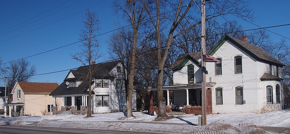
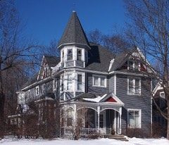
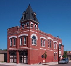
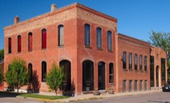
Built in 1904. Listed on the National Register of Historic Places in 1979.
From the record
“Hawkins Clinic, Hospital, and House comprise a historic former medical complex in Montrose, Minnesota, United States. Hawkins established his medical practice in 1897 in the front room of his residence.”
Wikipedia article Dr. E.P. Hawkins Clinic, Hospital, and House, CC BY-SA 4.0.
One of 22 National Register listings published here for Wright County · listed in 1979 · category: Building · built in 1904.
National Register reference number.79001277- the number the National Park Service assigned this property when it was listed, and the key its nomination file is catalogued under at the National Archives.
Montrose was surveyed and platted in 1878 by J. F. Miller, T. S. Gunn and J, N, Haven, The plat included the southwest quarter of section 35 and the southwest quarter of section 36, The proprietors opened a grain house and a general store and did a big business in grain, lumber and ties.
Edward P. Hawkins, M. D., physician and surgeon of Montrosé, is one of the most useful citizens in Wright county, and his general practice, his hospital and his training school, have done much to alleviate suffering, lengthen life, and promote sanitation. He was born in Carthage, Ill, August 9, 1863, son of William R. and Julia (Wright) Hawkins. He received his preparatory education in the schools of his native town. In 1887 he graduated from the Adventist College, at Battle Creek, Mich. With the class of 1897 he completed his course in the medical department of the University of Michigan, at Ann Arbor. In the interim he had taught school for several years. In October, 1897, he located at Montrose, and opened an office. His suecess was assured from the start. His skill, his sympathy, his knowledge won him friends from many miles around, and his practice soon grew to large proportions. People from the country pleaded to be taken into his home for operations, and finally he established a hospital. As a natural outcome of this came the Incorporated Training School for Nurses, in which are six young ladies in training. Dr. Hawkins has a sightly residence, and a roomy hospital building, He is a skilled surgeon and is assisted in his operations by Dr. E. A. Warner, of Waverly. His head nurse is Christine Olson. Dr. Hawkins has traveled extensively, and has made wide research and deep studies. He has done good service as school officer and health office of Montrose, and has also served the village in other capacities. Dr. Hawkins was married January 15, 1889, to Vesta Miller, of Battle Creek, Mich., a classmate of his school days. They have an adopted daughter, Fern Leona.
Regional context, not property-specific
evidence. The
federal wildfire occurrence database
lists 2 fires within 5 miles of Hawkins, Dr. E. P., Clinic, Hospital and House
between 2001 and 2012, burning about 81 acres in total. None started naturally. None was recorded as arson.
Distance is straight-line from the map coordinates, so a fire counted
here may appear on a neighbouring settlement's page as well.
Reported cause
Fires
Missing data/not specified/undetermined
1
Debris and open burning
1
The most recent of
them, most recent first, with the day each was reported and the service
that recorded it.
Regional context, not property-specific
evidence. The federal mineral resources record lists
1 working within 5 miles of Hawkins, Dr. E. P., Clinic, Hospital and House: 1 past producer.
None of them still produces. What was taken out: Sand and Gravel, Construction. Distance is straight-line from the
map coordinates, so a quarry counted here may appear on a neighbouring
settlement's page as well.
Regional context, not property-specific
evidence. The National Weather Service names
Montrose, the town this property stands in, in 29 storm reports between 1999 and 2024: 15 hail, 11 thunderstorm wind, 2 heavy rain, 1 funnel cloud.
No death or injury is recorded in these reports. Each account below is quoted exactly as the forecast office
filed it, from the NOAA Storm Events Database, and each date
opens the federal record of that event.
No historic map-sheet match is published
for this property yet. That does not mean no map exists. This record needs
a coordinate-quality review before it can be joined to a sheet boundary.
Browse the county's mapped places while that work is
pending.
Listed places nearby
6 within 8 miles
Other National Register properties close
enough to walk or drive between, ordered by distance from this one. Both
positions come from the same geocoding pass that matched these properties
to their map sheets.
Listing record. National Park Service National Register of Historic Places, listed-properties dataset, current to 2026-05-22.
Map join. Address geocoded through the United States Census geocoder, then tested against the published boundary of every sheet in the USGS Historical Topographic Map Collection.
How this page is made. Listing fields come from federal records; map-sheet coverage is a labelled coordinate-to-boundary calculation, not a source-field claim.
Wildfire. Short, Karen C. 2022. Spatial wildfire occurrence data for the United States, 1992-2020 [FPA_FOD_20221014]. 6th Edition. Fort Collins, CO: Forest Service Research Data Archive. https://doi.org/10.2737/RDS-2013-0009.6 Collected with United States Government funding and usable without additional permissions or fees.
Mines and quarries. USGS Mineral Resources Data System (MRDS) https://mrdata.usgs.gov/mrds/ A work of the United States government, no copyright under 17 U.S.C. 105.
Storms. NOAA National Centers for Environmental Information, Storm Events Database https://www.ncei.noaa.gov/stormevents/ A work of the United States government, no copyright under 17 U.S.C. 105. Narratives are quoted verbatim from the National Weather Service report and are not edited or summarised.
 Block