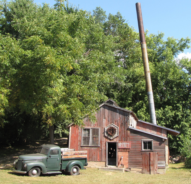
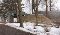
Listed on the National Register of Historic Places in 1979.
From the record
“The Seha Sorghum Mill is a historic sorghum syrup mill in Janesville Township, Minnesota, United States, in operation circa 1904 to 1956. It was listed on the National Register of Historic Places in 1979 for having state-level significance in the themes of agriculture, engineering, industry, and social history.”
Wikipedia article Seha Sorghum Mill, CC BY-SA 4.0.
One of 12 National Register listings published here for Waseca County · listed in 1979 · category: Building.
National Register reference number.79003718- the number the National Park Service assigned this property when it was listed, and the key its nomination file is catalogued under at the National Archives.
The records of this township for the first ten years of its existence are missing; and the best that can be done is to give Avhat can be picked up here and there from other sources. It is among the early traditions that the first white settlers in Janesville were a man named John Douglas and another named Hughes. They did not become permanent settlers, but removed, shortly afti.Twards, further west. The next settlers were two dissolute characters, Alfred Holstein and John Davis. Davis claimed a portion of section 28, and Holstein a portion of section 27. Their principal business was trading with the Indians, and, by common reputation, they dealt mostly in whisky and tobacco - Davis, especially, being a great drinker himself. Both of them were social, friendly, and kind hearted to all comers, but their ideas of morality and decency were not of high grade. Davis finally went to one of the Carolinas. Holstein was sent to state prison by a United' States court for stealing horses from the Winnebago Indians. A man named John Rowley settled on section 9, the same summer and became a long-time resident.
John Cunningham was one of those first-class men who settled in Janesville in 1855. He made his claim on section 29, where he resided until his death, August 30, 1870. He was one of the first to respond to the call for men to fight the Indians in 1862, and enlisted October 4th, with ten other men from this county, in Company B, First Minnesota ^Mounted Rangers, and served until the close of the Indian war. He married Mrs. ]\Iary Crawford, widow of AV. H. Crawford, one of the early settlers of this county. At the breaking out of the war ^iv. Crawford was murdered by Texas rebels for the awful crime of being a northern republican.
Regional context, not property-specific
evidence. The
federal wildfire occurrence database
lists 2 fires within 5 miles of Seha Sorghum Mill
in 2006, burning about 2 acres in total. None started naturally. 2 were recorded as arson.
Distance is straight-line from the map coordinates, so a fire counted
here may appear on a neighbouring settlement's page as well.
Reported cause
Fires
Arson/incendiarism
2
The most recent of
them, most recent first, with the day each was reported and the service
that recorded it.
Regional context, not property-specific
evidence. The National Weather Service names
Janesville, the town this property stands in, in 40 storm reports between 1997 and 2025: 17 hail, 14 thunderstorm wind, 3 tornado, 2 funnel cloud.
No death or injury is recorded in these reports. Each account below is quoted exactly as the forecast office
filed it, from the NOAA Storm Events Database, and each date
opens the federal record of that event.
An EF-0 tornado touched down just south of Elysian Lake Road, just south of 412th Avenue, in northern Waseca County. The tornado tracked north for approximately 2.8 miles while paralleling the eastern shore of Elysian Lake and Elysian Lake Road. It crossed Elysian Lake near 427th Ave, before moving into southern Le Sueur County. ||Damage was primarily associated with uprooted trees and roof damage. The worst damage occurred to a farmstead which had a metal storage shed collapse along Elysian Lake Road. ||Based on trees uprooted and structural damage to a metal storage shed, winds were estimated around 80 mph.
Several trees and large branches were blown down between Janesville and Waseca, with a street light damaged, and a few metal sheds and trampolines thrown.
A NWS storm survey, plus areal footage of drone and satellite data, concluded that an EF0 tornado tracked 1.4 miles from southwest of Reeds Lake, then northeast to the Waseca, Le Sueur county line. Tornado damage was consistent with EF0 damage with winds up to 75 mph, and a maximum path width of 125 yards.
Captured on video by law enforcement, this was the seventh and last in a series of tornadoes produced by a cyclic tornadic supercell. It touched down briefly in an open field and dissipated before reaching the city of Janesville.
No historic map-sheet match is published
for this property yet. That does not mean no map exists. This record needs
a coordinate-quality review before it can be joined to a sheet boundary.
Browse the county's mapped places while that work is
pending.
Listed places nearby
2 within 8 miles
Other National Register properties close
enough to walk or drive between, ordered by distance from this one. Both
positions come from the same geocoding pass that matched these properties
to their map sheets.
Listing record. National Park Service National Register of Historic Places, listed-properties dataset, current to 2026-05-22.
Map join. Address geocoded through the United States Census geocoder, then tested against the published boundary of every sheet in the USGS Historical Topographic Map Collection.
How this page is made. Listing fields come from federal records; map-sheet coverage is a labelled coordinate-to-boundary calculation, not a source-field claim.
Wildfire. Short, Karen C. 2022. Spatial wildfire occurrence data for the United States, 1992-2020 [FPA_FOD_20221014]. 6th Edition. Fort Collins, CO: Forest Service Research Data Archive. https://doi.org/10.2737/RDS-2013-0009.6 Collected with United States Government funding and usable without additional permissions or fees.
Storms. NOAA National Centers for Environmental Information, Storm Events Database https://www.ncei.noaa.gov/stormevents/ A work of the United States government, no copyright under 17 U.S.C. 105. Narratives are quoted verbatim from the National Weather Service report and are not edited or summarised.
 Block