 Block
From the record
One of 60 National Register listings published here for Goodhue County · listed in 1980 · category: Building.
Sources: the case file at the National Archives · the National Register database, National Park Service
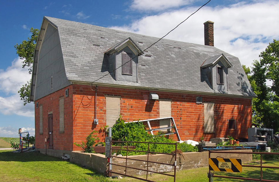
Listed on the National Register of Historic Places in 1980.
One of 60 National Register listings published here for Goodhue County · listed in 1980 · category: Building.
Sources: the case file at the National Archives · the National Register database, National Park Service
The chapter on Roscoe Township in History of Goodhue County, Including a Sketch of the Territory and State of Minnesota; Together with an Account of the Early French Discoveries, Indian Massacres, the Part Borne by Minnesota's Patriots in the War of the Great Rebellion, and a Full and Complete History of the County from the Time of Its Occupancy by Swiss Missionaries in 1838. Pioneer Incidents, Biographical Sketches of Early and Prominent Settlers and Representative Men, and of Its Cities, Towns, Churches, Schools, Secret Societies, Etc, published 1878 names Pine Island. This is what it says, exactly as the scans read.
POWERS, U. B., farmer, sec. 20, P. O. Roscoe. Born in Buffalo, Jan. 31, 1836. Emigrated to Pa. in 1852; to Wis. in 1854; and in Oct., same year, came to this Co. and settled in Pine Island, where he pre-empted 160 acres on sec. 31, built a cabin and lived two years, and moved on sec. 30; was the first living settler in that town. Married Mary E. Miller in 1856; she was born in Pa., Feb, 28, 1838. Moved on his present estate in 1864, con- sisting of 120 acres. Mr. P. was the first man to run the mill built by Howard at P. Island in L855. Flora A., George B , James C, Alice M., Frank E., Mark H. and William R. are their children.
PETERSON, NELS, farmer, sec. 13, P. 0. Zumbrota. Born in Norway in 1826. Married Christina Christianson in 1851. She died in 1867 and left five children, Peter, Mathias, Carrie, Mary and Emma. Emigrated to America in 1861, and settled in Pine Island, where he purchased a farm, and in 1869 he married Gena Goodmand. She was born in Norway in 1840, and ha,ve four children, Gustave B., Adrian A., Adolph E. and Nicol G. In 1875, he settled on his present estate, consisting of 80 acres. Are members of Lutheran Church.
Machine-read from a century-old scan, so expect the errors a machine makes: misspelled names, dropped words, stray characters.
Read the whole chapter on Roscoe Township - 4,561 words on its settlement, mills, schools and churches.
Regional context, not property-specific evidence. The federal wildfire occurrence database lists 3 fires within 5 miles of Roscoe Butter and Cheese Factory between 2003 and 2015, burning about 6 acres in total. None started naturally. None was recorded as arson. Distance is straight-line from the map coordinates, so a fire counted here may appear on a neighbouring settlement's page as well.
| Reported cause | Fires |
|---|---|
| Missing data/not specified/undetermined | 3 |
The most recent of them, most recent first, with the day each was reported and the service that recorded it.
| Date | Cause | Size | Reported by | Name on the report |
|---|---|---|---|---|
| 27 August 2003 | Missing data/not specified/undetermined | under an acre | Minnesota Department of Natural Resources | not named |
| 29 April 2015 | Missing data/not specified/undetermined | under an acre | Minnesota Department of Natural Resources | not named |
| 8 October 2003 | Missing data/not specified/undetermined | 6.0 acres | Minnesota Department of Natural Resources | not named |
Regional context, not property-specific evidence. The federal mineral resources record lists 2 workings within 5 miles of Roscoe Butter and Cheese Factory: 2 producers. All of them still produce. What was taken out: Stone, Crushed/Broken. Distance is straight-line from the map coordinates, so a quarry counted here may appear on a neighbouring settlement's page as well.
| Where | Site | Commodity | Status | Recorded |
|---|---|---|---|---|
| Peterson Quarry | Stone, Crushed/Broken | Producer | ||
| Roscoe Quarry | Stone, Crushed/Broken | Producer |
Regional context, not property-specific evidence. The National Weather Service names Pine Island, the town this property stands in, in 1 storm report in 1996: 1 thunderstorm wind. No death or injury is recorded in these reports. Each account below is quoted exactly as the forecast office filed it, from the NOAA Storm Events Database, and each date opens the federal record of that event.
| When | Event | Place named | Harm | What the report says |
|---|---|---|---|---|
| May 1996 | Thunderstorm Wind | Pine Island | - | no account filed |
No historic map-sheet match is published for this property yet. That does not mean no map exists. This record needs a coordinate-quality review before it can be joined to a sheet boundary. Browse the county's mapped places while that work is pending.
Other National Register properties close enough to walk or drive between, ordered by distance from this one. Both positions come from the same geocoding pass that matched these properties to their map sheets.
| Photograph | Property | Distance | Listed |
|---|---|---|---|
 | Church of St. Rose of Lima | 4.4 miles | 2013 |
| Bringgold, Jacob A. and Mary Finn House | 6.1 miles | 2014 | |
| Jacob Bringghold House | 6.1 miles | 1980 | |
 | Opera Block House | 6.3 miles | 1980 |
 | Pine Island City Hall and Fire Station | 6.3 miles | 1980 |
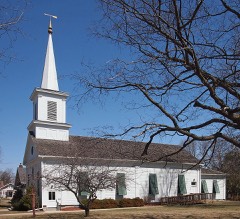 | First Congregational Church of Zumbrota | 6.8 miles | 1980 |
| National Archives record | The nomination case file for reference 80002054 in Record Group 79. |
| Goodhue County | All 60 listed properties in this county. |