
BlockBefore

James B. Wakefield House

Listed on the National Register of Historic Places in 1980.

From the record

“Following events in their order, we now record the fact that Blue Earth City, the only village in the township, and the oldest in the county, was surveyed and platted in July, 1856, and the first buildings were erected in that year. The founding of the village preceded the organization and naming of the township.”

The History of Faribault County, Minnesota : from Its First Settlement to the Close of the Year 1879 : the Story of the Pioneers (1896). Machine-read text.

One of 11 National Register listings published here for Faribault County · listed in 1980 · category: Building.

Sources: the county history on the Internet Archive · the case file at the National Archives · the National Register database, National Park Service
The listing

  • What is counted as historic. The nomination lists 1 building as contributing to the listing.
  • Listed as. Wakefield, James B., House - the National Register files a house under its owner's surname.
  • Address. 405 E. 6th St., Blue Earth, 56013
  • When was it listed? May 1980
  • Category. building
  • Also known as. Faribault County MRA
  • City. Blue Earth city
  • National Register reference number. 80004258 - the number the National Park Service assigned this property when it was listed, and the key its nomination file is catalogued under at the National Archives.

The ground it stands on

6,978 words

The chapter on Blue Earth City in The History of Faribault County, Minnesota : from Its First Settlement to the Close of the Year 1879 : the Story of the Pioneers, published 1896 names Blue Earth. This is what it says, exactly as the scans read.

Following events in their order, we now record the fact that Blue Earth City, the only village in the township, and the oldest in the county, was surveyed and platted in July, 1856, and the first buildings were erected in that year. The founding of the village preceded the organization and naming of the township. The original proprietors and founders of the village were James B. Wakefield, Henry P. Constans, Samuel V. Hibler and Spier Spencer.

Passage source: The History of Faribault County, Minnesota : from Its First Settlement to the Close of the Year 1879 : the Story of the Pioneers, published 1896.

By the act organizing the county, the county seat was located at Blue Earth City, and the question of location was voted upon at the next general election, which was held in October, 1856, and was decided unanimously in favor of Blue Earth City. The question of removal of the county seat from Blue Earth City to Winnebago City voted upon at the general election of 18G1, and a large majority of the votes proved to be against removal, and the capital of the county has remained, from the first, at this village. But our general history of the county will show that many subsequent attempts have been made to remove the county seat.

Passage source: The History of Faribault County, Minnesota : from Its First Settlement to the Close of the Year 1879 : the Story of the Pioneers, published 1896.

Machine-read from a century-old scan, so expect the errors a machine makes: misspelled names, dropped words, stray characters.

Read the whole chapter on Blue Earth City - 6,978 words on its settlement, mills, schools and churches.

Storms near this property

44 since 1994

Regional context, not property-specific evidence. The National Weather Service names Blue Earth, the town this property stands in, in 44 storm reports between 1994 and 2023: 18 hail, 15 thunderstorm wind, 3 flash flood, 3 heavy rain. No death or injury is recorded in these reports. Each account below is quoted exactly as the forecast office filed it, from the NOAA Storm Events Database, and each date opens the federal record of that event.

WhenEvent Place namedHarm What the report says
July 1997Tornado (F0)Blue Earth$100,0002 farmsteads damaged.
June 2010Thunderstorm WindBlue Earth$5,000Several large tree branches were blown down, and caused a garage roof to be damaged in the city of Blue Earth, Minnesota.
April 2002Thunderstorm WindBlue Earth$5,000Tree down on car.
April 2016Thunderstorm WindBlue Earth$2,000Large tree branches were blown down, with a trailer tossed near Blue Earth.
June 2014Thunderstorm WindBlue Earth-Several large trees were blown down into houses and vehicles.
May 2012LightningBlue Earth-Two people were killed in a house fire in Blue Earth, Minnesota, Sunday morning around 5 a.m. The deceased were a 39 year old male, and a 47 year old male. An investigation found the cause of the fire had been a lightning strike to the home, which had no functioning smoke detectors.
September 2012Thunderstorm WindBlue Earth-A Minnesota Department of Transportation weather sensor, along Interstate 90, measured a wind gust of 58 mph.
March 2011FloodBlue Earth-Several county roads became impassable due to Spring snow melt and rainfall around the Blue Earth River.
March 2010FloodBlue Earth-Several roads along Coon Creek were flooded due to an ice jam.
June 2010Thunderstorm WindBlue Earth-A storm spotter measured a 53 knot wind gust.
June 2010Thunderstorm WindBlue Earth-Numerous trees were blown down in the city of Blue Earth, Minnesota.
July 2010Heavy RainBlue Earth-An observer measured 2.00 inches of rainfall in six hours.
September 2010Heavy RainBlue Earth-A cooperative observer measured 4.92 inches of rainfall in less than 5 hours.
May 2007Thunderstorm WindBlue Earth-Trees down.
July 2007Thunderstorm WindBlue Earth-About one dozen trees down.
August 2006Flash FloodBlue Earth-Four to five inches of rain resulted in U.S. Highway 169 closing briefly due to 2-3 feet of water on roadway. Street flooding with water running into basements. Manhole blown off and water running into basement windows.
August 2005Thunderstorm WindBlue Earth-Three inch diameter branches were downed.
September 2005Thunderstorm WindBlue Earth-Tree branches were downed.
May 2004Heavy RainBlue Earth-A spotter reported 3.25 inches of rain.
July 2003Thunderstorm WindBlue Earth-Gust measured by MNDOT Road Weather System.
June 2002Flash FloodBlue Earth-Two feet of water on city streets. Manhole covers blown off sewers.
July 2002Thunderstorm WindBlue Earth-Several trees down.
July 2000Thunderstorm WindBlue Earth-Trees and power lines down.
May 1998Tornado (F1)Blue Earth-Brief touchdown tore roof off metal structure at canning plant.
June 1998Flash FloodBlue Earth-Between 3 and 4 inches of rain resulted in street flooding.
August 1994HailBlue Earth-Golfball size hail reported 6 miles east of Blue Earth.
August 2023HailBlue Earth-no account filed
June 2020HailBlue Earth-no account filed
June 2019Thunderstorm WindBlue Earth-no account filed
April 2010HailBlue Earth-no account filed
June 2010HailBlue Earth-no account filed
June 2009HailBlue Earth-no account filed
June 2007HailBlue Earth-no account filed
October 2006HailBlue Earth-no account filed
June 2004HailBlue Earth-no account filed
July 2002HailBlue Earth-no account filed
May 2001HailBlue Earth-no account filed
June 1999HailBlue Earth-no account filed
May 1998HailBlue Earth-no account filed
June 1997HailBlue Earth-no account filed
June 1996HailBlue Earth-no account filed
June 1995HailBlue Earth-no account filed

Every storm recorded in Faribault County

Map coverage status

No historic map-sheet match is published for this property yet. That does not mean no map exists. This record needs a coordinate-quality review before it can be joined to a sheet boundary. Browse the county's mapped places while that work is pending.

Listed places nearby

3 within 8 miles

Other National Register properties close enough to walk or drive between, ordered by distance from this one. Both positions come from the same geocoding pass that matched these properties to their map sheets.

Photograph PropertyDistance Listed
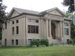
Memorial Libraryunder 500 feet1988
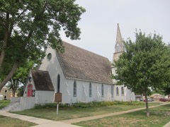
Church of the Good Shepherd-Episcopal0.2 miles1980
Faribault County Courthouse0.4 miles1977

Sources for this property

National Archives recordThe nomination case file for reference 80004258 in Record Group 79.
Faribault CountyAll 11 listed properties in this county.

Provenance

  • Listing record. National Park Service National Register of Historic Places, listed-properties dataset, current to 2026-05-22.
  • Map join. Address geocoded through the United States Census geocoder, then tested against the published boundary of every sheet in the USGS Historical Topographic Map Collection.
  • How this page is made. Listing fields come from federal records; map-sheet coverage is a labelled coordinate-to-boundary calculation, not a source-field claim.
  • Storms. NOAA National Centers for Environmental Information, Storm Events Database https://www.ncei.noaa.gov/stormevents/ A work of the United States government, no copyright under 17 U.S.C. 105. Narratives are quoted verbatim from the National Weather Service report and are not edited or summarised.