
BlockBefore
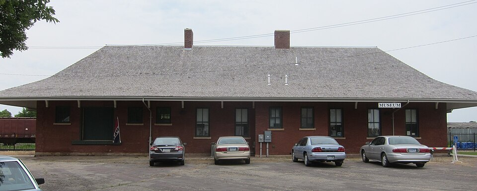
Photograph of Chicago, Milwaukee, St. Paul and Pacific Depot and Lunchroom
Photograph by Elkman, CC BY-SA 3.0. Via Wikimedia Commons.

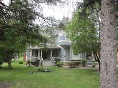
District No. 40 School

Listed on the National Register of Historic Places in 1980.

From the record

“Paul and Pacific Railroad Depot and Lunchroom are two buildings located in Wells, Minnesota, and built by the Chicago, Milwaukee, St.”

Wikipedia article Wells station (Minnesota), CC BY-SA 4.0.

One of 11 National Register listings published here for Faribault County · listed in 1980 · category: Building.

Sources: the Wikipedia article · the case file at the National Archives · the National Register database, National Park Service
The listing

  • What is counted as historic. The nomination lists 1 building as contributing to the listing.
  • Address. MN 109, Wells, 56097
  • When was it listed? May 1980
  • Category. building
  • Also known as. Faribault County MRA
  • Township. Walnut Lake township
  • National Register reference number. 80004264 - the number the National Park Service assigned this property when it was listed, and the key its nomination file is catalogued under at the National Archives.

Storms near this property

31 since 1996

Regional context, not property-specific evidence. The National Weather Service names Wells, the town this property stands in, in 31 storm reports between 1996 and 2024: 12 thunderstorm wind, 6 hail, 5 flash flood, 3 funnel cloud. No death or injury is recorded in these reports. Each account below is quoted exactly as the forecast office filed it, from the NOAA Storm Events Database, and each date opens the federal record of that event.

WhenEvent Place namedHarm What the report says
May 1996Thunderstorm WindWells$1,500,000no account filed
June 2013HailWells$100,000Baseball size hail caused damage to area roofs in Wells, Minnesota.
June 2013HailWells$25,000There was damage to roof shingles and siding of houses, with the hail depth of a few inches.
June 2013Thunderstorm WindWells$25,000A trained spotter, along with video coverage of the storm, had sustained severe winds lasting for 10 minutes or more. In addition to numerous trees blown down or uprooted, a barn north of Wells was destroyed.
June 2001Thunderstorm WindWells$20,000Barn shifted off foundation. Several trees felled.
June 2013HailWells$15,000There was damage to trees and broken windshields north of Wells, Minnesota.
August 2024Tornado (EF0)Wells-The tornado mostly moved across fields, but it did hit one house. A storm chaser took video of the tornado. Satellite imagery showed a path through the crops, enabling a determination of the beginning and end points.
August 2024Thunderstorm WindWells-Several trees and very large branches were taken down in the southeast side of Wells due to a downburst not far from a tornado.
August 2024Flash FloodWells-Flooded roadways in the southwest part of Wells due to heavy rain.
June 2024Heavy RainWells-A total of 3 to 5 inches of rain fell from multiple rounds of thunderstorms. CoCoRaHS observers measured 4.62 inches near Minnesota Lake.
July 2019Thunderstorm WindWells-In the city of Wells, several large branches, and a tree were blown down in the city park.
September 2016Heavy RainWells-A local trained weather observer measured 5.15 inches of rainfall near Wells between Wednesday afternoon, September 21st, to the early morning of Thursday, September 22nd.
September 2015Flash FloodWells-Several streets were flooded in the town of Wells.
June 2014Heavy RainWells-A measured 12 hour rainfall total of 2.57 inches near Wells.
June 2014Thunderstorm WindWells-Several large tree branches and trees were blown down in Wells.
June 2013Flash FloodWells-Several resources including trained spotters, emergency managers and the local media indicated that significant flooding occurred in northeast Faribault County. County Road 109 between Alden (Freeborn County) and Wells (Faribault County) had several areas at which one lane was closed due to water over the roadway. In addition, several farms, fields and flood prone areas had standing water for several hours after 2 to 3 inches of rain fell in a short period of time.
June 2013Thunderstorm WindWells-Scattered trees were blown down near Wells.
September 2012Thunderstorm WindWells-A few trees were blown down in Wells, Minnesota. Power outages also occurred.
June 2010Tornado (EF0)Wells-Numerous trees were broken, mostly in a cemetery on the west edge of Wells.
June 2010Thunderstorm WindWells-A strong rear flank downdraft accompanied the Wells tornado. The winds knocked down numerous trees, mostly in the south side of the city of Wells.
June 2009Funnel CloudWells-Caught on video by storm chaser. Fire department members stated it reached 3/4 of the way to the ground.
July 2008Thunderstorm WindWells-Numerous corn fields flattened throughout town.
August 2007Flash FloodWells-A few streets under two feet of water. Half Moon Park was flooded. The cooperative observer in Wells measured 6.20 inches rain as of 0830 CST August 19.
September 2006Funnel CloudWells-Multiple reports.
August 2004HailWells-A cornfield was laid over along Highway 22 at 140th St. The time was estimated.
August 2004Flash FloodWells-Roads and low lying areas in and outside of Wells were under water.
July 2003Thunderstorm WindWells-Tree down on house.
June 1998Funnel CloudWells-Funnel clouds also sighted south of Easton.
June 1998Thunderstorm WindWells-Large tree limbs blown down. Estimated windspeed.
June 2013HailWells-no account filed
July 2003HailWells-no account filed

Every storm recorded in Faribault County

Map coverage status

No historic map-sheet match is published for this property yet. That does not mean no map exists. This record needs a coordinate-quality review before it can be joined to a sheet boundary. Browse the county's mapped places while that work is pending.

Listed places nearby

3 within 8 miles

Other National Register properties close enough to walk or drive between, ordered by distance from this one. Both positions come from the same geocoding pass that matched these properties to their map sheets.

Photograph PropertyDistance Listed
Muret N. Leland House4.9 miles1980
Milwaukee Chicago St. Paul and Pacific Depot and Lunchroom5.1 miles1980
Peter Kremer House6.7 miles1980

Sources for this property

National Archives recordThe nomination case file for reference 80004264 in Record Group 79.
Wikipedia articleCommunity-written account of this property, licensed CC BY-SA.
Faribault CountyAll 11 listed properties in this county.

Provenance

  • Listing record. National Park Service National Register of Historic Places, listed-properties dataset, current to 2026-05-22.
  • Map join. Address geocoded through the United States Census geocoder, then tested against the published boundary of every sheet in the USGS Historical Topographic Map Collection.
  • How this page is made. Listing fields come from federal records; map-sheet coverage is a labelled coordinate-to-boundary calculation, not a source-field claim.
  • Storms. NOAA National Centers for Environmental Information, Storm Events Database https://www.ncei.noaa.gov/stormevents/ A work of the United States government, no copyright under 17 U.S.C. 105. Narratives are quoted verbatim from the National Weather Service report and are not edited or summarised.