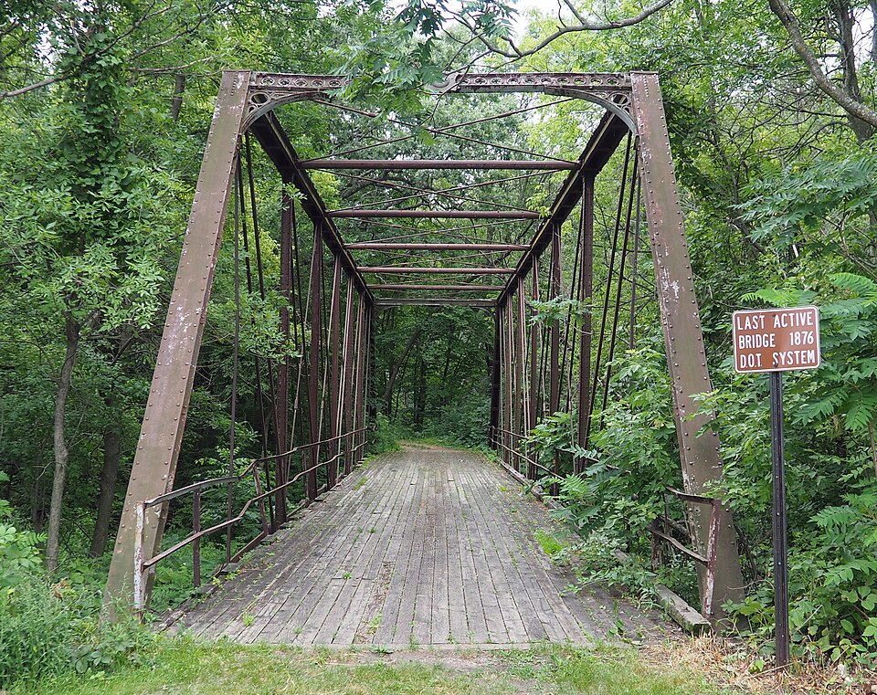
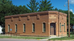
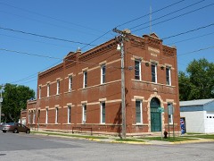
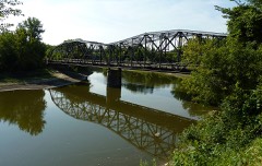
Listed on the National Register of Historic Places in 1981.
From the record
“The Shanaska Creek Bridge, also called Washington Park Bridge and officially Bridge 4846, is an iron 8 panel pin-connected Pratt through truss bridge which was erected in 1875 over the Blue Earth River in the U.S. State of Minnesota and moved twice since.”
Wikipedia article Shanaska Creek Bridge, CC BY-SA 4.0.
One of 28 National Register listings published here for Le Sueur County · listed in 1981 · category: Structure.
National Register reference number.81000681- the number the National Park Service assigned this property when it was listed, and the key its nomination file is catalogued under at the National Archives.
Fires near this property
1 since 1996
Regional context, not property-specific
evidence. The
federal wildfire occurrence database
lists 1 fire within 5 miles of Bridge No. 4846 (1)
in 1996, burning about 290 acres in total. None started naturally. 1 was recorded as arson.
Distance is straight-line from the map coordinates, so a fire counted
here may appear on a neighbouring settlement's page as well.
Reported cause
Fires
Arson/incendiarism
1
The most recent of
them, most recent first, with the day each was reported and the service
that recorded it.
Regional context, not property-specific
evidence. The federal mineral resources record lists
17 workings within 5 miles of Bridge No. 4846 (1): 17 producers.
All of them still produce. What was taken out: Sand and Gravel, Construction, Stone, Crushed/Broken, Limestone, Dimension, Silica. Distance is straight-line from the
map coordinates, so a quarry counted here may appear on a neighbouring
settlement's page as well.
Regional context, not property-specific
evidence. The National Weather Service names
Kasota, the town this property stands in, in 24 storm reports between 1998 and 2026: 10 thunderstorm wind, 7 hail, 4 flood, 1 tornado.
The reports record 1 death and 30 injuries. Each account below is quoted exactly as the forecast office
filed it, from the NOAA Storm Events Database, and each date
opens the federal record of that event.
The F3 tornado that began in Nicollet County at 1630 CST moved into Le Sueur County near the northern city limits of Kasota. Over 100 homes suffered some damage, dozens of homes had major damage, and three were completely leveled. The tornado moved east-northeast for about ten miles in Le Sueur County, then turned and moved east-southeast until dissipation. Hundreds of farm animals were killed, including 200 cows at a large dairy. Approximately five thousand acres of corn and soybeans were estimated to be ruined across the county. A State Farm spokeswoman said the company expected 4,500 homeowner claims and 8,000 auto claims from the storm. Some information provided by the Star Tribune newspaper. A 91 year old man perished in the upper floor of his home when a tree crashed through the roof.
There were multiple reports of road closures due to high water and debris along the Minnesota River. In the southeast part of Le Sueur County, some residents in the town of Waterville, Minnesota had to evacuate their homes along Lillian Street due to rising waters of the local lake. The city council declared the town a disaster area and had volunteers help them fill sandbags to stop further damage to homes. As lake levels rose, several homes were surrounded by water from the nearby lakes, and a few will be completely destroyed. The city closed four streets and parts of three others due to the flooding.
Several six to eight inch diameter trees were blown down across southwest Le Sueur County between the towns of Kasota, St. Peter and Cleveland. One tree landed on a house. Power lines were also blown down which knocked out power to several hundred customers throughout the southwest part of the county.
Highway 22 was closed due to flood waters south of Kasota, between County road 140 and 298. Based on the amount of rainfall that occurred in a few hours before midnight, more county roads were probably impassable for short periods of time.
Numerous roads were closed for several days due to snow melt, and the flood waters that develop from it. Rapidly runoff led to impassable roads, especially along streams and creeks along county roads.
Runoff from torrential rainfall that occurred across most of southern Le Sueur County Wednesday night, September 21st, caused numerous roads to remain impassable and closed.
Numerous roads were closed due to excessive rainfall that fell on September 22nd and 23th. The major areal flooding didn't recede until late Saturday when most of the small streams and creeks had crested and only mainstem rivers remained flooded.
No historic map-sheet match is published
for this property yet. That does not mean no map exists. This record needs
a coordinate-quality review before it can be joined to a sheet boundary.
Browse the county's mapped places while that work is
pending.
Listed places nearby
6 within 8 miles
Other National Register properties close
enough to walk or drive between, ordered by distance from this one. Both
positions come from the same geocoding pass that matched these properties
to their map sheets.
Listing record. National Park Service National Register of Historic Places, listed-properties dataset, current to 2026-05-22.
Map join. Address geocoded through the United States Census geocoder, then tested against the published boundary of every sheet in the USGS Historical Topographic Map Collection.
How this page is made. Listing fields come from federal records; map-sheet coverage is a labelled coordinate-to-boundary calculation, not a source-field claim.
Wildfire. Short, Karen C. 2022. Spatial wildfire occurrence data for the United States, 1992-2020 [FPA_FOD_20221014]. 6th Edition. Fort Collins, CO: Forest Service Research Data Archive. https://doi.org/10.2737/RDS-2013-0009.6 Collected with United States Government funding and usable without additional permissions or fees.
Mines and quarries. USGS Mineral Resources Data System (MRDS) https://mrdata.usgs.gov/mrds/ A work of the United States government, no copyright under 17 U.S.C. 105.
Storms. NOAA National Centers for Environmental Information, Storm Events Database https://www.ncei.noaa.gov/stormevents/ A work of the United States government, no copyright under 17 U.S.C. 105. Narratives are quoted verbatim from the National Weather Service report and are not edited or summarised.
 Block