National Register reference number.82002967- the number the National Park Service assigned this property when it was listed, and the key its nomination file is catalogued under at the National Archives.
The ground it stands on
3,684 words
The chapter on Wilmington Township in History of Houston County, Minnesota, published 1919 names Eitzen. This is what it says, exactly as the scans read.
It is supposed that the first log house put up in the valley was by Joseph Tippery and his brother William, which was in 1853. It was placed near the upper mill on section 23, where the cemetery now is, and near where there was at the time a ford across the creek. It was sold, as above mentioned, to Mr. Coe. In the spring of 1858 Peter McDonald lived in the house. He had two children, a son and a daughter, and that season the little boy was drowned in the spring branch near the house. This house was a source of considerable trouble afterwards as it was sold to I. C. Calkins, who moved it to the prairie, a quarter of a mile east of Eitzen, and placed it across the road south of J. A. Melvin's. Of course it made Melvin indignant to have his communications thus cut off, and the vendetta began in a modified Corsican style. Calkins proceeded to build a barn, which was burned on May 9, 1864. Melvin was arrested as an incendiary and held to bail to answer before the grand jury, but this tribunal found no bill against him. Melvin then proceeded against Calkins in a legal way and secured the arrest of him and his family, and he, securing a postponement of the case, took himself beyond the jurisdiction of the court, in May, 1865, and this practically ended the local war.
The first blacksmith's shop in town was started by Thomas Biggs, a practical workman, who built shop on the farm of J. A. Melvin on section 32, in 1862, near Eitzen, and was carried on by him for several years. T. H. Templeton, in 1862 or 1863, built a shop on section 25, but his fire only continued to burn about a year. The next man to erect a forge was B. J. Smith, in 1867, near the upper mill, who after hammering away a while sold to Mr. Kemp. About the year 1870 Charles Vorpole started a shop at Eitzen.
Regional context, not property-specific
evidence. The
federal wildfire occurrence database
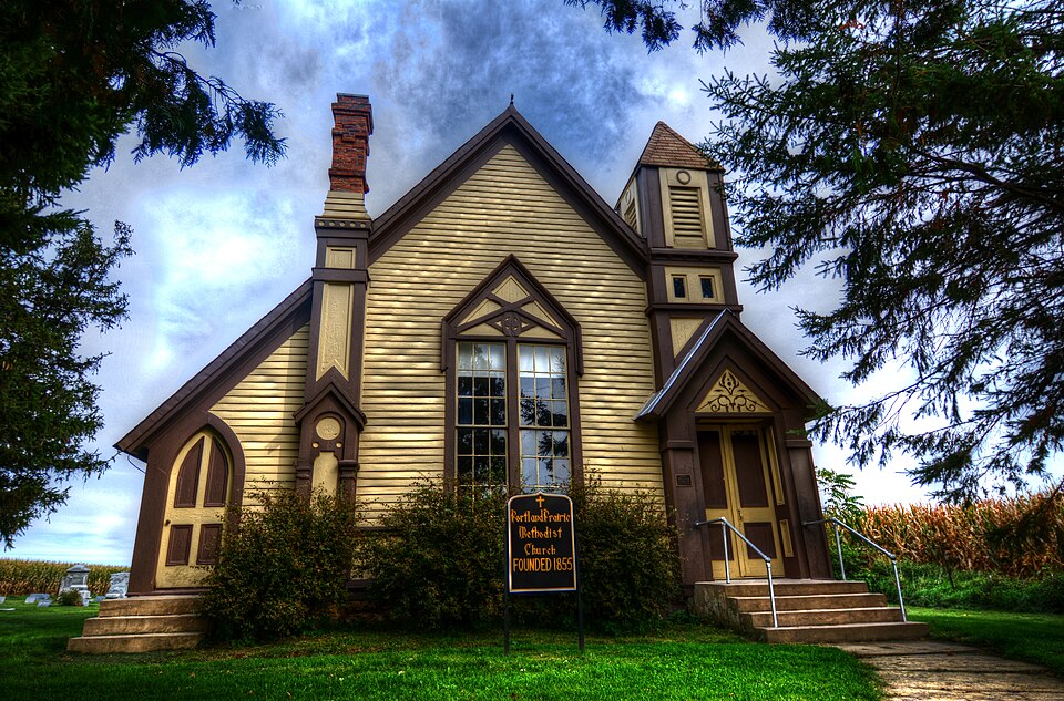
lists 10 fires within 5 miles of Portland Prairie Methodist Episcopal Church
between 1992 and 2017, burning about 29 acres in total. None started naturally. None was recorded as arson.
Distance is straight-line from the map coordinates, so a fire counted
here may appear on a neighbouring settlement's page as well.
Reported cause
Fires
Debris and open burning
5
Equipment and vehicle use
3
Missing data/not specified/undetermined
2
The most recent of
them, most recent first, with the day each was reported and the service
that recorded it.
Regional context, not property-specific
evidence. The federal mineral resources record lists
1 working within 5 miles of Portland Prairie Methodist Episcopal Church: 1 producer.
All of them still produce. What was taken out: Stone, Crushed/Broken. Distance is straight-line from the
map coordinates, so a quarry counted here may appear on a neighbouring
settlement's page as well.
Regional context, not property-specific
evidence. The National Weather Service names
Eitzen, the town this property stands in, in 8 storm reports between 1996 and 2025: 4 hail, 2 thunderstorm wind, 1 heavy rain, 1 tornado.
The reports record 2 injuries. Each account below is quoted exactly as the forecast office
filed it, from the NOAA Storm Events Database, and each date
opens the federal record of that event.
This weak tornado continued into Houston County from Allamakee County where it produced additional minor tree damage. Much of this tree damage occurred within the proximity of structures but no structural damage was observed.
No historic map-sheet match is published
for this property yet. That does not mean no map exists. This record needs
a coordinate-quality review before it can be joined to a sheet boundary.
Browse the county's mapped places while that work is
pending.
Listed places nearby
6 within 8 miles
Other National Register properties close
enough to walk or drive between, ordered by distance from this one. Both
positions come from the same geocoding pass that matched these properties
to their map sheets.
Listing record. National Park Service National Register of Historic Places, listed-properties dataset, current to 2026-05-22.
Map join. Address geocoded through the United States Census geocoder, then tested against the published boundary of every sheet in the USGS Historical Topographic Map Collection.
How this page is made. Listing fields come from federal records; map-sheet coverage is a labelled coordinate-to-boundary calculation, not a source-field claim.
Wildfire. Short, Karen C. 2022. Spatial wildfire occurrence data for the United States, 1992-2020 [FPA_FOD_20221014]. 6th Edition. Fort Collins, CO: Forest Service Research Data Archive. https://doi.org/10.2737/RDS-2013-0009.6 Collected with United States Government funding and usable without additional permissions or fees.
Mines and quarries. USGS Mineral Resources Data System (MRDS) https://mrdata.usgs.gov/mrds/ A work of the United States government, no copyright under 17 U.S.C. 105.
Storms. NOAA National Centers for Environmental Information, Storm Events Database https://www.ncei.noaa.gov/stormevents/ A work of the United States government, no copyright under 17 U.S.C. 105. Narratives are quoted verbatim from the National Weather Service report and are not edited or summarised.
 Block