 Block
From the record
16 National Register listings published here.
Sources: the county history on the Internet Archive · the National Register database, National Park Service
31 topographic sheets cover 28 settlements here, and 16 properties are on the National Register of Historic Places.
16 National Register listings published here.
Sources: the county history on the Internet Archive · the National Register database, National Park Service
Every property in this county listed on the National Register of Historic Places, with the year it was listed and the federal nomination document.
| Photograph | Property | Type | Listed | Reference |
|---|---|---|---|---|
| Ballard Hotel | building | 2017 | 100001841 | |
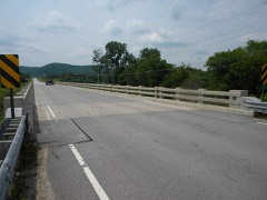 | Bridge No. 6679 | structure | 2011 | 11000468 |
| Bridge No. L4013 | structure | 1990 | 90000976 | |
 | Christian Bunge Jr. Store | building | 1982 | 82002964 |
 | Caledonia Commercial Historic District | district | 1994 | 94000830 |
| Daniel Cameron House | building | 1982 | 82002968 | |
| Church of the Holy Comforter-Episcopal | building | 1970 | 70000298 | |
| Eitzen Stone Barn | building | 82002965 | ||
| Hokah Municipal Building | building | 2014 | 14000868 | |
 | Houston County Courthouse and Jail | building | 1983 | 83000905 |
| Jefferson Grain Warehouse | building | 1994 | 94001386 | |
| Johnson Mill | building | 1982 | 82002966 | |
 | Portland Prairie Methodist Episcopal Church | building | 1982 | 82002967 |
| Schech Mill | building | 1978 | 78001548 | |
| David R. and Ellsworth A. Sprague Houses | building | 1982 | 82002962 | |
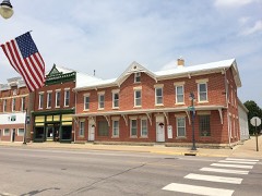 | Spafford Williams Hotel | building | 1982 | 82002963 |
Every wildfire the federal occurrence database records inside this county: 181 of them, burning about 1,215 acres. 3 started naturally and 12 were recorded as arson. Each settlement page carries the fires within five miles of it.
| Reported cause | Fires |
|---|---|
| Debris and open burning | 88 |
| Missing data/not specified/undetermined | 36 |
| Equipment and vehicle use | 28 |
| Arson/incendiarism | 12 |
| Recreation and ceremony | 8 |
| Natural | 3 |
| Smoking | 2 |
| Railroad operations and maintenance | 2 |
| Power generation/transmission/distribution | 1 |
| Misuse of fire by a minor | 1 |
The five largest, by the area the report gives. None of them was recorded as arson.
| Date | Cause | Size | Reported by | Name on the report |
|---|---|---|---|---|
| 9 April 2012 | Equipment and vehicle use | 195 acres | LaCrosse District, Upper Mississippi National Wildlife Refuge | LAWRENCE LAKE |
| 9 April 2012 | Equipment and vehicle use | 166 acres | McGregor District, Upper Mississippi River Complex | WHALEN |
| 2 April 1999 | Missing data/not specified/undetermined | 124 acres | Minnesota Department of Natural Resources | PIEPER FIRE |
| 12 April 2003 | Missing data/not specified/undetermined | 70 acres | Minnesota Department of Natural Resources | not named |
| 22 March 2009 | Missing data/not specified/undetermined | 60 acres | Minnesota Department of Natural Resources | not named |
| 11 April 1996 | Equipment and vehicle use | 51 acres | Minnesota Department of Natural Resources | not named |
| 18 October 2003 | Missing data/not specified/undetermined | 42 acres | Minnesota Department of Natural Resources | not named |
| 2 April 2000 | Debris and open burning | 42 acres | Minnesota Department of Natural Resources | not named |
Every settlement page carries the fires within five miles of it - see the settlement index below.
The NOAA Storm Events Database holds 259 reports for this county, causing 2 deaths, 34 injuries and about $65,533,380 in recorded property damage. Each settlement page carries the reports that name it.
| Kind of event | Reports |
|---|---|
| Thunderstorm Wind | 98 |
| Hail | 79 |
| Flash Flood | 23 |
| Heavy Rain | 20 |
| Flood | 17 |
| Tornado | 14 |
| Lightning | 6 |
| Funnel Cloud | 2 |
The most serious of them, by death, then injury, then recorded damage. The accounts are quoted exactly as the forecast office filed them.
| When | Event | Place named | Harm | What the report says |
|---|---|---|---|---|
| August 2007 | Flash Flood | La Crescent | 1 killed, 2 hurt, $3,000,000 | A man was killed when he attempted to cross flood waters with two others in his vehicle. The car was washed away on County Road 6 near Pine Creek. His two female companions were rescued but the victim's legs were pinned under a part of the car and rescue workers could not save him. Several rescue workers also became caught in flood waters which swamped at least two rescue boats. This all occurred during the early morning hours of Sunday, August 19th in darkness.||Highway 26 from La Crescent to the Iowa border, Highway 16 from La Crescent to Hokah, and Highway 61 north of La Crescent were all closed by flood waters and damage. |
| August 2007 | Flash Flood | Houston | 1 killed, $600,000 | A 55-year old man was killed near Storer Creek when his mobile home was swept away by flash flooding. The man had been asked to evacuate twice before flood waters swept him and his home away. The normally tranquil trout stream was about 80 yards wide and 7 to 8 feet above nearby bridges. |
| August 2007 | Flash Flood | Hokah | 30 hurt, $27,000,000 | At least 50 mudslides were reported across the county with four state highways and eight county roads closed. At one point 20 roads were closed across the county. Some homes collapsed or were carried away by mudslides. Numerous railroad tracks and bridges washed out. There were numerous reports of injuries. Hardest hit communities included Houston, Hokah, La Crescent and Brownsville. A 25 foot earthen dam near Hokah, which was built in 1921, collapsed. This caused significant damage to a portion of the town, including the main park and an automobile dealership. First calls of flooding began around 9:30 p.m. Saturday August 18 to dispatch center, with flooding problems becoming exceedingly worse afterwards.||4,200 homes were reportedly damaged or destroyed. |
| May 1996 | Hail | Eitzen | 2 hurt, $1,000,000 | no account filed |
| June 2013 | Flash Flood | Houston | $7,100,000 | Very heavy rain caused widespread flash flooding across a good portion of Houston County. Roads around the town of Houston became covered with water and impassable. Rapidly rising water along Riceford Creek caused a campground to be evacuated. A mudslide occurred just outside of Spring Grove. Numerous other roads around the county sustained damage, including County Highway 27 which had a complete section washed out. State Highway 16 east of Houston, State Highway 76 between Caledonia and Houston and County Highway 43 along with numerous other county roads were closed along with at least 20 township roads. In the western part of the county, one vehicle was swept off a road and the driver had to be rescued and at least three campers and a 73 foot mobile home were washed down Crystal Creek. In Hokah, the Root River rise high enough to top the levee requiring a local auto dealership to move about 60 cars to save them from the water. The flooding washed away a gravel road and two walking bridges at Camp Winnebago near Caledonia. |
| June 2008 | Flood | Black Hammer | $6,500,000 | Widespread flooding forced the closure of virtually all roads across the county. Several civil emergency messages were sent by request of county officials for evacuations in mainly the southern half of the county. An estimated 9300 acres of corn and 5400 acres of beans were lost. There were massive mudslides in some parts of the county, just like in August 2007. Debris backup was common against area bridge supports. |
| August 2007 | Flash Flood | Money Creek | $6,000,000 | Tremendous flash flooding and mudslides covered many highways in the area, including Highway 76 between Money Creek and Houston. Highway bridges were completely blown out and sections of roads were quickly eroded away. Other mudslides were reported on county highways 9, 13 and 26. |
| June 2008 | Flash Flood | Newhouse | $2,500,000 | Very heavy rain led to flash flooding through much of the county. A rainfall total of 7.18 inches was measured 3 miles southwest of Reno. The bridge over Clear Creek was reported damaged and unsafe for use. In addition, highway 26 was closed due to mudslides. County Highways 5, 23, 31 and 249 were closed due to high water and washouts. |
| May 1965 | Tornado (F3) | not stated | $2,500,000 | no account filed |
| August 2014 | Lightning | La Crescent | $1,500,000 | A lightning strike hit a transformer in La Crescent and the resulting damage also took out a nearby substation. Around 3,400 customers were without power until the next day. |
| June 2000 | Flash Flood | Countywide | $1,200,000 | no account filed |
| August 2007 | Flood | Houston | $1,000,000 | Law enforcement officials reported roads and bridges washed out or still under water. Houston was under mandatory evacuation orders until flood waters receded. Area highways were closed including Highway 26 from Money Creek to Rushford and Highway 9 from Highway 21 to the Winona/Houston County line. |
| September 2016 | Flood | Black Hammer | $800,000 | Flooding along Winnebago Creek caused officials to close County Highway 5 over the southern portions of the county. The flooding also caused the lower portion of Camp Winnebago to be closed where the road was washed out. Flood waters also covered Cutacross Road and Yucatan Road. |
| August 2007 | Flood | Houston | $750,000 | The Root River at Houston reached a record crest of 18.75 feet on August 19. Flood stage is 15 feet. The town of Houston was completely cutoff by flood waters for awhile. Hundreds of acres of crops along the river were lost when they were inundated by flood waters. |
| August 2018 | Flash Flood | Hokah | $720,000 | Runoff from heavy rain pushed the Root River out of its banks and over State Highway 16 near Hokah. Flooding also occurred along Thompson Creek which destroyed Como Falls and carved a new path through Como Falls park. |
| April 2011 | Hail | Hokah | $330,000 | no account filed |
| December 2021 | Tornado (EF1) | Perkins | $300,000 | An EF1 tornado formed west of Houston and moved northeast, passing to the east of Money Creek before dissipating just before the Winona County line. Several farms along the Root River sustained damage from this tornado. |
| April 2011 | Hail | Mound Prairie | $250,000 | no account filed |
| May 2011 | Tornado (EF2) | Mound Prairie | $240,000 | This EF2 tornado cut a path across northeast Houston County from around 5 miles southwest of Hokah, through the very southern part of Hokah to the Target Lake area southeast of La Crescent, before crossing the Mississippi River. Near the beginning of the track, significant damage to some residences, barns and farm out buildings occurred. In the same area, numerous 100 foot tall and 3 foot diameter trees were either uprooted or snapped off. Around a mile west of Hokah, 2 barns were significantly damaged and a residence received minor damage. Some minor roof damage and extensive tree damage was done on the south side of the town of Hokah. Tree damage was noted east of Hokah into the Mississippi River. Damages from the tornado were estimated to be almost $250 thousand. |
| August 2018 | Heavy Rain | Caledonia | $189,000 | Rainfall totaled 4.80 inches during this time frame. |
| August 2018 | Flash Flood | Riceford | $145,000 | Runoff from heavy rains caused flooding to occur along Riceford Creek northwest of Spring Grove. The flooding prompted the evacuation of a campground that then had to remained closed through the Labor Day weekend. |
| July 2022 | Tornado (EF0) | Money Creek | $125,000 | An EF0 tornado moved through rural portions of Houston County north of the city of Houston. The tornado destroyed one barn, pushed another off its foundation, and damaged trees and some crops. |
| April 2011 | Thunderstorm Wind | Sheldon | $125,000 | Two swaths of wind damage occurred three to five miles north of Caledonia. Several barns were damaged, a wind mill was hit, numerous trees were blown over, and a mobile home was destroyed from wind gusts. |
| June 2018 | Flash Flood | Newhouse | $110,000 | Flash flooding was reported across mainly southwest parts of Houston County from rounds of heavy rain. |
| June 2022 | Thunderstorm Wind | Caledonia | $100,000 | A localized downburst blew down trees, power lines, a barn and some farm outbuildings just northwest of Caledonia. |
| September 2012 | Thunderstorm Wind | Caledonia | $95,000 | An eighty foot tall tree fell on a garage and four vehicles near the intersection of First and Main Streets in Caledonia. |
| August 1997 | Tornado (F0) | Caledonia | $80,000 | no account filed |
| July 2004 | Hail | Brownsville | $75,000 | no account filed |
| August 2018 | Flash Flood | Caledonia | $70,000 | Runoff from heavy rains caused street flooding to occur in Caledonia. |
| September 2021 | Lightning | Houston | $50,000 | A house fire in Houston was started by a lightning strike. Damage to the home was primarily limited to the attic. |
| August 1998 | Thunderstorm Wind | La Crescent | $50,000 | no account filed |
| June 1998 | Thunderstorm Wind | Brownsville | $46,000 | no account filed |
| August 2018 | Heavy Rain | Eitzen | $45,000 | Rainfall totaled 5.66 inches during this time frame. |
| September 2016 | Flash Flood | Freeburg | $44,000 | Heavy rain caused more water than normal to flow over the Freeburg spillway and produced flooding along Crooked Creek. The flooding washed out a portion of Whitetail Drive. |
| September 2016 | Flash Flood | Newhouse | $40,000 | A mudslide north of Brownsville caused boulders to tumble down the side of a bluff. One of these boulders hit a house causing considerable damage. Numerous roads in the southern sections of Houston County had water over them prompting officials to close some of them, including State Highway 16 near La Crescent. Flood waters from Winnebago Creek damaged a road in Camp Winnebago south of Caledonia and covered County Highway 5 in the extreme southern part of the county. |
| June 1998 | Thunderstorm Wind | Caledonia | $40,000 | no account filed |
| August 2018 | Heavy Rain | River Jct | $35,000 | Rainfall totaled 4.50 inches during this time frame. |
| June 1998 | Thunderstorm Wind | Caledonia | $35,000 | no account filed |
| August 1998 | Flash Flood | La Crescent | $35,000 | no account filed |
| March 2017 | Thunderstorm Wind | Caledonia | $34,000 | Barns were damaged in the Caledonia area from strong storm winds. |
| May 2000 | Lightning | La Crescent | $30,000 | no account filed |
| June 1998 | Thunderstorm Wind | Hokah | $30,000 | no account filed |
| May 1998 | Hail | Houston | $30,000 | no account filed |
| May 2024 | Thunderstorm Wind | Spring Grove | $25,000 | Law enforcement reported power lines down in Spring Grove. |
| March 2017 | Thunderstorm Wind | Hokah | $25,000 | Two outbuildings were destroyed, other buildings were damaged and several large trees were snapped southeast of Hokah. |
| July 2000 | Lightning | Brownsville | $25,000 | no account filed |
| July 2000 | Flash Flood | Countywide | $25,000 | no account filed |
| April 1991 | Tornado (F1) | not stated | $25,000 | no account filed |
| August 1965 | Tornado (F1) | not stated | $25,000 | no account filed |
| June 2008 | Flood | Perkins | $20,000 | The Root River went above flood stage across northern parts of Houston County for a day or two. The crest at Houston was 16.13 feet and the flood stage is 15 feet. Another crest occurred on June 14th of 15.26 feet. |
| August 1997 | Hail | Freeburg | $20,000 | no account filed |
| July 2021 | Hail | River Jct | $15,000 | Quarter to half dollar sized hail was reported in La Crescent. |
| June 2020 | Thunderstorm Wind | Houston | $15,000 | Three trees fell on a house in Houston. |
| August 2007 | Heavy Rain | Hokah | $15,000 | The cooperative observer 1 mile south-southwest of Hokah reported a rainfall total of 15.60 inches. 12.73 inches of this rain fell between 8 p.m. August 18th and 3 a.m. August 19th, and a new 24-hour record of 15.10 inches set a new state record. |
| June 1999 | Hail | Caledonia | $15,000 | no account filed |
| August 1997 | Thunderstorm Wind | Caledonia | $15,000 | no account filed |
| August 2018 | Heavy Rain | Mound Prairie | $14,000 | Rainfall totaled 6.92 inches during this time frame. |
| July 2017 | Flash Flood | River Jct | $12,000 | Locally heavy rains caused a mudslide to occur west of La Crescent. The slide covered Burns Valley Road near the Pine Creek Golf Course. |
| August 2000 | Hail | Caledonia | $12,000 | no account filed |
| June 1998 | Thunderstorm Wind | Spring Grove | $12,000 | no account filed |
The Survey's mineral resources record lists 17 workings inside this county. 16 still produce and 1 is closed or unrecorded. Each settlement page carries the workings within five miles of it.
| Commodity | Workings |
|---|---|
| Stone, Crushed/Broken | 17 |
The least common of them first, because a county's hundredth gravel pit says nothing its first ten did not.
| Where | Site | Commodity | Status | Recorded |
|---|---|---|---|---|
| Beneke Quarry | Stone, Crushed/Broken | Producer | ||
| Cherry Quarry | Stone, Crushed/Broken | Producer | ||
| Conniff Quarry & Mill | Stone, Crushed/Broken | Producer | ||
| Gap Hill Quarry & Mill | Stone, Crushed/Broken | Producer | ||
| Gengler Quarry & Mill | Stone, Crushed/Broken | Producer | ||
| Guberud Quarry & Mill | Stone, Crushed/Broken | Producer | ||
| Holty-Badger Quarry - Badger | Stone, Crushed/Broken | Producer | ||
| Holty-Badger Quarry- Holty | Stone, Crushed/Broken | Producer | ||
| Horn Quarry | Stone, Crushed/Broken | Producer | ||
| Muhly Quarry | Stone, Crushed/Broken | Producer | ||
| Oak Ridge Quarry | Stone, Crushed/Broken | Producer | ||
| Pool Hill Quarry & Mill | Stone, Crushed/Broken | Past Producer | ||
| Rauk Quarry | Stone, Crushed/Broken | Producer | ||
| Roverud Quarry | Stone, Crushed/Broken | Producer | ||
| Thiele Quarry | Stone, Crushed/Broken | Producer | ||
| Underpass Quarry | Stone, Crushed/Broken | Producer | ||
| Zaiger Quarry | Stone, Crushed/Broken | Producer |
History of Houston County, Minnesota devotes a chapter to each township: its boundaries and streams, who settled it and when, the mills, the schools and the churches. All 13 are reproduced here in full. Each row shows the township's own shape and where it lies in the county, drawn from the Census Bureau's boundary. Which settlements belong to which township is computed from that same boundary, not taken from the book.
| Shape and position in the county | Township | Settlements in it | Length | Sections |
|---|---|---|---|---|
| Black Hammer Township | Black Hammer | 1,062 words | 0 | |
| Brownsville City | Brownsville | 1,087 words | 0 | |
| Caledonia Township | Caledonia, Highland Park Estates, Pine Estates, Schechs Mill | 9,241 words | 7 | |
| Crooked Creek Township | Freeburg, Reno | 6,116 words | 0 | |
| Hokah Township | Hokah, Village Terrace | 2,087 words | 1 | |
| Houston City | Houston | 3,901 words | 0 | |
| Jefferson Township | Jefferson | 6,146 words | 0 | |
| La Crescent Township | La Crescent, Pine Creek, River Junction, Shepardson's Park | 2,728 words | 0 | |
| Mound Prairie Township | South Ridge | 37,718 words | 30 | |
| Sheldon Township | Sheldon | 3,800 words | 0 | |
| Spring Grove Township | Newhouse, Riceford, Spring Grove | 4,415 words | 0 | |
| Wilmington Township | Bee, Willington Grove, Wilmington | 3,684 words | 0 | |
| Yucatan Township | Yucatan | 1,655 words | 0 |
2 books written about this county, cut here where the book itself is cut, at its printed chapters: 82 chapters in all. Every chapter is public domain, machine-read from the scan and reproduced complete. A chapter already given under one of the county's towns is not repeated in this list.
| Chapter | Length |
|---|---|
| Chapter 1: Minnesota | 8,174 words |
| Chapter 2: Physical Features | 6,993 words |
| Chapter 3: Aboriginal Remains | 2,738 words |
| Chapter 4: Reign of the Indians | 6,777 words |
| Chapter 5: Early Exploration | 4,140 words |
| Chapter 6: Governmental Jurisdiction | 4,829 words |
| Chapter 7: Early Settlement | 4,260 words |
| Chapter 8: Transportation | 10,615 words |
| Chapter 9: County Government | 7,912 words |
| Chapter 10: Public Schools | 12,953 words |
| Biographical sketches | 327,155 words in 21 parts |
| Chapter 14: Agricultural Progress | 4,757 words |
| Chapter 15: County Representation | 2,766 words |
| Chapter 16: Courts and Lawyers | 3,261 words |
| Chapter 17: Houston County Masonry | 1,780 words |
| Chapter 18: The Norwegian Lutheran Church | 9,897 words |
Named settlements recorded in the Geographic Names Information System, each with the topographic sheets covering it. Villages, hamlets and abandoned places alike. Each is shown with the nearest named watercourse or landform and the survey quadrangle it falls on.
Black Hammer township · 55974 · On Black Hammer Bluff · Spring Grove quadrangle
8 sheets, 1958 to 1990
Brownsville city · 55919 · On Wildcat Creek · Brownsville quadrangle
10 sheets, 1956 to 1990
La Crescent city · 55947 · Near Minnesota Island · La Crescent quadrangle
14 sheets, 1930 to 1991
Money Creek township · 55943 · Near Campbell Valley · Houston quadrangle
10 sheets, 1958 to 1990
Money Creek township · 55943 · Near Cushings Peak · Rushford East quadrangle
10 sheets, 1958 to 1990
La Crescent township · 55947 · Near Lane Valley · Mound Prairie quadrangle
13 sheets, 1930 to 1990
La Crescent city · 55947 · Near Minnesota Island · La Crescent quadrangle
14 sheets, 1930 to 1991
Caledonia township · 55921 · On Beaver Creek East · Sheldon quadrangle
9 sheets, 1958 to 1990
La Crescent city · 55947 · Near Minnesota Island · La Crescent quadrangle
14 sheets, 1930 to 1991
Hokah township · 55941 · On Butterfield Creek · La Crescent quadrangle
14 sheets, 1930 to 1991